
Junagadh is the city and headquarters of Junagadh district in the Indian state of Gujarat. Located at the foot of the Girnar hills, 355 kilometres (221 mi) southwest of Ahmedabad and Gandhinagar, it is the seventh largest city in the state. It is dominated by the Chudasama clan of Rajputs since ancient times.

Saurashtra, also known as Kathiawar, is a peninsular region of Gujarat, India, located on the Arabian Sea coast. It covers about a third of Gujarat state, notably 11 districts of Gujarat, including Rajkot District. It was formerly a state of India before it merged with Bombay state. In 1961 it separated from Bombay and joined Gujarat.
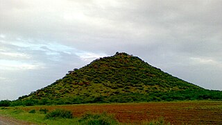
Bagasara is a municipality in Bagasara Taluka of Amreli district, Gujarat, India. The town is situated on the northern bank of the Satalli river. nearest airport div airport.
Chorwad or Chorvad is a town and a municipality in Junagadh district in the state of Gujarat, India. It lies on the coast of the Arabian Sea.

The Bhal region is an area of Gujarat, India. It is spread across the political boundaries of the districts of Bhavnagar, Ahmedabad, and Anand. The Bhal region is situated on the deltas of the Sabarmati, Bhogawo, Bhadar, Lilka and other rivers that flow east and southeast off the Kathiawar peninsula into the Gulf of Cambay. The word Bhaal seems to have been derived from the Sanskrit word भाल which means forehead. Such a name is given to this region probably because it is mostly as flat as a forehead with almost entire region's soil without any stones, pebbles or gravel.

Mer, Maher or Mehar is a caste from the Saurashtra region of Gujarat in India. They are largely based in the Porbandar district, comprising the Ghēḍ and Barḍā areas, and they speak a dialect of the Gujarati language. The Mers of the Ghēḍ and Barḍā form two groups of the jāti and together they are the main cultivators in the Porbandar.
Bhuvatimbi or Bhuva Timbi is a village in Sutrapada Taluka in Gir Somnath district of Gujarat state, India. It is located 86 km south of Junagadh, 23 km from Sutrapada, and 386 km from the State capital Gandhinagar. The local language is Gujarati.

The Battle of Bhuchar Mori, also known as Battle of Dhrol, was fought between the army of Kathiawar led by Nawanagar State and the Mughal army at Bhuchar Mori plateau near Dhrol, Saurashtra. It was meant to protect Muzaffar Shah III, the last Sultan of Gujarat Sultanate who had taken asylum under Jam Sataji of Nawanagar after his escape from the Mughal emperor Akbar. It was fought in July 1591. The Kathiawar army included the armies of Junagadh who betrayed Nawanagar and joined the Mughal army at last. The battle led to a large number of casualties on both sides. The battle resulted in the victory of the Mughal army.
Aṭkoṭ is a neighborhood in Jasdan City, Gujarat, India. It was founded by the Samma ruler Lakho Phulani.
Stepwells are wells in which the water is reached by steps. They are most commonly found in western India especially Gujarat where over 120 such wells are reported. The origin of the stepwell may be traced to reservoirs of the cities of the Indus Valley civilization such as Dholavira and Mohenjo-daro. The stepwells were constructed in the south western region of Gujarat around 600 AD. From there they spread north to Rajasthan and subsequently to north and west India. Construction activities accelerated during the tenth to 13th century during the Chaulukya and Vaghela periods. The construction of these stepwells hit its peak during the 11th to 16th century. The Muslim rulers of the 13th to 16th century did not disrupt the culture that was practiced in these stepwells and encouraged the building of stepwells. The wells lost their significance in the 19th century due to introduction of water pumps and pipe-systems.
Chogath (Thapnath) is a village in Umrala Taluka of Bhavnagar district, Gujarat, India. It is a former princely state.

The early history of the Chudasama dynasty in Saurashtra is largely lost. Bardic legends vary significantly in names, sequence, and numbers, rendering them unreliable as historical sources. Mandalika Kavya, a Sanskrit poem by Gangadhara, provides some information on the dynasty, though it holds limited historical accuracy. Certain inscriptions from the period offer early genealogical details, but these also vary in their order of succession. Historians like Ranchhodji Diwan, A. K. Forbes, James Burgess, and Gaurishankar Oza have attempted to determine a more consistent genealogy and chronology. Based on dates from inscriptions linked to Chudasama kings and other literary sources, the genealogy and chronology of the dynasty's later period are now relatively established. It is known that they ruled approximately from Vikram Samvat (VS) 900 to VS 1527, or around 875 CE to 1472 CE.
The Last Hindu Rajput Ruler Of Saurashtra Mandalika III, called by the epithet Ra Gangajalio, was a Chudasama king of Saurashtra region of western India who reigned from 1451 CE to 1472 CE. His capital was at Junagadh.
Ra Mokalasimha, also known as Muktasimha, was a Chudasama king of Saurashtra region of western India who reigned from 1384 CE to 1396 CE. He ruled from Junagadh and later moved his capital to Vanthali when Saurashtra came under influence of the Delhi Sultanate.
Khengara was a Chudasama king of Saurashtra region of western India who reigned in the 12th century. His capital was at Junagadh. He was a contemporary of Jayasimha Siddharaja, the Chaulukya ruler of Anahilapataka. According to bardic tales, he was a son of Navaghana and had succeeded him.
Ranakadevi was a legendary 12th century queen of Khengara, the Chudasama ruler of Saurashtra region of western India. She is mentioned in the bardic tragic romance representing the battle between Chudasama king Khengara and Chaulukya king Jayasimha Siddharaja. However, this legend is not credible.
The early history of Chudasama dynasty of Saurashtra region is almost lost. The bardic legends differs very much in names, order and numbers so they are not considered reliable. Mandalika Kavya, a Sanskrit poem by Gangadhara, gives some information on dynasty but it has little historical value. Some of their inscriptions gives their genealogy but they too differ in order of succession. Ranchhodji Diwan, A. K. Forbes, James Burgess and Gaurishankar Oza had tried to fix genealogy and chronology. They ruled about from Vikram Samvat (VS) 900 to VS 1527.
The Gohil dynasty or Gohil or Guhilas of Saurashtra ruled parts of Saurashtra region of present-day Gujarat state of India as subordinates or independents starting 12th century. Their origin is traced to Guhila dynasty of Gujarat and they had migrated to Saurashtra in 12th century. The earliest known inscription of Gohils is found from Mangrol. They later moved to the east coast where they established themselves and the region came to be known as Gohilwar and ruled till the independence of India in 1947. The erstwhile princely states of Bhavnagar, Palitana, Lathi, Vala and Rajpipla belonged to Gohil rulers.
Ra Khengar Vav or Ra Khengar stepwell is a 13th-century stepwell located near Koyliphatak village between Vanthali and Junagadh in Gujarat, India.
Bagasara Taluka is a geographical subdivision located in the Amreli district of the state of Gujarat, India. It is situated in the western part of the country and falls within the Saurashtra region. Bagasara is the headquarters of the Taluka.
