Bagholi

Last updated

Bagholi
Village
Bagholi Haveli.jpg
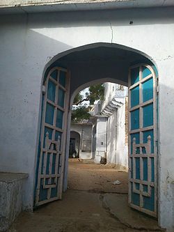
Phool Singh Ji Ki Haveli, Bagholi
India Rajasthan location map.svg
Red pog.svg
Bagholi
Bagholi within the map of Rajasthan
Coordinates: 27°46′12″N75°40′47″E / 27.770102°N 75.679594°E / 27.770102; 75.679594
Country India
State Rajasthan
District Neem Ka Thana
Time zone UTC+5:30 (IST)

Bagholi is a village located in Jhunjhunu district, Rajasthan, India. It is within a locally self-governing Scheduled Area.

Contents

Overview

Bagholi, located in udaipurwati tehsil (English: administrative division) and surrounded by the Aravali Range of mountains, has 8 Rajput panas,[ clarification needed ] each containing a separate haveli (manor). Brahmin and Baniya have individual havelis. Most local Baniya have moved to Kolkata, specifically for business in Burrabazar.

The largest haveli belongs to the Thakur Sahab Phool Singh Ji, who is well known in Paintalisa.[ clarification needed ] He has led construction of this haveli throughout his life; it spreads around 22 bigha (approximately 35,611.4 square metres [383,318 sq ft]) centred in this village.

Thakur Durg Singh Ji ruled for approximately 25 years as sarpanch (English: elected leader) of gram panchayat (English: self-governing village council), succeeded by Thakur Sahab Bhagwan Singh Ji for 5 years.[ citation needed ]

The village has the area's first electrical grid and provides water to the villages and nearby khetri (English: copper mines). [1]

See also

Related Research Articles

<span class="mw-page-title-main">Shekhawati</span> Region in Rajasthan, India

Shekhawati is a semi-arid historical region located in the northeast part of Rajasthan, India. The region was ruled by Shekhawat Rajputs. Shekhawati is located in North Rajasthan, comprising the districts of Neem Ka Thana, Jhunjhunu, Sikar that lies to the west of the Aravalis and Churu. It is bounded on the northwest by the Jangladesh region, on the northeast by Haryana, on the east by Mewat, on the southeast by Dhundhar, on the south by Ajmer, and on the southwest by the Marwar region. Its area is 13,784 square kilometers.

Ratangarh is a town and Tehsil of the Churu district in Rajasthan, India. Ratangarh was previously called Kolasar. It is famous for grand havelis (mansions) with frescoes, which is an architectural specialty of the Shekhawati region. Ratangarh is also famous for its handicraft work.

Fatehpur is a city in the Sikar district of Indian state Rajasthan. It is part of the Shekhawati region. It is midway between Sikar city and Bikaner on National Highway 52. It is also the land to Havelis built by Marwari Seth's. It also has many Kuldevi Temples of the Agarwal community for Bajoria,Bindal, Saraf, Chamadia, Choudhary, Goenka, Lohia, Singhania, Saraogi, Bhartia Families. It is famous for its extreme weather conditions throughout the year. In winters, the minimum temperature falls below 0 °C at night for many days making it the coldest town in India in non mountainous region. In summer the temperature rises to 50 °C in the afternoon making it one of the hottest places in India. 1985 Bollywood film Ghulami starting Dharmendra, Naseeruddin Shah, Mithun Chakraborty and Smita Patil was extensively shot here in many of its havelis and the railway station.

Nawalgarh is a heritage city in Jhunjhunu district of Indian state of Rajasthan. It is part of the Shekhawati region and is midway between Jhunjhunu and Sikar. It is 31.5 km from Sikar and 39.2 km from Jhunjhunu. Nawalgarh is famous for its fresco and havelis and considered as Golden City of Rajasthan. It is also the motherland of some great business families of India.

<i>Haveli</i> Traditional house in the Indian subcontinent

A haveli is a traditional townhouse, mansion, manor house, in the Indian subcontinent, usually one with historical and architectural significance, and located in a town or city. The word haveli is derived from Arabic hawali, meaning "partition" or "private space", popularised under the Mughal Empire, and was devoid of any architectural affiliations. Later, the word haveli came to be used as a generic term for various styles of regional mansions, manor houses, townhouse found in the Indian subcontinent.

<span class="mw-page-title-main">Chhatri</span>

Chhatri are semi-open, elevated, dome-shaped pavilions used as an element in Indo-Islamic architecture and Indian architecture. They are most commonly square, octagonal, and round. Originating as a canopy above tombs, they largely serve as decorative elements as opposed to functional elements. The earliest examples of chhatri being used in the Indian Subcontinent were found in the Shrine of Ibrahim in Bhadreswar, constructed between 1159 and 1175 AD.

<span class="mw-page-title-main">Shekhawat</span> Rajput clan

Shekhawat is a clan of Rajputs found mainly in Shekhawati region of Rajasthan. Shekhawats are descendants of Maharao Shekha of Amarsar. Shekhawat is the most prominent clan among Kachhwaha. The Shekhawati region was ruled by them for more than 500 years. Fought against mughals many time. Rao Sujjan Singh of Chhapoli fought mughal army with 300 men to save a temple.

<span class="mw-page-title-main">Loharu</span> City in Haryana, India

Loharu is a city, municipal committee and assembly constituency, near Bhiwani City in the Bhiwani district of the Indian state of Haryana. It is the administrative headquarters of one of the four administrative sub-divisions of the district and covers 119 villages. It is also a railway junction station.

<span class="mw-page-title-main">Mandawa</span> Town in Rajasthan, India

Mandawa is a town, just 29 km from Jhunjhunu city in Jhunjhunu district of Rajasthan, India. It is part of Shekhawati region. Mandawa is located at 28.05°N 75.15°E. It has an average elevation of 316 metres (1036 ft). The nearest railway station is Jhunjhunu railway station.

<span class="mw-page-title-main">Jakhal</span> Village in Rajasthan, India

Jakhal is a village located in the Nawalgarh tehsil of Jhunjhunu district of Rajasthan, India. It is located in shekhawati region, approx. 35 km south of Jhunjhunu city and 20 km east of Nawalgarh. Jakhal was founded by Salehadi Singh Shekhawat on 9 August 1732. Although hundreds of Jakhal's residents serve in the armed forces, the village's main occupation is farming. In the monsoon seasons, the main crops are bajara, moth, and guar, but in winter, the main crops are wheat, barley, sarson, and chana (chickpeas). The major part of the population belongs to Jat community with Moond, Khedar and garhwal Jat gotras.

Mahansar is a village in the Shekhawati region in Rajasthan, India. It was founded in 1768 by the Thakurs of one of the branch of Shekhawats. It is located in Jhunjhunu District at a distance of 40 km from Jhunjhunu near the trifurcation of Jhunjhunu, Churu and Sikar districts.

Ratannagar is a city, near Churu city, and a municipality in Churu district in the Indian state of Rajasthan. Ratannagar is a small town in the Churu District in the State of Rajasthan, India. It is situated about 8 kilometers south of Churu and has a population of approximately 14,000 people. It is located on the Jaipur road and is famous for its havelis. In 1982, Director J.P. Dutta made a motion picture in the village entitled "Gulami", starring Dharmendra, Mithun, Nasirudin Shah, Kulbhushan Kharbanda, Smita Patil, Anita Raj and Rina Rai. The main reason the small town was used for the month-long shooting was the noted havelis.

<span class="mw-page-title-main">Nangal Sirohi</span> City in Haryana, India

Nangal Sirohi, famous for the painted Shekhavati Rajput architecture Havelis, is a village in Mahendragarh district in the Indian state of Haryana. It is 9.5 km from Mahendragarh towards Narnaul in South Haryana.

Jhajhar is a village, situated in the erstwhile province of Shekhawati of Rajasthan, India. It is located in the Jhunjhunu District, approximately 7 km from Nawalgarh. Formally it was the part of Pentalisa of Bhojyana.

Pentalisa was a territory which was located in the region of Shekhawati, India. The group of 45 villages under Udaipurwati was known as Pentalisa. The Bhojraj Ji Ka Shekhawat Rajputs ruled over two territories, Pentalisa and Panch Pana.

Tain is a village in the Jhunjhunu district, India. It is part of the Shekhawati region of Rajasthan.

<span class="mw-page-title-main">Alsisar</span> Town in Rajasthan, India

Alsisar is a small town in the north-western part of Jhunjhunu district, Rajasthan, India. The area surrounding the town is an arid semi desert. This place is known for its temperature ranging from 48 °C in summer to below zero levels in winter.

Kalipahari village is a big community of Shekhawat Rajputs in the Jhunjhunu District of Rajasthan. It is situated 5 km south of Bagar, Jhunjhunu. The village is famous for the frescos on its grand havelis.

<span class="mw-page-title-main">Mandela, Rajasthan</span> Town in Shekhawati, Rajasthan, India

Mandela is a town in the Shekhawati region and Jhunjhunu district of Rajasthan state in India.

Randhisar is a small village and a Panchayat in Churu district in the state of Rajasthan, India. It is located in the Shekhawati region. The local language is Hindi. It is 220 km from Jaipur and situated on the road from Ratangarh to Sujangarh. The village of Randhisar lies in Sujangarh tehsil of Churu district. The nearest Railway station is Chappar, which lies on Degana-Churu-Rewari broad gauge rail line. The nearest airport is in Sanganer, 225 km away. Randhisar is famous for the mining industry and good quality of building material grit. Most of the residents are Rajpurohit, who maintain traditions similar to the Brahmins and Rajputs. The Sarpanch is Bhawani Singh Randhisar. There are three temples associated with the village: Ambe Maa Temple, Shivdayalya Temple, Thakur Ji Temple, and Balaji Temple. It also has the distinction of being Sujangarh District's first ODF village.

References

  1. "मणकसास में 5 दिन से आता है पानी". Dainik Bhaskar (in Hindi). Retrieved 31 August 2018.