Dhosi | |
|---|---|
Village | |
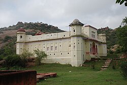 Chyvan Rishi Temple on Dhosi Hill | |
 Dhosi Dhosi within the map of Rajasthan | |
| Coordinates: 28°04′19″N76°01′29″E / 28.071900°N 76.024684°E | |
| Country | India |
| State | Rajasthan |
| District | Jhunjhunu district |
| Population (2011) | |
• Total | 1,543 |
| Time zone | UTC+5:30 (IST) |
| ISO 3166 code | IN-RJ |
Dhosi is a village in Khetri subdistrict, Jhunjhunu district, Rajasthan, India. [1]