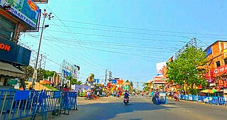
Madhyamgram is a city and a municipality of North 24 Parganas district in the Indian state of West Bengal. It is close to Kolkata and also a part of the area covered by Kolkata Metropolitan Development Authority (KMDA).
Athipattu is a census town in Chennai in Thiruvallur district in the state of Tamil Nadu, India. The neighbourhood is served by Athipattu railway station of the Chennai Suburban Railway network. it is a suburb in northern part of Chennai.
Chitbara Gaon is a town and a nagar panchayat of Ballia district, Uttar Pradesh, India.
Dergaon is a town and a municipality in the Golaghat district of Assam, India.It is 282 km from the state capital Guwahati.

Desur is a Town panchayat in Tiruvanamalai district in the Indian state of Tamil Nadu.
Kumar Kaibarta Gaon is a census town in Jorhat district in the Indian state of Assam.
Mehragaon is a Village in Narmadapuram district in the Indian state of Madhya Pradesh.
Mhowgaon is a Nagar Panchayat under Sub Division Dr. Ambedkar Nagar (Mhow) in Indore district in the Indian state of Madhya Pradesh. The total geographical area of Mhowgaon nagar panchayat is 13.5 km2 and it is the smallest city by area in the sub district. The population density of the city is 2309 persons per km2. Mhowgaon is divided into 15 wards for which elections are held every 5 years. Among them, Mhowgaon Ward No. 2 is the most populous ward with a population of 3440 and Mhowgaon Ward No. 15 is the least populous ward with a population of 957. Mhowgaon Nagar Panchayat has total administration over 6,373 houses to which it supplies basic amenities like water and sewerage. It is also authorized to build roads within Nagar Panchayat limits and impose taxes on properties coming under its jurisdiction.
Tukmeerpur is a census town in North East district in the Indian state of Delhi.Pradhan of Tukmeerpur gaon Ch. Joginder Pradhan
Naubaisa Gaon is a census town in Jorhat district in the Indian state of Assam.
Salumbar is a District in the Indian state of Rajasthan.
Senchoa Gaon is a census town in Jorhat district in the Indian state of Assam.

Bali is a town and a municipality in Pali district in the state of Rajasthan, India. The town is situated on the left bank of the Mithari River. This walled town was the headquarters of a district having the same name in the Jodhpur State. Bali is a tehsil and panchayat samiti with the same name. Bali is also a sub-divisions among the 10 sub-divisions of the Pali district. It is known for its fort. Nearest towns are Falna & Sadri and nearest villages are Shri Sela and Boya.
Dumuria is a village and a Gaon Panchayat in Barpeta district in the Indian state of Assam.
Kerur is a town in Bagalkot district in Karnataka, which located on NH 218. It has an average elevation of 617 meters (2024 feet). It's a birthplace of Jagadish Shettar, a former Chief Minister of Karnataka. Kerur is a Town Panchayat city in district of Bagalkot, Karnataka. The Kerur city is divided into 16 wards for which elections are held every five years. The Kerur Town Panchayat has population of 19,731 of which 9,929 are males while 9,802 are females as per report released by Census India 2011.
Koselao is a village in Sumerpur tehsil of Pali district in Rajasthan state of India. It is located near Sanderao.
Salal Gaon is a village located in the Lakhimpur district in the northeastern Indian state of Assam. North Lakhimpur, Bihapuria, Dhakuakhona, Naoboicha, Narayanpur are the nearest towns to Salal Gaon.

Taudhakpur, also known as Mirzapur Urf Taudhakpur, is a village located in Raebareli district, in the state of Uttar Pradesh, India. The village is 31 km from Raebareli and 87 km from Lucknow. As of 2011, the village had the population of 833 with 70.43% literacy rate. With the introduction of a digitized information center and modern-age communication facilities in 2018, Taudhakpur became the first smart village of India.

Malkegaon, also spelled Malkigaon or Malke Gaon, is a village in Sareni block of Rae Bareli district, Uttar Pradesh, India. It is located 13 km from Lalganj, the tehsil headquarters. As of 2011, it has a population of 2,951 people, in 504 households. It has one primary school and no healthcare facilities, and it hosts a weekly haat but not a permanent market. The haat is held on Wednesdays and Saturdays and mostly involves the sale of cloth and vegetables. It is the headquarters of a nyaya panchayat, which also includes 13 other villages.


