Baileyville, Illinois

Last updated
Baileyville
Baileyville, IL Sign.JPG
Sign showing Baileyville, Illinois.
Location map of Ogle County, Illinois.svg
Red pog.svg
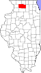
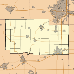
Baileyville
Location within Ogle County
USA Illinois location map.svg
Red pog.svg
Baileyville
Baileyville (Illinois)
Coordinates: 42°11′50″N89°35′36″W / 42.19722°N 89.59333°W / 42.19722; -89.59333
CountryUnited States
StateIllinois
County Ogle
Township Forreston
Area
[1]
  Total0.24 sq mi (0.63 km2)
  Land0.24 sq mi (0.63 km2)
  Water0.00 sq mi (0.00 km2)
Elevation
[2]
925 ft (282 m)
Population
 (2020)
  Total187
  Density772.73/sq mi (298.62/km2)
Time zone UTC-6 (CST)
  Summer (DST) UTC-5 (CDT)
ZIP Code
61007
Area codes 779, 885
FIPS code 17-03337

Baileyville is an unincorporated community in Ogle County, Illinois, and is located west of Rockford.

Contents

The community was named after O. Bailey, a pioneer citizen. [3]

Demographics

Historical population
CensusPop.Note
2020 187
U.S. Decennial Census [4]
Grain elevators in Baileyville. Baileyville, IL Grain Elevator.JPG
Grain elevators in Baileyville.
Older elevator in Baileyville. Baileyville, IL Old Grain Elevator.JPG
Older elevator in Baileyville.

Related Research Articles

<span class="mw-page-title-main">Clinton County, Illinois</span> County in Illinois, United States

Clinton County is located in the U.S. state of Illinois. At the 2020 census, the population was 36,899. Its county seat is Carlyle.

<span class="mw-page-title-main">Clay County, Illinois</span> County in Illinois, United States

Clay County is a county in the U.S. state of Illinois. As of the 2020 United States Census, the population was 13,288. Since 1842, its county seat has been Louisville, in the center of the county's area.

<span class="mw-page-title-main">Will County, Illinois</span> County in Illinois, United States

Will County is a county in the northeastern part of the state of Illinois. According to the 2020 census, it had a population of 696,355, an increase of 2.8% from 677,560 in 2010, making it Illinois's fourth-most populous county. The county seat is Joliet. Will County is one of the five collar counties of the Chicago-Naperville-Elgin, IL-IN-WI Metropolitan Statistical Area. The portion of Will County around Joliet uses area codes 815 and 779, while 630 and 331 are for far northern Will County and 708 is for central and eastern Will County.

<span class="mw-page-title-main">Nemaha County, Kansas</span> County in Kansas, United States

Nemaha County is a county located in the northeastern part of the U.S. state of Kansas. Its county seat is Seneca. As of the 2020 census, the county population was 10,273. The county was named for the Nemaha River.

<span class="mw-page-title-main">Stephenson County, Illinois</span> County in Illinois, United States

Stephenson County is a county located in the U.S. state of Illinois. According to the 2020 United States Census, it had a population of 44,630. Its county seat is Freeport.

<span class="mw-page-title-main">St. Clair County, Illinois</span> County in Illinois, United States

St. Clair County is the ninth most populous county in Illinois. Located directly east of St. Louis, the county is part of the Metro East region of the Greater St. Louis metropolitan area in southern Illinois. As of the 2020 United States census, St. Clair County had a population of 257,400, making it the third most populous county in Illinois outside the Chicago metropolitan area. Belleville is the county’s seat and largest city.

<span class="mw-page-title-main">Sangamon County, Illinois</span> County in Illinois, United States

Sangamon County is located in the center of the U.S. state of Illinois. According to the 2020 census, it had a population of 196,343. Its county seat and largest city is Springfield, the state capital.

<span class="mw-page-title-main">Ogle County, Illinois</span> County in Illinois, United States

Ogle County is a county in the northern part of the U.S. state of Illinois. According to the 2020 United States Census, it had a population of 51,788. Its county seat is Oregon, and its largest city is Rochelle. Ogle County comprises Rochelle, IL Micropolitan Statistical Area, which is also included in the Rockford-Freeport-Rochelle, IL Combined Statistical Area.

<span class="mw-page-title-main">McLean County, Illinois</span> County in Illinois, United States

McLean County is the largest county by land area in the U.S. state of Illinois. According to the 2020 Census, it had a population of 170,954. Its county seat is Bloomington. McLean County is included in the Bloomington–Normal, IL Metropolitan Statistical Area.

<span class="mw-page-title-main">Macoupin County, Illinois</span> County in Illinois, United States

Macoupin County is located in the U.S. state of Illinois. According to the 2020 census, it had a population of 44,967. The county seat is Carlinville.

<span class="mw-page-title-main">DeKalb County, Illinois</span> County in Illinois, United States

DeKalb County is a county located in the U.S. state of Illinois. As of the 2020 United States Census, the population was 100,420. Its county seat is Sycamore.

<span class="mw-page-title-main">Champaign County, Illinois</span> County in Illinois, United States

Champaign County is a county in the U.S. state of Illinois. As of the 2020 Census, its population was 205,865, making it the 10th-most populous county in Illinois. Its county seat is Urbana.

<span class="mw-page-title-main">Cass County, Illinois</span> County in Illinois, United States

Cass County is a county located in the U.S. state of Illinois. As of the 2020 United States Census, the population was 13,042. Its county seat is Virginia. It is the home of the Jim Edgar Panther Creek State Fish and Wildlife Area.

<span class="mw-page-title-main">Joliet, Illinois</span> City in Illinois, United States

Joliet is a city in Will and Kendall counties in the U.S. state of Illinois, 35 miles (56 km) southwest of Chicago. It is the county seat of Will County. At the 2020 census, the city was the third-largest in Illinois, with a population of 150,362.

Baileyville is a town in Washington County, Maine, United States. The population was 1,318 at the 2020 census. Within the town is the census-designated place of Woodland. The town was originally settled by Quakers in 1780. In 1830, Ezekiel Bailey began the commercial manufacture of oilcloth. The business flourished and expanded until it comprised several factories, which burned down in 1921.

<span class="mw-page-title-main">Wallkill, Orange County, New York</span> Town in New York, United States

Wallkill is a town in Orange County, New York, United States. The population was 30,486 at the 2020 census. It is centrally located in the county. Interstate 84 crosses New York State Route 17 in the southern part of the town. U.S. Route 6 and New York State routes 17K, 211 and 302 also cross portions of the town.

Baileyville may refer to:

<span class="mw-page-title-main">Forreston Township, Ogle County, Illinois</span> Township in Illinois, United States

Forreston Township is located in Ogle County, Illinois. As of the 2010 census, its population was 2,080 and it contained 885 housing units. Forreston Township was formed from a portion of Brookville Township on March 4, 1857. The village of Forreston and the unincorporated community of Baileyville are located within it.

<span class="mw-page-title-main">Area codes 815 and 779</span> Telephone area codes

Area codes 815 and 779 are telephone area codes in the North American Numbering Plan (NANP) for most of northern Illinois outside the Chicago and Quad Cities areas. It also serves the Joliet area and some of Chicago’s western and northwestern exurbs. 815 was one of the four original Illinois area codes set up in 1947. Area code 779 was assigned to the same numbering plan area in 2009 to form an overlay.

<span class="mw-page-title-main">Baileyville, Pennsylvania</span> Census-designated place in Pennsylvania, United States

Baileyville is a census-designated place in the southern portion of Ferguson Township, Centre County, Pennsylvania. As of the 2010 census, the population was 201 residents.

References

  1. "2020 U.S. Gazetteer Files". United States Census Bureau. Retrieved March 15, 2022.
  2. "USGS detail on Newtown" . Retrieved 2007-10-21.
  3. Illinois Central Magazine. Illinois Central Railroad Company. 1922. p. 43.
  4. "Census of Population and Housing". Census.gov. Retrieved June 4, 2016.