Byron, Illinois

Last updated

Byron
Byron, IL Post Office 03.JPG
Post Office in Byron.
Motto: 
Gateway to the Rock River Valley.
Ogle County Illinois Incorporated and Unincorporated areas Byron Highlighted.svg
Location of Byron in Ogle County, Illinois.
Location map of Ogle County, Illinois.svg
Red pog.svg
Byron
Location within Ogle County
Coordinates: 42°07′38″N89°15′39″W / 42.12722°N 89.26083°W / 42.12722; -89.26083
CountryUnited States
StateIllinois
County Ogle
Township Byron
FoundedJuly 1835
Incorporated Town 1878
City Charter ?
Government
   Mayor John Rickard
Area
[1]
  Total4.65 sq mi (12.05 km2)
  Land4.65 sq mi (12.04 km2)
  Water0.00 sq mi (0.00 km2)
Elevation
[2]
728 ft (222 m)
Population
 (2020)
  Total3,784
  Density813.76/sq mi (314.23/km2)
Time zone UTC-6 (CST)
  Summer (DST) UTC-5 (CDT)
ZIP code
61010 [3]
Area code 815
FIPS code 17-10240
Website byron.govoffice.com
Byron IL.jpg

Byron is a city in Ogle County, Illinois, United States, probably best known as the location of the Byron Nuclear Generating Station, one of the last nuclear power plants commissioned in the United States. Byron is located in Byron Township, along the Rock River. The population was 3,753 at the 2010 census, up from 2,917 at the 2000 census. The town bills itself as the "Gateway to the Rock River Valley". [4]

Contents

History

The city that is now Byron was founded when a settler rode through the area on his way from Galena to Midway. [5] [6]

Geography

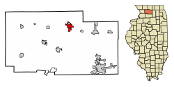
Byron is located in Byron Township at the junction of Illinois Route 72 and Illinois Route 2. Byron's topography includes a man-made prairie and the Rock River that passes through the town. It is generally flat and is ideal for farming in most regions. [7] According to the 2010 census, Byron has a total area of 3.572 square miles (9.25 km2), of which 3.57 square miles (9.25 km2) (or 99.94%) is land and 0.002 square miles (0.01 km2) (or 0.06%) is water. [8]

Byron's average temperature in the spring tends to be 50–65 degrees with considerable rain. Summer tends to be 75–100 degrees with moderate humidity. Fall tends to be 35–65 degrees with leaves falling in mid-October. Winter tends to be cold, with temperatures averaging from freezing to ten or fifteen degrees below freezing in January.

The Iowa, Chicago, and Eastern Railroad passes by the town as well.

Economy

The Byron Nuclear Generating Station, currently owned by Exelon Corporation, is just south of Byron. It began operations in 1985, after ten years of construction. The station provides a great deal of the electricity used in northern Illinois.

Education

There are three schools: Mary Morgan Elementary School, Byron Middle School, and Byron High School (pre-K-12) serving approximately 2,500 students. Byron High School placed fourth in the Illinois State Finals Academic Challenge in 2001.

Mary Morgan Elementary School was named an "Exemplary High Performing School" by the U.S. Department of Education's National Blue Ribbon Schools Program, awarded in 2017. [9]

Demographics

Historical population
CensusPop.Note
1890 698
1900 1,01545.4%
1910 932−8.2%
1920 855−8.3%
1930 9157.0%
1940 1,11321.6%
1950 1,23711.1%
1960 1,57827.6%
1970 1,74910.8%
1980 2,03516.4%
1990 2,28412.2%
2000 2,91727.7%
2010 3,75328.7%
2020 3,7840.8%
U.S. Decennial Census [10]

As of the census [11] of 2000, there were 2,917 people, 1,119 households, and 747 families residing in the city. The population density was 1,179.2 inhabitants per square mile (455.3/km2). There were 1,166 housing units at an average density of 471.4 per square mile (182.0/km2). The racial makeup of the city was 97.70% White, 0.41% African American, 0.14% Native American, 0.31% Asian, 0.31% from other races, and 1.13% from two or more races. Hispanic or Latino of any race were 1.54% of the population. According to a special census taken in 2006, the population of the city has increased to 3,779 since the 2000 census.

There were 1,119 households, out of which 38.6% had children under the age of 18 living with them, 51.4% were married couples living together, 12.0% had a female householder with no husband present, and 33.2% were non-families. 28.8% of all households were made up of individuals, and 13.0% had someone living alone who was 65 years of age or older. The average household size was 2.53 and the average family size was 3.15.

In the city, the population was spread out, with 30.2% under the age of 18, 7.4% from 18 to 24, 30.2% from 25 to 44, 17.4% from 45 to 64, and 14.8% who were 65 years of age or older. The median age was 34 years. For every 100 females, there were 88.3 males. For every 100 females age 18 and over, there were 83.5 males.

The median income for a household in the city was $37,027, and the median income for a family was $46,250. Males had a median income of $40,568 versus $23,221 for females. The per capita income for the city was $17,164. About 6.9% of families and 7.8% of the population were below the poverty line, including 8.3% of those under age 18 and 7.5% of those age 65 or over.

Law and government

Byron is divided into four wards, each of which elects two alderman, giving the city an eight-member council. The eight members of the council are organized into five committees with specific responsibilities, necessarily, given the number of council members, committee memberships overlap.

Elected separately, by the whole city, is the mayor. The mayor's powers include the right to appoint members of the five standing committees, and to preside over council meetings. He may also call special meetings of the council. The mayor receives an annual salary of $9000.

The city also has other elected officials, including a city clerk and a treasurer. There are also unelected paid positions; these are filled by appointment of the mayor. These include the comptroller and the city attorney.

Despite the fact that Byron has a mayor-council system of government, the municipal code for Byron contains a provision whereby a city administrator may be appointed, if the mayor and council so desire. To date, this provision has not been placed into effect.

Festivals

Notable people

See also

Notes

  1. "2020 U.S. Gazetteer Files". United States Census Bureau. Retrieved March 15, 2022.
  2. "USGS detail on Newtown" . Retrieved October 21, 2007.
  3. "Byron IL ZIP Code". zipdatamaps.com. 2023. Retrieved May 12, 2023.
  4. "Byron, Illinois Home Page". Byron, Illinois.
  5. Sherman, Ardis L. "Reflections - Byron, Illinois 1835-1976," Byron, Illinois, 1976, pg. 3, Library of Congress Catalog No. 76-20318, Retrieved August 22, 2007.
  6. history.com/byron-il//
  7. history.com
  8. "G001 - Geographic Identifiers - 2010 Census Summary File 1". United States Census Bureau. Archived from the original on February 13, 2020. Retrieved December 25, 2015.
  9. "NBRS Mary Morgan Elementary School of Byron, IL". June 30, 2000.
  10. "Census of Population and Housing". Census.gov. Retrieved June 4, 2015.
  11. "U.S. Census website". United States Census Bureau . Retrieved January 31, 2008.
  12. "ByronFest 2022 - July 8, 9, 10". ByronFest.
  13. Reflections - Byron, Illinois 1835-1976 Retrieved on August 7, 2007
  14. Reichler, Joseph L., ed. (1979) [1969]. The Baseball Encyclopedia (4th ed.). New York: Macmillan Publishing. ISBN   0-02-578970-8.

Related Research Articles

<span class="mw-page-title-main">Alexandria, Indiana</span> City in Indiana, United States

Alexandria is a city in Monroe Township, Madison County, Indiana, United States. It is about 48 miles (77 km) northeast of Indianapolis. According to the 2020 census, its population was 5,149, nearly unchanged from 2010.

<span class="mw-page-title-main">Quartz Hill, California</span> Census-designated place in California, United States

Quartz Hill is a census-designated place (CDP) in Los Angeles County, California, United States. The population was 10,912 at the 2010 census, up from 9,890 at the 2000 census. The name is also shared with the neighboring district areas of its border cities, Palmdale, and Lancaster. Quartz Hill was once home to the Quartz Hill Airport. According to the Greater Antelope Valley Economic Alliance report of 2009, the Palmdale / Lancaster urban area of which Quartz Hill is a part, has a population of 483,998.

<span class="mw-page-title-main">Richton Park, Illinois</span> Village in Illinois, United States

Richton Park is a village and a southern suburb of Chicago in Cook County, Illinois, United States. The population was 12,775 at the 2020 census. The community was named after a Richton in Vermont, the native home of a first settler.

<span class="mw-page-title-main">Genoa, Illinois</span> Place in Illinois, United States

Genoa is a city in the north-east corner of DeKalb County, Illinois, United States. It is located on the historic Galena-Chicago stagecoach route. At the 2020 census the city had a population of 5,298, up from 5,193 in 2010.

<span class="mw-page-title-main">Farmington, Illinois</span> City in Illinois, United States

Farmington is a city in Fulton County & Peoria County, Illinois, United States. It is north of Canton, west of Peoria, southeast of Galesburg, and northeast of Macomb. The population was 2,389 at the 2020 census. The public school system is Farmington Central Community Unit School District 265, which includes Farmington Central High School. Because it is in Fulton County & Peoria County, it is a part of the Canton Micropolitan Area and the wider Peoria Consolidated Statistical Area.

<span class="mw-page-title-main">Coal City, Illinois</span> Village in Illinois, United States

Coal City is a village in Grundy and Will Counties in the U.S. state of Illinois. It is considered a fringe town of the Chicago metropolitan area. The population was 5,587 at the 2010 census.

Venetian Village is a census-designated place (CDP) in Lake County, Illinois, United States. Per the 2020 census, the population was 2,761.

<span class="mw-page-title-main">Red Bud, Illinois</span> City in Illinois, United States

Red Bud is a city in Randolph County, Illinois, in the United States. The population was 3,804 at the 2020 census.

<span class="mw-page-title-main">Port Byron, Illinois</span> Village in Illinois, United States

Port Byron is a village in Rock Island County, Illinois, United States and part of the Quad Cities Metropolitan Area. The population was 1,668 at the time of the 2020 census; up from 1,647 at the 2010 census.

<span class="mw-page-title-main">Divernon, Illinois</span> Village in Illinois, United States

Divernon is a village in Sangamon County, Illinois, United States. The population was 1,172 at the 2010 census, and 1,119 at a 2018 estimate. It is part of the Springfield, Illinois Metropolitan Statistical Area.

<span class="mw-page-title-main">Nashville, Illinois</span> City in Illinois, United States

Nashville is a city in Washington County, Illinois, United States. As of the 2020 census, the city population was 3,105. It is the county seat of Washington County.

<span class="mw-page-title-main">LeClaire, Iowa</span> City in Iowa, United States

LeClaire is a city in Scott County, Iowa, United States. The population was 4,710 in 2020, a 65.4% increase from 2,847 in 2000, making it one of the fastest-growing communities in the Quad Cities. LeClaire is considered a suburb and part of the Quad Cities Metropolitan Area, which includes the area of Davenport and Bettendorf, Iowa, and Rock Island, Moline, and East Moline, Illinois.

<span class="mw-page-title-main">Princeton, Iowa</span> City in Iowa, United States

Princeton is a city in Scott County, Iowa, United States. The population was 923 at the time of the 2020 census.

<span class="mw-page-title-main">Washington, Iowa</span> City in Iowa, United States

Washington is a city in and the county seat of Washington County, Iowa, United States. It is part of the Iowa City, Iowa Metropolitan Statistical Area. The population was 7,352 at the time of the 2020 census.

<span class="mw-page-title-main">Andover, Minnesota</span> City in Minnesota, United States

Andover is a city in Anoka County, Minnesota, United States. The population was 32,601 at the 2020 census.

<span class="mw-page-title-main">Little Canada, Minnesota</span> City in Minnesota, United States

Little Canada is a city in Ramsey County, Minnesota, United States. It is a second-ring suburb of Minneapolis-Saint Paul. The population was 10,819 at the 2020 census.

<span class="mw-page-title-main">Canfield, Ohio</span> City in Ohio, United States

Canfield is a city in central Mahoning County, Ohio, United States. The population was 7,699 as of the 2020 census. A suburb about 8 miles (13 km) southwest of Youngstown, the city lies at the intersection of U.S. Routes 62 and 224 and is part of the Youngstown–Warren metropolitan area. In 2005, Canfield was rated the 82nd best place to live in the United States by Money magazine.

<span class="mw-page-title-main">Jefferson, Oregon</span> City in Oregon, United States

Jefferson is a city in Marion County, Oregon, United States. It is part of the Salem Metropolitan Statistical Area. The population was 3,327 at the 2020 census. The city sits on the right bank of the Santiam River between Salem and Albany along Oregon Route 164 east of Interstate 5.

<span class="mw-page-title-main">Hamlin, West Virginia</span> Town in West Virginia, United States

Hamlin is a town in and the county seat of Lincoln County, West Virginia, United States, along the Mud River. The population was recorded as 1,040 at the 2020 census. It is part of the Huntington–Ashland metropolitan area.

<span class="mw-page-title-main">St. Croix Falls (town), Wisconsin</span> Town in Wisconsin, United States

St. Croix Falls is a town in Polk County, Wisconsin, United States. The population was 1,119 at the 2000 census. The City of St. Croix Falls is located within the town. The unincorporated community of Lamar is located in the town.