Kings, Ogle County, Illinois

Last updated

Kings
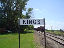
Kings, IL Sign 01.JPG
Sign along the railroad tracks for Kings
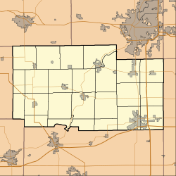
Location map of Ogle County, Illinois.svg
Red pog.svg
Kings
Location within Ogle County
USA Illinois location map.svg
Red pog.svg
Kings
Kings (Illinois)
Coordinates: 42°00′16″N89°06′24″W / 42.00444°N 89.10667°W / 42.00444; -89.10667
Country United States
State Illinois
County Ogle
Township White Rock
Area
[1]
  Total
0.15 sq mi (0.40 km2)
  Land0.15 sq mi (0.40 km2)
  Water0.00 sq mi (0.00 km2)
Elevation
[2]
886 ft (270 m)
Population
 (2020)
  Total
146
  Density954.25/sq mi (368.01/km2)
Time zone UTC-6 (CST)
  Summer (DST) UTC-5 (CDT)
ZIP Code
61045
Area code 815
FIPS code 17-39987

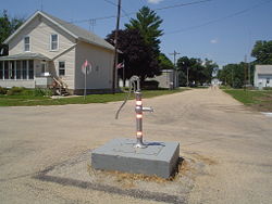
Kings is an unincorporated community in Ogle County, Illinois, United States, and is located northwest of Rochelle. [3]

Contents

Demographics

Historical population
CensusPop.Note
2020 146
U.S. Decennial Census [4]

Kings first appeared as a census designated place in the 2020 U.S. Census. [5]

Related Research Articles

<span class="mw-page-title-main">Ogle County, Illinois</span> County in Illinois, United States

Ogle County is a county in the northern part of the U.S. state of Illinois. According to the 2020 United States Census, it had a population of 51,788. Its county seat is Oregon, and its largest city is Rochelle. Ogle County comprises Rochelle, IL Micropolitan Statistical Area, which is also included in the Rockford-Freeport-Rochelle, IL Combined Statistical Area.

<span class="mw-page-title-main">Lee County, Illinois</span> County in Illinois, United States

Lee County is a county located in the U.S. state of Illinois. According to the 2020 census, it has a population of 34,145. Its county seat is Dixon. The Dixon, IL Micropolitan Statistical Area includes all of Lee County.

<span class="mw-page-title-main">Jo Daviess County, Illinois</span> County in Illinois, United States

Jo Daviess County is the northwesternmost county in the U.S. state of Illinois. According to the 2020 census, it had a population of 22,035. Its county seat is Galena. Jo Daviess County is part of the Tri-State Area and is located near Dubuque, Iowa and Platteville, Wisconsin. As part of the Driftless Area, Jo Daviess County contains rugged terrain compared to the rest of the state. Within Jo Daviess County lies Charles Mound, the highest natural point in Illinois, as well as eight of the ten highest points in Illinois.

<span class="mw-page-title-main">DeKalb County, Illinois</span> County in Illinois, United States

DeKalb County is a county located in the U.S. state of Illinois. As of the 2020 United States census, the population was 100,420. Its county seat is Sycamore. DeKalb County is part of the Chicago–Naperville–Elgin, IL–IN–WI Metropolitan Statistical Area.

<span class="mw-page-title-main">Ashton, Illinois</span> Village in Illinois, United States

Ashton is a village in Lee County, Illinois, United States. The population was 972 at the 2010 census, down from 1,142 in 2000.

<span class="mw-page-title-main">Chatsworth, Illinois</span> Town in Illinois, United States

Chatsworth is an incorporated town in Livingston County, Illinois, United States. The population was 1,332 at the 2020 census.

<span class="mw-page-title-main">Cornell, Illinois</span> Village in Illinois, United States

Cornell is a village in Livingston County, Illinois, United States. The population was 446 at the 2020 census.

<span class="mw-page-title-main">Davis Junction, Illinois</span> Village in Illinois, United States

Davis Junction is a village in Ogle County, Illinois, United States. The population was 2,512 at the 2020 census. Named for Jeremiah Davis, it is located where the Illinois Railway Rockford Line and the Canadian Pacific Railway Chicago Subdivision intersect along Illinois Route 72. It is the site of the Orchard Hills Landfill - one of the largest in the United States.

<span class="mw-page-title-main">Mount Morris, Illinois</span> Village in Illinois, United States

Mount Morris is a village in Mount Morris Township, Ogle County, Illinois, United States. The population was 2,998 at the 2010 census, down from 3,013 in 2000.

<span class="mw-page-title-main">Oregon, Illinois</span> City in Illinois, United States

Oregon is a city in and the county seat of Ogle County, Illinois, United States. The population was 3,721 in 2010.

<span class="mw-page-title-main">Shiloh, Illinois</span> Village in Illinois, United States

Shiloh is a village in St. Clair County, Illinois, United States. The 2010 census recorded a population of 12,651. Shiloh is located within the St. Louis metropolitan area

<span class="mw-page-title-main">Northwestern Illinois</span> Geographic region of the U.S. state of Illinois

Northwestern Illinois is a geographic region of the state of Illinois within the USA.

<span class="mw-page-title-main">Monroe Center, Illinois</span> Village in Illinois, United States

Monroe Center is a village in Ogle County, Illinois, United States, southeast of Rockford in Monroe Township. It is located on the Canadian Pacific Railway and on Illinois Route 72, about .6 mile east of Exit 111 from Interstate 39. The village had a population of 471 at the 2010 census.

<span class="mw-page-title-main">Baileyville, Illinois</span> Place in Illinois, United States

Baileyville is an unincorporated community and census designated place (CDP) in Ogle County, Illinois, and is located west of Rockford.

<span class="mw-page-title-main">Byron Township, Illinois</span> Township in Illinois, United States

Byron Township is one of twenty-four townships in Ogle County, Illinois, USA. As of the 2010 census, its population was 6,563 and it contained 2,594 housing units.

<span class="mw-page-title-main">Dement Township, Illinois</span> Township in Illinois, United States

Dement Township is one of twenty-four townships in Ogle County, Illinois, USA. As of the 2010 census, its population was 989 and it contained 409 housing units.

<span class="mw-page-title-main">Eagle Point Township, Illinois</span> Township in Illinois, United States

Eagle Point Township is one of twenty-four townships in Ogle County, Illinois, USA. As of the 2010 census, its population was 227 and it contained 106 housing units.

<span class="mw-page-title-main">Rockford metropolitan area, Illinois</span> Combined Statistical Area in Illinois, United States

The Rockford Metropolitan Statistical Area, as defined by the United States Census Bureau, is an area consisting of four counties in north-central Illinois, anchored by the city of Rockford. As of the 2010 census, the MSA had a population of 349,431. The Rockford MSA abuts the southern portions of the Janesville-Beloit MSA and the Chicago MSA. It forms the main part of the larger Rockford–Freeport–Rochelle Combined Statistical Area.

Holcomb is an unincorporated community in Ogle County, Illinois, United States. Holcomb is 3 miles (4.8 km) south of Davis Junction. Holcomb has a post office with ZIP code 61043. Holcomb was founded in 1876. It was named for William H. Holcomb, General Manager of the Chicago and Iowa Railroad at the time. He was also the Superintendent of Transportation for the World's Columbian Exposition held in Chicago in 1893.

Twin Grove is an unincorporated community and census-designated place (CDP) in McLean County, Illinois, United States. As of the 2020 census, Twin Grove had a population of 1,524.

References

  1. "2020 U.S. Gazetteer Files". United States Census Bureau. Retrieved March 15, 2022.
  2. "USGS detail on Newtown" . Retrieved October 21, 2007.
  3. "Kings, Ogle County, Illinois". Geographic Names Information System . United States Geological Survey, United States Department of the Interior.
  4. "Census of Population and Housing". Census.gov. Retrieved June 4, 2016.
  5. "2020 Geography Changes". United States Census Bureau.