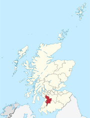
Kilmaurs is a village in East Ayrshire, Scotland which lies just outside of the largest settlement in East Ayrshire, Kilmarnock. It lies on the Carmel Water, 21 miles southwest of Glasgow. Population recorded for the village in the 2001 Census recorded 2,601 people resided in the village It was in the Civil Parish of Kilmaurs.

The village or hamlet of Gatehead is located in East Ayrshire, Parish of Kilmaurs, Scotland. It is one and a quarter miles from Crosshouse and one and a half miles from Kilmarnock. In the 18th and 19th centuries the locality was a busy coal mining district. The settlement runs down to the River Irvine where a ford and later a bridge was located.
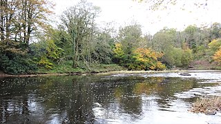
Knockentiber is a village in East Ayrshire, Parish of Kilmaurs, Scotland. Knockentiber is two miles west-northwest of Kilmarnock and 1⁄2 mile northeast of Crosshouse. Latitude:55.6193°N Longitude:4.5455°W and grid reference NS397392. The population was 359 in 1991, however the population is much higher following the construction of several housing estates (2007). In the 18th and 19th and mid 20th centuries the locality was a highly industrialised coal mining district. The settlement is on the Carmel Burn, which runs into the River Irvine, around one mile to the south.
A moot hill or mons placiti is a hill or mound historically used as an assembly or meeting place, as a moot hall is a meeting or assembly building, also traditionally to decide local issues. In early medieval Britain, such hills were used for "moots," meetings of local people to settle local business. Among other things, proclamations might be read; decisions might be taken; court cases might be settled at a moot. Although some moot hills were naturally occurring features or had been created long before as burial mounds, others were purpose-built.

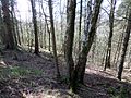
Kilmaurs Place, The Place or Kilmaurs House, is an old mansion house and the ruins of Kilmaurs Tower grid reference NS41234112 are partly incorporated, Kilmaurs, East Ayrshire, Scotland. The house stands on a prominence above the Carmel Water and has a commanding view of the surrounding area. Once the seat of the Cunningham Earls of Glencairn it ceased to be the main residence after 1484 when Finlaystone became the family seat. Not ot be confused with Kilmaurs Castle that stood on the lands of Jocksthorn Farm.

Kilmaurs Castle was located on the lands of Jocksthorn Farm near Kilmaurs in East Ayrshire, Scotland. It is described by Timothy Pont in the early 17th century as "Ye castell is ane ancient ftronge building belonging to ye Earls of Glencairne environed with a fair park called Carmell wod from ye vatter of Carmell yat runs by it." Dobie goes on to state that "The old baronial manor place is supposed to have been situated about a mile south-east of Kilmaurs, where some ruins can still be pointed out on the farm of Jock's-thorn, probably the original Villam de Cuninghame - the first possession of the family." The castle is not to be confused with the later Cunninghame family possession known as Kilmaurs Place which Dobie calls "..comparatively modern" in 1876.

The Castle of Clonbeith is in the old feudal Baillerie of Cunninghame, near Auchentiber, on a sideroad off the B778, in what is now North Ayrshire, Scotland.

Busbie Castle was situated in what is now known as Knockentiber, a village in East Ayrshire, Parish of Kilmaurs, Scotland. Knockentiber is 2 miles (3.2 km) WNW of Kilmarnock and 1/2 mile NE of Crosshouse. The castle overlooked the Carmel Glen and its Burn, which runs into the River Irvine, a mile or so to the south, after passing through the old Busbie Mill.
Buiston Loch, also known as Buston, Biston, and Mid Buiston was situated in the mid-Ayrshire clayland at an altitude of 90 m OD. The loch was natural, sitting in a hollow created by glaciation. The loch waters drained via the Garrier Burn that joins the Bracken and Lochridge Burns before joining the River Irvine.

Lindston Loch was a small freshwater loch situated within a glacial 'kettle hole.' The loch lies in the South Ayrshire Council Area, Parish of Dalrymple, Scotland.
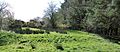
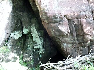
The Maak's or Monk's Well is situated beside the Carmel Water in Kilmaurs, East Ayrshire., Scotland. A possible 'Holy Well', it was once a public water supply for the villagers and residents of the old castle at Kilmaurs Place.

The Lands of Tour and Kirkland (NS416406) formed a small estate close to the old Kirktoun and St Maurs-Glencairn collegiate church about 1 km south-east of Kilmaurs, East Ayrshire, Parish of Kilmaurs, Scotland. The word 'Tour' in Scots refers to a 'tower' and 'kirk' to a parish church.

The Scheduled Ancient Monument of Alloway Mote, also known as the Alloway Moat or Alloway Motte, is a roughly circular earthwork that is regarded as a possible early medieval ringwork, located near the town of Alloway in South Ayrshire, Scotland.
The Holy Cave at Hunterston in the Parish of West Kilbride is associated with Saint Mungo, also known as St Kentigern and is often referred to as the Hawking Craig Cave however two caves exists in the Hawking Craig Wood and 'Three Sisters' area of the cliffs, the other being Smith's Cave, better described as a rock shelter lying a short distance to the south. The main cave has been excavated and the finds indicate three periods of occupation over many centuries.
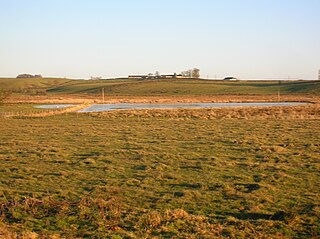
What now survives of the old Caprington Loch (NS402352) is situated near Earlston, Riccarton, East Ayrshire, Scotland. The loch was a natural feature, sitting in a hollow on the old Caprington Castle estate. The loch waters drain via the Todrigs Burn that flows into the River Irvine to the east of Gatehead village. It was partly drained, probably sometime after the 1820s, as were so many other lochs, as part of 18th and 19th centuries extensive agricultural improvements and the only area of open water that remains does so as it was once used as a curling pond for the Caprington Castle Estate owners and their employees or tenants.

The ruins of the large courtyard style Kyle Castle, once also known as Cavil Castle or occasionally Dalblair Castle lie close to the hamlet of Dalblair in Auchinleck parish near Muirkirk in the East Ayrshire council area, Scotland. The castle stands at the confluence of the Guelt Water and the Glenmuirshaw Water on a peninsula carved out by these rivers. Its name suggests that it was once of some significance.
The castle known as Gadgirth Old Ha' or Gadgirth Old Hall, was the first castle at Gadgirth, held by the Chalmer family, standing on a whinstone promontory overlooking the River Ayr in the Parish of Coylton, the old district of Kyle, now part of South Ayrshire, Scotland.
Cairnduff,Cairn Duff or Carn Duff is a roughly circular Bronze Age burial cairn, located on the lands of High Peacockbank Farm near the town of Stewarton in East Ayrshire, Scotland. It was built around 3000 years ago.

Lawthorn is a hamlet near Perceton in Strathannick, Irvine, North Ayrshire, Scotland. The settlement lies on the old Irvine to Stewarton toll road.

The Glencairn Aisle or Glencairn Vault at Kilmaurs, East Ayrshire is a vaulted sepulchral chapel built as a place for private contemplation and prayer and also contains a large memorial monument, as well as the burial crypt of the Cunningham Earls of Glencairn and their family members. It houses an exceptional ornately carved stone monument dated 1600 that commemorates James Cunningham, the 7th Earl of Glencairn, his countess, Margaret Campbell and eight of their children. It is the oldest such monument in Ayrshire and the oldest post-reformation monument in Scotland. The other Ayrshire examples being the Bargany Aisle at Ballantrae of circa 1601, the Skelmorlie Aisle at Largs of 1639 and the Hamilton Aisle at Dunlop of 1641.