Jajarkot District a part of Karnali Province, is one of the seventy-seven districts of Nepal. The district, with Khalanga as its district headquarters, covers an area of 2,230 km2 (860 sq mi) and has a population of 171,304 in 2011 Nepal census.

Solukhumbu District (Nepali: सोलुखुम्बु जिल्ला, Sherpa: ཤར་ཁུམ་བུ་རྫོང་།, Wylie: shar khum bu dzong) is one of 14 districts of Koshi Province of eastern Nepal. As the name suggests, it consists of the subregions Solu and Khumbu. The closest post office to Solukhumbu with a postal code assigned to it is the Sindhuli D.P.O., which has the postal code 56000.

Tanahun District, a part of Gandaki Province, is one of the seventy-seven districts of Nepal. The district lies in central Nepal, with Damauli as its district headquarters. It covers an area of 1,546 km2 (597 sq mi) and has a population (2011) of 323,288. Previously the town of Bandipur was its district headquarter. The postal code of Tanahun is 33900.

Siddhidas Mahaju was a Nepalese poet and one of the Four Pillars of Nepal Bhasa. He was at the forefront in the endeavour to revive literature in Nepal Bhasa that had become stagnant as a result of official suppression. He has been honored with the title Great Poet.
Dhanauji is a rural municipality in Dhanusha District in Province No. 2 of south-eastern Nepal established in 2073. As of 2011 Nepal census, it has a population of 22,395. It was formed by joining Jhojhi Kataiya, Lakhauri, Bahuarba and former Dhanuji Village development committees. The total area of Nagarain municipality is 22 km2.
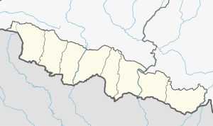
Nagarain is a municipality in Dhanusha District in Province No. 2 of south-eastern Nepal. As of 2011 Nepal census, it has a population of 36,336 living in 6,478 individual households. It was formed by joining Fulgama, Devdiha, old Nagrain, Lagmagadha Guthi and Ghodghans village development committees. The total area of Nagarain municipality is 38.71 km2.
Mukhiyapatti Musharniya is a rural municipality in Dhanusha District in Province No. 2 of south-eastern Nepal established in 2073 BS. As of 2011 Nepal census, it has a population of 25,482. It was formed by joining Tulsiyahi Nikas, Tulsiyani Jabdi, Baheda Bela and former Mukhiyapatti Musharniya Village development committees. The total area of Nagarain municipality is 26.84 km2.
Ratnanagar is a municipality in Chitwan District of Bagmati Province in Nepal. It is the second biggest municipality after Bharatpur Metropolitan City that was formed in 1997 through the merger of the former Village Development Committees Old-Ratnanagar and Panchakanya. It is adjacent to Chitwan National Park, and serves as a gateway to the park. Agricultural products produced from Ratnanagar includes rice, maize, mustard and vegetables. This municipality is also a major place for production of poultry products and animal husbandry. Tourism is another source of income generation for the people in Ratnanagar. People are directly or indirectly dependent in tourism industry. Ratnanagar is also concerned in environment preservation so in order to preserve and protect environment, eco-friendly electric risk-shaw has also been introduced and available in different parts of this municipality. It lies on the bank of East Rapti River.
Bhagawati Tol is a former village development committee in Jajarkot District in the Karnali Province of Nepal. At the time of the 1991 Nepal census it had a population of 2247 living in 424 individual households.

Vyas (Byas), is a municipality of Tanahun District located in Gandaki Province in Nepal and incorporates the village Damauli, the district headquarters, for which the municipality is also often referred to as Damauli. The municipality was established by merging the former Village development committee Damauli with several of its neighbors, the most recent merger being the one with Pokhari Bhanjyang in 2014. It lies on the bank of Madi Khola.
Balara (Maithili/Nepali: बलरा) is a municipality in Sarlahi District, a part of Madhesh Province in Nepal. It was formed in 2016 occupying current 12 sections (wards) from previous 9 former VDCs. It occupies an area of 48.55 km2 with a total population of 45,194.
Kaudena is a rural municipality in Sarlah i District, a part of Province No. 2 in Nepal. It was formed in 2016 occupying current 7 sections (wards) from previous 7 former VDCs. It occupies an area of 25.33 km2 with a total population of 36,881.The postal code of Kaudena is 45809. It is rich in Cultural diversity. All the groups, cast live peacefully here. There is the proper facility of School, Hospital, Health center, Clinic.There are two major boarding school here and one is government school. At here you will find a very good market facility for the farmers. The market for the farmers is opened on Monday and Thursday to sell their vegetables. There is a Police custody for the culprits which is located just by the side of Village market. Overall the road development is good. There are many shops for clothes, dairy, kirana, electrical.
Bindyabasini is a rural municipality in Parsa District in Province No. 2 of Nepal. It was formed in 2016 occupying current 5 sections (wards) from previous 5 former VDCs. It occupies an area of 26.04 km2 with a total population of 24,468. It now consists of 5 wards of 14 small villages

Nepal has a long postal history. The modern form of postal service was started by the Rana Prime minister Ranaudip Singh in 1878. He established the first post office which was named Nepal Hulak Ghar. In 1881, the first postal stamp was issued. As of 2020, about 1367 types of postal stamps have been issued. Currently, the postal service is regulated by the Postal act of Nepal. Nepal Post, locally known as Hulak Sewa(Nepali: हुलाक सेवा विभाग) or Daak Sewa(Nepali: डाँक सेवा) under the Ministry of Information and Communications is responsible for the postal service in Nepal.

Koshi Province is the autonomous easternmost province adopted on 20 September 2015 by Constitution of Nepal. The province is rich in natural resources, tourist attractions, recreational activities, and natural beauty. The province covers an area of 25,905 km2, about 17.5% of the country's total area. With the industrial city of Biratnagar as its capital, the province covers other major eastern towns including Birtamod, Birat Chowk, Damak, Dharan, Itahari, Triyuga and Mechinagar and includes several mountains including the Everest, Kangchenjunga, and Ama Dablam. Koshi River, the largest river of the nation, is the province's western boundary. Understanding of the first-past-the-post voting system issued by the Constituency Delimitation Commission, Nepal, the province hosts 28 parliamentary seats and 56 provincial assembly seats.

Madhesh Province is a province in southeastern Terai region of Nepal bordering Koshi Pradesh to the east and the north, Bagmati Province to the north, and India’s Bihar state to the south and the west. It has an area of 9,661 km2 (3,730 sq mi) covering about 6.5% of the country's total area. It has a population of 6,126,288 as per the 2021 Nepal census, making it Nepal's most densely populated province and smallest province by area.

Bagmati Province is one of the seven provinces of Nepal established by the constitution of Nepal. The province is Nepal's second-most populous province and fifth largest province by area. Bagmati is bordered by Tibet Autonomous Region of China to the north, Gandaki Province to the west, Koshi Pradesh to the east, Madhesh Province and the Indian state of Bihar to the south. With Hetauda as its provincial headquarters, the province is also the home to the country's capital Kathmandu, is mostly hilly and mountainous, and hosts mountain peaks including Gaurishankar, Langtang, Jugal, and Ganesh.

Karnali Province is one of the seven federal provinces of Nepal formed by the new constitution which was adopted on 20 September 2015. The total area of the province is 27,984 square kilometres (10,805 sq mi) covering 18.97% of the country, making it the largest province in Nepal. According to the 2011 Nepal census, the population of the province was 1,570,418, making it the least populous province in Nepal. It borders the Tibet Autonomous Region of China to the north, Gandaki Province to the east, Sudurpashchim Province to the west, and Lumbini Province to the south. Birendranagar with a population of 154,886 is both the province's capital and largest city.
Hanumannagar Kankalini is a municipality of Saptari District in Sagarmatha Zone of eastern Nepal. The municipality was established on 19 September 2015 by merging the existing Hanuman Nagar, Joginiya-1, Joginiya-2, Gobargada and Inarwa village development committees (VDCs). Later, Bhardaha, Portaha, Madhawapur, Rampur Malhniya, Malhniya village development committees (VDCs) were added to the existing Hanumannagar Yoginimai Municipality.
Nalgad is an urban municipality located in Jajarkot District of Karnali Province of Nepal.