
Centre County is a county in the Commonwealth of Pennsylvania, United States. As of the 2020 census, the population was 158,172. Its county seat is Bellefonte. Centre County comprises the State College, PA Metropolitan Statistical Area. The county is part of the Central Pennsylvania region of the state.

Bellefonte is a borough in, and the county seat of, Centre County, Pennsylvania, United States. It is approximately twelve miles northeast of State College and is part of the State College, Pennsylvania metropolitan statistical area. The borough population was 6,187 at the 2010 census. It houses the Centre County Courthouse, located downtown on the diamond. Bellefonte has also been home to five of Pennsylvania's governors, as well as two other governors. All seven are commemorated in a monument located at Talleyrand Park.

Lock Haven is the county seat of Clinton County, in the U.S. state of Pennsylvania. Located near the confluence of the West Branch Susquehanna River and Bald Eagle Creek, it is the principal city of the Lock Haven Micropolitan Statistical Area, itself part of the Williamsport–Lock Haven combined statistical area. At the 2020 census, Lock Haven's population was 8,108.

The Nittany and Bald Eagle Railroad is a short line railroad that operates 73 miles (117 km) of track in Blair, Centre, and Clinton counties in Pennsylvania in the United States. It is part of the North Shore Railroad System.
The Bellefonte Central Railroad was a shortline connecting Bellefonte and State College, Pennsylvania. Constructed in the late 19th century to haul local iron ore to furnaces in the Bellefonte region, it later hauled freight traffic to Penn State and lime for steelmaking from local quarries. The line to State College was abandoned in 1974, and most of the remaining railroad in 1984, but a small portion is still used by the Nittany and Bald Eagle Railroad.
The Central Railroad of Pennsylvania was a short railroad of 27.3 miles (43.9 km) built to connect Bellefonte, Pennsylvania with the Beech Creek Railroad at Mill Hall, Pennsylvania. Sustained by shipments from the Bellefonte iron industry, the abandonment of the iron furnaces there led to its demise in 1918.
The Nittany Valley Railroad was a Pennsylvania shortline built to haul iron ore to blast furnaces near Bellefonte.

Pennsylvania Route 150 is a 41.1-mile-long (66.1 km) highway in Central Pennsylvania. Its southern terminus is at PA 26 in Dale Summit, Pennsylvania near State College, at the location of the Nittany Mall. Its northern terminus is at U.S. Route 220 in Avis.

Bald Eagle Valley is a low-lying area in Pennsylvania that drains into Bald Eagle Creek between the Allegheny Front and Bald Eagle Mountain, south of the West Branch Susquehanna River, in the Ridge-and-valley Appalachians. The valley is located southwest of West Branch Susquehanna Valley and includes Williamsport, Nittany Valley, and State College in the central portion of Centre County and southern portion of Clinton County.

Nittany Valley is an eroded anticlinal valley located in Centre County, Pennsylvania. It is separated from the Bald Eagle Valley by Bald Eagle Mountain and from Penns Valley by Mount Nittany. The valley is closed to the north by a high plateau that joins these two mountain ridges, but is open to the south at the southern terminus of Mount Nittany. The valley drains to Bald Eagle Creek through water gaps in Bald Eagle Mountain formed by Spring Creek and Fishing Creek, along with smaller streams running through Curtain Gap and Howard Gap. The northwest side of the valley between the Bald Eagle Mountain ridge and the lower Sand Ridge is also known as the Little Nittany Valley.
The Bellefonte and Snow Shoe Railroad was a coal-hauling railroad in Centre County, Pennsylvania. Begun in 1859, it came under the control of the Pennsylvania Railroad in 1881. Closing of mines in the 1930s resulted in the decline of traffic on the railroad, which was abandoned in 1959.
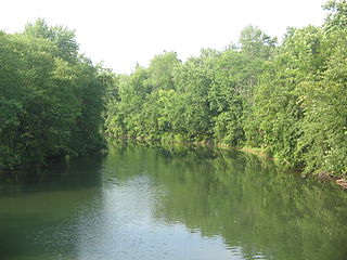
Bald Eagle Creek is a 55.2-mile-long (88.8 km) tributary of the West Branch Susquehanna River mostly in Centre County, Pennsylvania, in the United States.
John Wesley Gephart was a Bellefonte, Pennsylvania lawyer and industrialist. Educated in Bellefonte and at Princeton University, Gephart's diligence and intelligence were already marked when he was admitted to the bar at the end of 1876 and joined the Bellefonte law practice of James A. Beaver in 1877. He took a prominent part in the civic and moral life of the town, and enjoyed a reputation as a skillful lawyer and charismatic orator. In 1891, he became president of the newly organized Valentine Iron Company, and thereafter became increasingly devoted to furthering industry and commerce in his home town. He laid aside his legal practice in 1893, after becoming the superintendent of the new Central Railroad of Pennsylvania, to become a full-time industrialist.

Pennsylvania Route 144 is a state highway located in the U.S. state of Pennsylvania, covering a distance of about 109 miles (175 km). The southern terminus is located near an interchange with U.S. Route 322 (US 322) at State Route 2015 in Potter Township while the northern terminus is located at US 6 in Galeton. Between Snow Shoe and Renovo, PA 144 is known as the High Plateau Scenic Byway, a Pennsylvania Scenic Byway.

The Bald Eagle and Spring Creek Navigation Company was a canal company in central Pennsylvania intended to link the iron industry of Bellefonte, Pennsylvania, with the Pennsylvania canal system. Opened for half its length in 1837, the remainder of the canal was not completed until 1848. Destroyed by flooding in 1865, it was not rebuilt; a paralleling railroad completed that year replaced it.
The Lewisburg and Tyrone Railroad, previously the Lewisburg, Centre and Spruce Creek Railroad, was a subsidiary of the Pennsylvania Railroad (PRR) in central Pennsylvania. Originally intended to connect the Susquehanna Valley with Tyrone and the ore lands to its northeast, it was built in two discontinuous and never-connected pieces, one from Tyrone to Fairbrook and one from Lewisburg to Lemont. These served as lightly trafficked branches of the PRR into the early 20th Century. The line from Tyrone to Fairbrook passed into the hands of the short line Bellefonte Central Railroad in 1927, but the PRR's manipulations ensured its abandonment in 1941. The line between Lewisburg and Lemont was severed in 1970 and was gradually cut further back towards Montandon. Regular service ended on the last remaining part of the line in 1997, and it was abandoned in 2008.
Edmund Blanchard was a lawyer and prominent businessman in Centre County, Pennsylvania. He was an early promoter of rail transportation in the area.

The Bald Eagle Creek Path was a major Native American trail in the U.S. State of Pennsylvania that ran from the Great Island on the West Branch Susquehanna River southwest to what is now the village of Frankstown on the Frankstown Branch Juniata River. The path ran from Clinton County southwest through Centre County and a small part of Blair County to its southern end in Blair County. It was part of a "Warriors Path", an important connector between paths leading to New York and the Six Nations of the Iroquois and the Ohio River country in the north and west, and paths leading to what are now Maryland, Virginia, and the Carolinas in the south.
The Beech Creek Railroad is a defunct railroad which operated in central Pennsylvania between Jersey Shore and Mahaffey. Originally chartered in 1882, it was leased by the New York Central and Hudson River Railroad in 1890 and was directly operated by that company afterwards. Much of the line was abandoned in the second half of the 20th century, though sections at both ends are still active.

The Tyrone and Clearfield Railroad was a railway company in Pennsylvania. It was incorporated in 1854 and began operation in 1862. The Pennsylvania Railroad leased the company from the beginning of operation. It was reorganized in 1867 as the Tyrone and Clearfield Railway.
