Shanballymore is a small village in north County Cork, Ireland. It neighbours the towns of Doneraile, Kildorrery and Castletownroche, and is off the main route from Mallow to Mitchelstown. Shanballymore is part of the Cork East Dáil constituency.

Monkstown is a village in County Cork, Ireland, in the old barony of Kerrycurrihy. It lies 14 kilometres southeast of Cork city on the estuary of the River Lee, facing Great Island and looking onto Monkstown Bay. For census purposes, Monkstown is combined with the nearby town of Passage West, and the combined area has a population of approximately 5,800 residents.

Ratoath is a commuter town in County Meath, Ireland. A branch of the Broad Meadow Water flows through the town. The R125 and R155 roads meet in the village. At the 2016 census, there were 9,533 people living in Ratoath. The town is around 25 kilometres (16 mi) northwest of Dublin city centre.

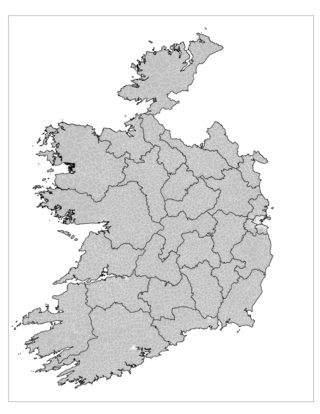
An electoral division is a legally defined administrative area in the Republic of Ireland, generally comprising multiple townlands, and formerly a subdivision of urban and rural districts. Until 1996, EDs were known as district electoral divisions in the 29 county council areas and wards in the five county boroughs. Until 1972, DEDs also existed in Northern Ireland. The predecessor poor law electoral divisions were introduced throughout the island of Ireland in the 1830s. The divisions were used as local-government electoral areas until 1919 in what is now the Republic and until 1972 in Northern Ireland.

Ballinskelligs, officially Baile an Sceilg, is a townland in the civil parish of Prior, County Kerry, Ireland. It may also refer to the wider district around the townland. It is located in the south-west of the Iveragh peninsula and is within the Gaeltacht. According to the 2016 census about 10% of the population of the electoral division speak Irish on a daily basis outside the education system. The townland was in the Poor law union of Cahersiveen.

Gort an Choirce or Gort a' Choirce, anglicised as Gortahork, is a village and townland in the northwest of County Donegal, Ireland. It is a Gaeltacht community, where the Irish language is the main language spoken in the area. Along with Falcarragh, it forms part of the district known as Cloughaneely.

Annyalla or Annayalla is a small village and townland situated in the east of County Monaghan in Ireland between Castleblayney and Clontibret. Annyalla townland is part of the civil parish of Clontibret.

Carnmore is an electoral area located at the southern end of the parish of Claregalway, approximately 8 miles (13 km) east of Galway city in County Galway, Ireland. Carnmore is in a Gaeltacht area, although the majority of residents use English as their first language. Incorporating the townlands of Carnmore, Carnmore West and Carnmore East, the area is represented in hurling competitions by Carnmore GAA. Galway Airport is also nearby.

Rostellan is a civil parish, townland and village in the historical Barony of Imokilly, County Cork, Ireland. An electoral division of the same name forms part of the Cork East Dáil constituency. For census purposes, the village of Rostellan is combined with the neighbouring villages of Farsid and Aghada. As of the 2011 census, the combined settlement of Aghada-Farsid-Rostellan had a population of 1,015 people.
Canovee is the name of a rural region and a village nucleus in the Lee valley in County Cork, Ireland. The toponym 'Canovee' is synonymous with the official version Cannaway, and the electoral division of Cannaway.

Doohoma or Doohooma is a townland, peninsula and a census town in County Mayo, Ireland. It is located on Ireland's Atlantic coastline overlooking Achill Island and the Mullet Peninsula.
Moneenroe is a townland, electoral division and village in north County Kilkenny, Ireland. It is located in the province of Leinster along the N78 road about 21 kilometres (13 mi) from Kilkenny city in the south-east of the island of Ireland. As of 2016, the population of Moneenroe was 722.

Clogh is a village, and namesake of an electoral district in County Kilkenny, Ireland. It is also a townland in the civil parish of Castlecomer in the ancient barony of Fassadinin.
Ballymoreen, or Ballymurreen, is a townland in the civil parish of the same name in County Tipperary in Ireland. It is within the historical barony of Eliogarty in the south-east corner of North Tipperary, between Littleton and Horse and Jockey. Evidence of ancient settlement in Ballymurreen include a number of ringfort sites, a ruined church and graveyard dating to at least the 17th century, and the former site of a tower house and bawn. The townland, which is 1.3 square kilometres (0.5 sq mi) in area, had a population of 65 as of the 2011 census.
Rathinch is a townland in the civil parish of Ballymurreen, County Tipperary. At the time of the 1911 census, there were three households, containing people of four different surnames in the townland. According to death notices appearing in 2012, the townland still contained people bearing the two latter surnames.

Moycarkey is an electoral division in County Tipperary in Ireland. It was originally an electoral division in the Thurles Poor Law Union in North Tipperary but is still used for various administrative purposes.

Littleton is an electoral division in County Tipperary in Ireland. The code number assigned it by the Central Statistics Office is 22071.

Originally called Burris poor law electoral division, and sometimes called Borrisleigh in the past, this electoral division in County Tipperary in Ireland is now known as Twomileborris.

Rahealty, or Rahelty, is an electoral division in County Tipperary in Ireland.

Garraun is a townland, containing a little over 567 acres, in Twomileborris civil parish in County Tipperary.


