Ballyraine

Last updated

Ballyraine
Baile Raithin
Town
Ireland adm location map.svg
Red pog.svg
Ballyraine
Location in Ireland
Coordinates: 54°57′24″N7°43′13″W / 54.9566°N 7.7204°W / 54.9566; -7.7204
Country Ireland
Province Ulster
County County Donegal
Government
   Dáil Éireann Donegal
Elevation
52 m (171 ft)
Population
 (2006)
   Rural
2,350
Time zone UTC+0 (WET)
  Summer (DST) UTC-1 (IST (WEST))
Area code(s) 074, +000 353 74
Irish Grid Reference C167119

Ballyraine (Irish : Baile Raithin) is a district of Letterkenny, County Donegal, Ireland, located in the parish of Aughaninshin. Ballyraine Linear Park is found here. Ballyraine National School, a co-educational primary school which is under joint management of the Church of Ireland and Presbyterian Church, is also located in the area. [1]

Contents

Physical distance from the town centre, lack of permeability and lack of neighbourhood facilities result in an isolated neighbourhood with high dependency on car usage for daily conveniences. [2] Residents regard the area as dangerous to children. [3]

History

Imported coal being loaded onto a lorry at Port Ballyraine, 1938 Port Ballyraine Letterkenny.jpg
Imported coal being loaded onto a lorry at Port Ballyraine, 1938

The area has a rich maritime past. In 1824, when the first description of Letterkenny as a modern town was written, it was stated that: "Within half a mile is the Port of Ballyraine, whither vessels of 100 tons bring iron, salt and colonial produce and whence they export hides and butter".

Port Ballyraine would have seen the regular importation of timber to the building trade and also the poles to carry out the Electrification of Rural Ireland programme during the 1930s. [4] The port was closed to commercial shipping in the 1960s. The 19th-century shipping warehouses were demolished in 2001, [5] a coal yard remains at the Port Bridge. [6] The Polestar monument located on the Port Bridge Roundabout serves as a reminder of the area's past. Created by Locky Morris, Its shape alludes to the outline of a boat, as well as having a locomotive (train track) theme, to commemorate the fact that both forms of transportation played a major part in the town's development in the past.

In 1990, due to the growing population of the area, it was deemed necessary to construct a church. The Church of the Irish Martyrs was completed in 1994 and became the first church in Ireland to be named after the Irish Catholic Martyrs. [7]

Amenities

Children attend the Robertson School. [3]

Local economy

Businesses currently operating in the area include Donegal Creameries, which has operations in Ireland, Britain and Holland, [8] leisure complex Arena 7 which is located in Ballyraine Retail Park [9] and the Mount Errigal Hotel. [10] The Donegal studio of RTÉ is located in the Donegal Enterprise Fund Business Centre in Ballyraine. [11] Confectionery manufacturers Oatfield are based at the entrance to Ballyraine. Happy Days shop, Keys shop & Garage/Petrol Station, Sweeney's shop & Petrol Station, Ballyraine Park Health Centre (GP), Ballyraine Pharmacy, the SOLAS(formerly FAS)Training Centre, and Education and training centre Rossan College are also located in the area. [12]

Former industries included a UNIFI plant which closed in 2004. [13]

Sport

Ballyraine F.C., founded in 1979, is the local soccer club. [14]

Related Research Articles

<span class="mw-page-title-main">Letterkenny</span> Town in County Donegal, Ireland

Letterkenny, nicknamed the Cathedral Town, is a large town in County Donegal, Ireland, on the River Swilly in the north-west of Ulster. Along with the nearby city of Derry, Letterkenny is a regional economic gateway for the north-west of Ireland.

<span class="mw-page-title-main">Lifford</span> County town of Donegal, Ireland

Lifford is the county town of County Donegal, Ireland, the administrative centre of the county and the seat of Donegal County Council, although the town of Letterkenny is often mistaken as holding this role.

<span class="mw-page-title-main">Dunfanaghy</span> Village in Donegal, Republic of Ireland

Dunfanaghy is a small town, former fishing port, and commercial centre on the north coast of County Donegal, Ireland. It lies on Donegal's North West coast, specifically the west side of Sheephaven Bay, on the N56 road.

<span class="mw-page-title-main">Errigal</span> Mountain in Donegal, Ireland

Errigal is a 751-metre (2,464 ft) mountain near Gweedore in County Donegal, Ireland. It is the tallest peak of the Derryveagh Mountains and the tallest peak in County Donegal. Errigal is also the most southern and the highest of the mountain chain called the "Seven Sisters" by locals. The other peaks of the Seven Sisters are Muckish, Crocknalaragagh, Aghla Beg, Ardloughnabrackbaddy, Aghla More, and Mackoght.

<span class="mw-page-title-main">Gweedore</span> Gaeltacht area in County Donegal, Ireland

Gweedore is an Irish-speaking district and parish located on the Atlantic coast of County Donegal in the north-west of Ireland. Gweedore stretches some 26 kilometres (16 mi) from Glasserchoo and Bloody Foreland in the north to Crolly in the south and around 14 kilometres (9 mi) from Dunlewey in the east to Magheraclogher and Magheralosk in the west, and is one of Europe's most densely populated rural areas. It is the largest Irish-speaking parish in Ireland with a population of around 4,065, and is also the home of the northwest regional studios of the Irish-language radio service RTÉ Raidió na Gaeltachta, as well as an external campus of the University of Galway. Gweedore includes the settlements of Brinlack, Bunbeg, Derrybeg, Crolly and Dunlewey, and sits in the shade of County Donegal's highest peak, Errigal.

<span class="mw-page-title-main">N14 road (Ireland)</span> Road in Ireland

The N14 road is a national primary road in the Republic of Ireland. The entirety of the route is located in the northwest of Ireland, in County Donegal, connecting Manorcunningham to Lifford in the east. Here it connects to the N15 near the border with Northern Ireland and along the A38 to Strabane in County Tyrone.

<span class="mw-page-title-main">East Wall</span> Northern inner city area of Dublin, Ireland

East Wall is an inner city area of the Northside of Dublin, Ireland. Built on reclaimed ground in the 1820s, the area is also 30 minutes walk from Dublin's main thoroughfare, O'Connell Street.

<span class="mw-page-title-main">Castlefin</span> Town in County Donegal, Ireland

Castlefin, sometimes spelt Castlefinn, is a market town and townland in the Finn Valley of County Donegal in Ulster, the northern province in Ireland. It is located between Ballybofey and Lifford in East Donegal and, as of 2016, the population was 705. The River Finn flows by the town. The town is located in along the main N15 national primary road, which runs from Bundoran to Lifford. The town lies 6 miles from Lifford and 8 miles from the twin towns of Ballybofey and Stranorlar. It has close links to Letterkenny, to the twin towns of Ballybofey and Stranorlar, and to West Tyrone in Northern Ireland, especially with the towns of Strabane and Castlederg.

<span class="mw-page-title-main">River Swilly</span> River in County Donegal, Ireland

The River Swilly is a river in County Donegal, Ireland, which flows in an eastern direction through Letterkenny. Letterkenny, the largest town in County Donegal, is built on the river and became the first crossing point on the river in the 17th century.

<span class="mw-page-title-main">Manorcunningham</span> Village in County Donegal, Ireland

Manorcunningham, or Manor is a small village and townland in County Donegal, Ireland. It is located 7 kilometers from Letterkenny on the main road to Derry. It is known locally and throughout Donegal as just Manor.

As with other towns and cities in Ireland, Letterkenny has a history of great architecture. Many examples of ancient architecture remain in the town to the present day – though much has been lost also, through decay and modern development.

<span class="mw-page-title-main">Oatfield (confectioner)</span> Irish chocolate and confectionery manufacturer

Oatfield was a chocolate and confectionery manufacturer located in Letterkenny, County Donegal, Ireland. The company was the oldest confectionery manufacturer in Ireland.

<span class="mw-page-title-main">Courtyard Shopping Centre</span> Retail facility in Letterkenny, County Donegal, Ireland

The Courtyard Shopping Centre is a retail complex in County Donegal, Ireland, located in central Letterkenny.

<span class="mw-page-title-main">Letterkenny Regional Sports and Leisure Complex</span>

Letterkenny Regional Sports and Leisure Complex is a sports complex located in Letterkenny, County Donegal, Ireland. Located near O'Donnell Park, RTÉ Television has broadcast live from the venue on several occasions.

<span class="mw-page-title-main">Crolly</span> Gaeltacht village in County Donegal, Ireland

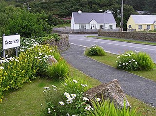
Croithlí or Croichshlí is a village in the Gaeltacht parishes of Gweedore and The Rosses in the west of County Donegal, Ireland. The two parishes are separated by the Crolly River. It has one convenience shop/restaurant and petrol station and one public house, Páidí Óg's. Crolly is located in two baronies: the Gweedore part of the village is in the Barony of Kilmacrenan while The Rosses part of the village is in the Barony of Boylagh.

<span class="mw-page-title-main">Earagail Arts Festival</span>

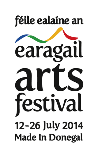
The Earagail Arts Festival is an annual festival which takes place in County Donegal, Ireland, every June or July. The festival began in June 1988.

<span class="mw-page-title-main">Redmond Herrity</span>

Redmond Herrity is an Irish sculptor from Letterkenny, County Donegal.

Oldtown is a district of Letterkenny, County Donegal, Ireland, in the parish of Conwal and Leck to the south of the River Swilly. As its name suggests, it is the oldest part of Letterkenny—being older than Letterkenny itself—and was the starting point of the area's development.

<span class="mw-page-title-main">Main Street, Letterkenny</span>

Main Street is an important thoroughfare in Letterkenny, County Donegal, Ireland. Sometimes claimed to be the longest street in Ireland, it is divided into two sections, with Lower Main Street running from the junction at Oldtown Road to the Market Square and Upper Main Street running from the Market Square to the junction at Crossview House. Traffic flows in a one-way system from Crossview House southwards.

The Church of the Irish Martyrs is a Catholic church in the parish of Aughaninshin in the Ballyraine area of Letterkenny, County Donegal, Ireland.

References

  1. "Ballyraine National School – Official site".
  2. "Draft Letterkenny Plan 2009 – 2015 Volume 1" (PDF). Donegal County Council . Archived from the original (PDF) on 3 March 2009.
  3. 1 2 Doyle, Louise (21 January 2021). "The Way We Were — 50 Years Ago: January 23, 1971 — Traffic dangers to children in Ballyraine area". Donegal News . p. 18.
  4. "Polestar at Port Bridge".
  5. "Only Warehouse Architecture remains". Archived from the original on 27 September 2007.
  6. The Port – A Short Illustrated History of Port Ballyraine, Letterkenny, Published by John Baird, 2002.
  7. "Church of the Irish Martyrs". Archived from the original on 13 July 2011.
  8. Donegal Creameries – About Us
  9. "Arena 7 – Official site". Archived from the original on 5 February 2009. Retrieved 16 December 2008.
  10. "Mount Errigal Hotel – Ballyraine Letterkenny Co Donegal". Archived from the original on 27 August 2008. Retrieved 16 December 2008.
  11. "RTÉ Studios". Raidió Teilifís Éireann . Archived from the original on 24 July 2009.
  12. "Rossan College".
  13. "UNIFI management confirms factory closure". RTÉ News . 29 July 2004.
  14. McNulty, Chris (30 July 2019). "Ballyraine FC set to mark 40th anniversary with big celebration".