Balmoral School

Last updated

Balmoral School
Address
Balmoral School
19 Brixton Road

,
1024

Coordinates 36°53′06″S174°44′44″E / 36.88490°S 174.74567°E / -36.88490; 174.74567
Information
Type State primary and intermediate
Established1926 [1]
Ministry of Education Institution no. 1219
PrincipalMalcolm Milner
Grades1–8
GenderCoeducational
School roll926 [2]
Socio-economic decile9 [3]
Website www.balmoral.school.nz

Balmoral School is a co-educational state primary and intermediate school in Balmoral in Auckland, New Zealand. [4] It teaches students in year levels 1 to 8, however the year 1 to 6 classes of the primary school are separated from the year 7 and 8 classes of the intermediate school. Primary students wear mufti, whilst Intermediate students wear a uniform that consists of a red polo shirt and navy blue shorts. [5] As of November 2018, the school had a population of 926 students. [2]

Contents

History

Beginnings

In 1926, Balmoral School opened as Brixton Road School. [6] The 1920s saw large population growth throughout New Zealand including in suburbs such as Mount Albert and Mount Eden, hence the need for more schools became apparent. [7]

Redevelopment

In 2015, the green light was given to redevelop some of the school. [8] This redevelopment set out to increase the number of permanent classrooms from 33 to 42, and was prompted by the lack of waterproofing in the existing already ageing buildings as well as the school's continued growth. [9] The estimated cost of the redevelopment was $24M NZD, and construction was planned to start in early 2017. [10] In July 2020, the new intermediate block and new gymnasium were handed over to the school. Construction is now focussing on the construction of a 20 room primary school block.

Demographics

Balmoral School was last evaluated by the Education Review Office in November 2018. [2]

Of the 926 students that attend the school, the report stated that 51% were boys and 49% were girls. The ethnic composition is as follows: 68% New Zealand European (Pākehā), 9% Chinese, 8% Indian, Māori, Samoan and Tongan at 4% each and 3% other ethnic groups. [2]

Uniform

Regular uniform

There is no required uniform for the primary school. The intermediate school uniform, which is compulsory, consists of a red polo shirt with a navy blue collar and the school's logo situated to the right of the buttons, navy blue shorts that are embroidered with the word 'BALMORAL' in red, and black shoes. [11]

PE uniform

The primary school's optional physical education (PE) gear consists of a light blue t-shirt that has the student's name (often a surname, first name or nickname) printed on the back. The intermediate school's compulsory PE uniform is a navy blue t-shirt with short sleeves, of which are the colour of the school house group a student is part of. The shorts are also navy blue. [11]

House groups

House groups at Balmoral School compete in a year long competition in which whatever group receives the most points wins. Only intermediate students belong to house groups. House points can be gained in a number of ways, such as the bi-weekly house sports competition where classes compete in mini sports games, during class time and at major school sporting events such as athletics and swimming sports. There are four house groups, as can be seen in the table below.

Balmoral School House Group Information
Colour Māori translation Motto
Te AhiThe Fire 'Pursue your goals with passion and zest, persevere to achieve your best.' [12]
Te HauThe Wind 'Harness energy, strength and force, use them all to stay your course.' [13]
Te WaiThe Water 'There will be highs, there will be lows, the more we learn the more we grow.' [14]
Te WhenuaThe Land 'For the future we strive, to the challenge we rise.' [15]

See also

Related Research Articles

The education system in New Zealand implements a three-tier model which includes primary and intermediate schools, followed by secondary schools and by tertiary education at universities and polytechnics. The academic year in New Zealand varies between institutions, but generally runs from early February until mid-December for primary schools, late January to late November or early December for secondary schools and polytechnics, and from late February until mid-November for universities.

<span class="mw-page-title-main">Te Kūiti</span> Town in Waikato, New Zealand

Te Kūiti is a town in the north of the King Country region of the North Island of New Zealand. It lies at the junction of State Highways 3 and 30 and on the North Island Main Trunk railway, 80 kilometres (50 mi) south of Hamilton. The town promotes itself as the sheep shearing capital of the world and is host to the annual New Zealand National Shearing Championships.

<span class="mw-page-title-main">Whangārei</span> City in Northland, New Zealand

Whangārei is the northernmost city in New Zealand and the regional capital of Northland Region. It is part of the Whangarei District, a local body created in 1989 from the former Whangārei City, Whangārei County and Hikurangi Town councils, to administer both the city proper and its hinterland. The city population was estimated to be 56,900 in June 2023, an increase from 47,000 in 2001.

<span class="mw-page-title-main">Morrinsville</span> Town in Waikato, New Zealand

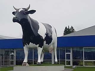
Morrinsville is a provincial town in the Waikato region of New Zealand's North Island, with an estimated population of 8,960 as of June 2023. The town is located at the northern base of the Pakaroa Range, and on the south-western fringe of the Hauraki Plains. Morrinsville is around 33 kilometres east of Hamilton and 22 kilometres west of Te Aroha. The town is bordered by the Piako River to the east and the Waitakaruru Stream to the south.

<span class="mw-page-title-main">Dargaville</span> Town in Northland, New Zealand

Dargaville is a town located in the North Island of New Zealand. It is situated on the bank of the Northern Wairoa River in the Kaipara District of the Northland region. Dargaville is located 55 kilometres (34 mi) southwest of Whangārei, and 174 kilometres (108 mi) north of Auckland.

<span class="mw-page-title-main">Kaitaia</span> Town in the North Island of New Zealand

Kaitaia is a town in the Far North District of New Zealand, at the base of the Aupōuri Peninsula, about 160 km northwest of Whangārei. It is the last major settlement on State Highway 1. Ahipara Bay, the southern end of Te Oneroa-a-Tōhē / Ninety Mile Beach, is 5 kilometres (3.1 mi) west.

<span class="mw-page-title-main">Henderson, New Zealand</span> Suburb in Auckland, New Zealand

Henderson is a major suburb of West Auckland, in the North Island of New Zealand. It is 13 kilometres (8.1 mi) west of Auckland city centre, and two kilometres (1.2 mi) west of the Whau River, a southwestern arm of the Waitematā Harbour. The suburb is located within the Henderson-Massey Local Board of the Waitākere Ward, one of the thirteen administrative divisions of Auckland Council.

<span class="mw-page-title-main">Te Puke</span> Town in the Bay of Plenty, New Zealand

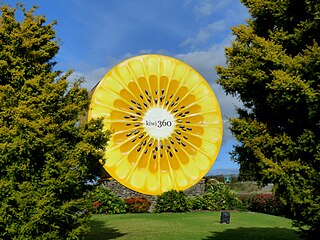
Te Puke is a town located 18 kilometres southeast of Tauranga in the Western Bay of Plenty of New Zealand. It is particularly well known for the cultivation of Kiwifruit.

Te Kamo is a northern suburb of the New Zealand city of Whangārei. The area was colloquially known as Kamo until 2023. It is approximately five minutes' drive from the centre of Whangārei. There was coal mining in the area between 1875 and 1955, and it was known for its hot springs in the early years of the 20th century.

<span class="mw-page-title-main">Hauraki</span> Suburb in Auckland, New Zealand

Hauraki is a suburb located on the southern North Shore of Auckland, the largest metropolitan city in New Zealand. It is under the local governance of the Auckland Council.

<span class="mw-page-title-main">Ōtāhuhu</span> Suburb in Auckland, New Zealand

Ōtāhuhu is a suburb of Auckland, New Zealand – 13 kilometres (8.1 mi) to the southeast of the CBD, on a narrow isthmus between an arm of the Manukau Harbour to the west and the Tāmaki River estuary to the east. The Auckland isthmus is the narrowest connection between the North Auckland Peninsula and the rest of the North Island, being only some 1,200 metres (3,900 ft) wide at its narrowest point, between the Ōtāhuhu Creek and the Māngere Inlet. As the southernmost suburb of the former Auckland City, it is considered part of South Auckland.

<span class="mw-page-title-main">Sandringham, New Zealand</span> Suburb in Auckland, New Zealand

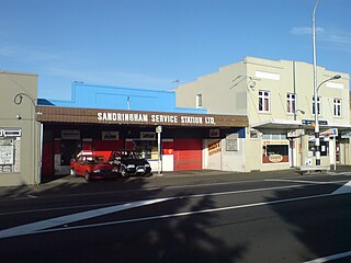
Sandringham is a suburb of Auckland, New Zealand. It is a multi-ethnic suburb with a population of over 12,000.

<span class="mw-page-title-main">Balmoral, New Zealand</span> Suburb in Auckland, New Zealand

Balmoral is a suburb of Auckland, New Zealand that is bordered by Mount Eden, Epsom, Mount Roskill and Sandringham and is located approximately 5 km from the centre of Auckland. It was named around the turn of the 20th century and derives its name from Balmoral Castle, the Scottish country residence of the Royal family. Much of the housing in the area is from the 1920s and 1930s, often in the Californian Bungalow style. Balmoral was part of Mount Eden Borough Council which became a part of Auckland City in 1989. In November 2010, the area was included into the Albert-Eden-Roskill ward of the new Auckland Council.

Southern Cross Campus is a composite school that caters for students in Years 1-13 in the suburb of Māngere East in Auckland, New Zealand. The school has deep ties to the Mangere East community by providing education, facilities, and programmes for the wider use of the whole school. It is a Māori and Pacific Islands ethnic school, with students of European (Pākehā), Asian, and other ethnicities as a 0.5% minority.

<span class="mw-page-title-main">Auckland CBD</span> Central business district in Auckland Council, New Zealand

The Auckland Central Business District (CBD), or Auckland city centre, is the geographical and economic heart of the Auckland metropolitan area. It is the area in which Auckland was established in 1840, by William Hobson on land gifted by mana whenuahapū Ngāti Whātua Ōrākei. It is New Zealand's leading financial hub, and the centre of the country's economy; the GDP of the Auckland Region was NZD$139 billion in the year ending September 2023.

<span class="mw-page-title-main">Brooklands, New Plymouth</span> Suburb in New Plymouth, New Zealand

Brooklands is a suburb of New Plymouth, in the Taranaki region of the western North Island of New Zealand. It is located on the southern edge of the city and east of Vogeltown. The area is named after Brooklands farm, established in 1842.

<span class="mw-page-title-main">Ōtara</span> Suburb in Auckland, New Zealand

Ōtara is a suburb of South Auckland, New Zealand, situated 18 kilometres to the southeast of the Auckland City Centre. Ōtara lies near the head of the Tamaki River, and is surrounded by the suburbs of Papatoetoe, East Tāmaki, Clover Park and Flat Bush. The area is traditionally part of the rohe of Ngāi Tai ki Tāmaki, and the name Ōtara refers to Ōtara Hill / Te Puke ō Tara, a former Ngāi Tai ki Tāmaki pā and volcanic hill to the north of the suburb. From 1851 to 1910 the area was part of the Goodfellow family farm, and during the 1910s the area was an agricultural college run by the Dilworth Trust.

<span class="mw-page-title-main">Clendon Park</span> Suburb in Auckland, New Zealand

Clendon Park is a suburb of Auckland in northern New Zealand. It is located to the west of Manurewa and north of Weymouth. The suburb is in the Manurewa-Papakura ward, one of the 21 local boards of Auckland Council.

<span class="mw-page-title-main">School uniforms by country</span> School uniforms described by country

School uniform is a practice that dates to the 16th century in England. Charity schools such Christ's Hospital, founded in 1552 in London, were among the first schools to use a uniform for their students. The earliest documented proof of institutionalised use of a standard academic dress dates back to 1222 when the Archbishop of Canterbury ordered wearing of the cappa clausa.

References

  1. "Balmoral School History" . Retrieved 1 April 2019.
  2. 1 2 3 4 "Balmoral School (Auckland) – 20/12/2018". Education Review Office. Retrieved 1 May 2019.
  3. "Decile ratings New Zealand" . Retrieved 1 April 2019.
  4. "Ministry of Education – Education Counts". www.educationcounts.govt.nz. Retrieved 1 April 2019.
  5. "Year 7 & 8 Uniform Requirements". Balmoral School. Retrieved 1 April 2019.
  6. "History". Balmoral School. Retrieved 1 April 2019.
  7. "Overview – The 1920s". nzhistory.govt.nz. Retrieved 29 April 2019.
  8. "Balmoral School's $24 million upgrade". Stuff. Retrieved 1 April 2019.
  9. "$24m redevelopment for Balmoral School, Auckland". www.scoop.co.nz. 28 October 2015. Retrieved 1 April 2019.
  10. "$24m redevelopment for Balmoral School, Auckland". The Beehive. Retrieved 1 April 2019.
  11. 1 2 "Balmoral School (Auckland) | The Warehouse". www.thewarehouse.co.nz. Retrieved 29 April 2019.
  12. "Te Ahi". Lensdump. Retrieved 2 April 2019.
  13. "Te Hau". Lensdump. Retrieved 2 April 2019.
  14. "Te Wai". Lensdump. Retrieved 2 April 2019.
  15. "Te Whenua". Lensdump. Retrieved 2 April 2019.