
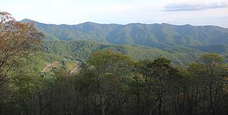
Mount Rogers is the highest natural point in Virginia, United States, with a summit elevation of 5,729 feet (1,746 m) above mean sea level. The summit straddles the border of Grayson and Smyth Counties, Virginia, about 6.45 miles (10.38 km) WSW of Troutdale, Virginia. Most of the mountain is contained within the Lewis Fork Wilderness, while the entire area is part of the Mount Rogers National Recreation Area, which itself is a part of the Jefferson National Forest.

Hawksbill Mountain is a mountain with an elevation of 4,050 feet (1,234 m). Marking the border between Madison County and Page County in Virginia, the summit of Hawksbill Mountain is the highest point in Shenandoah National Park, as well as the highest point in both Madison and Page counties.

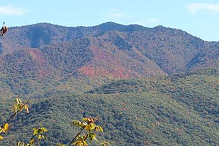
Whitetop Mountain is the second highest independent mountain in the U.S. state of Virginia, after nearby Mount Rogers. It is also the third highest named peak in Virginia, after Mount Rogers and its subsidiary peak, Pine Mountain. It is located at the juncture of Grayson, Smyth, and Washington Counties, and is also within the Mount Rogers National Recreation Area of the Jefferson National Forest. Whitetop was the location of the White Top Folk Festival from 1932 to 1939, with the exception of 1937. Like nearby Mount Rogers, it represents an ecological "island" of flora and fauna commonly found much farther north than Virginia, such as old growth red spruce and other northern softwoods.

Beartown State Park is a 110-acre (45 ha) state park located on the eastern summit of Droop Mountain, 7 miles (11 km) southwest of Hillsboro, West Virginia, in northern Greenbrier County, West Virginia. The land was purchased in 1970 with funds from the Nature Conservancy and a donation from Mrs. Edwin G. Polan, in memory of her son, Ronald Keith Neal, a local soldier who was killed in the Vietnam War. Development of the park has been minimal in order to preserve the natural attractions of the area. Recreation in the park consists of hiking along improved trails and boardwalks. Markers explain the natural processes at work in the area. The name "Beartown State Park" was chosen because local residents claimed that many cave-like openings in the rocks made ideal winter dens for the native black bears, the state animal of West Virginia. Also because the many deep, narrow crevasses were formed in a regular criss-cross pattern which appear from above like the streets of a small town. Beartown is noted for its unusual rock formations, which consist of Droop, or Pottsville, Sandstone formed during the Pennsylvanian age. Massive boulders, overhanging cliffs and deep crevasses make up the beauty of the park. On the face of the cliffs are hundreds of eroded pits. These pits range from the size of a marble to others large enough to hold two grown men. It is not unusual to see ice and snow remaining in the deeper crevasses until midsummer.

Mount Willey is a mountain located in Grafton County, New Hampshire. The mountain is named after Samuel Willey, Jr. (1766–1826) and his family, who in 1825 moved into a house in Crawford Notch. The family was killed a year later in August 1826 during a landslide.

Waterrock Knob is a mountain peak in the U.S. state of North Carolina. It is the highest peak in the Plott Balsams and is the 16th-highest mountain in the Eastern United States.

Black Balsam Knob, also known as Black Balsam Bald, is in the Pisgah National Forest southwest of Asheville, North Carolina, near milepost 420 on the Blue Ridge Parkway. It is the second highest mountain in the Great Balsam Mountains. The Great Balsams are within the Blue Ridge Mountains, which are part of the Appalachian Mountains. It is the 23rd highest of the 40 mountains in North Carolina over 6000 feet.

The Great Balsam Mountains, or Balsam Mountains, are in the mountain region of western North Carolina, United States. The Great Balsams are a subrange of the Blue Ridge Mountains, which in turn are a part of the Appalachian Mountains. The most famous peak in the Great Balsam range is Cold Mountain, which is the centerpiece of author Charles Frazier's bestselling novel Cold Mountain. Other notable peaks include Richland Balsam, which is the highest peak in the range, Black Balsam Knob, and Mount Pisgah.

Balsam Lake Mountain is one of the Catskill Mountains, located in the Town of Hardenburgh, New York, United States. It is the westernmost of the range's 35 High Peaks. Its exact height has not been determined, but the highest contour line on topographic maps, 3,720 feet (1,130 m), is usually given as its elevation.

Balsam Cap is a mountain located in Ulster County, New York. The mountain is part of the Catskill Mountains. Balsam Cap is flanked to the north by Friday Mountain, and to the southwest by Rocky Mountain.

Mount Craig, 6,647 feet (2,026 m), is the second highest peak of the Appalachian Mountains and second only to 6,684 feet (2,037 m) Mount Mitchell in eastern mainland North America. It is located in the Black Mountains in Yancey County, North Carolina. The mountain lies about a mile (2 km) north of Mount Mitchell and is within Mount Mitchell State Park and the Pisgah National Forest.
The Plott Balsams are a mountain range in western North Carolina in the southeastern United States.
Richland Balsam is a mountain in the Great Balsam Mountains in the U.S. state of North Carolina. Rising to an elevation of 6,410 feet (1,950 m), it is the highest mountain in the Great Balsam range, is among the 20 highest summits in the Appalachian range, and is the ninth highest peak in the Eastern United States. The Blue Ridge Parkway reaches an elevation of 6,053 feet (1,845 m)—the parkway's highest point—as it passes over Richland Balsam's southwestern slope. The Jackson County-Haywood County line crosses the mountain's summit.
Beartown Mountain is in the Clinch Mountain range, which is in eastern Russell County, Virginia, United States. At 4,689 feet (1,429 m), it is the 7th highest summit in Virginia. It is the 41st highest County High Point of the Eastern United States.
This article comprises three sortable tables of the major mountain peaks of Virginia. This article defines a significant summit as a summit with at least 100 meters of topographic prominence, and a major summit as a summit with at least 500 meters of topographic prominence. All summits in this article have at least 500 meters of topographic prominence. An ultra-prominent summit is a summit with at least 1500 meters of topographic prominence.
