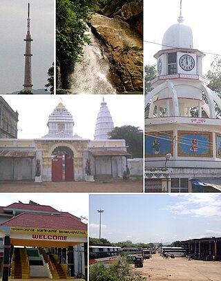
Mayurbhanj district is one of the 30 districts in Odisha state in eastern India. It is the largest district of Odisha by area. Its headquarters are at Baripada. Other major towns are Rairangpur, Karanjia and Bahalda. As of 2011, it is the third-most-populous district of Odisha, after Ganjam and Cuttack.

Koraput district is a district of India in southern Odisha, with headquarters at Koraput. The district is located in the Eastern Ghats and is known for its hilly terrain, rich and diverse types of mineral deposits and its tribal culture and traditions. The district headquarters town of Koraput and its largest city, Jeypore are major centres of trade and commerce for South Odisha and fall on an important road connecting Visakhapatnam to Raipur.

Cuttack district is one of the 30 districts of Odisha state in India. It is located in the coastal part of the state and its administrative headquarters are located in the city of Cuttack. As of 2011 Census, after Ganjam, it is the second most populous district of Odisha, with a population of 2,624,470. The name is an anglicized form of Kataka or Katak meaning Fort – referring to the Barabati Fort. The district is bisected by the river Mahanadi and its numerous distributaries and occupies a large portion of the river's delta. It is bounded by the Angul, Dhenkanal, Nayagarh and Khurda districts to the west while its southern and eastern boundaries touch Puri, Jagatsinghpur, Kendrapara and Jajpur districts.

Kalahandi district is a district of Odisha in India. Archaeological evidence of Stone Age and Iron Age human settlement has been recovered from the region. Asurgarh offered an advanced, well civilised, cultured and urban human settlement about 2000 years ago in the region. In South Asia it is believed that the lands of Kalahandi district and Koraput district were the ancient places where people started cultivation of paddy. In ancient time it was known as Mahakantara and Karunda Mandal, which means treasure of precious stones like karandam (corundum/manik), garnet, beruz, neelam, and alexandrite, etc. Manikeswari is the clan deity of Kalahandi may also signify its historical name.

Nuapada district is located in Odisha state in India. Nuapada town is the headquarters of the district. It has 1 Subdivision: Nuapada; five blocks: Khariar, Sinapali, Boden, Komna, and Nuapada. Nuapada District has 3 Notified Area Councils: Khariar, Khariar Road, and Nuapada; and 6 tehsils and more village like Gandabahali, Tukla, Hatibandha, Duajher, Bargaon, Tarbod, Udyanbandh, Larka etc.

Balasore District also known as Baleswar District or Baleshwar District, is an administrative district of Odisha state, in eastern India. Balasore is one of the coastal districts of Odisha and lies on the northernmost part of the state.

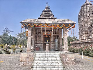
Bhawanipatna is a city and the headquarter of Kalahandi district in the state of Odisha, India. Bhawanipatna has numerous temples dedicated to different deities of the Hindu pantheon. It is named after the presiding deity, Bhawani-Shankar, and Patna, which means "place" in Odia.
Dharamjaygarh is a town and a nagar panchayat in Raigarh District in the state of Chhattisgarh, India. Major languages spoken are Hindi and Chhattisgarhi, with a little Odia, Bengali and English. Laljeet Singh Rathia is a current MLA of the Dharamjaigarh constituency.
Kesinga is a town and a notified area committee in Kalahandi district in the Indian state of Odisha, near India's east coast. It is also called the gate to Kalahandi. Kesinga is rich in agriculture, small industries, and start-ups as well.

Bhunjias, are an ethnic group found in India mainly reside in Sunabeda plateau in Odisha and Chhattisgarh. They are mostly found in Nuapada district, which is roughly between 22° 55′ N and 21° 30′ N latitude and 82° 35′ E longitude. It was a part of Khariar Zamindari, which formed the eastern and the southeastern region of Raipur district of Chhattisgarh division in Central Province till 1 April 1936, when it was transferred to Odisha on its creation. It is now in Komna block of Nuapada district in Orissa. In Chhattisgarh they are found in Raipur district.
Ampani is a town in the Kalahandi district of the state of Odisha, in India. It is a gram panchayat that comes under Kokasara tehsil. It is 15 km from its main town and blocks Kokasara.

The Eastern Indo-Aryan languages, also known as Māgadhan languages, are spoken throughout the eastern Indian subcontinent, including Bihar, Uttar Pradesh, Jharkhand, Bengal, Tripura, Assam, and Odisha; alongside other regions surrounding the northeastern Himalayan corridor. Bengali is official language of Bangladesh and the state of West Bengal, Tripura and the Barak valley of Assam while Assamese and Odia are the official languages of Assam and Odisha, respectively. The Eastern Indo-Aryan languages descend from Abahattha, which descends from Magadhan Apabhraṃśa and ultimately from Magadhi Prakrit.
Kalahandia is a dialect of Odia spoken in the region of Kalahandi and Nuapada district of Odisha state in India. Local weekly Odia newspaper such as Arjji and Kalahandi Express publish articles in standard Odia Form and Kalahandia Odia Form.
Bhawanipatna is classified as one of the major tourist destinations by the tourism Department of Government of Odisha. All the tourist attraction in Kalahandi region comes under Bhawanipatna jurisdiction. Though tourist potential of Kalahandi has not been exploited optimally due to poor marketing, political negligence and infrastructure development, the land is very rich in terms of water fall, forest and wild life, natural and scenic beauty, tribal life, mountains, agriculture field, historical sites and handicrafts. The best time to visit Kalahandi region is from October to March. April–June is hard Summer and the mercury may rise to 45 degree C and June to August is the Monsoon Season. It occasionally rains in September, but do not miss the great festival like Nuakhai in September and Dassara in end of September or early October. Beginning of Dessara marks the pleasant weather condition till the celebration of Chaitra in February/March.
Narla is a town in Narla Tehsil in Kalahandi district in the Indian state of Odisha. This town is maintaining 29 km distance from its district main city Bhawanipatna and 430 km far from its state capital Bhubaneswar.

Durgapur is a village located in Angul district, in the Indian state of Odisha.
Badagam is a small village in the Rayagada Block and Parlakhemundi municipality in Gajapati district in the Indian state of Odisha. The major languages spoken in this place are Kui and Oriya.

Badadungiriguda is a village in Odisha, India. It is located in the Karlamunda block of the Kalahandi district. It comes under the administration of the Gajabahal gram panchayat.
Bhikampali is a medium-sized village in the Jharsuguda district of Odisha, India. It is situated on the banks of Badkelo River in the foothill of Chhelia Pahad. The village is located at a distance of 60 km from the district headquarter of Jharsuguda. It is within the Brajarajnagar assembly constituency, and the Bargarh Parliament constituency. As of 2011 census, its population is 920.

Hirlipali is a village in Attabira Tehsil of Bargarh district of Odisha, India. The village is located on the banks of canal that flows reservoir water from Hirakud Dam. It is about 10 km from Attabira and about 20 km from Bargarh town. The total geographical area of Hirlipali Gram Panchayat is 25.19 square kilometers, and has a total population of 8,320 peoples. There are about 1,817 households in Hirlipali Gram Panchayat


