Related Research Articles

Amber is fossilized tree resin that has been appreciated for its color and natural beauty since Neolithic times. Much valued from antiquity to the present as a gemstone, amber is made into a variety of decorative objects. Amber is used in jewelry and has been used as a healing agent in folk medicine.
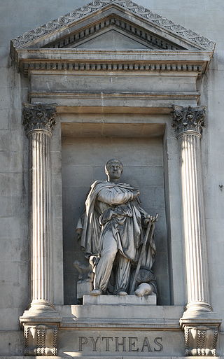
Pytheas of Massalia was a Greek geographer, explorer and astronomer from the Greek colony of Massalia. He made a voyage of exploration to northwestern Europe in about 325 BC, but his account of it, known widely in Antiquity, has not survived and is now known only through the writings of others.

Sambia or Samland or Kaliningrad Peninsula is a peninsula in the Kaliningrad Oblast of Russia, on the southeastern shore of the Baltic Sea. The peninsula is bounded by the Curonian Lagoon to the north-east, the Vistula Lagoon in the southwest, the Pregolya River in the south, and the Deyma River in the east. As Sambia is surrounded on all sides by water, it is technically an island. Historically it formed an important part of the historic region of Prussia.
Truso was a Viking Age port of trade (emporium) set up by the Scandinavians at the banks of the Nogat delta branch of the Vistula River, close to a bay, where it emptied into the shallow and brackish Vistula Lagoon. This sizeable lagoon is separated from the Gdańsk Bay by the Vistula Spit at the southern Baltic Sea coast. In the 9th century, the merchant Wulfstan of Hedeby travelled to Truso in the service of the English King Alfred the Great and wrote his account of the place at a prominent location of the Amber Road, which attracted merchants from central and southern Europe, who supplied the markets in the Mediterranean and the Middle East with the highly valued commodity.
The Battle of Aegospotami was a naval confrontation that took place in 405 BC and was the last major battle of the Peloponnesian War. In the battle, a Spartan fleet under Lysander destroyed the Athenian navy. This effectively ended the war, since Athens could not import grain or communicate with its empire without control of the sea.

The Teutons were an ancient northern European tribe mentioned by Roman authors. The Teutons are best known for their participation, together with the Cimbri and other groups, in the Cimbrian War with the Roman Republic in the late second century BC.

In Greek mythology, the Hyperboreans were a mythical people who lived in the far northern part of the known world. Their name appears to derive from the Greek ὑπέρ Βορέᾱ, "beyond Boreas", although some scholars prefer a derivation from ὑπερφέρω.

A periplus, or periplous, is a manuscript document that lists the ports and coastal landmarks, in order and with approximate intervening distances, that the captain of a vessel could expect to find along a shore. In that sense, the periplus was a type of log and served the same purpose as the later Roman itinerarium of road stops. However, the Greek navigators added various notes, which, if they were professional geographers, as many were, became part of their own additions to Greek geography.
The Corinthian War was a conflict in ancient Greece which pitted Sparta against a coalition of city-states comprising Thebes, Athens, Corinth and Argos, backed by the Achaemenid Empire. The war was caused by dissatisfaction with Spartan imperialism in the aftermath of the Peloponnesian War, both from Athens, the defeated side in that conflict, and from Sparta's former allies, Corinth and Thebes, who had not been properly rewarded. Taking advantage of the fact that the Spartan king Agesilaus II was away campaigning in Asia against the Achaemenid Empire, Thebes, Athens, Corinth and Argos forged an alliance in 395 BC with the goal of ending Spartan hegemony over Greece; the allies' war council was located in Corinth, which gave its name to the war. By the end of the conflict, the allies had failed to end Spartan hegemony over Greece, although Sparta was durably weakened by the war.
The Battle of Abydos was an Athenian naval victory in the Peloponnesian War. In the battle, the Spartan fleet, under Mindarus, attempted to rescue a small allied fleet that had been driven ashore at Dardanus, but was attacked by the Athenian fleet, under Thrasybulus. The fighting was evenly contested for a great length of time, but towards evening, the arrival of Alcibiades with Athenian reinforcements tipped the balance in favor of the Athenians, and the Peloponnesians were forced to flee back to their base at Abydos, suffering heavy losses along the way.
Lechaeum or Lechaion, also called Lecheae and Lecheum, was the port in ancient Corinthia on the Corinthian Gulf connected with the city of Corinth by means of the Long Walls, 12 stadia in length. The Long Walls ran nearly due north, so that the wall on the right hand was called the eastern, and the one on the left hand the western or Sicyonian. The space between them must have been considerable; since there was sufficient space for an army to be drawn up for battle. Indeed, the area was the scene of battles between Sparta and Athens in 391 BCE, leaving Spartans in command of Lechaeum, which they garrisoned with their troops.
The Aesti were an ancient people first described by the Roman historian Tacitus in his treatise Germania. According to Tacitus, the land of Aesti was located somewhere east of the Suiones.
Oropus or Oropos was a town on the borders of ancient Attica and Boeotia, and the capital of a district, called after it Oropia This district is a maritime plain, through which the Asopus flows into the sea, and extends for 5 miles (8.0 km) along the shore. It is separated from the inland plain of Tanagra by some hills, which are a continuation of the principal chain of the Diacrian mountains.
The Gutones were a Germanic people who were reported by Roman era writers in the 1st and 2nd centuries to have lived in what is now Poland. The most accurate description of their location, by the geographer Ptolemy, placed them east of the Vistula river.
Thrasyllus was an Athenian strategos (general) and statesman who rose to prominence in the later years of the Peloponnesian War. First appearing in Athenian politics in 410 BC, in the wake of the Athenian coup of 411 BC, he played a role in organizing democratic resistance in an Athenian fleet at Samos. There, he was elected strategos by the sailors and soldiers of the fleet, and held the position until he was controversially executed several years later after the Battle of Arginusae.

Atalanti or Atalantonisi (Αταλαντονήσι) or Talandonísi (Ταλαντονήσι) is a small uninhabited island in the North Euboean Gulf, about 600 m off the coast near the town Atalanti, Phthiotis, Greece. There are several small islets next to Atalanti island, including the islet of Agios Nikolaos.

Oreus or Oreos, prior to the 5th century BC called Histiaea or Histiaia (Ἱστίαια), also Hestiaea or Hestiaia (Ἑστίαια), was a town near the north coast of ancient Euboea, situated upon the river Callas, at the foot of Mount Telethrium, and opposite Antron on the Thessalian coast. From this town the whole northern extremity of Euboea was named Histiaeotis According to some it was a colony from the Attic deme of Histiaea; according to others it was founded by the Thessalian Perrhaebi. Another foundation story had it that the name Histiaea is said to derive from the mythical figure Histiaea, the daughter of Hyrieus. It was one of the most ancient of the Euboean cities. It occurs in the Catalogue of Ships in the Iliad, where Homer gives it the epithet of πολυστάφυλος ; and the Periplus of Pseudo-Scylax mentions it as one of the four cities of Euboea. It was an important city in classical antiquity due to its strategic location at the entrance of the North Euboean Gulf, in the middle of a large and fertile plain.

Bibliotheca historica is a work of universal history by Diodorus Siculus. It consisted of forty books, which were divided into three sections. The first six books are geographical in theme, and describe the history and culture of Egypt, of Mesopotamia, India, Scythia, and Arabia (II), of North Africa (III), and of Greece and Europe (IV–VI). In the next section, he recounts human history starting with the Trojan War, down to the death of Alexander the Great. The last section concern the historical events from the successors of Alexander down to either 60 BC or the beginning of Caesar's Gallic War in 59 BC. He selected the name "Bibliotheca" in acknowledgement that he was assembling a composite work from many sources. Of the authors he drew from, some who have been identified include: Hecataeus of Abdera, Ctesias of Cnidus, Ephorus, Theopompus, Hieronymus of Cardia, Duris of Samos, Diyllus, Philistus, Timaeus, Polybius and Posidonius.

Ictis, or Iktin, is or was an island described as a tin trading centre in the Bibliotheca historica of the Sicilian-Greek historian Diodorus Siculus, writing in the first century BC.
Andros was the chief city of, and a polis (city-state) on, the island of Andros in the Aegean Sea. The city was named after the island, which, according to tradition, derived its name either from Andreus, a general of Rhadamanthus or from the seer Andrus. It was colonized by Ionians, and early attained so much importance as to send colonies to Acanthus and Stageira in Chalcidice about 654 BCE. The Andrians were compelled to join the fleet of Xerxes I in his invasion of Greece, in 480 BCE; in consequence of which Themistocles attempted to levy a large sum of money from the people, and upon their refusing to pay it, laid siege to their city, but was unable to take the place.
References
- ↑ William Smith in his Dictionary of Greek and Roman Geography (1854) wrote Baltia was "probably a portion of the Prussian coast upon the Baltic"."ABALUS was said by Pytheas to be an island in the northern ocean, upon which amber was washed by the waves, distant a day's sail from the aestuary called Mentonomon, on which the Gothones dwelt. This island was called Basilia by Timaeus, and Baltia by Xenophon of Lampsacus. It was probably a portion of the Prussian coast upon the Baltic." - Dictionary of Greek and Roman Geography, William Smith, LLD. London. Walton and Maberly, Upper Gower Street and Ivy Lane, Paternoster Row; John Murray, Albemarle Street. 1854.
- ↑ Alexander von Humboldt placed Baltia west of the Jutland Peninsula in the North Sea. Cosmos: A Sketch Of A Physical Description Of The Universe , Alexander Von Humboldt, Kessinger Publishing, 2004, p. 493.
- ↑ Pliny the Elder, Natural History, iv.(13).95, xxxvii.(11).35.
- ↑ The Library of History of Diodorus Siculus — Book V; Chapters 19‑40