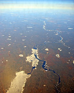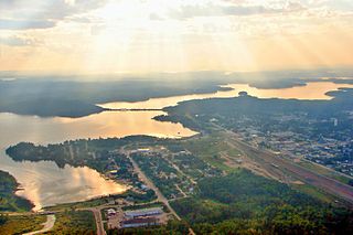
Lake Doré is a freshwater lake in the township of North Algona-Wilberforce, Renfrew County, Ontario, Canada, about 6 kilometres (3.7 mi) north of the community of Eganville in the neighbouring township of Bonnechere Valley.

Balsam Lake is a lake in the City of Kawartha Lakes in Central Ontario, Canada. It is in the Great Lakes Basin, is one of the lakes of the Kawartha Lakes, and is at the summit of the Trent–Severn Waterway.

Kawaweogama Lake is a lake in the James Bay drainage basin in Unorganized Thunder Bay District in northwestern Ontario, Canada, about 35 kilometres (22 mi) east of the community of Savant Lake on Ontario Highway 516, 80 kilometres (50 mi) west of Armstrong on Ontario Highway 527, and 210 kilometres (130 mi) northwest of Thunder Bay. Except for the northwestern shore, the lake is encompassed by Brightsand River Provincial Park.

The Albany River is a river in Northern Ontario, Canada, which flows northeast from Lake St. Joseph in Northwestern Ontario and empties into James Bay. It is 982 kilometres (610 mi) long to the head of the Cat River, tying it with the Severn River for the title of longest river in Ontario. Major tributaries include the Kenogami River and Ogoki River.

Limerick Lake is a lake in the Trent River and Lake Ontario drainage basins in the township of Limerick, Hastings County, Ontario, Canada, about 3 kilometres (1.9 mi) northwest of the community of St. Ola, 2.5 kilometres (1.6 mi) northeast of Highway 62, and 25 kilometres (16 mi) southeast of the town of Bancroft. In 1934, the building of St. Ola Dam raised the level of Big Salmon Lake by two metres. The lake was then renamed, as part of a process in Ontario to give each large lake a unique name. The original concrete dam was assessed in 2002 and significant cracking was found. The dam was replaced in 2004 with a new concrete dam. The waterway falls under the jurisdiction of the Crowe Valley Conservation Authority which has responsibility for furthering the conservation, development, and management of natural resources, but whose main activity is flood control.

Big Mink Lake is a fresh water lake in the St. Lawrence River drainage basin in Hastings Highlands, Hastings County, Ontario, Canada. It is about 5 kilometres (3.1 mi) west of the community of Lake St. Peter on Highway 127 and 25 kilometres (16 mi) northwest of Bancroft.

Kabinakagami Lake is a lake in the Unorganized North Part of Algoma District in northeastern Ontario, Canada. The lake is on the Kabinakagami River and is part of the James Bay drainage basin. It is located northwest of the Chapleau Crown Game Preserve, and about 17 kilometres (11 mi) southwest of the settlement of Oba and 100 kilometres (62 mi) southwest of the town of Hearst.

Lac des Mille Lacs is a lake in the western part of Thunder Bay District in northwestern Ontario, Canada. It is in the Nelson River drainage basin and is the source of the Seine River. The lake lies between Ontario Highway 17 on the north and Ontario Highway 11 on the south about 100 kilometres (62 mi) west of the city of Thunder Bay.

Botsford Lake is a lake in the Hudson Bay drainage basin in Kenora District in northwestern Ontario, Canada. It is about 15 kilometres (9 mi) long and 2.2 kilometres (1.4 mi) wide, is at an elevation of 357 metres (1,171 ft), and lies between the settlements of Superior Junction and McDougall Mills; Rosnel is on the south shore of the lake. The CN transcontinental rail line travels the along the entire south shore. Highway 642 runs west of the lake, and Highway 516 runs approximately parallel to the north shore of the lake at a distance of about 6 kilometres (4 mi).

Pelican Lake is a lake in the Hudson Bay drainage basin in the town of Sioux Lookout and in Unorganized Kenora District in Kenora District, northwestern Ontario, Canada. It is about 8.5 kilometres (5.3 mi) long and 6.3 kilometres (3.9 mi) wide and lies at an elevation of 356 metres (1,168 ft). The town centre of Sioux Lookout is on the east shore of the lake, the railway point Pelican on the southwest, and the Canadian National Railway transcontinental main line crosses the lake and runs along the west shore.

Summit Lake is a lake in the James Bay drainage basin in the Unorganized North Part of Algoma District in northeastern Ontario, Canada. It is the source of the Kabinakagami River, which flows via the Kenogami River and Albany River to James Bay. The lake is about 1.0 kilometre (0.6 mi) long and 0.2 kilometres (0.1 mi) wide, lies at an elevation of 442 metres (1,450 ft), and there are no significant inflows.

Summit Lake is a lake in Rainy River District, Ontario, Canada. It is about 790 metres (2,592 ft) long and 360 metres (1,181 ft) wide, and lies at an elevation of 380 metres (1,247 ft) about 18 kilometres (11 mi) southeast of the community of Nestor Falls. The lake is in the Nelson River system in the Hudson Bay drainage basin. There are no primary inflows, and the primary outflow, on the west side of the lake, is an unnamed creek west to Kishkutena Lake on the Sabaskong River, which flows into Lake of the Woods, and then via the Winnipeg River and Nelson River into Hudson Bay. The Height of Land portage runs from the north tip of the lake to Kishkutena Lake.

Summit Lake is a lake in Unorganized Thunder Bay District in Northwestern Ontario, Canada, about 75 kilometres (47 mi) northwest of the community of Nakina, and 22 kilometres (14 mi) northeast of the Auden and Ombabika stops on the Canadian National Railway transcontinental mainline.

Summit Lake is a lake in geographic Shenango Township in the Unorganized North Part of Sudbury District in Northeastern Ontario, Canada. It is in the James Bay drainage basin about 29 kilometres (18 mi) northwest of the community of Foleyet on Highway 101, and 4 kilometres (2.5 mi) northwest of the Missonga and 6.7 kilometres (4.2 mi) southeast of the Oatland railway points on the Canadian National Railway transcontinental main line, which runs along the entire west side of the lake.

Casummit Lake is a lake in Kenora District, Ontario, Canada, about 110 kilometres (68 mi) northeast of the community of Red Lake. The settlement of Casummit and a mine are on the northeast shore of the lake. A fishing outfitter has a cabin on the north shore of the lake.

South Summit Lake is a lake in Thunder Bay, Unorganized, Thunder Bay District, Ontario, Canada, about 40 kilometres (25 mi) north of Lake Nipigon and 60 kilometres (37 mi) northeast of the community of Armstrong.

Deerock Lake is a lake in the Moira River in Tweed, Hastings County and Addington Highlands, Lennox and Addington County in Ontario, Canada.

Merrill Lake is a lake in the Moira River and Lake Ontario drainage basins that straddles the border between the Cashel portion of Tudor and Cashel, Hastings County and Addington Highlands, Lennox and Addington County in Ontario, Canada.

Pearson Lake is a lake in the Moira River and Lake Ontario drainage basins in Addington Highlands, Lennox and Addington County, Ontario, Canada. The lake is about 10 kilometres (6 mi) northwest of the community of Cloyne and is within Bon Echo Provincial Park.

McKay Lake is a lake in Lake Superior drainage basin in the east part of Thunder Bay District in northwestern Ontario, Canada and the source of the Pic River. The northeast tip of the lake is 2 kilometres (1.2 mi) southwest of the Canadian National Railway mainline, 15 kilometres (9 mi) south of Ontario Highway 11 and 17 kilometres (11 mi) west of the community of Caramat.


