Related Research Articles
Ban Gu was a Chinese historian, poet, and politician best known for his part in compiling the Book of Han, the second of China's 24 dynastic histories. He also wrote a number of fu, a major literary form, part prose and part poetry, which is particularly associated with the Han era. A number of Ban's fu were collected by Xiao Tong in the Wen Xuan.

The Kingdom of Khotan was an ancient Buddhist Saka kingdom located on the branch of the Silk Road that ran along the southern edge of the Taklamakan Desert in the Tarim Basin. The ancient capital was originally sited to the west of modern-day Hotan at Yotkan. From the Han dynasty until at least the Tang dynasty it was known in Chinese as Yutian. This largely Buddhist kingdom existed for over a thousand years until it was conquered by the Muslim Kara-Khanid Khanate in 1006, during the Islamization and Turkicization of Xinjiang.

The Tarim Basin is an endorheic basin in Xinjiang, Northwestern China occupying an area of about 888,000 km2 (343,000 sq mi) and one of the largest basins in Northwest China. Located in China's Xinjiang region, it is sometimes used synonymously to refer to the southern half of the province, that is, Southern Xinjiang or Nanjiang, as opposed to the northern half of the province known as Dzungaria or Beijiang. Its northern boundary is the Tian Shan mountain range and its southern boundary is the Kunlun Mountains on the edge of the Tibetan Plateau. The Taklamakan Desert dominates much of the basin. The historical Uyghur name for the Tarim Basin is Altishahr, which means 'six cities' in Uyghur. The region was also called Little Bukhara or Little Bukharia.

Kucha or Kuche was an ancient Buddhist kingdom located on the branch of the Silk Road that ran along the northern edge of what is now the Taklamakan Desert in the Tarim Basin and south of the Muzat River.

The Hexi Corridor (Chinese: 河西走廊; pinyin: Héxī Zǒuláng; Wade–Giles: Ho2-hsi1 Tsou3-lang2, Xiao'erjing: حْسِ ظِوْلاْ, Mandarin pronunciation:[xɤ˧˥ɕi˥tsoʊ˨˩˦lɑŋ˧˥]), also known as the Gansu Corridor, is an important historical region located in the modern western Gansu province of China. It refers to a narrow stretch of traversable and relatively arable plain west of the Yellow River's Ordos Loop (hence the name Hexi, meaning "west of the river"), flanked between the much more elevated and inhospitable terrains of the Mongolian and Tibetan Plateaus.

Karasahr or Karashar, which was originally known in the Tocharian languages as Ārśi, Qarašähär, or Agni or the Chinese derivative Yanqi, is an ancient town on the Silk Road and the capital of Yanqi Hui Autonomous County in the Bayingolin Mongol Autonomous Prefecture, Xinjiang.

Yarkant County, also Shache County, also transliterated from Uyghur as Yakan County, is a county in the Xinjiang Uyghur Autonomous Region, China, located on the southern rim of the Taklamakan Desert in the Tarim Basin. It is one of 11 counties administered under Kashgar Prefecture. The county, usually referred to as Yarkand in English, was the seat of an ancient Buddhist kingdom on the southern branch of the Silk Road and the Yarkand Khanate. The county sits at an altitude of 1,189 metres (3,901 ft) and as of 2003 had a population of 373,492.
Korla, also known as Kurla or Kuerle, is the second largest city by population in Xinjiang, China. It is a county-level city and the seat of Bayingolin Mongol Autonomous Prefecture, the largest prefecture of China.

Shanshan was a kingdom located at the north-eastern end of the Taklamakan Desert near the great, but now mostly dry, salt lake known as Lop Nur.

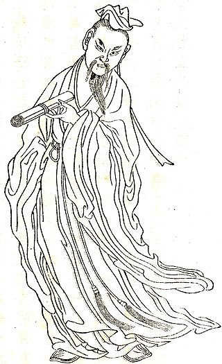
Ban Chao, courtesy name Zhongsheng, was a Chinese diplomat, explorer, and military general of the Eastern Han dynasty. He was born in Fufeng, now Xianyang, Shaanxi. Three of his family members—father Ban Biao, elder brother Ban Gu, younger sister Ban Zhao—were well known historians who wrote the historical text Book of Han, which recorded the history of the Western Han dynasty. As a Han general and cavalry commander, Ban Chao was in charge of administrating the "Western Regions" while he was in service. He also led Han forces for over 30 years in the war against the Xiongnu and re-established Han control over the Tarim Basin region. He was made Protector General of the Western Regions by the Han government for his efforts in protecting and governing the regions. Ban Chao is depicted in the Wu Shuang Pu by Jin Guliang.

The Book of the Later Han, also known as the History of the Later Han and by its Chinese name Hou Hanshu, is one of the Twenty-Four Histories and covers the history of the Han dynasty from 6 to 189 CE, a period known as the Later or Eastern Han. The book was compiled by Fan Ye and others in the 5th century during the Liu Song dynasty, using a number of earlier histories and documents as sources.

Ban Biao, courtesy name, was a Chinese historian and politician born in what is now Xianyang, Shaanxi during the Han dynasty. He was the nephew of Consort Ban, a famous poet and concubine to Emperor Cheng.
Ren Shang was the Protector General of the Western Regions under Eastern Han between 102 and 106 CE.

The Han–Xiongnu War, also known as the Sino–Xiongnu War, was a series of military conflicts fought over two centuries between the Chinese Han Empire and the nomadic Xiongnu confederation, although extended conflicts can be traced back as early as 200 BC and ahead as late as 188 AD.

The Protectorate of the Western Regions (simplified Chinese: 西域都护府; traditional Chinese: 西域都護府; pinyin: Xīyù Dūhù Fǔ; Wade–Giles: Hsi1-yü4 Tu1-hu4 Fu3) was an imperial administration (a protectorate) situated in the Western Regions administered by Han dynasty China and its successors on and off from 59 or 60 BCE until the end of the Sixteen Kingdoms period in 439 AD. The "Western Regions" refers to areas west of Yumen Pass, especially the Tarim Basin in southern Xinjiang. These areas would later be termed Altishahr (southern Xinjiang, excluding Dzungaria) by Turkic-speaking peoples. The term "western regions" was also used by the Chinese more generally to refer to Central Asia.
The Chief Official of the Western Regions was a Chinese military official in charge of the Western Regions during the Eastern Han, Cao Wei and Jin dynasties.
The Jushi, or Gushi, were a people probably associated with the Subeshi culture, who established a kingdom during the 1st millennium BC in the Turpan basin. The kingdom included the area of Ayding Lake, in the eastern Tian Shan range. During the late 2nd and early 1st century BC, the area was increasingly dominated by the Han dynasty and the northern neighbours of the Jushi, the Xiongnu, and became one of the many minor states of the Western Regions of Han dynasty China. In 450 AD the Northern Liang destroyed the state of Jushi (車師) and occupied its capital city of Jiaohe 交河 (Yarkhoto). Jiaohe, later known as Yarkhoto and Yarghul, was destroyed in a Mongol attack in the 13th century.

The Han dynasty was the second imperial dynasty of China. It followed the Qin dynasty, which had unified the Warring States of China by conquest. It was founded by Liu Bang. The dynasty is divided into two periods: the Western Han and the Eastern Han, interrupted briefly by the Xin dynasty of Wang Mang. These appellations are derived from the locations of the capital cities Chang'an and Luoyang, respectively. The third and final capital of the dynasty was Xuchang, where the court moved in 196 CE during a period of political turmoil and civil war.

Kashgar or Kashi is a city in the Tarim Basin region of southern Xinjiang, China. It is one of the westernmost cities of China, located near the country's border with Kyrgyzstan and Tajikistan. For over 2,000 years, Kashgar was a strategically important oasis on the Silk Road between China, the Middle East, and Europe. It is one of the oldest continuously inhabited cities in the world and has a population of 711,300 people. Kashgar's urban area covers 15 km2 (5.8 sq mi), although its administrative area extends over 555 km2 (214 sq mi).
The history of Kashgar begins in the first millennium BC, when the tribes of Yuedzhi, Usuns and Saks were roaming around the vast expanses of the Taklamakan Desert and the piedmont slopes of the Pamir. Wandering from one encampment to another in the oases, they eventually began founding small settlements, which later were developed into cities on the Silk Road.
References
Citations
- ↑ Chavannes (1906), p. 239.
- ↑ Hill (2009), n. 1.45.
- ↑ Chavannes (1906), p. 246.
- ↑ Hill (2009), p. 11.
- ↑ Grousset, Rene (1970). The Empire of the Steppes. Rutgers University Press. pp. 47–48. ISBN 0-8135-1304-9.
- ↑ Hill (2009), p. 46.
- ↑ Hill (2009), pp. vi, xv, 13.
- ↑ Chavannes (1906), pp. 253-254.
- ↑ Hill (2009), pp. 11, 45.
- ↑ Chavannes (1906), pp. 254-255.
Sources
- Chavannes, Édouard (1906). "Trois Généraux Chinois de la dynastie des Han Orientaux. Pan Tch’ao (32-102 p.C.); – son fils Pan Yong; – Leang K’in (112 p.C.). Chapitre LXXVII du Heou Han chou." T’oung pao 7, pp. 210–269.
- Hill, John E. (2009). Through the Jade Gate to Rome: A Study of the Silk Routes during the Later Han Dynasty, First to Second Centuries CE. BookSurge. ISBN 978-1-4392-2134-1.[ dead link ]