
Srikakulam is a city and the headquarters of Srikakulam district in the Indian state of Andhra Pradesh. As of 2011 census,. it has a population of 165,735. There are many other places of Buddhist Tourism such as Salihundam, Calinga Patnam, Dabbaka Vaani Peta, Nagari Peta, Jagati Metta, Singupuram etc. in Srikakulam District. The Buddhist heritage site of Salihundam has some unique features. It has a beautiful star atop a stupa, rock cut massive stupaas inside chaitya grihas, brick stupas with wheel pattern plan, votive stupas, inscriptions on the steps leading to the stupas and museum housing over two dozen sculpted statue and figurines of Buddha, Jain Teerthankars and other deities

Kalyandurg is a town in Anantapur district of the Indian state of Andhra Pradesh. It is the headquarters for Kalyandurg mandal and Kalyandurg revenue division. The discovery of diamond-bearing Kimberlites in Kalyandurg area, is one of the clusters that has been discovered.

Dharmavaram is a city in Sri Sathya Sai District of the Indian state of Andhra Pradesh. It is the mandal and divisional headquarters of Dharmavaram mandal and Dharmavaram revenue division respectively. The city is known for its handloom silk sarees. The city is renowned for cotton, silk weaving industries and leather puppets. The city is called as Silk city of Andhra Pradesh.

Proddatur is a city in the YSR Kadapa District of Andhra Pradesh.

Tadepalligudem (TPG) is a City in West Godavari district of the Indian state of Andhra Pradesh. It is a Selection Grade municipality and the mandal headquarters of Tadepalligudem mandal in Bhimavaram revenue division. Tadepalligudem is second biggest town next to bhimavaram city in west godavari District as per 2011 census in terms of population.

Jangareddygudem (JRG) is a municipality in newly formed Eluru district which is previously in West Godavari district of the Indian state of Andhra Pradesh.
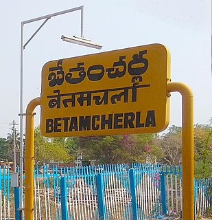
Bethamcherla is a town with Nagar panchayat civic status and mandal headquarters located in Nandyal district of the Indian state of Andhra Pradesh. It comes under Dhone assembly constituency and Nandyal Parliament Constituency.

Hindupur is a city in Sri Sathya Sai district of the Indian state of Andhra Pradesh. It is located at the edge of the Andhra–Karnataka border and is the headquarters of Hindupur mandal. Hindupur was biggest town in newly formed District Sri Sathya Sai. It is located about 67 km from district headquarters Puttaparthi, 100 km from Bengaluru the capital of Karnataka, 95 km From Kadiri.
Narasaraopet is a City and District headquarters of Palnadu District of the Indian state of Andhra Pradesh .The town is a municipality and mandal headquarters of Narasaraopet mandal and Headquarters of Narasaraopet revenue division. The town also is the seat of the court of Additional District Judge. Narasaraopet acts as a melting point for the Palnadu and Delta regions of the district. The town is also referred as the 'Gateway of Palnadu'. The main offices of Nagarjuna Sagar Jawahar Canal Operation & Maintenance Lingamguntla Circle are located in this town.

Narsipatnam is a town in Anakapalle district of the Indian state of Andhra Pradesh. It was upgraded from a gram panchayat into municipality in 2012. The town is spread over an area of 42 km2 (16 sq mi) The resting place of the revolutionary Indian freedom fighter Alluri Sitarama Raju is located in Krishna Devi Peta village of Narsipatnam.

Sompeta is a census town in Srikakulam district of the Indian state of Andhra Pradesh. It is the mandal headquarters of Sompeta mandal in Tekkali revenue division.

Srikalahasti is a holy town in Tirupati district of the Indian state of Andhra Pradesh. It is a municipality and the revenue division of Srikalahasti mandal. It is a part of Tirupati Urban Development Authority, which is located on the banks of the River Swarnamukhi.
Tirupati (NMA) is a census town in Tirupati district in the Indian state of Andhra Pradesh.

Nagari is a Town in Chittoor district of the Indian state of Andhra Pradesh. It is the mandal headquarters of Nagari revenue division.
Ibrahimpatnam is a part of Vijayawada in NTR district of the Indian state of Andhra Pradesh. It is also the mandal headquarters of Ibrahimpatnam mandal. Dr Narla Tata Rao Thermal Power Station, one of the major Thermal power stations of the state is located near the town. Railway Wagon Workshop at Rayanapadu is also located very near to Ibrahimpatnam at a distance of 4 km.

Guntupalli is a census town in Krishna district of the Indian state of Andhra Pradesh. It is located in Ibrahimpatnam mandal of Vijayawada revenue division. It is a suburb of Vijayawada.
Vaddeswaram is a census town in Guntur district of the Indian state of Andhra Pradesh. It is located at a distance of 5 km (3.1 mi) from Krishna River, in Tadepalle mandal part of Mangalagiri Tadepalle Municipal Corporation part of Guntur revenue division.

Gavaravaram is a census town in West Godavari district of the Indian state of Andhra Pradesh. Gavaravaram is also known as Venkayapalam because of Gopina venkana garu 1914 to 1991 who is great person and owned most areas of the village once up on a time.It is located in Eluru mandal of Eluru revenue division. The town is a constituent of Eluru urban agglomeration.

Satrampadu is a census town in West Godavari district of the Indian state of Andhra Pradesh. It is located in Eluru mandal of Eluru revenue division. The town is a constituent of Eluru urban agglomeration.

Sanivarapupeta is a census town in West Godavari district of the Indian state of Andhra Pradesh. It is located in Eluru mandal of Eluru revenue division. The town is a constituent of Eluru urban agglomeration.
