
Puthunagaram is a town and gram panchayat in the Palakkad district, state of Kerala, India. It is about 10 km south of Palakkad and 8 Km from Kollengode. Palakkad-Pollachi railway line passes through this town.
Madipakkam is residential locality situated in south of Chennai, India. It has been recently placed under the Greater Chennai Corporation.
Beawar is a city in Beawar district of Indian state of Rajasthan. As of 2011, the population of Beawar is 342,935. It is located 60 kilometres south from Ajmer, the divisional headquarter and 184 kilometres (114 mi) southwest of the state capital Jaipur, amidst Aravali hills. Nearest airports are Jodhpur (145 km), Kishangarh and Jaipur (190 km). It is also connected by RSRTC operated buses to all parts of Rajasthan, and neighboring Delhi NCR, Ahmedabad (Gujarat), Gwalior. It also has railway connectivity with Delhi, Mumbai, Ahmadabad, Bangalore (bi-weekly), Haridwar, Dehradun (weekly), Bareilly and Muzzafarpur.
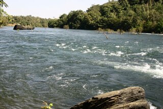
Dandeli is a taluk in Uttara Kannada district of Karnataka, India, in the Malenadu region.
Athipattu is a census town in Chennai in Thiruvallur district in the state of Tamil Nadu, India. The neighbourhood is served by Athipattu railway station of the Chennai Suburban Railway network. It is a suburb in northern part of Chennai.

Birwadi is a census town in Raigad district in the state of Maharashtra, India.
Chinnasekkadu is a neighbourhood of Chennai in Chennai district in the state of Tamil Nadu, India. Chinnasekkadu used to be a town panchayat in Thiruvallur district. In 2011, Chinnasekkadu town panchayat was merged with Chennai Corporation. Chinnasekkadu comes under ward 29 in Zone 3(Madhavaram) of Chennai Corporation.

Desur is a Town panchayat in Tiruvanamalai district in the Indian state of Tamil Nadu.
Dhanuha is a census town in Jaunpur district in the state of Uttar Pradesh, India.
Ezhudesam is a town panchayat in Kanniyakumari district in the state of Tamil Nadu, India.
Herohalli is a census town in Bangalore district in the Indian state of Karnataka.

Injambakkam is a locality in the south of Chennai in the Indian state of Tamil Nadu. Being a part of the Walajabad block of the district, its panchayat is part of Walajabad panchayat union. Injambakkam is located along the ECR.
Kothnur is a census town in Bangalore district in the Indian state of Karnataka.
Naravarikuppam is a town in Thiruvallur district in the Indian state of Tamil Nadu.
Perumbaikad is a census town in Kottayam district in the Indian state of Kerala.
Thevaram is a town in Theni district in the Indian state of Tamil Nadu. Thevaram is located in Tamil Nadu near the border of Kerala at the Eastern side foot-hill of the Western Ghats. It is connected with State Highway SH100.
Vengathur is a census town in Thiruvallur district in the Indian state of Tamil Nadu.
Venkatapur is a census town in Bhatkal Taluk in Uttara Kannada district of Karnataka.
Jafarabad is a town and nagar panchayat in Jaunpur district in the Indian state of Uttar Pradesh.
Kerur is a town in Bagalkot district in Karnataka, which located on NH 218. It has an average elevation of 617 meters (2024 feet). It's the birthplace of Jagadish Shettar, a former Chief Minister of Karnataka. Kerur is a Town Panchayat city in the district of Bagalkot, Karnataka. The Kerur city is divided into 16 wards for which elections are held every five years. The Kerur Town Panchayat has a population of 19,731 of which 9,929 are males while 9,802 are females as per report released by Census India 2011.


 India
India 