Champua

Last updated

Champua
Town
India Odisha location map.svg
Red pog.svg
Champua
Location in Odisha, India
India location map.svg
Red pog.svg
Champua
Champua (India)
Coordinates: 22°05′N85°40′E / 22.08°N 85.67°E / 22.08; 85.67
Country India
State Odisha
District Kendujhar district
Elevation
346 m (1,135 ft)
Population
 (2011)
  Total10,394
Languages
  Official Odia,
  Local Ho, Munda, Kudmali
Time zone UTC+5:30 (IST)
Vehicle registration OD 09
Website odisha.gov.in

Champua is a notified area council [1] in Kendujhar district in the state of Odisha, India.As per SC & ST department of Odisha, the Champua sub-division is under scheduled areas of Odisha. [2] Nicholson Forest training institute is present here. [3] The suburb has its importance as it provides a major trade route for transport of iron ore and manganese from some of the major mines of the state to the nearest port & out-state depots. [4] It is also known for its pre-independence truss bridge built by British rulers, the judicial buildings of the same period as well as a few educational institutes who have a good reputation in the state. [5] The river Baitarani flows by Champua, which is one of the largest rivers of the state second only to Mahanadi.

Contents

Major Tribes

Champua block is inhabited by tribal communities like Ho, Juang, Bhuinya, Oraon, Gond, Bhumij and other tribal communities . These tribes constitute nearly 87.21% population of the Sub-division.

Geography

Champua is located at 22°05′N85°40′E / 22.08°N 85.67°E / 22.08; 85.67 . [6] It has an average elevation of 346 metres (1135 feet).

Demographics

Champua has a population of 10,394, of which 5,543 are males, while 4,851 are females as per a report released by Census India 2011. [7] The literacy rate of Champua city is 87.00% higher than the state average of 72.87%. Male literacy is 90.85%, while female literacy rate is 82.59%.

Languages

As the champua area has been dominated by Ho people, local people widely speak in the Ho language [it is written with the "Varang Kshiti" (also "Warang Chiti" script)] as their mode of communication. Most people can speak, write all three languages Odia, Hindi, and English.

Politics

The current MLA for Champua (GE) Assembly Constituency is Minaskhi Mahanta, of the Biju Janata Dal (BJD) party, who defeated Murali Sharma, a candidate from the Bharatiya Janata Party (BJP). [8]

Champua is part of Keonjhar (Lok Sabha constituency). [9]

Related Research Articles

<span class="mw-page-title-main">Rairangpur</span> City in Odisha, India

Rairangpur is a city and a tehsil in the Mayurbhanj district of the state of Odisha, India. It is located 287 kilometres from the state capital Bhubaneswar, 82 kilometres from the district headquarters of Baripada, and about 73 kilometres from Jamshedpur. Rairangpur is the second largest city in the Mayurbhanj district, a notable mining area of Odisha, producing iron-ore from the Gorumahisani, Badampahar, and Suleipat mines.

<span class="mw-page-title-main">Khordha district</span> District of Odisha in India

Khordha district is an administrative division of the state of Odisha, India. It was formed on April 1, 1993, by the division of former Puri District into Puri, Khordha and Nayagarh districts. In the year 2000 the district name was changed to Khordha. The district headquarters is Khordha Town. The capital city of Bhubaneswar is located in this district. Khordha is the most urbanized of all the districts of Odisha.

<span class="mw-page-title-main">Jharsuguda district</span> District in Odisha, India

Jharsuguda is a district in Odisha, India with Jharsuguda town as its headquarters. This region is rich in coal and other mineral reserves. Of late, many small and medium scale iron and steel units have been set up in the vicinity of Jharsuguda town, giving impetus to the industrial growth of the district.

<span class="mw-page-title-main">Karimganj</span> Town in Assam, India

Karimganj is a town in the Karimganj District of the Indian state of Assam. It is the administrative headquarters of the district.

<span class="mw-page-title-main">Rangiya</span> City in Assam, India

Rangiya also known as Rangia, is a major city of Lower Assam division and a municipal board located in the Kamrup district of Assam, India. Rangiya is also the headquarters of Kamrup district, and Rangiya serves as the Sub-divisional headquarter of Rangiya Sub-division. One of Rangiya's significant features is its role as the divisional headquarter of the Northeast Frontier Railway, which is one of the major railway zones in India. Baralia river flows through the heart of the city. The Redhorn Division of the Indian Army is located just three kilometers from the city.

<span class="mw-page-title-main">Noamundi</span> Census town in Jharkhand, India

Noamundi is a census town in West Singhbhum district in the Indian state of Jharkhand. It is also an administrative block. It is a small mining town located close to the Odisha border. It lies near Jamshedpur and 64 km (40 mi) from Chaibasa. Nearby towns include Padapahar, Barajamda, jagannathpur, Kharsawan, Gua and Kiriburu.

Chhatrapur (ଛତ୍ରପୁର) is a town and a Municipality in Ganjam district in the state of Odisha, India.

<span class="mw-page-title-main">Rayagada</span> Town in Odisha, India

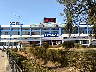
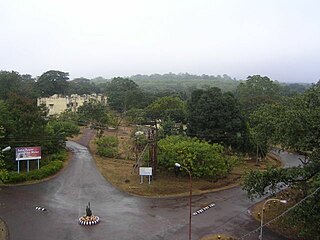
Rayagada is a municipality in Rayagada district in the Indian state of Odisha. It is the administrative headquarters of Rayagada district.

Bissam Cuttack is a town and Notified Area Council in the Rayagada district of Odisha, India.

<span class="mw-page-title-main">Gunupur</span> Town in Odisha, India

Gunupur is a Municipality and one of the sub-divisional headquarters of Rayagada district in the Indian state of Odisha. It is the second biggest town in Rayagada district.

Karanjia is a town and a Municipality in the eastern Indian state of Odisha, about 221 kilometres (134 mi) north of the state capital Bhubaneswar. It is the sub-divisional headquarter of Panchpir sub-division and a NCA in Mayurbhanj district. It is bounded on its South-East by Deo river which forms the natural district border for Mayurbhanj.

<span class="mw-page-title-main">Khallikote</span> Town in Odisha, India

Khallikote is a town and a Notified Area Council in Ganjam district in the Indian state of Odisha.

Khandapada is a town and a Notified Area Council in Nayagarh district in the Indian state of Odisha. It is located in the valley of nine mountains.

<span class="mw-page-title-main">Kuchinda</span> Town in Odisha, India

Kuchinda is the town and a notified area council in Sambalpur district in the Indian state of Odisha. It is located about 80 km (49.71 mi) from the district headquarters of Sambalpur, and about 48 km (29.83 mi) away from Jharsuguda. Kuchinda is famous for its "Dushera". Kuchinda is also famous for the Gudguda waterfall. Most of the people of Kuchinda sub-division depends on farming. Kuchinda is more of a tribal area.

Kotpad is a town and a notified area committee in Koraput district in the Indian state of Odisha. Nearest railway station to Kotpad is Kotpad Road station which is a part of East Coast railway.

Patnagarh is a town and a Notified Area Council in Bolangir district in the Indian state of Odisha. Its original name is Patnāgarh, and it is pronounced verbally as Patnāgad. The official language is Odia. Patnagarh bears historical significance as it was the epicentre of power in middle age. Patnagarh was the capital of 18 garh that come under south Koshal. In 12th century AD the progenies of the famous King of Delhi, Prithviraj Chauhan came and settled down in Patnagarh. They came here because Mohammad Ghori defeated Prithviraj Chauhan in 2nd battle of Tarai in 1193. The first child of the royal scion who ruled Patnagarh as per recorded history was Ramai Deo. However after 16th century onwards when Balangir and Sambalpur came in to being, the city lost its charm.

<span class="mw-page-title-main">Pipili</span> Town in Odisha, India

Pipili is a town and a NAC under jurisdiction of Puri district in the Indian state of Odisha. It is famous for designing beautiful Applique handicrafts. It is a town of artisans famous for their colourful fabrics.

<span class="mw-page-title-main">Kendujhar district</span> District of Odisha in India

Kendujhar District, is an administrative district of Odisha. The district is one of the fifth Scheduled Areas of Odisha. The town of Kendujhar is the district headquarters. The district has three sub-divisions, Anandapur, Champua, and Kendujhar.

Umerkote, also known as Umarkot and Amarkot, is a town of Nabarangpur district, Odisha, in eastern India. Umerkote is an urban area and the name of a Municipality declared on 3 March 2014 and a Subdivision declared by State Cabinet on 3 November 2015. The town is a prominent business place of the Nabarangpur District.

Khireitangiri is a village located in Patna Tehsil in the Kendujhar District in the Indian state of Odisha.

References

  1. "Elections to new Baliguda, Champua NACs on Jan 19".
  2. "ST & SC Development, Minorities & Backward Classes Welfare Department:: Government of Odisha". Archived from the original on 9 October 2021. Retrieved 9 October 2021.
  3. http://rtiodisha.gov.in/Pages/printAllManual/office_id:4440/lang:
  4. ". . : : Centre For Environmental Studies : : . ". cesorissa.org. Retrieved 28 March 2019.
  5. "Baitarini Bridge Champua". Mapio.net. Retrieved 28 March 2019.
  6. Falling Rain Genomics, Inc - Champua
  7. "Champua Census Town City Population Census 2011-2021 | Orissa".
  8. "Know The Winners Of Odisha Assembly Constituencies". Odisha Bytes. 24 May 2019.
  9. "Assembly Constituencies - Corresponding Districts and Parliamentary Constituencies of Odisha" (PDF). Election Commission of India. Archived from the original (PDF) on 4 March 2009. Retrieved 27 September 2008.