Rakovica is a village and a municipality in south-central Croatia, in the region of Kordun south of Karlovac and Slunj, and north of the Plitvice Lakes. Rakovica is an underdeveloped municipality which is statistically classified as the First Category Area of Special State Concern by the Government of Croatia.

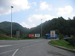
Macelj is the name of a village and a forest in northern Croatia bordering on Slovenia. There is an official border crossing in Macelj, and the end of the A2 highway. The villages are administratively divided into Gornji Macelj (Upper), population 204, and Donji Macelj (Lower), population 566.
Žumberak is a village and a municipality in Croatia in the Zagreb County. According to the 2011 census, there are 883 inhabitants, 98% of which are Croats. Žumberak municipality covers an area of 110 km2 (42 sq mi).

Barilović is a village and a municipality in central Croatia, in the Karlovac County.

Netretić is a village and a municipality in Karlovac County, Croatia. There are 2,862 inhabitants, 99% of whom are Croats.

Selnica is a municipality in Međimurje County, Croatia. There are 2,991 inhabitants, absolute majority who are Croats.

Rovinjsko Selo is a village in Croatia. It is connected by the D303 highway.
Veleševec is a village in Croatia.
Ivanovo Selo is a village in Croatia.
Andrilovec is a settlement in the Dugo Selo town of Zagreb County, Croatia. As of 2011 it had a population of 286 people.
Kozinščak is a settlement in the Dugo Selo town of Zagreb County, Croatia. As of 2011 it had a population of 1,345 people.
Mala Ostrna is a settlement in the Dugo Selo town of Zagreb County, Croatia. As of 2011 it had a population of 325 people.
Puhovo, Croatia is a settlement in the Dugo Selo town of Zagreb County, Croatia. As of 2011 it had a population of 710 people.
Velika Ostrna is a settlement in the Dugo Selo town of Zagreb County, Croatia. As of 2011 it had a population of 1,271 people.
Leprovica is a settlement in the Dugo Selo town of Zagreb County, Croatia. As of 2011 it had a population of 254 people.
Draganje Selo is a settlement (naselje) in the Samobor administrative territory of Zagreb County, Croatia. As of 2011 it had a population of 83 people.
Šalovec is a settlement (naselje) in the Sveti Ivan Zelina administrative territory of Zagreb County, Croatia. As of 2011 it had a population of 169 people.
Lonjica is a settlement (naselje) in the Vrbovec administrative territory of Zagreb County, Croatia. As of 2011 it had a population of 1,020 people.
Prilesje is a settlement (naselje) in the Vrbovec administrative territory of Zagreb County, Croatia. As of 2011 it had a population of 181 people.


