
Kirkby Lonsdale is a town and civil parish in the Westmorland and Furness district of Cumbria, England, on the River Lune. Historically in Westmorland, it lies 13 miles (21 km) south-east of Kendal on the A65. The parish recorded a population of 1,771 in the 2001 census, increasing to 1,843 at the 2011 Census.

The River Lune is a river 53 miles (85 km) in length in Cumbria and Lancashire, England.

A packhorse bridge is a bridge intended to carry packhorses across a river or stream. Typically a packhorse bridge consists of one or more narrow masonry arches, and has low parapets so as not to interfere with the panniers borne by the horses. Multi-arched examples sometimes have triangular cutwaters that are extended upward to form pedestrian refuges.

Beckfoot Bridge was historically a significant crossing point over Harden Beck in Bingley, West Yorkshire, England.

The Trout Beck is a fast flowing stream of the Lake District in North West England. It is one of the main sources of replenishment for Windermere, and is part of the Leven catchment. Its name comes from Old Norse and appears in documents from 1292 as Trutebyk. The river rises between the peaks of Stony Cove Pike and Thornthwaite Crag in the High Street range, at a height of about 1,970 feet (600 m).

The River Sprint is a river in Cumbria, England with its source high up on the south-facing side of Harter Fell. It flows into the River Kent just to the south of Burneside.

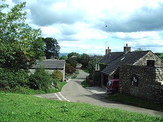
Barbon is a village and civil parish in Westmorland and Furness, England. According to the 2001 census it had a population of 263, reducing to 236 at the 2011 Census. The church is dedicated to St Bartholomew. The village is about 3 miles (4.8 km) north of Kirkby Lonsdale and 2 miles (3.2 km) north of Casterton. Barbon Beck flows through, and takes its name from, the village before flowing into the River Lune. The A683 road passes to the west of the village between Kirkby Lonsdale and Sedbergh. The village has been within the Yorkshire Dales National Park since 1 August 2016.

The River Winster is a river in the English county of Cumbria. The Winster was the boundary between the ancient counties of Lancashire and Westmorland. It has a relatively small catchment area; other streams flow parallel to it on either side.

Stainton Beck is a watercourse in Cumbria, England. Its upper reaches are known as St. Sunday's Beck.
Leck Beck is a watercourse in Lancashire with its source on Crag Hill in Cumbria between Leck Fell and Casterton Fell.
Weasdale Beck is a stream in Cumbria, England.

Sandwath Beck is a river running through Cumbria in England.
Artle Beck is a minor river of Lancashire, England.
Waitby is a small village and civil parish in the Eden district of Cumbria, England. The parish contains two small villages, Waitby and Smardale, plus the small hamlets of Riddlesay, Stripes and Leases, all of which are in the farmed and enclosured northern part at an elevation of around 200–300m. The southern half of the parish is mostly heath and unused for agriculture, it rises to Smardale fell; which it includes, at elevations between 300 and 400m. The civil parish of Ravenstonedale forms the boundary to the south. The western border with Crosby Garrett civil parish is formed by Scandal Beck. To the north and east lie Soulby and Kirkby Stephen civil parishes respectively. The population of the civil parish as measured at the 2011 Census was less than 100. Details are included in the parish of Crosby Garrett.
Smardale is a small village and former civil parish, now in the parish of Waitby, in the Eden district, in Cumbria, England. In 1891 the parish had a population of 36.

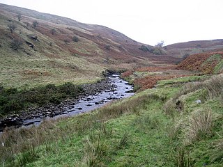
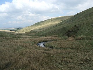
The Wasdale Horseshoe is a group of hills on the eastern fringe of the English Lake District, to the west of the A6, south of Shap, Cumbria. They surround the valley of Wasdale Beck, a tributary of Birk Beck and ultimately of the River Lune. The horseshoe is the subject of a chapter of Wainwright's book The Outlying Fells of Lakeland. This Wasdale should not be confused with the better known Wasdale, containing Wast Water, on the west of the Lake District.

The Ingleton branch line was a rural railway line in the West Riding of Yorkshire, Lancashire and Westmorland in England. It was originally planned in 1846 to form part of a main line route from London to Scotland, but fell victim to rivalry between railway companies. Completion was delayed until 1861, and it was only ever a rural branch line, serving the towns of Ingleton, Kirkby Lonsdale and Sedbergh. It closed to passengers in 1954 and was dismantled in 1967.

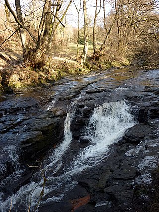
Harden Beck is a stream that flows from Hewenden Reservoir, over Goit Stock Waterfall to the River Aire in Bingley, West Yorkshire. The route starts out further up the valley as Denholme Beck, Hewenden Beck and Hallas Beck. Its waters are fed by Thornton Moor Reservoir, Stubden Reservoir, Doe Park Reservoir and Hewenden Reservoir.

Winster is a village in the South Lakeland District of Cumbria, in North West England. Historically within the county of Westmorland, it is situated less than two miles east of Windermere, England's largest natural lake. The village is within the Lake District National Park. The village has a pub, the Brown Horse Inn, an 1850s coaching inn.
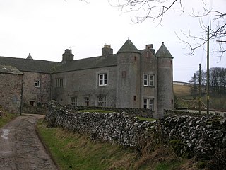
Barbon is a civil parish in the South Lakeland District of Cumbria, England. It contains 23 listed buildings that are recorded in the National Heritage List for England. Of these, two are listed at Grade II*, the middle of the three grades, and the others are at Grade II, the lowest grade. The parish contains the village of Barbon and the surrounding countryside. The listed buildings consist of houses, farmhouses and farm buildings, bridges, a milestone, a boundary stone, and a church.
