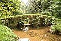
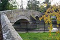
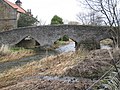
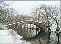
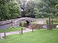
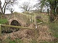
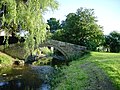
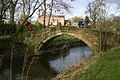
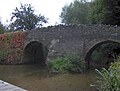
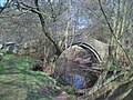
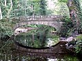
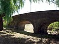
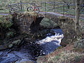
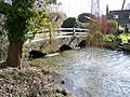
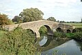
Packhorse bridge

Last updated
Essex Bridge, a packhorse bridge across the River Trent The bridge at the back of Shugborough Hall - geograph.org.uk - 82324.jpg
Essex Bridge, a packhorse bridge across the River Trent
Medieval packhorse bridge crossing the Almofrei at Cotobade, Galicia PAlmofrei.jpg
Medieval packhorse bridge crossing the Almofrei at Cotobade, Galicia

A packhorse bridge is a bridge intended to carry packhorses (horses loaded with sidebags or panniers) across a river or stream. Typically a packhorse bridge consists of one or more narrow (one horse wide) masonry arches, and has low parapets so as not to interfere with the panniers borne by the horses. [1] Multi-arched examples sometimes have triangular cutwaters that are extended upward to form pedestrian refuges. [2] :24–25

Contents

Packhorse bridges were often built on the trade routes (often called packhorse routes) that formed major transport arteries across Europe and Great Britain until the coming of the turnpike roads and canals in the 18th century. [1] Before the road-building efforts of Napoleon, all crossings of the Alps were on packhorse trails. [3] Travellers' carriages were dismantled and transported over the mountain passes by ponies and mule trains.

Definition

In the British Isles at least, the definition of a packhorse bridge is somewhat nebulous. Ernest Hinchliffe discusses the difficulty of defining a true packhorse bridge in A Guide to the Packhorse Bridges of England. [2] He claims that "before the eighteenth century bridges were described as 'horse bridges' or 'cart bridges'" and his strict definition excludes the latter. He suggests that a classic packhorse bridge should generally be:

He categorises the 190 English bridges listed in his book into three groups:

The difficulty of classification is illustrated by Moulton Bridge in Suffolk, which Hinchliffe places in Group 1 but which English Heritage describes as "perhaps not strictly a packhorse bridge since it was wide enough to take carts". [4]

List of packhorse bridges in the British Isles

The following list includes all listed buildings described as packhorse bridges by English Heritage, Cadw, or Historic Scotland; all 106 of Hinchliffe's Group 1 bridges in England; and certain other candidates. (For England, Hinchliffe's Group numbers are given as superscripts after the bridge name.)

England

CountyLocationNameGroupPhotographCrossesNotes
Bedfordshire Sutton
52°06′42″N0°13′08″W / 52.1117°N 0.2190°W / 52.1117; -0.2190
Sutton Packhorse Bridge1
Suttonbridge 1431.jpg
Potton Brook Medieval with later repairs; two pointed arches. Grade II* listed, [5] Scheduled monument. [6]
Cheshire Crowton
53°16′13″N2°37′34″W / 53.2702°N 2.6262°W / 53.2702; -2.6262
Bridge over Acton Brook, Crowton.JPG
Acton BrookSingle segmental arch. Carries public bridleway.
Cheshire Hockenhull Platts
53°11′10″N2°47′05″W / 53.1861°N 2.7848°W / 53.1861; -2.7848
Roman Bridges1
Roman Bridge.jpg
River Gowy Three bridges, "probably late 18th-century" [7] or "late 17th-century". [8] Grade II listed. [7] [9] The three bridges carry a public byway.
Cheshire Quarry Bank Mill, Styal
53°20′38″N2°15′01″W / 53.3440°N 2.2503°W / 53.3440; -2.2503
The Packhorse Bridge
Packhorse Bridge at Quarry Bank Mill - geograph.org.uk - 734147.jpg
River Bollin 1820, single segmental arch. Grade II listed. [10] Carries a public byway.
Cheshire/Derbyshire Three Shire Heads
53°12′50″N1°59′15″W / 53.2139°N 1.9875°W / 53.2139; -1.9875
Three Shire Heads Bridge2
Three Shire.jpg
River Dane Probably late 18th-century; single span. Grade II listed. [11] Carries public byway.
Cornwall Bowithick
50°36′55″N4°34′09″W / 50.6154°N 4.5691°W / 50.6154; -4.5691
Bowithick Bridge
BowithickBridgeBodminMoorCornwallFromGeograph.jpg
Penpont Water Probably early 19th-century; three stone arches, one larger and two small. Grade II listed. [12]
Cornwall Launceston
50°38′29″N4°21′58″W / 50.641492°N 4.366202°W / 50.641492; -4.366202
West Bridge (Prior's Bridge)
Prior's Bridge and the River Kensey - geograph.org.uk - 323493.jpg
River Kensey Late medieval; five-span bridge with two cut-waters. Grade I listed. [13]
Cumbria Ambleside
54°27′09″N2°57′33″W / 54.4525°N 2.9592°W / 54.4525; -2.9592
High Sweden Bridge1
High Sweden Bridge - geograph.org.uk - 1187444.jpg
Scandale Beck Late 17th-century; single-span. Grade II listed. [14] < Carries public footpath.
Cumbria Barbon
54°13′50″N2°35′37″W / 54.2306°N 2.5937°W / 54.2306; -2.5937
High Beckfoot Bridge1
Ford at Beckfoot Farm (geograph 4251848).jpg
Barbon Beck Probably late 17th- or 18th-century; described as "ruinous" in 1725. [8] Single-span. Grade II listed. [15] Carries public bridleway.
Cumbria Dean
54°37′29″N3°27′33″W / 54.6246°N 3.4592°W / 54.6246; -3.4592
Calva Hall packhorse bridge1
Packhorse bridge at Calva Hall - geograph.org.uk - 2778915.jpg
River Marron Dated 1697; [2] :38 single-span. Grade II listed. [16]
Cumbria Drigg
54°22′32″N3°25′21″W / 54.3756°N 3.4224°W / 54.3756; -3.4224
Drigg Holme Packhorse Bridge1
Drigg Holme Packhorse Bridge - geograph.org.uk - 3070747.jpg
River Irt Single-span. Scheduled monument. [17] Carries public bridleway.
Cumbria Eskdale
54°23′44″N3°15′00″W / 54.3956°N 3.2499°W / 54.3956; -3.2499
Doctor[s] Bridge2
Doctor Bridge - geograph.org.uk - 10550.jpg
River Esk Probably 17th-century, widened in 1734. Grade II listed. [18] Carries public road.
Cumbria Gaisgill
54°27′10″N2°33′39″W / 54.4527°N 2.5609°W / 54.4527; -2.5609
Barugh Bridge1
Rais Beck Packhorse Bridge - panoramio.jpg
Rais GillProbably 18th-century, but maybe earlier. Grade II listed. [19] Carries public byway.
Cumbria Knock
54°39′02″N2°28′45″W / 54.6506°N 2.4791°W / 54.6506; -2.4791
Swindale Beck Possibly 17th-century; single segmental arch. Grade II listed. [20]
Cumbria Little Langdale
54°25′04″N3°03′42″W / 54.4178°N 3.0616°W / 54.4178; -3.0616
Slater[s] Bridge 1
Slater Bridge - geograph.org.uk - 1563250.jpg
River Brathay 17th-century; two clapper slabs and a single arch. Grade II* listed. [21] Carries public footpath.
Cumbria Lowgill
54°21′44″N2°35′32″W / 54.3621°N 2.5921°W / 54.3621; -2.5921
Lowgill Packhorse Bridge
Packhorse and road bridges, Lowgill.jpg
Lowgill BeckProbably 17th- or 18th-century; single-span. Grade II listed. [22]
Cumbria Pennington
54°12′24″N3°08′28″W / 54.2066°N 3.1411°W / 54.2066; -3.1411
Devil's Bridge1
Devil's Bridge (geograph 7105573).jpg
Rathmoss Beck17th- or 18th-century; single-span. Grade II listed. [23] Alongside public road.
Cumbria Sca Fell
54°25′20″N3°11′32″W / 54.4221°N 3.1923°W / 54.4221; -3.1923
Lingcove or Throstlegarth Bridge1
Sheep crossing Lingcove Bridge - geograph.org.uk - 493840.jpg
Lingcove BeckSingle arch. On Open Access land.
Cumbria Seathwaite, Allerdale
54°29′16″N3°10′59″W / 54.4877°N 3.1830°W / 54.4877; -3.1830
Stockley Bridge2
Stockley Bridge, Seathwaite.jpg
Grains GillEarly- or mid-18th-century; single span. Grade II listed. [24] Carries public bridleway.
Cumbria Shap
54°32′11″N2°43′11″W / 54.5364°N 2.7197°W / 54.5364; -2.7197
Parish Crag Bridge1
Parish Crag Bridge - geograph.org.uk - 121509.jpg
Swindale BeckProbably 18th-century; single span. Grade II listed. [25] Carries public footpath.
Cumbria Shap
54°32′16″N2°45′05″W / 54.5378°N 2.7515°W / 54.5378; -2.7515
Park Bridge2
Park Bridge - geograph.org.uk - 270509.jpg
Haweswater Beck 1860–69; single span. [26] Carries public footpath.
Cumbria Stainton
54°16′00″N2°43′58″W / 54.2666°N 2.7327°W / 54.2666; -2.7327
packhorse bridge1
Packhorse bridge at Stainton.jpg
Stainton BeckProbably 17th-century; single segmental arch. Grade II listed. [27] Adjacent to ford.
Cumbria Ullock
54°36′07″N3°25′54″W / 54.6020°N 3.4318°W / 54.6020; -3.4318
packhorse bridge1
Old and the new - geograph.org.uk - 571939.jpg
Black BeckSingle span. [2] :52
Cumbria Wasdale Head
54°28′06″N3°15′24″W / 54.4682°N 3.2567°W / 54.4682; -3.2567
Row Bridge1
Row Bridge at Wasdale Head.jpg
Mosedale BeckProbably 18th-century; single span. Grade II listed. [28] [29]
Cumbria Watendlath
54°32′14″N3°07′17″W / 54.5371°N 3.1214°W / 54.5371; -3.1214
Watendlath Packhorse Bridge1
Packhorse Bridge Watendlath.JPG
Watendlath Beck18th-century; single span. Grade II listed. [30] [31] Carries public bridleway.
Cumbria Wilton
54°28′44″N3°26′46″W / 54.4790°N 3.4460°W / 54.4790; -3.4460
Monk's Bridge1
Monks Bridge - geograph.org.uk - 161722.jpg
River Calder Probably 17th- or 18th-century; single span. Also known as High Wath Bridge, Mattie Benn's Bridge, Hannah Benn Bridge and Roman Bridge. [2] :46 Grade II listed. [32] [33]
Cumbria Winster
54°20′27″N2°54′18″W / 54.3408°N 2.9051°W / 54.3408; -2.9051
Old Pack Horse Bridge in Winster.jpg
tributary of River Winster Probably 17th-century. Grade II listed. [34] Adjacent to A5074 road.
Cumbria Winster
54°19′37″N2°54′08″W / 54.3269°N 2.9021°W / 54.3269; -2.9021
Winster Bridge1
Winster Bridge.jpg
River Winster 1729 with 20th-century parapet; single span. Grade II listed. [35]
Derbyshire Ashford-in-the-Water
53°13′24″N1°42′37″W / 53.2232°N 1.7104°W / 53.2232; -1.7104
Sheepwash Bridge2
Ashford Bridge.jpg
River Wye 18th-century; three low arches, with integral walled sheep pen on southern bank. Grade II* listed, [36] Scheduled monument.
Derbyshire Bakewell
53°13′03″N1°40′44″W / 53.2175°N 1.6788°W / 53.2175; -1.6788
Holme Bridge1
River Wye and pack horse bridge - geograph.org.uk - 29091.jpg
River Wye 1664; five segmental arches. Grade I listed, [37] Scheduled monument. [38] Carries public bridleway.
Derbyshire Edale
53°22′16″N1°48′58″W / 53.3710°N 1.8161°W / 53.3710; -1.8161
Gibraltar Bridge1
Gibraltar Bridge, Edale - geograph.org.uk - 495431.jpg
Grindsbrook18th-century; single span. Grade II listed. [39] Carries public footpath.
Derbyshire Edale
53°22′20″N1°52′07″W / 53.3721°N 1.8687°W / 53.3721; -1.8687
Youngate or Jacob's Ladder Bridge1
Packhorse bridge below Jacob's Ladder - geograph.org.uk - 267644.jpg
River Noe Possibly 17th-century; single span. Grade II listed. [40] Carries public bridleway (part of the Pennine Way).
Derbyshire nr Errwood Hall
53°15′23″N1°58′55″W / 53.2563°N 1.9820°W / 53.2563; -1.9820
Goyts Bridge1
Packhorse Bridge, Goytsclough - geograph.org.uk - 1223011.jpg
River Goyt Moved to current position in 1968 from Goyt's Bridge hamlet. In open access land.
Derbyshire Hayfield
53°22′48″N1°55′35″W / 53.3801°N 1.9263°W / 53.3801; -1.9263
Bowden Bridge1
Bowden Bridge - geograph.org.uk - 48637.jpg
River Kinder Probably 18th-century; single-span. Grade II listed. [41] Carries public footpath.
Derbyshire/Staffordshire Hollinsclough
53°11′56″N1°54′26″W / 53.1988°N 1.9072°W / 53.1988; -1.9072
Hopping Packhorse Bridge1
Packhorse bridge - geograph.org.uk - 598943.jpg
River Dove Single semicircular arch. [2] :114–115 Carries public bridleway.
Derbyshire/Staffordshire Hollinsclough
53°12′12″N1°55′24″W / 53.2034°N 1.9232°W / 53.2034; -1.9232
Washgate Bridge1
Washgate Bridge - geograph.org.uk - 111631.jpg
River Dove Early 18th-century; single-span. Grade II listed, "A rare example of a perfectly preserved packhorse bridge." [42] Carries public byway.
Derbyshire/South Yorkshire Howden Reservoir
53°27′09″N1°44′48″W / 53.4526°N 1.7467°W / 53.4526; -1.7467
Slippery Stones Bridge 2
Slippery Stones Pack Horse Bridge - geograph.org.uk - 364629.jpg
River Derwent 1672; two segmental arches. Rebuilt 1959 after relocation from Derwent village. Grade II listed, [43] Scheduled monument. [44] Carries public bridleway.
Derbyshire Lea Hall
53°03′28″N1°42′26″W / 53.0577°N 1.7073°W / 53.0577; -1.7073
Bradbourne Brook 17th-century or earlier; single pointed arch. Formerly Grade II listed, now delisted. [45] On private land.
Derbyshire/South Yorkshire Longdendale
53°29′46″N1°47′42″W / 53.4962°N 1.7950°W / 53.4962; -1.7950
Ladyshaw Bridge
Lady Shaw Bridge, Longdendale, Derbyshire.JPG
Salter's Brook17th-century; single-span. Carries public byway, part of the Trans-Pennine Trail.
Derbyshire/Staffordshire Milldale
53°05′20″N1°47′38″W / 53.0890°N 1.7938°W / 53.0890; -1.7938
Viator's Bridge 1
Viators Bridge, Milldale 206415 deb07465.jpg
River Dove 17th-century or earlier; two segmental arches. Grade II listed. [46] Carries public footpath. Mentioned in The Compleat Angler (1653) by Izaak Walton.
Derbyshire Youlgreave
53°10′24″N1°40′48″W / 53.1732°N 1.6799°W / 53.1732; -1.6799
Bradford Packhorse Bridge1
Packhorse bridge in Derbyshire.jpg
River Bradford 18th-century, single segmental arch. Grade II listed. [47] Carries public bridleway.
Derbyshire Youlgreave
53°11′00″N1°40′49″W / 53.1833°N 1.6804°W / 53.1833; -1.6804
Coalpit Bridge1
Coalpit Bridge over River Lathkill.jpg
River Lathkill Mid-18th-century; three segmental arches. Grade II listed. [48] Carries public bridleway.
Devon Brendon
51°13′14″N3°45′50″W / 51.2205°N 3.7639°W / 51.2205; -3.7639
Packhorse Bridge
Packhorse bridge at Brendon - geograph.org.uk - 1306363.jpg
East Lyn River Probably 17th- or 18th-century; single round arch. Grade II listed. [49]
Devon Drewsteignton
50°41′44″N3°46′52″W / 50.6955°N 3.7810°W / 50.6955; -3.7810
Fingle Bridge
Fingle Bridge - geograph.org.uk - 1403306.jpg
River Teign 17th-century Grade II* listed three-arch granite bridge carrying unclassified road with pedestrian refuges over cutwaters. [50]
Devon Membury
50°48′30″N3°02′39″W / 50.8082°N 3.0442°W / 50.8082; -3.0442
Beckford Bridge1
Beckford Bridge - geograph.org.uk - 427130.jpg
River Yarty 18th- or 19th-century; single-span. Grade II listed, [51] Scheduled monument. [52]
Devon Sidford
50°42′10″N3°13′22″W / 50.7029°N 3.2229°W / 50.7029; -3.2229
Sidford Bridge1
Bridge over the River Sid, Sidford, Devon - geograph.org.uk - 1235977.jpg
River Sid Said to be 12th-century. Grade II listed. Parapets of original packhorse bridge incorporated into widened road bridge of 1930 carrying A3052 road. [53]
Devon Westcott Barton, Marwood
51°07′37″N4°06′03″W / 51.1269°N 4.1007°W / 51.1269; -4.1007
Knowl WaterProbably 18th- or early 19th-century. Grade II listed. [54] Carries public footpath.
Dorset near Corfe Castle
50°39′45″N2°02′55″W / 50.6626°N 2.0485°W / 50.6626; -2.0485
Sharford Bridge1
Sharford Bridge - geograph.org.uk - 269633.jpg
Corfe River Scheduled monument. [55] Carries public bridleway.
Dorset Fifehead Neville
50°53′57″N2°19′33″W / 50.8993°N 2.3257°W / 50.8993; -2.3257
Fifehead Neville Packhorse Bridge1
Fifehead Neville, pack-horse bridge - geograph.org.uk - 505294.jpg
River Divelish Probably medieval. Grade II listed; two pointed arches. [56] Carries footpath alongside ford on public road.
Dorset Gussage St Michael
50°54′45″N2°01′42″W / 50.9126°N 2.0282°W / 50.9126; -2.0282
packhorse bridge
Bridge over the "stream" at Ryall's Lodge - geograph.org.uk - 276736.jpg
River Allen Probably 18th-century; single semicircular arch. Grade II listed. [57] Carries public footpath.
Dorset Holwell
50°54′25″N2°25′45″W / 50.9069°N 2.4291°W / 50.9069; -2.4291
packhorse bridge1Caundle BrookProbably medieval, with 19th- and 20th-century alterations. Grade II listed. [58] Carries public bridleway.
Dorset Rampisham
50°49′07″N2°37′24″W / 50.8187°N 2.6232°W / 50.8187; -2.6232
packhorse bridge1
The centre of Rampisham - geograph.org.uk - 1215223.jpg
River Frome 16th- or 17th-century alterations; three pointed arches. Grade II listed. [59] Carries public bridleway.
Dorset Sturminster Marshall
50°48′04″N2°04′42″W / 50.8010°N 2.0782°W / 50.8010; -2.0782
packhorse bridge1
Bridges at Sturminster Marshall.jpg
River Winterborne 17th-century; single cambered arch. Grade II listed. [60] Carries public bridleway.
Dorset Tarrant Monkton
50°52′51″N2°04′45″W / 50.8808°N 2.0793°W / 50.8808; -2.0793
packhorse bridge1
Pack horse bridge over the River Tarrant - geograph.org.uk - 451298.jpg
River Tarrant Probably 17th-century; 3 segmental arches. Grade II listed. [61] Alongside ford on public road.
Durham Bowes
54°32′06″N1°59′57″W / 54.5350°N 1.9992°W / 54.5350; -1.9992
Nabb Bridge1
Nabb Bridge - geograph.org.uk - 1256271.jpg
Deepdale Beck1699 per datestone (contra English Heritage listing, which says "Mid C18"); single segmental arch. Grade II listed. [62]
Durham Brafferton
54°34′06″N1°31′58″W / 54.5682°N 1.5328°W / 54.5682; -1.5328
Ketton Packhorse Bridge1
Ketton Packhorse Bridge. - geograph.org.uk - 161090.jpg
River Skerne Late 17th- or early 18th-century; single segmental arch. Grade II listed. [63]
Durham Cornsay
54°47′39″N1°46′55″W / 54.7941°N 1.7819°W / 54.7941; -1.7819
Pan BurnPossibly early 18th-century; single wide segmental arch. Grade II listed. [64] On private land.
Durham Egglestone Abbey
54°31′56″N1°54′19″W / 54.5322°N 1.9052°W / 54.5322; -1.9052
Bow Bridge1
Bow Bridge, Thorsgill Beck - geograph.org.uk - 2482556.jpg
Thorsgill Beck17th-century; single round arch. [2] :56 Grade II listed. [65]
Durham Headlam
54°33′55″N1°43′28″W / 54.5653°N 1.7245°W / 54.5653; -1.7245
packhorse bridge1
Bridge over Headlam Beck. - geograph.org.uk - 148180.jpg
Headlam or Dyance BeckProbably 18th-century; single round arch. Grade II listed. [66]
Durham West Hope
54°28′44″N1°57′09″W / 54.4788°N 1.9524°W / 54.4788; -1.9524
West Hope Packhorse Bridge1Hill or Waitgill BeckSingle segmental arch. [2] :59
Essex Feering
51°50′25″N0°42′26″E / 51.8402°N 0.7071°E / 51.8402; 0.7071
Roman Arches River Blackwater c.1750; seven brick arches. Under restoration. [67]
Gloucestershire Slad
51°46′16″N2°09′53″W / 51.7711°N 2.1647°W / 51.7711; -2.1647
packhorse bridge1
Bridge of Dillay Brook - geograph.org.uk - 962348.jpg
Dillay BrookCarries public footpath.
Gloucestershire/Warwickshire Todenham
52°02′09″N1°38′38″W / 52.0357°N 1.6440°W / 52.0357; -1.6440
packhorse bridge1
Crossing Knee Brook (2) - geograph.org.uk - 1619854.jpg
Knee BrookPossibly 16th-century in origin, rebuilt 18th century; two semicircular arches. Grade II listed. [68] Carries public bridleway.
Gloucestershire Wickwar
51°35′29″N2°23′22″W / 51.5914°N 2.3895°W / 51.5914; -2.3895
Sturt Bridge1
Sturt Bridge - geograph.org.uk - 102063.jpg
Little Avon River Also known as Roman Arch. Probably late medieval or 16th-/17th-century; two arches. Grade II listed. [69] Carries public footpath.
Greater Manchester Prestolee
53°33′08″N2°22′36″W / 53.5523°N 2.3767°W / 53.5523; -2.3767
Prestolee Bridge1
Pack horse bridge stoneclough.jpg
River Irwell Late 18th-century; five semicircular arches with cutwaters. Grade II listed. [70]
Greater Manchester Strines
53°22′58″N2°03′05″W / 53.3829°N 2.0515°W / 53.3829; -2.0515
Roman Bridge1
Roman Bridge - geograph.org.uk - 1347216.jpg
River Goyt 18th-century; single segmental span. Grade II listed. [71] [72] Carries public bridleway.
Greater Manchester Uppermill
53°33′14″N2°00′33″W / 53.5540°N 2.0091°W / 53.5540; -2.0091
Packhorse Bridge, Uppermill 2.jpg
Diggle Brook"Medieval". Adjacent to Oldham & Ripponden Trust Turnpike bridge (1864) [73] and Brownhill Bridge Mill, which is Grade II listed. [74]
Kent Eynsford
51°22′05″N0°12′39″E / 51.3680°N 0.2109°E / 51.3680; 0.2109
Eynsford Bridge
Eynsford ford.jpg
River Darent 17th-century, two round arches. Grade II listed. [75]
Lancashire Barrowford
53°51′28″N2°12′38″W / 53.8577°N 2.2105°W / 53.8577; -2.2105
Higherford Old Bridge2
Packhorse Bridge Barrowford - geograph.org.uk - 1842452.jpg
Pendle Water 16th/17th-century, parapets added 1814–15; single span. Grade II* listed, [76] Scheduled monument. [77]
Lancashire Bleasdale
53°54′24″N2°39′44″W / 53.9066°N 2.6621°W / 53.9066; -2.6621
Brooks Packhorse Bridge1
Packhorse Bridge, Brooks, Bleasdale - geograph.org.uk - 1088956.jpg
River Brock Single-span. Listed per Hinchliffe, [2] :61 but not in English Heritage listings.
Lancashire Catlow Bottoms
53°49′22″N2°10′37″W / 53.8227°N 2.1770°W / 53.8227; -2.1770
packhorse bridge1
Catlow Bottoms - geograph.org.uk - 699410.jpg
Catlow Brook"Perhaps C17"; single semicircular arch. Grade II listed. [78]
Lancashire Capernwray
53°54′15″N2°19′44″W / 53.9041°N 2.3288°W / 53.9041; -2.3288
Capernwray bridges - geograph 1696131.jpg
River Keer Date uncertain; single semi-elliptical arch. Grade II listed. [79]
Lancashire Sawley
54°08′27″N2°43′22″W / 54.1408°N 2.7228°W / 54.1408; -2.7228
Swanside Bridge
Swanside Bridge over Smithies Brook (1736392).jpg
Smithies Brook17th-century or earlier; single high segmental arch. Grade II listed. [80] Carries public footpath.
Lancashire Wycoller
53°50′58″N2°06′15″W / 53.8494°N 2.1043°W / 53.8494; -2.1043
Wycoller Packhorse Bridge1
The packhorse bridge over Wycoller Beck - geograph.org.uk - 1733217.jpg
Wycoller Beck 17th-century or perhaps earlier; two segmental arches. Grade II* listed, [81] Scheduled monument. [82] Carries a public footpath.
Leicestershire Anstey
52°40′16″N1°11′05″W / 52.6711°N 1.1847°W / 52.6711; -1.1847
Anstey Bridge1
Packhorse bridge - geograph.org.uk - 631446.jpg
Rothley Brook Also known as The Old Bridge. Dated by W.G.Hoskins as c. 1500, by Jervoise as late 17th-century, and by English Heritage as 16th/17th-century; [2] :121 five arches. Grade II* listed, [83] Scheduled monument. [84] Carries public footpath.
Leicestershire Anstey
52°40′30″N1°10′43″W / 52.6750°N 1.1785°W / 52.6750; -1.1785
King William's Bridge3
King William's bridge - geograph.org.uk - 631449.jpg
Rothley Brook Probably 17th-century; two round arches. Grade II listed. [85] Carries public bridleway.
Leicestershire Aylestone
52°36′12″N1°09′46″W / 52.6033°N 1.1629°W / 52.6033; -1.1629
Aylestone Old Bridge1
Aylestone Packhorse Bridge detail.jpg
River Soar Also known as the Roman Bridge. Probably 15th-century; eleven small arches (eight on bridge, three on causeway). Grade II* listed, [86] Scheduled monument. [87]
Leicestershire Medbourne
52°31′45″N0°49′18″W / 52.5292°N 0.8218°W / 52.5292; -0.8218
packhorse bridge1
Medbourne - geograph.org.uk - 104697.jpg
Medbourne BrookPossibly 13th-century; four arches. Scheduled monument. [88]
Leicestershire Rearsby
52°43′27″N1°02′15″W / 52.7243°N 1.0375°W / 52.7243; -1.0375
Seven Arch Bridge1
Packhorse bridge - geograph.org.uk - 1020125.jpg
Rearsby Brook Pevsner says medieval, but datestone says 1714; seven semicircular arches, one almost buried. Grade II listed. [89]
Leicestershire Thurcaston
52°41′24″N1°10′25″W / 52.6900°N 1.1736°W / 52.6900; -1.1736
Coffin Bridge1
Coffin bridge - geograph.org.uk - 631470.jpg
Rothley Brook Three similar bridges between Thurcaston and Cropston: Sandham Bridge ( 52°41′34″N1°09′57″W / 52.6929°N 1.1658°W / 52.6929; -1.1658 ) and Coffin Bridge ( 52°41′24″N1°10′25″W / 52.6900°N 1.1736°W / 52.6900; -1.1736 ), both with two arches, and a third, single-span, bridge at 52°41′33″N1°09′56″W / 52.6924°N 1.1655°W / 52.6924; -1.1655 . All three are 16th- or 17th-century and separately Grade II listed. [90] [91] [92]
Lincolnshire Utterby
53°25′10″N0°02′13″W / 53.4194°N 0.0369°W / 53.4194; -0.0369
Utterby Packhorse Bridge1
Packhorse Bridge, Utterby.jpg
14th-century; double chamfered cambered arch. Grade II* listed. [93]
Lincolnshire West Rasen
53°23′22″N0°24′10″W / 53.3895°N 0.4028°W / 53.3895; -0.4028
Bishop's Bridge1
Packhorse Bridge - geograph.org.uk - 153075.jpg
River Rase 15th-century; three segmental arches. Grade II* listed, [94] Scheduled monument. [95]
Norfolk Walsingham
52°53′38″N0°52′37″E / 52.8940°N 0.8770°E / 52.8940; 0.8770
packhorse bridge1
Packhorse Bridge - geograph.org.uk - 574930.jpg
River Stiffkey Original date unknown, probably reconstructed late 19th century; four small arches. Grade II listed. [96] In grounds of Walsingham Abbey.
Northamptonshire Charwelton
52°12′01″N1°13′07″W / 52.2003°N 1.2186°W / 52.2003; -1.2186
Charwelton Bridge1
Charwelton High Street - geograph.org.uk - 924038.jpg
River Cherwell Probably 15th-century; two pointed arches. Grade II listed, [97] Scheduled monument. [98] Carries roadside pavement.
Northumberland Ovingham
54°58′02″N1°52′15″W / 54.9672°N 1.8709°W / 54.9672; -1.8709
Ovingham Packhorse Bridge1
Packhorse Bridge - geograph.org.uk - 2143530.jpg
Whittle Burn18th-century per English Heritage (Hinchliffe says 1698 [2] :65); two segmental arches. Grade II listed. [99]
North Yorkshire Aldbrough St John
54°29′51″N1°41′21″W / 54.4975°N 1.6893°W / 54.4975; -1.6893
packhorse bridge1
Footbridge in Aldbrough St John - geograph.org.uk - 1621537.jpg
Aldbrough Beck Possibly 16th- or 17th-century; three segmental pointed arches. Grade II listed. [100] Carries public footpath.
North Yorkshire Birstwith
54°02′17″N1°38′29″W / 54.0381°N 1.6415°W / 54.0381; -1.6415
New Bridge1
New Bridge Birstwith - geograph.org.uk - 136311.jpg
River Nidd Also known as Haxby Bridge. 1822; single-span. Grade II listed. [101] Carries public right-of-way.
North Yorkshire Boltby
54°16′22″N1°14′49″W / 54.2728°N 1.2470°W / 54.2728; -1.2470
packhorse bridge1
Gurtof Beck and Bridge - geograph.org.uk - 2098421.jpg
Gurtof BeckSingle semicircular arch. [2] :67
North Yorkshire Clapham
54°07′07″N2°23′30″W / 54.1185°N 2.3918°W / 54.1185; -2.3918
Brokken Bridge1
Bridge, Clapham - geograph.org.uk - 766329.jpg
Clapham BeckProbably 18th-century; single segmental arch. [102] Carries public footpath.
North Yorkshire Croft-on-Tees
54°29′05″N1°34′05″W / 54.4848°N 1.5680°W / 54.4848; -1.5680
Clow Beck Packhorse Bridge1
Packhorse Bridge Over Clow Beck - geograph.org.uk - 45074.jpg
Clow BeckPossibly 15th-century; two segmental arches on differing alignments. Grade II listed. [103] Carries public bridleway.
North Yorkshire Danby
54°16′34″N0°53′28″W / 54.2760°N 0.8910°W / 54.2760; -0.8910
Duck Bridge1
Duck Bridge between Danby and Houlsyke - geograph.org.uk - 19331.jpg
River EskAncient stone bridge over the River Esk, about 1 km North from Danby Castle.
North Yorkshire Glaisdale
54°26′20″N0°47′32″W / 54.4389°N 0.7921°W / 54.4389; -0.7921
Beggars Bridge2
"Beggars Bridge" Glaisdale. - geograph.org.uk - 149.jpg
River Esk 1619; single segmental arch. Grade II* listed. [104] Carries public footpath.
North Yorkshire Hampsthwaite
54°01′25″N1°36′17″W / 54.0236°N 1.6048°W / 54.0236; -1.6048
Cockhill Packhorse Bridge1
Old bridge in Hampsthwaite.jpg
Cockhill BeckProbably 17th-century; single small semicircular arch. Grade II listed. [105]
North Yorkshire Hubberholme
54°12′18″N2°06′03″W / 54.2049°N 2.1008°W / 54.2049; -2.1008
Crook Gill Bridge1
Footbridge over Crook GIll - geograph.org.uk - 1171460.jpg
Crook GillSingle segmental arch. [2] :72
North Yorkshire Ivelet
54°22′32″N2°06′16″W / 54.3756°N 2.1045°W / 54.3756; -2.1045
Ivelet Bridge2
Ivelet Bridge - geograph.org.uk - 460111.jpg
River Swale Late 16th-century; single semicircular arch. Grade II* listed. [106]
North Yorkshire Knox nr Harrogate
54°00′54″N1°33′06″W / 54.0150°N 1.5516°W / 54.0150; -1.5516
Knox or Spruisty Bridge1
Spruisty Bridge, Knox - geograph.org.uk - 2887853.jpg
Oak Beck 17th- or 18th-century; single slightly pointed arch. Grade II listed. [107]
North Yorkshire Linton
54°03′39″N2°00′20″W / 54.0607°N 2.0055°W / 54.0607; -2.0055
Redmayne Packhorse Bridge1
Packhorse Bridge, Linton - geograph.org.uk - 58948.jpg
Linton or Eller BeckLate 17th- or early 18th-century; single shallow arch with additional flood arch. Grade II listed. [108] Carries public byway alongside ford.
North Yorkshire Norwood
53°57′13″N1°42′09″W / 53.9535°N 1.7025°W / 53.9535; -1.7025
Dob Park Bridge1
Dob Park Bridge, Norwood - geograph.org.uk - 106511.jpg
River Washburn Probably early 17th-century; single segmental arch. Grade II listed. [109] Carries public byway.
North Yorkshire Pickering
54°13′39″N0°47′17″W / 54.2274°N 0.7880°W / 54.2274; -0.7880
Ings Bridge1
Ings Bridge near Pickering.jpg
Pickering BeckProbably early 19th-century; single segmental arch. Grade II listed. [110] Adjacent to public road.
North Yorkshire Ravenseat, Swaledale
54°25′32″N2°12′46″W / 54.4256°N 2.2129°W / 54.4256; -2.2129
Ravenseat Bridge1
RavenseatBridgeSwaledale.jpg
Whitsundale Beck18th-century; single segmental arch. Grade II listed. [111] Carries farm access.
North Yorkshire Romanby
54°20′10″N1°27′03″W / 54.3360°N 1.4509°W / 54.3360; -1.4509
Packhorse Bridge1
Pack Horse Bridge, Romanby - geograph.org.uk - 21611.jpg
Willow Beck16th-century, repaired 1621; single segmental arch. Grade II listed. [112] Carries public footpath.
North Yorkshire Skipton
53°57′40″N2°00′37″W / 53.9610°N 2.0102°W / 53.9610; -2.0102
Skipton packhorse bridge
Old packhorse bridge off Short Bank Road, Skipton (geograph 6139483).jpg
Wilderness BeckProbably 17th-century; single arch. Grade II listed. [113] Carries public footpath.
North Yorkshire Sowerby
54°13′11″N1°20′02″W / 54.2198°N 1.3339°W / 54.2198; -1.3339
Town End Bridge1
World's End Bridge, Sowerby - geograph.org.uk - 76693.jpg
Cod BeckAlso known as World's End Bridge. 1672; single segmental arch. Grade II listed. [114] Carries public footpath.
North Yorkshire Spofforth
53°57′31″N1°26′58″W / 53.9585°N 1.4495°W / 53.9585; -1.4495
packhorse bridge
Packhorse Bridge, Spofforth Mill - geograph.org.uk - 1612458.jpg
River Crimple 18th-century; single arch. Grade II listed. [115]
North Yorkshire Stokesley
54°28′09″N1°11′34″W / 54.4692°N 1.1927°W / 54.4692; -1.1927
Taylorson's Bridge1
Small bridge over the River Leven at Stokesley.jpg
River Leven 17th- or early 18th-century; single round arch. Grade II listed. [116]
North Yorkshire Thornthwaite
54°01′47″N1°44′10″W / 54.0296°N 1.7361°W / 54.0296; -1.7361
Thornthwaite Packhorse Bridge1
Packhorse Bridge at Thornthwaite - geograph.org.uk - 678184.jpg
Fall or Padside or Darley BeckSingle segmental span. Scheduled monument. [117]
North Yorkshire Westerdale
54°26′47″N0°58′40″W / 54.4464°N 0.9779°W / 54.4464; -0.9779
Hunter's Sty (Stee) Bridge2
Hunter's Stee - geograph.org.uk - 84103.jpg
River Esk 13th-century, restored 1874; single round span. Scheduled monument. [118] Carries public footpath.
North Yorkshire Yockenthwaite
54°12′26″N2°08′52″W / 54.2071°N 2.1477°W / 54.2071; -2.1477
Yockenthwaite Bridge2
Yockenthwaite Bridge - geograph.org.uk - 556918.jpg
River Wharfe Probably early 18th-century; single segmental arch. Grade II listed. [119]
Nottinghamshire Ratcliffe-on-Soar
52°52′05″N1°16′13″W / 52.8681°N 1.2702°W / 52.8681; -1.2702
Red Hill Lock Bridge
Red Hill lock - geograph.org.uk - 687348.jpg
River Soar
(Loughborough Navigation)
Late 18th- or early 19th-century; single semicircular brick arch. Grade II listed. [120] Although described as such in the official listing, this canal bridge is not a packhorse bridge by most accepted definitions.
Shropshire Clun
52°25′13″N3°01′49″W / 52.4204°N 3.0303°W / 52.4204; -3.0303
Clun Bridge
ClunBridge2c.jpg
River Clun Probably 16th-century; five segmental arches. Grade II listed. [121] Carries A488 road.
Shropshire Rushbury
52°31′11″N2°43′08″W / 52.5197°N 2.7190°W / 52.5197; -2.7190
Rushbury Packhorse Bridge1
Rushbury packhorse bridge.jpg
Eaton Brook17th-century; single segmental arch. Grade II listed. [122] Carries public bridleway.
Somerset Allerford
51°12′40″N3°34′08″W / 51.2110°N 3.5688°W / 51.2110; -3.5688
Allerford Bridge1
Allerford bridge.jpg
River Aller Medieval; two segmental-headed arches. Grade II* listed, [123] Scheduled monument. [124] Adjoins public road through ford.
Somerset Bruton
51°06′42″N2°27′12″W / 51.1118°N 2.4534°W / 51.1118; -2.4534
Bow Bridge, Plox 1
Bow Bridge Bruton.jpg
River Brue Possibly 15th-century; single-span. Grade I listed, [125] Scheduled monument. [126]
Somerset Charterhouse
51°17′54″N2°43′16″W / 51.2983°N 2.7210°W / 51.2983; -2.7210
Footbridges at Charterhouse - geograph.org.uk - 1236425.jpg
17th- or 18th-century; single low segmental arch. Grade II listed. [127]
Somerset Chew Stoke
51°21′11″N2°38′10″W / 51.3531°N 2.6360°W / 51.3531; -2.6360
packhorse bridge3
The Ford at Chew Stoke - geograph.org.uk - 1179744.jpg
Strode BrookTwo round arches.
Somerset Chewton Keynsham
51°23′45″N2°29′52″W / 51.3959°N 2.4978°W / 51.3959; -2.4978
Chewton Packhorse Bridge
Bridge over River Chew, near Chewton Keynsham.jpg
River Chew Early 18th-century; two segmental arches. Grade II listed, [128] Scheduled monument. [129] Carries public byway.
Somerset Dowlish Wake
50°54′38″N2°53′21″W / 50.9106°N 2.8893°W / 50.9106; -2.8893
Dowlish Wake Packhorse Bridge
Dowlish Wake - Packhorse Bridge.jpg
Dowlish Brook17th- or 18th-century rebuild of medieval bridge; four round arches (two inserted 1994–97 for flood relief purposes). [130] Grade II listed. [131] Carries public footpath alongside road.
Somerset Dunster
51°10′45″N3°26′49″W / 51.1792°N 3.4470°W / 51.1792; -3.4470
Gallox Bridge 1
Gallox Bridge.jpg
River Avill Possibly 15th-century; two round arches. Grade I listed, [132] Scheduled monument. Carries public bridleway.
Somerset Ilchester
51°00′28″N2°42′50″W / 51.0077°N 2.7140°W / 51.0077; -2.7140
Pill Bridge1
Pill Bridge Ilchester geograph 1914242.jpg
River Ivel 17th-century; three semicircular arches. Grade II listed, [133] Scheduled monument. [134] Carries public bridleway.
Somerset Horner
51°11′55″N3°34′47″W / 51.1985°N 3.5797°W / 51.1985; -3.5797
Hacketty Way Bridge1
Horner packhorse bridge - geograph.org.uk - 1237893.jpg
River Horner Late medieval; single-span. Grade II* listed, [135] Scheduled monument. [136] Carries public bridleway.
Somerset West Luccombe
51°12′13″N3°34′40″W / 51.2035°N 3.5777°W / 51.2035; -3.5777
West Luccombe packhorse bridge
West Luccombe packhorse bridge - geograph.org.uk - 1237872.jpg
River Horner Late medieval; single-span. Grade II* listed, [137] Scheduled monument. [138] Carries public footpath.
Somerset Oare
51°12′57″N3°43′52″W / 51.2159°N 3.7310°W / 51.2159; -3.7310
Malmsmead Bridge
Badgworthy Water Malmsmead.jpg
Badgworthy Water 17th–18th-century; two rounded arches. Grade II listed. [139] Carries public road.
Somerset Oare
51°12′18″N3°41′25″W / 51.2050°N 3.6904°W / 51.2050; -3.6904
Robber's Bridge
Robber's Bridge, Exmoor, Somerset.jpg
Weir WaterCarries public road.
Somerset Queen Camel
51°01′22″N2°34′48″W / 51.0229°N 2.5799°W / 51.0229; -2.5799
packhorse bridge1
The bridge on Blackwell Lane (geograph 7306797).jpg
River Cam Carries public footpath.
Somerset Rode
51°17′03″N2°17′25″W / 51.2842°N 2.2903°W / 51.2842; -2.2903
Scutt's Bridge1
Scutt's Bridge, near Rode, Somerset - geograph.org.uk - 1108934.jpg
River Frome Three semicircular arches. Grade II listed. [140] Carries public footpath.
Somerset Tellisford
51°17′59″N2°16′48″W / 51.2996°N 2.2799°W / 51.2996; -2.2799
Tellisford Bridge2
Tellisford Bridge - geograph.org.uk - 1004152.jpg
River Frome Three semicircular arches. Grade II listed. [141] Carries public footpath.
Somerset Watchet
51°10′28″N3°20′55″W / 51.1745°N 3.3486°W / 51.1745; -3.3486
Kentsford Bridge1
Kentsford Farm.jpg
Washford River Probably late medieval; two segmental arches. Grade II listed. [142] Carries public footpath.
Somerset Wellow
51°19′17″N2°22′21″W / 51.3213°N 2.3725°W / 51.3213; -2.3725
Wellow Bridge
Image Wellowbridge.jpg
Wellow Brook Late medieval; two round arches. Grade II listed. [143] Carries public footpath.
Somerset Winsford
51°07′31″N3°37′12″W / 51.1254°N 3.6201°W / 51.1254; -3.6201
Lyncombe Bridge
Lyncombe Bridge near Exford (geograph 6424946).jpg
River Exe 17th- or 18th-century, possibly earlier. Grade II listed. [144]
Somerset Winsford
51°06′19″N3°33′52″W / 51.1053°N 3.5644°W / 51.1053; -3.5644
Old Vicarage Bridge1
Bridges of Winsford - geograph.org.uk - 455270.jpg
River Exe Medieval, restored 1952; two semicircular arches. Grade II listed. [145] Carries public footpath, just upstream of 19th-century road bridge (also called Vicarage Bridge).
Somerset Winsford
51°06′10″N3°33′53″W / 51.1027°N 3.5646°W / 51.1027; -3.5646
packhorse bridge1
Stone footbridge, Winsford.jpg
Winn BrookMedieval, restored 1952; single semicircular arch. Grade II listed. [146]
South Yorkshire Longshaw
53°19′45″N1°36′21″W / 53.3291°N 1.6059°W / 53.3291; -1.6059
Burbage Brook Bridge1
Bridge, Hathersage Moor, Derbyshire.jpg
Burbage Brookc. 1750; single segmental arch. Grade II listed. [147] On open access moorland, near to Carl Wark.
South Yorkshire Oxspring
53°31′10″N1°35′55″W / 53.5195°N 1.5986°W / 53.5195; -1.5986
Willow Bridge1
The Willow Bridge.jpg
River Don Probably 17th-century; single slightly pointed arch. Grade II listed. [148] On public bridleway, part of the Trans-Pennine Trail.
South Yorkshire Rivelin Valley
53°22′53″N1°33′44″W / 53.3814°N 1.5622°W / 53.3814; -1.5622
packhorse bridge1
Footbridge reflected in River Rivelin.jpg
River Rivelin c. 1775; single elliptical arch. Grade II listed. [149] In Country Park.
South Yorkshire Wharncliffe Side
53°26′42″N1°33′41″W / 53.4449°N 1.5615°W / 53.4449; -1.5615
Glen Howe Packhorse Bridge2
Packhorse Bridge in Glen Howe Park.jpg
Tinker BrookFormerly New Mill Bridge. 1734; single elliptical arch. Grade II listed. [150] In public park; resited during construction of Ewden Reservoir.
Staffordshire Great Haywood
52°48′02″N2°00′31″W / 52.8006°N 2.0086°W / 52.8006; -2.0086
Essex Bridge 1
Essex Bridge.jpg
River Trent Probably 16th-century; fourteen round arches. Described as "perhaps the least altered old bridge in the county" [151] and "the longest packhorse bridge in the country". [2] :129 Grade I listed, [151] Scheduled monument. [152] Carries public bridleway.
Staffordshire Tamworth
52°37′52″N1°41′20″W / 52.631°N 1.689°W / 52.631; -1.689
The Old Bolebridge River Anker No longer extant; demolished c.1878–79. [153]
Staffordshire Wetton, Staffordshire
53°06′07″N1°51′33″W / 53.1020°N 1.8592°W / 53.1020; -1.8592
Wetton or Wettonmill Bridge
Wettonmill bridge (geograph 1999259).jpg
River Manifold Early 19th-century; four semicircular arches with triangular section buttresses. Described as a packhorse bridge by English Heritage, [154] though perhaps more accurately a cart bridge. Carries public byway.
Suffolk Cavenham
52°17′45″N0°35′19″E / 52.2958°N 0.5886°E / 52.2958; 0.5886
Stone Bridge2
Old bridge in Cavenham.jpg
tributary of River Lark Probably 16th-century; single segmental brick arch. Grade II listed. [155] Adjacent to public road.
Suffolk Moulton
52°15′10″N0°29′08″E / 52.2528°N 0.4855°E / 52.2528; 0.4855
Moulton Packhorse Bridge1
Moulton bridge.jpg
River Kennett ca. 1446 [156] with 18th-century alterations; [4] four pointed arches. Grade II* listed, [157] Scheduled monument. [158] Carries public footpath.
Surrey Ewell
51°21′35″N0°15′49″W / 51.3596°N 0.2637°W / 51.3596; -0.2637
The Packhorse Bridge
Packhorse Bridge, Ewell Court Park.jpg
Hogsmill River 18th-century; single semicircular brick arch. Grade II listed. [159]
Surrey Gomshall
51°13′14″N0°26′56″W / 51.2206°N 0.4490°W / 51.2206; -0.4490
Gomshall - Footbridge (geograph 5267299).jpg
River Tillingbourne 15th-century; three arches. Grade II listed. [160]
Warwickshire Shustoke
52°30′59″N1°41′25″W / 52.5165°N 1.6904°W / 52.5165; -1.6904
Blyth Hall Packhorse Bridge
Blyth Hall packhorse bridge (geograph 5671514).jpg
River Blythe 18th-century; three semicircular arches. Grade II listed. [161]
West Midlands Hampton-in-Arden
52°25′07″N1°41′16″W / 52.4186°N 1.6878°W / 52.4186; -1.6878
Hampton in Arden packhorse bridge 2
The old Packhorse Bridge - geograph.org.uk - 50348.jpg
River Blythe 15th-century; three stone and two brick arches. Grade II* listed, [162] Scheduled monument. [163]
West Yorkshire Bingley
53°50′32″N1°50′30″W / 53.8422°N 1.8418°W / 53.8422; -1.8418
Beckfoot Bridge 1
Bingley Beckfoot Bridge 1.jpg
Harden Beckc.1723; single-span. Grade II listed. [164] Carries public footpath.
West Yorkshire Clayton West
53°36′04″N1°36′27″W / 53.6010°N 1.6074°W / 53.6010; -1.6074
Park Mill Bridge1
Packhorse Bridge, Clayton West - geograph.org.uk - 38977.jpg
River Dearne Probably 18th-century; single-span. Grade II listed. [165] Carries public right-of-way.
West Yorkshire Colden
53°45′11″N2°03′48″W / 53.7531°N 2.0633°W / 53.7531; -2.0633
Strines Bridge1
Strines Bridge.JPG
Colden WaterPossibly 17th-century; single segmental arch. Grade II listed. [166] Carries public footpath; contra Hinchliffe, the English Heritage listing calls it a "fine graceful example of the packhorse type of bridge, but which having steps was probably only ever used as a foot-bridge...." [167]
West Yorkshire Goose Eye
53°51′38″N1°58′24″W / 53.8605°N 1.9734°W / 53.8605; -1.9734
Bridges old and ... older - geograph.org.uk - 778808.jpg
Dean BeckDate unknown; single arch. Grade II listed. [168] Adjacent to clapper bridge; carries public bridleway.
West Yorkshire Haworth
53°50′03″N1°58′13″W / 53.8343°N 1.9704°W / 53.8343; -1.9704
Long Bridge1
Long Bridge, Nr Haworth - geograph.org.uk - 33523.jpg
River Worth Date uncertain; single-span. Grade II listed. [169] Carries public footpath.
West Yorkshire Hebden Bridge
53°44′31″N2°00′48″W / 53.7420°N 2.0133°W / 53.7420; -2.0133
The Old Bridge2
Pack Horse Bridge - geograph.org.uk - 708938.jpg
Hebden WaterAlso known as Hepton Brig. [2] :93c.1510; three segmental arches. Grade II* listed. [170] Carries public right-of-way.
West Yorkshire Loxley
53°24′05″N1°33′02″W / 53.4015°N 1.5505°W / 53.4015; -1.5505
Packhorse Bridge, Croft House, Sheffield.JPG
River Loxley Probably 18th-century, restored 1864. Grade II listed. [171]
West Yorkshire Marsden
53°36′20″N1°57′29″W / 53.6055°N 1.9580°W / 53.6055; -1.9580
Close Gate Bridge1
Close Gate Bridge. - geograph.org.uk - 145486.jpg
Haigh Clough17th- or 18th-century; single-span. Grade II* listed. [172]
West Yorkshire Marsden
53°36′06″N1°55′49″W / 53.6017°N 1.9304°W / 53.6017; -1.9304
Mellor Bridge1
A footbridge over the River Colne, Marsden - geograph.org.uk - 2146287.jpg
River Colne 17th- or 18th-century; single-span. Grade II* listed. [173] Carries public footpath.
West Yorkshire Meanwood
53°49′16″N1°33′41″W / 53.8212°N 1.5613°W / 53.8212; -1.5613
Packhorse bridge over Meanwood Beck.jpg
Meanwood BeckEarly 18th-century. Grade II listed, "a rare survival of a pack-horse bridge sited within a suburban setting". [174]
West Yorkshire Oxenhope
53°49′12″N1°56′47″W / 53.8201°N 1.9465°W / 53.8201; -1.9465
North Ives or Donkey Bridge1
Bridges on Marsh Lane, north of Oxenhope.jpg
Bridgehouse BeckDate uncertain; single steeply arched span. Grade II listed. [175] Carries public footpath.
West Yorkshire Rishworth Moor
53°38′20″N1°59′38″W / 53.6389°N 1.9938°W / 53.6389; -1.9938
Oxygrains Old Bridge2
Oxygrains Old Bridge - geograph.org.uk - 1177906.jpg
Oxygrains CloughProbably early 17th-century; [176] single-span. Scheduled monument. [177] On Access Land.
West Yorkshire Ripponden
53°40′28″N1°56′24″W / 53.6745°N 1.9399°W / 53.6745; -1.9399
Waterloo or Ripponden Old Bridge2
The Old Bridge Inn, Ripponden - geograph.org.uk - 52152.jpg
River Ryburn 1752; [178] single-span. Grade II* listed, [179] Scheduled monument. [180] Public road.
West Yorkshire Stanbury
53°50′03″N1°58′42″W / 53.8342°N 1.9784°W / 53.8342; -1.9784
Lumbfoot Bridge1
Footbridge at Lumb Foot.jpg
River Worth Date uncertain; single-span. Grade II listed. [181] Carries public footpath.
West Yorkshire Wakefield
53°40′33″N1°29′22″W / 53.6759°N 1.4895°W / 53.6759; -1.4895
Little Bridge1
Pack Horse Bridge by Wakefield Bridge - geograph.org.uk - 283977.jpg
River Calder Probably 18th-century; three elliptical arches. Grade II listed. [182]
West Yorkshire Wadsworth
53°46′45″N2°00′47″W / 53.7791°N 2.0130°W / 53.7791; -2.0130
Lumb Bridge1
Lumb Bridge, Crimsworth Dean - geograph.org.uk - 1083218.jpg
Crimsworth Dean BeckProbably early 18th-century; single-span. Grade II listed. [183] Carries public bridleway.
Wiltshire Coombe Bissett
51°02′12″N1°50′46″W / 51.0368°N 1.8461°W / 51.0368; -1.8461
packhorse bridge2
Packhorse bridge, Coombe Bissett - geograph.org.uk - 1715829.jpg
River Ebble Medieval, widened in the 19th century; three low two-centred arches. Grade II listed. [184] Carries public footpath.
Wiltshire Melksham
51°21′28″N2°10′15″W / 51.3577°N 2.1708°W / 51.3577; -2.1708
packhorse bridge1
Packhorse Bridge, Whaddon, Wiltshire.jpg
River Avon 1725; four segmental arches. Grade II listed. [185] Carries public footpath.
Worcestershire Astley
52°18′10″N2°18′40″W / 52.3028°N 2.3112°W / 52.3028; -2.3112
New Bridge
Bridge in Newbridge Coppice (geograph 7343435).jpg
Dick Brook Late 18th- or early 19th-century, possibly earlier, single arch. Grade II listed. [186] Carries public bridleway.
Worcestershire Shell
52°14′07″N2°04′22″W / 52.2352°N 2.0729°W / 52.2352; -2.0729
Shell Packhorse Bridge1
Pedestrian Bridge by Shell Ford - geograph.org.uk - 84206.jpg
Bow Brook 17th-century or earlier, two round arches. Grade II listed. [187] Adjacent to ford on public road.

Isle of Man

CountyLocationNamePhotographCrossesNotes
Isle of Man Ballasalla
54°06′07″N4°37′53″W / 54.1020°N 4.6313°W / 54.1020; -4.6313
Crossag or Monks' Bridge
Monks Bridge.jpg
Silver Burn c. 1350; two slightly pointed arches. "It is believed to be the best example of [a] medieval bridge in the British Isles." [188]

Scotland

CountyLocationNamePhotographCrossesNotes
Borders Stow of Wedale
55°41′24″N2°51′46″W / 55.69°N 2.8629°W / 55.69; -2.8629
Stow Old Bridge
Pack Horse Bridge, Stow.jpg
Gala Water 1655; three segmental arches. Grade B listed. [189]
Highland Carrbridge
57°17′02″N3°48′56″W / 57.283889°N 3.815556°W / 57.283889; -3.815556
Carrbridge Packhorse Bridge
The Old Bridge, Carrbridge - geograph.org.uk - 1510138.jpg
Gala Water 1717; slender arch Cat B listed. [190] [191]
Fife Coaltown of Balgonie
56°10′21″N3°07′00″W / 56.1726°N 3.1166°W / 56.1726; -3.1166
Barrel Brig
New Bridge over the River Ore (geograph 6340167).jpg
River Ore, Fife Early 18th century; double-span with cutwaters. Grade B listed, Scheduled monument. [192] [193]
Highland John o' Groats
58°38′35″N3°05′07″W / 58.6430°N 3.0853°W / 58.6430; -3.0853
A pack-horse bridge over John o'Groats mill stream - geograph.org.uk - 480145.jpg
Huna Burn1651; single-span. Grade B listed. [194]
South Lanarkshire East Kilbride
55°43′46″N4°13′38″W / 55.7295°N 4.2271°W / 55.7295; -4.2271
Craig Mill Packhorse Bridge White Cart Water Single-span. Grade B listed. [195]

Wales

CountyLocationNamePhotographCrossesNotes
Blaenau Gwent Aberbeeg
51°42′36″N3°08′39″W / 51.7101°N 3.1442°W / 51.7101; -3.1442
Aberbeeg Packhorse Bridge
Grade II listed 17th century stone arched bridge, Aberbeeg (geograph 5222071).jpg
Ebbw Fach RiverGrade II listed. [196]
Conwy Penmachno
53°03′36″N3°46′51″W / 53.0599°N 3.7807°W / 53.0599; -3.7807
Roman Bridge
Roman Bridge near Penmachno - geograph.org.uk - 224910.jpg
River Machno Grade II listed. [197]
Flintshire Caergwrle
53°06′39″N3°02′12″W / 53.1109°N 3.0367°W / 53.1109; -3.0367
Caergwrle Packhorse Bridge
Caergwrle's Packhorse Bridge - geograph.org.uk - 377523.jpg
River Alyn Mid-17th-century; "one of the finest examples in Wales". [198] Grade II listed. [199]
Flintshire Ffrith
53°05′24″N3°03′57″W / 53.0901°N 3.0657°W / 53.0901; -3.0657
Ffrith Bridge
Ffrith Packhorse Bridge.JPG
River Cegidog Probably 18th-century; single-span. Grade II listed, Scheduled monument. [200]
Gwynedd Dyffryn Ardudwy
52°47′31″N4°01′31″W / 52.7919°N 4.0253°W / 52.7919; -4.0253
Pont Scethin
Pont Scethin - geograph.org.uk - 58162.jpg
Afon Ysgethin Probably 18th-century; single arch. Scheduled monument. [201]
Gwynedd Minllyn
52°42′25″N3°41′46″W / 52.7070°N 3.6961°W / 52.7070; -3.6961
Pont Minllyn
Pont Minllyn, Afon Dyfi - geograph.org.uk - 73508.jpg
River Dovey Probably 17th-century; two segmental arches. Grade II listed, [202] Scheduled monument. [203]
Powys Llangenny
51°51′49″N3°06′24″W / 51.8636°N 3.1067°W / 51.8636; -3.1067
Bridge over the Grwyne Fawr near Llangenny.jpg
Grwyne Fawr Grade II listed. [204]
Swansea Cheriton
51°36′40″N4°13′34″W / 51.6111°N 4.2262°W / 51.6111; -4.2262
Kittlehill Packhorse Bridge
Kittlehill - geograph.org.uk - 873498.jpg
Burry PillGrade II listed. [205]

Related Research Articles

<span class="mw-page-title-main">River Blythe</span> River in Warwickshire and the West Midlands, England

The River Blythe flows through the English Midlands from central Warwickshire, through the Borough of Solihull and on to Coleshill in north Warwickshire. It runs along the Meriden Gap in the Midlands Plateau, is fed by the River Cole and is a tributary of the River Tame beside the West Midland Bird Club's Ladywalk reserve. This then joins the River Trent, whose waters reach the North Sea via the Humber Estuary.

<span class="mw-page-title-main">Wycoller</span> Hamlet in England

Wycoller is a village in the civil parish of Trawden Forest in Pendle, Lancashire, England. It is 3 miles (4.8 km) east of Colne, near to the junction of the Lancashire, West Yorkshire and North Yorkshire borders.

<span class="mw-page-title-main">Moulton, Suffolk</span> Human settlement in England

Moulton is a village and civil parish in the West Suffolk district of Suffolk in eastern England, located close to the town of Newmarket. It pre-dates the 1086 Domesday book and, in 2005, it was estimated to have a population of 1090. 1,033 people were recorded at the 2011 census.

<span class="mw-page-title-main">Beckfoot Bridge</span> Historically a significant crossing point over Harden Beck, West Yorkshire, England

Beckfoot Bridge was historically a significant crossing point over Harden Beck in Bingley, West Yorkshire, England.

<span class="mw-page-title-main">Brompton Regis</span> Human settlement in England

Brompton Regis is a village and civil parish in the Somerset West and Taunton district of Somerset, England about 5 miles (8.0 km) north-east of Dulverton. It is situated on the River Pulham in the Brendon Hills within the Exmoor National Park, close to Wimbleball Lake, a water supply reservoir constructed in the 1970s and completed in 1979. According to the 2011 census the village had a population of 449. The parish boundary is marked by the River Exe which is crossed by the medieval Chilly Bridge and Hele Bridge. The Haddeo is crossed by Bury Bridge.

<span class="mw-page-title-main">Allerford</span> Human settlement in England

Allerford is a village in the county of Somerset, England, located within Exmoor National Park, and is part of the parish of Selworthy in the district of Somerset West and Taunton. It appears in Domesday Book as "Alresford – forda Ralph de Limesy Mill".

<span class="mw-page-title-main">Haweswater Beck</span> River in Cumbria, England

Haweswater Beck flows through Cumbria in England. It arises as a stream discharge from Haweswater Reservoir, at Gill Dubs, just east of the dam, and flows eastward, just north of Firth Woods, and then turns north to join the River Lowther between Bampton and Bampton Grange.

<span class="mw-page-title-main">River Winster</span> River in Cumbria, England

The River Winster is a river in the English county of Cumbria. The Winster was the boundary between the ancient counties of Lancashire and Westmorland. It has a relatively small catchment area; other streams flow parallel to it on either side.

<span class="mw-page-title-main">Wycoller Beck</span> Stream in Lancashire, England

Wycoller Beck is a stream in Lancashire, running through Wycoller Country Park and the village of Wycoller in Pendle. It is 3.76 miles (6.05 km) long and has a catchment area of 4.04 square miles (10.46 km2).

<span class="mw-page-title-main">Linton, North Yorkshire</span> Village and civil parish in North Yorkshire, England

Linton is a village and civil parish in the Craven district of North Yorkshire, England. The population as of the 2011 census was 176. It lies not far from Grassington, just south of the River Wharfe, and is 7 miles (11 km) north of Skipton. Linton Beck runs through the village and then joins the Wharfe at Linton Falls. The beck is crossed by two Grade II listed bridges on the village green, and is overlooked by Fountaine's Hospital, a Grade II* listed chapel and almshouse built in the style of Sir John Vanburgh. There is also a public house, the Fountaine Inn.

<span class="mw-page-title-main">Gallox Bridge, Dunster</span> Bridge in Somerset, England

The Gallox Bridge in Dunster, Somerset, England dates from the 15th century. It has been designated as a Grade I listed building and scheduled monument. The bridge is in the guardianship of English Heritage.

<span class="mw-page-title-main">Grade II* listed buildings in West Somerset</span>

West Somerset is a local government district in the county of Somerset which is in South West England. In the United Kingdom, the term listed building refers to a building or other structure officially designated as being of special architectural, historical or cultural significance; Grade II* structures are those considered to be "particularly significant buildings of more than local interest". Listing was begun by a provision in the Town and Country Planning Act 1947. Once listed, severe restrictions are imposed on the modifications allowed to a building's structure or its fittings. In England, the authority for listing under the Planning Act 1990 rests with Historic England, a non-departmental public body sponsored by the Department for Digital, Culture, Media and Sport; local authorities have a responsibility to regulate and enforce the planning regulations.

<span class="mw-page-title-main">Bradford Bridge</span> Bridge in United Kingdom

Bradford Bridge in Bradford on Tone in the English county of Somerset carries a road over the River Tone. It was built at some point between the 13th and 15th centuries and has been designated as a Grade II* listed building and scheduled as an ancient monument.

<span class="mw-page-title-main">Bury Bridge</span> Bridge

Bury Bridge at Bury in the parish of Brompton Regis within the English county of Somerset is a medieval packhorse bridge. It has been scheduled as an ancient monument and Grade II* listed building.

Borwick is a civil parish in Lancaster, Lancashire, England. It contains 27 listed buildings that are recorded in the National Heritage List for England. Of these, three are listed at Grade I, the top grade, and the others are at Grade II, the lowest of the three grades of listing. The parish contains the village of Borwick, and is otherwise rural. The most important building in the parish is Borwick Hall; this and a number of associated buildings and structures are listed. The Lancaster Canal passes through the parish, and associated with it are five listed bridges and an aqueduct. The other listed buildings include houses, farm buildings, bridges over the River Keer, a church, a milestone, and a telephone kiosk.

<span class="mw-page-title-main">Winster, Cumbria</span>

Winster is a village in the South Lakeland District of Cumbria, in North West England. Historically within the county of Westmorland, it is situated less than two miles east of Windermere, England's largest natural lake. The village is within the Lake District National Park. The village has a pub, the Brown Horse Inn, an 1850s coaching inn.

Orton is a civil parish in the Eden District, Cumbria, England. It contains 15 listed buildings that are recorded in the National Heritage List for England. Of these, two are listed at Grade II*, the middle of the three grades, and the others are at Grade II, the lowest grade. The parish contains the village of Orton, and smaller settlements including Kelleth, Raisbeck, and Greenholme, but is almost completely rural. Most of the listed buildings are houses and associated structures, farmhouses and farm buildings. The other listed buildings are a church, a packhorse bridge, a marker stone, and two former schools.

<span class="mw-page-title-main">Redbrook Incline Bridge</span> Bridge in England / Monmouthshire, Wales

The Redbrook Incline Bridge is a nineteenth-century tramway bridge that crosses the B4231 road at Redbrook on the England–Wales border. The bridge straddles the border and stands in the counties of Monmouthshire in Wales and Gloucestershire in England. It was built as a branch line from the Monmouth Tramroad to transport coal to the Redbrook Tinplate Works and was constructed on a significant incline as a consequence of its standing well below the main tramway. It is a remarkable survival of 19th-century industrialisation in the Wye Valley and is both a Grade II* and a Grade II listed structure, and a scheduled monument.

Stainton is a civil parish in the South Lakeland District of Cumbria, England. It contains eleven listed buildings that are recorded in the National Heritage List for England. All the listed buildings are designated at Grade II, the lowest of the three grades, which is applied to "buildings of national importance and special interest". The parish contains the village of Stainton, and is otherwise rural. The Lancaster Canal passes through the parish and a number of structures associated with it are listed. The other listed buildings include a farmhouse, a packhorse bridge, a church, a boundary stone, a boundary post, and a milestone.

<span class="mw-page-title-main">Hampton in Arden packhorse bridge</span> Bridge in the West Midlands of England

Hampton in Arden packhorse bridge crosses the River Blythe near Hampton in Arden in the West Midlands of England, between Birmingham and Coventry. Dating from the 15th century, it is the only bridge of its kind in the area now covered by the West Midlands, and is a grade II* listed building and a scheduled monument.

References

  1. 1 2 "Packhorse Cargo". cottontown.org. Archived from the original on June 17, 2006. Retrieved January 9, 2007.
  2. 1 2 3 4 5 6 7 8 9 10 11 12 13 14 15 16 Hinchliffe, Ernest (1994). A Guide to the Packhorse Bridges of England. Milnrow, Cumbria: Cicerone Press. ISBN   1-85284-143-5.
  3. Lay, Maxwell G. (199). Ways of the World: A History of the World's Roads . Rutgers University Press. pp.  23–25, 96.
  4. 1 2 "History of Moulton Packhorse Bridge". English Heritage. Retrieved 8 March 2018.
  5. Historic England. "Packhorse Bridge (Grade II) (1321630)". National Heritage List for England . Retrieved 7 March 2018.
  6. Historic England. "Sutton Packhorse Bridge (1004501)". National Heritage List for England. Retrieved 7 March 2018.
  7. 1 2 Historic England. "Central and easternmost Packhorse Bridges and adjoining causeway (Grade II) (1330298)". National Heritage List for England. Retrieved 7 March 2018.
  8. 1 2 Jervoise, E. (1931). The Ancient Bridges of the North of England. Architectural Press.
  9. Historic England. "Westernmost of the 3 Packhorse Bridges (Grade II) (1130564)". National Heritage List for England. Retrieved 8 March 2018.
  10. Historic England. "The Packhorse Bridge (Grade II) (1237830)". National Heritage List for England. Retrieved 8 March 2018.
  11. Historic England. "Three Shire Heads Bridge (Grade II) (1145883)". National Heritage List for England. Retrieved 8 March 2018.
  12. Historic England. "Footbridge and Pack Horse Bridge 200 Metres to South East of Bowithick (Grade II) (1328085)". National Heritage List for England. Retrieved 8 March 2018.
  13. Historic England. "The West Bridge (Grade I) (1196031)". National Heritage List for England. Retrieved 5 October 2015.
  14. Historic England. "High Sweden Bridge (Grade II) (1244787)". National Heritage List for England. Retrieved 8 March 2018.
  15. Historic England. "High Beckfoot Bridge (Grade II) (1086922)". National Heritage List for England. Retrieved 8 March 2018.
  16. Historic England. "Packhorse Bridge North of Calva Hall (Grade II) (1138225)". National Heritage List for England. Retrieved 8 March 2018.
  17. Historic England. "Drigg Holme packhorse bridge (1007107)". National Heritage List for England. Retrieved 8 March 2018.
  18. Historic England. "Doctor Bridge (Grade II) (1336032)". National Heritage List for England. Retrieved 8 March 2018.
  19. Historic England. "Packhorse bridge over Rais Beck circa 120 yards north east of Fawcett Mill (Grade II) (1158240)". National Heritage List for England. Retrieved 8 March 2018.
  20. Historic England. "Packhorse Bridge to North East of Knock Pike (Grade II) (1144944)". National Heritage List for England. Retrieved 8 March 2018.
  21. Historic England. "Slaters Bridge (That Part in the Lakes Urban District) (Grade II*) (1245295)". National Heritage List for England. Retrieved 8 March 2018.
  22. Historic England. "Packhorse Bridge to West of Lowgill Viaduct (Grade II) (1137685)". National Heritage List for England. Retrieved 22 March 2019.
  23. Historic England. "Devils Bridge (Grade II) (1311386)". National Heritage List for England. Retrieved 22 March 2019.
  24. Historic England. "Stockley Bridge (Grade II) (1107901)". National Heritage List for England. Retrieved 22 March 2019.
  25. Historic England. "Parish Crag Bridge over Swindale Beck (Grade II) (1145386)". National Heritage List for England. Retrieved 22 March 2019.
  26. "Park Bridge". Old Cumbria Gazetteer. Retrieved 7 November 2012.
  27. Historic England. "Pack horse bridge over Stainton Beck (Grade II) (1086531)". National Heritage List for England. Retrieved 22 March 2019.
  28. "Row Bridge North of Hotel, Wasdale". britishlistedbuildings.co.uk. Retrieved 13 November 2012.
  29. Historic England. "Row bridge, north of Hotel (Grade II) (1343669)". National Heritage List for England. Retrieved 16 June 2019.
  30. "Watendlath Packhorse Bridge, Borrowdale". britishlistedbuildings.co.uk. Retrieved 13 November 2012.
  31. Historic England. "Watendlath Packhorse Bridge (Grade II) (1119616)". National Heritage List for England. Retrieved 16 June 2019.
  32. "Monks Bridge over River Calder to South East of Farthwaite Farmhouse, Ennerdale and Kinniside". britishlistedbuildings.co.uk. Retrieved 13 November 2012.
  33. Historic England. "Monks' Bridge over River Calder to South-east of Farthwaite farmhouse (Grade II) (1086694)". National Heritage List for England. Retrieved 16 June 2019.
  34. Historic England. "Pack Horse Bridge Beside A5074 a Quarter of a Mile North West of High Mill House, Crook (Grade II) (1086603)". National Heritage List for England. Retrieved 5 April 2020.
  35. Historic England. "Winster Bridge (That Part in Cartmel), Cartmel Fell (Grade II) (1224963)". National Heritage List for England. Retrieved 5 April 2020.
  36. Historic England. "Sheepwash Bridge, Ashford in the Water (Grade II*) (1335270)". National Heritage List for England. Retrieved 5 April 2020.
  37. Historic England. "Holme Bridge, Bakewell (Grade I) (1247518)". National Heritage List for England. Retrieved 5 April 2020.
  38. "Holm (sic) Bridge". ancientmonuments.info. Retrieved 5 November 2012.
  39. Historic England. "Gibralter (sic) Bridge, Edale (Grade II) (1096616)". National Heritage List for England. Retrieved 5 April 2020.
  40. Historic England. "Packhorse Bridge at Foot of Jacobs Ladder, Edale (Grade II) (1096620)". National Heritage List for England. Retrieved 5 April 2020.
  41. Historic England. "Old Packhorse Bridge, Hayfield (Grade II) (1088005)". National Heritage List for England. Retrieved 5 April 2020.
  42. Historic England. "Packhorse Bridge, Hartington Upper Quarter (Grade II) (1087900)". National Heritage List for England. Retrieved 5 April 2020.
  43. Historic England. "Packhorse Bridge, Bradfield (Grade II) (1087992)". National Heritage List for England. Retrieved 5 April 2020.
  44. "Reconstructed packhorse bridge from Derwent Hall". ancientmonuments.info. Retrieved 4 November 2012.
  45. Historic England. "Packhorse Bridge at OS 197512, Tissington and Lea Hall (Grade II) (1122749)". National Heritage List for England. Retrieved 5 April 2020.
  46. Historic England. "Viators Bridge, Alstonefield (Grade II) (1203573)". National Heritage List for England. Retrieved 5 April 2020.
  47. Historic England. "Packhorse Bridge over River Bradford 120 Metres South East of Braemar House, Harthill (Grade II) (1109856)". National Heritage List for England. Retrieved 5 April 2020.
  48. Historic England. "Coal Pit Bridge over the River Lathkill, Youlgreave (Grade II) (1334999)". National Heritage List for England. Retrieved 5 April 2020.
  49. Historic England. "Packhorse Bridge Approximately 30 Metres to West of Leeford Bridge (That Part in Brendon CP), Brendon (Grade II) (1212839)". National Heritage List for England. Retrieved 5 April 2020.
  50. Historic England. "Fingle Bridge (1146775)". National Heritage List for England . Retrieved 4 March 2013.
  51. Historic England. "Beckford Bridge, Dalwood (Grade II) (1098481)". National Heritage List for England. Retrieved 5 April 2020.
  52. "Beckford Bridge". ancientmonuments.info. Retrieved 7 November 2012.
  53. Historic England. "Bridge, Sidmouth (Grade II) (1287481)". National Heritage List for England. Retrieved 5 April 2020.
  54. Historic England. "Packhorse Bridge Approximately 20 Metres west of Westcott Barton, Marwood, Devon (Grade II) (1107127)". National Heritage List for England. Retrieved 5 April 2020.
  55. "Sharford Footbridge". ancientmonuments.info. Retrieved 17 November 2012.
  56. Historic England. "Footbridge over the River Divelish, Fifehead Neville (Grade II*) (1110485)". National Heritage List for England. Retrieved 5 April 2020.
  57. Historic England. "Packhorse Bridge Approximately 35m South of Ryall's Farmhouse., Gussage St Michael (Grade II) (1323486)". National Heritage List for England. Retrieved 5 April 2020.
  58. Historic England. "Bridge 60 Metres North of St Laurence's Church Bridge (Grade II) (1118883)". National Heritage List for England. Retrieved 5 April 2020.
  59. Historic England. "Bridge 55 Metres North North East of the Manor House, Rampisham (Grade II) (1119420)". National Heritage List for England. Retrieved 5 April 2020.
  60. Historic England. "Footbridge over the River Winterbourne, 200 Metres West of King Street, Sturminster Marshall (Grade II) (1303766)". National Heritage List for England. Retrieved 5 April 2020.
  61. Historic England. "Footbridge over the River Tarrant of Monkton Ford, Tarrant Monkton (Grade II) (1118503)". National Heritage List for England. Retrieved 5 April 2020.
  62. Historic England. "Nabb Bridge, 160 Metres West of Nabb House, Bowes (Grade II) (1310969)". National Heritage List for England. Retrieved 5 April 2020.
  63. Historic England. "Ketton Packhorse Bridge, Whessoe (Grade II) (1185904)". National Heritage List for England. Retrieved 5 April 2020.
  64. Historic England. "Packhorse Bridge over Pan Burn South of Low Mill Farm, Cornsay (Grade II) (1185951)". National Heritage List for England. Retrieved 5 April 2020.
  65. Historic England. "Bow Bridge or Thorsgill Beck Packhorse Bridge, Westwick (Grade II) (1310503)". National Heritage List for England. Retrieved 5 April 2020.
  66. Historic England. "Pack-Horse Bridge, Headlam (Grade II) (1121080)". National Heritage List for England. Retrieved 5 April 2020.
  67. "The Packhorse Bridge between Kelvedon and Feering" . Retrieved 5 November 2012.
  68. Historic England. "Packhorse Bridge over Knee Brook, Todenham (Grade II) (1089487)". National Heritage List for England. Retrieved 5 April 2020.
  69. Historic England. "Sturt Bridge at National Grid Reference ST 7313 8812, Hawkesbury (Grade II) (1128749)". National Heritage List for England. Retrieved 5 April 2020.
  70. Historic England. "Prestolee Bridge over River Irwell, Bolton (Grade II) (1162287)". National Heritage List for England. Retrieved 5 April 2020.
  71. "Roman Bridge, Stockport". britishlistedbuildings.co.uk. Retrieved 17 November 2012.
  72. Historic England. "Roman Bridge (Grade II) (1242214)". National Heritage List for England . Retrieved 11 February 2015.
  73. "Highways Heritage Walks: By Turnpike and Towpath in Saddleworth". Milestone Society. Retrieved 26 August 2013.
  74. Historic England. "Brownhill Bridge Mill (Grade II) (1309426)". National Heritage List for England . Retrieved 26 August 2013.
  75. Historic England. "Eynsford Bridge, Eynsford (Grade II) (1222305)". National Heritage List for England. Retrieved 5 April 2020.
  76. Historic England. "Higherford Old Bridge, Barrowford (Grade II*) (1273194)". National Heritage List for England. Retrieved 5 April 2020.
  77. "Higherford Old Bridge". ancientmonuments.info. Retrieved 8 November 2012.
  78. Historic England. "Packhorse Bridge at SD 884 362, Nelson (Grade II) (1072665)". National Heritage List for England. Retrieved 5 April 2020.
  79. Historic England. "Packhorse Bridge, 130 Metres Downstream from Keer Bridge (Aqueduct) by Mill House, Borwick (Grade II) (1318049)". National Heritage List for England. Retrieved 5 April 2020.
  80. Historic England. "Swanside Bridge (Grade II) (1317311)". National Heritage List for England. Retrieved 4 July 2021.
  81. Historic England. "Pack Horse Bridge, Trawden Forest (Grade II*) (1243828)". National Heritage List for England. Retrieved 5 April 2020.
  82. "Wycoller packhorse bridge". ancientmonuments.info. Retrieved 6 November 2012.
  83. Historic England. "Pack Horse Bridge, Anstey (Grade II*) (1177116)". National Heritage List for England. Retrieved 5 April 2020.
  84. "Packhorse bridge". ancientmonuments.info. 1 June 1966. Retrieved 17 November 2012.
  85. Historic England. "King William's Bridge, Anstey (Grade II) (1361407)". National Heritage List for England. Retrieved 5 April 2020.
  86. Historic England. "Aylestone Old Bridge, Leicester (Grade II*) (1074055)". National Heritage List for England. Retrieved 5 April 2020.
  87. "The 'Roman' bridge, Aylestone". ancientmonuments.info. Retrieved 7 November 2012.
  88. "Bridge at Medbourne". ancientmonuments.info. Retrieved 17 November 2012.
  89. Historic England. "Bridge, Rearsby (Grade II) (1361184)". National Heritage List for England. Retrieved 5 April 2020.
  90. Historic England. "Sandham Bridge, Thurcaston and Cropston (Grade II) (1361097)". National Heritage List for England. Retrieved 5 April 2020.
  91. Historic England. "Coffin Bridge, Thurcaston and Cropston (Grade II) (1074629)". National Heritage List for England. Retrieved 5 April 2020.
  92. Historic England. "Bridge Near Sandham Bridge, Thurcaston and Cropston (Grade II) (1074626)". National Heritage List for England. Retrieved 5 April 2020.
  93. Historic England. "Packhorse Bridge, Utterby (Grade II*) (1168183)". National Heritage List for England. Retrieved 5 April 2020.
  94. Historic England. "Packhorse Bridge over River Rasen, West Rasen (Grade II*) (1063403)". National Heritage List for England. Retrieved 5 April 2020.
  95. "Packhorse bridge". ancientmonuments.info. Retrieved 7 November 2012.
  96. Historic England. "Pack Horse Bridge North East of the Abbey in Abbey Grounds, Walsingham (Grade II) (1039370)". National Heritage List for England. Retrieved 5 April 2020.
  97. Historic England. "Packhorse Bridge over River Cherwell, Charwelton (Grade II*) (1075316)". National Heritage List for England. Retrieved 5 April 2020.
  98. "Charwelton Bridge, Northamptonshire". ancientmonuments.info. Retrieved 4 November 2012.
  99. Historic England. "Footbridge, Ovingham (Grade II) (1044945)". National Heritage List for England. Retrieved 5 April 2020.
  100. Historic England. "Packhorse Bridge over Aldbrough Beck, Aldbrough (Grade II) (1316888)". National Heritage List for England. Retrieved 5 April 2020.
  101. Historic England. "New Bridge, Birstwith (Grade II) (1150597)". National Heritage List for England. Retrieved 5 April 2020.
  102. Historic England. "Brokken Bridge, Clapham cum Newby (Grade II) (1132404)". National Heritage List for England. Retrieved 5 April 2020.
  103. Historic England. "Clow Beck Pack Horse Bridge, Near Monk End Farm, Croft-on-Tees (Grade II) (1393924)". National Heritage List for England. Retrieved 5 April 2020.
  104. Historic England. "Beggars Bridge, Glaisdale (Grade II*) (1296156)". National Heritage List for England. Retrieved 5 April 2020.
  105. Historic England. "Cockhill Packhorse Bridge, Hampsthwaite (Grade II) (1150414)". National Heritage List for England. Retrieved 5 April 2020.
  106. Historic England. "Ivelet Bridge, Muker (Grade II*) (1179137)". National Heritage List for England. Retrieved 5 April 2020.
  107. Historic England. "Spruisty Bridge, Harrogate (Grade II) (1149448)". National Heritage List for England. Retrieved 5 April 2020.
  108. Historic England. "Bridge at Ford over Linton Beck, Linton (Grade II) (1132118)". National Heritage List for England. Retrieved 5 April 2020.
  109. Historic England. "Dob Park Bridge, Norwood (Grade II) (1295637)". National Heritage List for England. Retrieved 5 April 2020.
  110. Historic England. "Ings Bridge, Pickering (Grade II) (1260661)". National Heritage List for England. Retrieved 5 April 2020.
  111. Historic England. "Bridge Between Ravenseat Farmhouse and Ravenseat Cottage, Muker (Grade II) (1131533)". National Heritage List for England. Retrieved 5 April 2020.
  112. Historic England. "Packhorse Bridge, Romanby (Grade II) (1190645)". National Heritage List for England. Retrieved 5 April 2020.
  113. Historic England. "Pack-Horse Bridge over Wilderness Beck, Skipton (Grade II) (1131854)". National Heritage List for England. Retrieved 5 April 2020.
  114. Historic England. "Town End Bridge, Sowerby (Grade II) (1189109)". National Heritage List for England. Retrieved 5 April 2020.
  115. Historic England. "Packhorse Bridge Approximately 1 Metre to West of Old Corn Mill, Spofforth with Stockeld (Grade II) (1174937)". National Heritage List for England. Retrieved 5 April 2020.
  116. Historic England. "Pack Horse Bridge, Stokesley (Grade II) (1150225)". National Heritage List for England. Retrieved 5 April 2020.
  117. "Thornthwaite Packhorse Bridge, 140m North East of Church House". ancientmonuments.info. Retrieved 16 November 2012.
  118. "Hunter's Sty Bridge". ancientmonuments.info. Retrieved 16 November 2012.
  119. Historic England. "The Bridge, Buckden (sic) (Grade II) (1132216)". National Heritage List for England. Retrieved 5 April 2020.
  120. Historic England. "Packhorse Bridge Redhill Lock, Ratcliffe on Soar (Grade II) (1242237)". National Heritage List for England. Retrieved 5 April 2020.
  121. Historic England. "Clun Bridge, Clun (Grade II*) (1054499)". National Heritage List for England. Retrieved 5 April 2020.
  122. Historic England. "Packhorse Bridge, Rushbury (Grade II) (1383383)". National Heritage List for England. Retrieved 5 April 2020.
  123. Historic England. "Packhorse Bridge at NGR SS 9051 4691, Selworthy (Grade II*) (1058014)". National Heritage List for England. Retrieved 5 April 2020.
  124. "Allerford Packhorse Bridge, Immediately North of Cross Lane Farm". ancientmonuments.info. Retrieved 7 November 2012.
  125. Historic England. "Bow Bridge, Bruton (Grade I) (1176195)". National Heritage List for England. Retrieved 5 April 2020.
  126. "The Packhorse Bridge 100m North West of the Church of St Mary". ancientmonuments.info. Retrieved 7 November 2012.
  127. Historic England. "Packhorse Bridge on Roadside at NGR ST 4983 5571, Priddy (Grade II) (1345130)". National Heritage List for England. Retrieved 5 April 2020.
  128. Historic England. "Chewton Pack Horse Bridge at St 654 664 to East of Chewton Keynsham, Keynsham (Grade II) (1384604)". National Heritage List for England. Retrieved 5 April 2020.
  129. "Chewton Keynsham packhorse bridge". ancientmonuments.info. Retrieved 19 November 2012.
  130. "Watching Brief and Recording (1994–97), Dowlish Wake Packhorse Bridge, Dowlish Wake". 11 October 2004. Retrieved 8 November 2012.
  131. Historic England. "Packhorse Bridge, Dowlish Wake (Grade II) (1366407)". National Heritage List for England. Retrieved 5 April 2020.
  132. Historic England. "Gallox Bridge, Dunster (Grade I) (1296207)". National Heritage List for England. Retrieved 5 April 2020.
  133. Historic England. "Pill Bridge, Long Sutton (Grade II) (1223184)". National Heritage List for England. Retrieved 5 April 2020.
  134. "Pill Bridge". ancientmonuments.info. Retrieved 17 November 2012.
  135. Historic England. "Packhorse Bridge at NGR SS 8974 4554, Luccombe (Grade II*) (1057326)". National Heritage List for England. Retrieved 5 April 2020.
  136. "Horner packhorse bridge". ancientmonuments.info. Retrieved 4 November 2012.
  137. Historic England. "Packhorse Bridge at NGR SS 8987 4608, Luccombe (Grade II*) (1174852)". National Heritage List for England. Retrieved 5 April 2020.
  138. "West Luccombe packhorse bridge". ancientmonuments.info. Retrieved 4 November 2012.
  139. Historic England. "Malsmead Bridge at NGR SS 7919 4770, Oare (Grade II) (1173396)". National Heritage List for England. Retrieved 5 April 2020.
  140. Historic England. "Scutt's Bridge over River Frome at NGR ST 7985 5394, Tellisford (Grade II) (1058903)". National Heritage List for England. Retrieved 5 April 2020.
  141. Historic England. "Bridge over River Frome at NGR ST 8058 5565, Tellisford (Grade II) (1176205)". National Heritage List for England. Retrieved 5 April 2020.
  142. Historic England. "Bridge, About 50 Metres South West of Kentsford Farmhouse, Williton (Grade II) (1345669)". National Heritage List for England. Retrieved 5 April 2020.
  143. Historic England. "Wellow Bridge, Wellow (Grade II) (1311421)". National Heritage List for England. Retrieved 5 April 2020.
  144. Historic England. "Packhorse Bridge at NGR SS 8670 3748, About 50 Metres West of Lyncombe, Winsford (Grade II*) (1174159)". National Heritage List for England. Retrieved 5 April 2020.
  145. Historic England. "Packhorse Bridge over River Exe at NGR SS 9057 3516, Winsford (Grade II) (1345401)". National Heritage List for England. Retrieved 5 April 2020.
  146. Historic England. "Packhorse Bridge over Winn Brook at NGR SS 9055 3488, Winsford (Grade II) (1174193)". National Heritage List for England. Retrieved 5 April 2020.
  147. Historic England. "Packhorse Bridge Approximately 850 Metres North of Burbage Brook, Sheffield (Grade II) (1255107)". National Heritage List for England. Retrieved 5 April 2020.
  148. Historic England. "Willow Bridge, Approximately 300 Metres North of Willow Lane Bungalow, Oxspring (Grade II) (1151024)". National Heritage List for England. Retrieved 5 April 2020.
  149. Historic England. "Packhorse Bridge 70 Metyres (sic) East of Rails Road Bridge, Sheffield (Grade II) (1271042)". National Heritage List for England. Retrieved 5 April 2020.
  150. Historic England. "Glen Howe Packhorse Bridge, Approximately 100 Metres Upstream of Cottage, Bradfield (Grade II) (1281510)". National Heritage List for England. Retrieved 5 April 2020.
  151. 1 2 "Essex Bridge, Colwich". britishlistedbuildings.co.uk. Retrieved 4 November 2012.
  152. "Essex Bridge, Great Haywood". ancientmonuments.info. Retrieved 5 November 2012.
  153. "Old Bolebridge, Bolebridge, Tamworth". Staffordshire County Council. Retrieved 6 November 2012.
  154. Historic England. "Wetton Bridge (Grade II) (1227194)". National Heritage List for England . Retrieved 24 April 2017.
  155. Historic England. "Packhorse Bridge, Known As Stone Bridge, Cavenham (Grade II) (1037608)". National Heritage List for England. Retrieved 5 April 2020.
  156. "Moulton Suffolk – Moulton Village Website". Moulton Village Website. Moulton, Suffolk. Archived from the original on September 26, 2012. Retrieved 9 November 2012. Further along the river you can find the Pack Horse Bridge which was built about 1446 and formed part of the trade route from Bury St Edmunds to Cambridge.{{cite web}}: CS1 maint: unfit URL (link)
  157. Historic England. "Pack Horse Bridge over the River Kennet, Moulton (Grade II*) (1037678)". National Heritage List for England. Retrieved 5 April 2020.
  158. "Packhorse bridge". ancientmonuments.info. Retrieved 5 November 2012.
  159. Historic England. "Packhorse Bridge at Ewell Court, Epsom and Ewell (Grade II) (1288502)". National Heritage List for England. Retrieved 5 April 2020.
  160. Historic England. "Packhorse Bridge to Rear of Gomshall Tanneries, Shere (Grade II) (1029465)". National Heritage List for England. Retrieved 5 April 2020.
  161. Historic England. "Blyth Hall Packhorse Bridge over River Blyth, Shustoke (Grade II) (1226397)". National Heritage List for England. Retrieved 5 April 2020.
  162. Historic England. "Packhorse Bridge over River Blythe, Hampton in Arden (Grade II*) (1345569)". National Heritage List for England. Retrieved 5 April 2020.
  163. "Packhorse bridge". ancientmonuments.info. Retrieved 5 November 2012.
  164. Historic England. "Bridge Approximately 15 Metres North of Beckfoot Farmhouse, Bradford (Grade II) (1199392)". National Heritage List for England. Retrieved 5 April 2020.
  165. Historic England. "Packhorse Bridge, Denby Dale (Grade II) (1135303)". National Heritage List for England. Retrieved 5 April 2020.
  166. "Strines Bridge, Blackshaw". britishlistedbuildings.co.uk. Retrieved 17 November 2012.
  167. Historic England. "Strines Bridge (Grade II) (1133947)". National Heritage List for England . Retrieved 15 May 2016.
  168. Historic England. "Packhorse Bridge over Dean Beck, Keighley (Grade II) (1313900)". National Heritage List for England. Retrieved 5 April 2020.
  169. Historic England. "Long Bridge, Haworth, Cross Roads and Stanbury (Grade II) (1200484)". National Heritage List for England. Retrieved 5 April 2020.
  170. Historic England. "The Old Bridge over the Hebden Water, Hebden Royd (Grade II*) (1228914)". National Heritage List for England. Retrieved 5 April 2020.
  171. Historic England. "Packhorse Bridge over River Loxley at Croft House, Bradfield (Grade II) (1261011)". National Heritage List for England. Retrieved 5 April 2020.
  172. Historic England. "Close Gate Bridge, Kirklees (Grade II*) (1276561)". National Heritage List for England. Retrieved 5 April 2020.
  173. Historic England. "Mellor Bridge, Kirklees (Grade II*) (1275335)". National Heritage List for England. Retrieved 5 April 2020.
  174. Historic England. "Packhorse Bridge over Meanwood Beck at NGR 2898 3619, Leeds (Grade II) (1375169)". National Heritage List for England. Retrieved 5 April 2020.
  175. Historic England. "North Ives Bridge, Oxenhope (Grade II) (1134069)". National Heritage List for England. Retrieved 5 April 2020.
  176. "Jaggermen's Bridges on Old Trails".{{cite web}}: Missing or empty |url= (help)
  177. "Oxygrains packhorse bridge, Rishworth". ancientmonuments.info. Retrieved 6 November 2012.
  178. "Register of ancient monuments, Reference number 1005805". Calderdale Council. Archived from the original on 11 September 2013. Retrieved 12 May 2016. This saddlebacked bridge ... dates from 1752
  179. Historic England. "Ripponden Old Bridge (Grade II*) (1232463)". National Heritage List for England . Retrieved 12 May 2016.
  180. Historic England. "Ripponden (or Waterloo) Bridge (scheduled monument) (1005805)". National Heritage List for England . Retrieved 12 May 2016.
  181. Historic England. "Packhorse Bridge, Keighley (Grade II) (1200167)". National Heritage List for England. Retrieved 5 April 2020.
  182. Historic England. "Packhorse Bridge, Wakefield (Grade II) (1273509)". National Heritage List for England. Retrieved 5 April 2020.
  183. Historic England. "Lumb Bridge, Wadsworth (Grade II) (1265493)". National Heritage List for England. Retrieved 5 April 2020.
  184. Historic England. "Packhorse Bridge over River Ebble, Coombe Bissett (Grade II) (1375630)". National Heritage List for England. Retrieved 5 April 2020.
  185. Historic England. "Packhorse Bridge, Melksham Without (Grade II) (1251182)". National Heritage List for England. Retrieved 5 April 2020.
  186. Historic England. "Packhorse Bridge on Dick Brook South of Church of St Peter, Astley and Dunley (Grade II) (1349458)". National Heritage List for England. Retrieved 5 April 2020.
  187. Historic England. "Packhorse Bridge About 100 Yards South of Shell Manor, Himbleton (Grade II) (1350154)". National Heritage List for England. Retrieved 5 April 2020.
  188. "Isle of Man guide: Monks' Bridge". iomguide.com. Retrieved 19 November 2012.
  189. "Stow, Old Stow Bridge". Canmore. Historic Environment Scotland. Retrieved 17 July 2023.
  190. "Carrbridge, Old Bridge". Canmore. Historic Environment Scotland. Retrieved 18 February 2023.
  191. "Old Bridge Over River Dulnain, Carrbridge". British Listed Buildings. British Listed Buildings. Retrieved 18 February 2023.
  192. "Coaltown of Balgonie, Barrel Brig". Historic Environment Scotland. Retrieved 21 March 2016.
  193. "Coaltown of Balgonie, Barrel Brig, Thornton". British Listed Buildings. 1 March 1996. Retrieved 21 March 2016.
  194. "John O'Groat Mills and Mill Bridge over Huna Burn, Canisbay". britishlistedbuildings.co.uk. Retrieved 19 November 2012.
  195. "Craig Mill, Packhorse Bridge, and Mill Dam., East Kilbride". britishlistedbuildings.co.uk. Retrieved 17 November 2012.
  196. "Aberbeeg 'Packhorse' Bridge, Llanhilleth". britishlistedbuildings.co.uk. Retrieved 19 November 2012.
  197. "Roman Bridge, Bro Machno". britishlistedbuildings.co.uk. Retrieved 19 November 2012.
  198. "Caergwrle Packhorse Bridge Information Plaque" . Retrieved 19 November 2012.
  199. "Pack Horse Bridge, Hope". britishlistedbuildings.co.uk. Retrieved 19 November 2012.
  200. "CPAT Regional Sites & Monuments Record: PRN 100035 – Ffrith Packhorse bridge" . Retrieved 19 November 2012.
  201. "Pont Scethin". ancientmonuments.info. Retrieved 19 November 2012.
  202. "Pont Minllyn, Mawddwy". britishlistedbuildings.co.uk. Retrieved 19 November 2012.
  203. "Pont Minllyn". ancientmonuments.info. Retrieved 19 November 2012.
  204. "Packhorse Bridge, The Vale of Grwyney". britishlistedbuildings.co.uk. Retrieved 19 November 2012.
  205. "Packhorse Bridge over Burry Pill, Llangennith, Llanmadoc and Cheriton". britishlistedbuildings.co.uk. Retrieved 19 November 2012.