This article's lead sectioncontains information that is not included elsewhere in the article. If this information is appropriate for the lead, it should also be included in the article's body. Relevant discussion may be found on the talk page.(October 2023) ( Learn how and when to remove this message )
The county covers 169 square miles (440km2), with a population of 155,000 in 2021. After Connah's Quay (16,771), the largest settlements are Flint (13,736), Buckley (16,127) and Mold (10,123). The east of the county is industrialised and contains the Deeside conurbation, which extends into Cheshire and has a population of 53,568. The adjacent coast is also home to industry, but further west has been developed for tourism, particularly at Talacre. Inland, the west of the county is sparsely populated and characterised by gentle hills, including part of the Clwydian Range and Dee ValleyAONB. The county is part of the preserved county of Clwyd.
Flintshire takes its name from the historic county of Flintshire, which also formed an administrative county between 1889 until 1974 when it was abolished under the Local Government Act 1972. The principal area re-established in 1996 under the Local Government (Wales) Act 1994 does not share the same boundaries and covers a smaller area.
Early history
At the time of the Roman invasion, the area of present-day Flintshire was inhabited by the Deceangli, one of the Celtic tribes in ancient Britain, with the Cornovii to the east and the Ordovices to the west. Lead and silver mine workings are evident in the area, with several sows of lead found bearing the name 'DECEANGI' inscribed in Roman epigraphy.[3] The Deceangli appear to have surrendered to Roman rule with little resistance. Following Roman Britain, and the emergence of various petty kingdoms, the region had been divided into the Hundred of Englefield (Welsh: Cantref Tegeingl), derived from the Latin Deceangli.
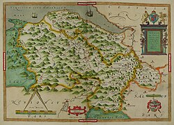
The Domesday Hundreds of Atiscross and Exestan later forming the principal area of Flintshire are shown in pink.
It became part of the Kingdom of Mercia by the 8th century AD, with much of the western boundary reinforced under Offa of Mercia after 752, but there is evidence that Offa's Dyke is probably a much earlier construction.[4] By the time of the Norman conquest in 1066 it was under the control of Edwin of Tegeingl, from whose Lordship the Flintshire coat of arms is derived.
Edwin's mother is believed to have been Ethelfleda or Aldgyth, daughter of Eadwine of Mercia. At the time of the establishment of the Earldom of Chester, which succeeded the Earl of Mercia, the region formed two of the then twelve Hundreds of Cheshire of which it remained a part for several hundred years.[5]
Flintshire today approximately resembles the boundaries of the Hundred of Atiscross as it existed at the time of the Domesday Book.[6] Atiscross, along with the Hundred of Exestan, was transferred from the Earldom of Chester to the expanding Kingdom of Gwynedd[7] from the west in the 13th century following numerous military campaigns. This region, as well as an exclave formed from part of the Hundred of Dudestan (known as Maelor Saesneg), later formed the main areas of Flintshire, established by the Statute of Rhuddlan in 1284 under Edward I. It was administered with the Palatinate of Chester and Flint by the Justiciar of Chester. The county was consolidated in 1536 by the Laws in Wales Acts 1535–1542 under the Tudor King Henry VIII, when it was incorporated into the Kingdom of England; it included the detached exclave of Welsh Maelor.
Flintshire as a separate local authority remained in existence until 1974 when it was merged with those of Denbighshire and Edeyrnion Rural District to form the administrative county of Clwyd. Clwyd was abolished 22 years later and Flintshire reorganised in its present form in 1996. However, some parts of the historic country are not included within the present administrative boundaries: significantly English Maelor was incorporated into Wrexham County Borough, and St Asaph, Prestatyn and Rhyl into Denbighshire.
Modern history
The current administrative area of Flintshire (a unitary authority and Principal area) came into existence in 1996, when the former administrative counties in Wales were split into smaller areas. The principal area was formed by the merger of the Alyn and Deeside and Delyn districts. In terms of pre-1974 divisions, the area comprises:
The district of Rhuddlan, which was also formed entirely from the administrative county of Flintshire was included in the new Denbighshire instead. Other parts of the pre-1974 administrative Flintshire to be excluded from the principal area are the Maelor Rural District and the parish of Marford and Hoseley, which became part of the Wrexham Maelor district in 1974 and are now part of Wrexham County Borough.
Parts of Flintshire have major manufacturing industries. Amongst these are an advanced Toyota plant that manufactures engines, Eren Paper,[8] and Airbus UK, making the wings for the A320, A330 and A350 aircraft at Broughton.[9]
Flintshire is home to Shotwick Solar Park, currently the largest photovoltaic solar array in the UK. It was built in 2016 and covers 250 acres of the south western edge of the Wirral Peninsula near the village of Shotwick. It has a maximum generating capacity of 72.2 MW and is connected directly to the largest paper-mill in the UK, UPM Shotton Paper.[needs update]
Flintshire was home to a thriving steel industry with many of the local communities and homes being built around this sector. Steelmaking came to an end in 1980 with the loss of 6500 on one day. The Shotton Steelworks site, now owned by Tata Steel, continues to produce coated steel products, mainly for the construction industry.[10]
In December 2022, the Climate Change Committee met and Buckley Bistre West councillor Carolyn Preece recommended weekly vegan school meals in the local schools to combat climate change.[12]
Local TV coverage is mainly served by BBC Wales and ITV Cymru Wales with BBC North West and ITV Granada can be also received. Television signals in the county are received from the Moel-y-Parc transmitter which is situated close to Caerwys, Winter Hill transmitter can also be received as well as the Storeton relay transmitter which is transmitted from both transmitters.[13]
An online news website covering the Flintshire area, Deeside.com, operates from Deeside.
Both constituencies have continuously elected Welsh Labour MSs at every election since 1999.
A further four members representing the wider region are elected to the Welsh Parliament by proportional representation via a Closed list system, 2 from the Welsh Conservatives, 1 from Plaid Cymru, and 1 from Welsh Labour.
The two UK Parliament constituencies covering Flintshire (in pink) from 2024. 1 = Clwyd East and 2 = Alyn and Deeside.
From 2024, Flintshire is covered by two UK parliament constituencies, Alyn and Deeside and Clwyd East, with Delyn being abolished.[16] Both parliamentary seats are held by the Labour Party.[17] The Senedd uses the old set of Alyn and Deeside, and Delyn.
↑"Flintshire". menden.de (in German). Menden (Sauerland). Archived from the original on 3 December 2019. Retrieved 6 May 2020.
Sources
Harris, B.E.; Thacker, A.T. (1987), The Victoria History of the County of Chester. (Volume 1: Physique, Prehistory, Roman, Anglo-Saxon, and Domesday), Oxford: Oxford University Press, ISBN0-19-722761-9
External links
Wikimedia Commons has media related to Flintshire.
This page is based on this Wikipedia article Text is available under the CC BY-SA 4.0 license; additional terms may apply. Images, videos and audio are available under their respective licenses.