Nant-y-Ffrith

Last updated

View over Nant-y-Ffrith woods from Bwlchgwyn. Nant-y-Ffrith1.jpg
View over Nant-y-Ffrith woods from Bwlchgwyn.

Nant-y-Ffrith refers to a stream and the wooded valley through which it flows on the border between Flintshire and Wrexham County Borough in Wales. The stream begins in moorland to the east of Llandegla. It passes Bwlchgwyn village before entering a rather steep-sided, rocky valley. It passes under the viaduct of a disused railway line before joining the River Cegidog at Ffrith.

Contents

The woodlands contain some deciduous trees but are dominated by recent conifer plantations planted by the Forestry Commission after the second world war. They contain a range of flora and fauna including various ferns and mosses and woodland birds such as wood warbler and redstart. During the 1950s, people travelled from miles around to park their cars on the Drofa (or hair-pin bend in English) overlooking Nant-y-Ffrith, and listen to nightingales, whose song echoed in the valley.

There are several abandoned silica quarries and lead mines in the area. Lead mining may have begun as early as Roman times and has left a number of caves.

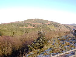
Pre-Roman/Celtic Activity

The mountain on the Flintshire side of Nant-y-Ffrith in modern Welsh is called the Penllyn. Pen in Welsh literally means 'head' and is often used to describe a notable high point, a pinnacle. The name has its origins in ancient history. The Brythonic precursor to modern day Welsh used the word across Britain's landscape: 'Penmaenmawr', 'Penmachno' and the 'Pennines' in the Lake District. The ancient Welsh using the word to describe the mountain ties with evidence of roundhouse foundations discovered on the Penllyn sometime during the 1960-70s. There are also other pointers to ancient Welsh history on the mountain in its name. On older maps there are variations of a full name, 'Pen llun y gwr' and 'Pen llan y gwr'.

Footbridge crossing the stream Nant-y-Ffrith footbridge.jpg
Footbridge crossing the stream

The word 'gwr' at the end is interesting, meaning 'man' maybe an elder or leader in this context. 'Gwr' also appears in the nearby village of Caergwrle. The inclusion of 'gwr' in the hillfort's name may have provided a differentiation for the ancient Welsh with other nearby hillforts, Pen llan y gwr perhaps having been a seat of tribal governance or set up by an older generation. The closest high point across the valley in the village of Bwlchgwyn is the edge of a quarry where Fronheulog Hall once stood. This site, lower than the Penllyn, was the site of a Brythonic hill fort before it was quarried away in the 19th century. Being in such close proximity, both hillforts are likely to have been built by the same people. The 'llan' of this elder or tribe leader is unlikely to have referred to a 'church' or 'parish', as in modern day Welsh, and is more likely to be an abbreviation of the Welsh word 'llanerch', a woodland clearing. That would certainly fit with the tree clearing required to build of a hill fort. 'Llyn' in the current day Penllyn, meaning lake is an unlikely candidate as is 'llun', meaning picture, which is to be found on some maps.

Nant-y-Ffrith Hall

Nant-y-Ffrith Hall was originally built as a hunting lodge in 1850. Successive owners enlarged the building and created landscaped gardens. An open day and garden party was held each year for local villagers. The hall gradually fell into disrepair; it was used for ammunition storage in the Second World War and finally demolished between 1947 and 1950. The only signs of it today are a clearing in the woods, scattered stones and some exotic vegetation such as rhododendrons.

Nant-y-Ffrith Waterfall

Nant-yFfrith waterfall middle tier Nant-yFfrith waterfall middle tier.jpg
Nant-yFfrith waterfall middle tier

Roughly halfway down the gorge, approximately 100m upstream of a small wooden footbridge that crosses the stream, there is a large four-tier cascade waterfall hidden amongst the trees. The waterfall is approximately 15m in total height, with the final drop being between 4-5m high. It is the largest in the Flintshire / Wrexham area, the nearest other sizable waterfall being Dyserth falls in Denbighshire.

The lower tier of Nant-y-Ffrith waterfall Nant-y-Ffrith waterfall - Geograph-2885500-by-John-Harrison.jpg
The lower tier of Nant-y-Ffrith waterfall
The upper tier of the falls circa 1900, showing the steps on the right-hand side. Nant y Ffrith falls circa 1900.jpg
The upper tier of the falls circa 1900, showing the steps on the right-hand side.

Despite the waterfall's size and significance, access is poor and public information is very limited. Access to the bottom of the falls is from a small path on the south side of the valley accessed about 20m upstream from the wooden footbridge. Access to the top of the falls is from a bend in the forestry track next to a sign warning of steep and dangerous ground. Both paths are steep, uneven and slippery.

During the heyday of Nant-y-Ffrith Hall in the second half of the 19th century steps were built up the rocks on the north side of the falls allowing viewing and access to all parts of the falls. Unfortunately, like the hall, the gardens and these steps fell into disrepair and they are no longer present, except for one section just below Wedding Cave, alongside the artificial section of the waterfall.

Nant-y-Ffrith Reservoir

Nant-y-Ffrith Reservoir
Flintshire UK relief location map.jpg
Red pog.svg
Nant-y-Ffrith Reservoir
Location Wales
Coordinates 53°4′11″N3°7′52″W / 53.06972°N 3.13111°W / 53.06972; -3.13111 (Nant-y-Ffrith Reservoir)
Type reservoir
Primary inflows Nant-y-Ffrith
Primary outflows Nant-y-Ffrith
Basin  countriesUnited Kingdom

This is a small reservoir near the source of the stream. It provides water to the villages to the west of Wrexham. Work began on it in October 1868 and it was supplying water by February 1871. It was built by Brymbo Water Company and is now owned by Hafren Dyfrdwy.

Breeding birds on the reservoir include great crested grebe and coot with sedge warbler and reed bunting in the surrounding vegetation and lapwing and curlew in nearby fields.

Related Research Articles

Clwyd Preserved county of Wales

Clwyd is a preserved county of Wales, situated in the north-east corner of the country; it is named after the River Clwyd, which runs through the area. To the north lies the Irish Sea, with the English ceremonial counties of Cheshire to the east and Shropshire to the south-east. Powys and Gwynedd lie to the south and west respectively. Clwyd also shares a maritime boundary with Merseyside along the River Dee. Between 1974 and 1996, a slightly different area had a county council, with local government functions shared with six district councils. In 1996, Clwyd was abolished, and the new principal areas of Conwy County Borough, Denbighshire, Flintshire and Wrexham County Borough were created; under this reorganisation, "Clwyd" became a preserved county, with the name being retained for certain ceremonial functions.

Wrexham County Borough County borough in Wales

Wrexham County Borough is a county borough in the north-east of Wales. It borders England to the east and south-east, Powys to the south-west, Denbighshire to the west and Flintshire to the north-west. The county borough has a population of over 135,000 inhabitants, with around 65,000 residing in either the town of Wrexham, the surrounding conurbation of urban villages around Wrexham, or the two other towns in the county borough, Chirk and Holt. The remainder lives to the south and east of Wrexham in more rural areas, including the county borough's large salient into the Ceiriog Valley, and the English Maelor.

North Wales Geographic region in Wales

North Wales, also known as the North of Wales, is a geographic region of Wales, encompassing its northernmost areas. It borders Mid Wales to the south, England to the east, and the Irish Sea to the north and west. The area is highly mountainous and rural, with Snowdonia National Park and the Clwydian Range and Dee Valley, known for its mountains, waterfalls and trails, located wholly within the region. Its population is more concentrated in the north-east, and northern coastal areas of the region, whilst significant Welsh-speaking populations are situated in its western and rural areas. North Wales is imprecisely defined, lacking any exact definition or administrative structure. For the public purposes of health, policing and emergency services, and for statistical, economic and cultural purposes, North Wales is commonly defined administratively as its six most northern principal areas, but other definitions of the geographic region exist, with Montgomeryshire historically considered to be part of the region.

Ruabon Village in Wales

Ruabon is a village and community in Wrexham County Borough, Wales. The name comes from Rhiw Fabon, rhiw being the Welsh word for "slope" or "hillside" and Fabon being a mutation from St Mabon, the original church name, of earlier, Celtic origin. An older English spelling, Rhuabon, can sometimes be seen.

Afon Ogwen River in Wales

The Afon Ogwen is a river in north-west Wales draining from some of the greatest peaks in Snowdonia before discharging to the sea on the eastern side of Bangor, Gwynedd.

Abergwyngregyn Human settlement in Wales

Abergwyngregyn is a village and community of historical note in Gwynedd, a county and principal area in Wales. Under its historic name of Aber Garth Celyn it was the seat of Llywelyn ap Gruffudd. It lies in the historic county of Caernarfonshire.

Bwlchgwyn Human settlement in Wales

Bwlchgwyn is a village in Wrexham County Borough, Wales, on the A525 road, 5 miles (8 km) west of the town of Wrexham and 10 miles (16 km) south-east of the town of Ruthin. Bwlchgwyn is part of the community of Brymbo. In the 2011 Census the population of the village was 855.

Hafren Forest

Hafren Forest lies north-west of Llanidloes, an ancient market town in Mid Wales.

Nant Gwynant

Nant Gwynant is a valley in north Wales. The A498 road descends 600 feet (180 m) into the valley in about two miles (3 km) from Pen-y-Gwryd; it follows the Nant Cynnyd, the Afon Glaslyn and alongside Llyn Gwynant, then beside the Nant Gwynant river to Llyn Dinas and passing below Dinas Emrys to Beddgelert. The road continues through the Aberglaslyn Pass to Porthmadog.

Brymbo Village in Wales

Brymbo is a large village and community in Wrexham County Borough, Wales. It lies in the hilly country to the west of Wrexham town, largely surrounded by farmland.

Ffrith Settlement in Wales

Ffrith is a small village in the community of Llanfynydd in Flintshire, north-east Wales.

River Cegidog River in north-east Wales

The River Cegidog is a river in north-east Wales. It flows mainly through Flintshire but towards the end of its course it forms the border between Flintshire and Wrexham County Borough.

Llan and its variants are a common element of Celtic placenames in the British Isles and Brittany, especially of Welsh toponymy. In Welsh, an name of a local saint or a geomorphological description follows the Llan morpheme to form a single word: for example Llanfair is the parish or settlement around the church of St. Mair. Whereas, Goidelic toponyms end in -lann.

Wych Brook River in Wales and England

The Wych Brook, Worthenbury Brook and Red Brook, formerly known as the River Elfe, is a tributary of the River Dee in England and Wales, forming part of both the historic and present-day border between the two countries. The stream forms part of the border between Cheshire and Shropshire in England to the east, and Wales, particularly the Maelor Saesneg, to the west.

River Gwenfro

The River Gwenfro is a small river in Wrexham County Borough, north Wales. It is a tributary of the Clywedog. The name Gwenfro is possibly derived from the Welsh language words gwen, "white", and bro, "border", "boundary".

Llanfynydd, Flintshire Human settlement in Wales

Llanfynydd is a village, local government community and electoral ward in Flintshire, Wales. Its name is derived from the Welsh words llan, and mynydd ("mountain").

Brymbo railway branch lines

The Brymbo railway branch lines served the rich reserves of coal, iron, limestone and other minerals in an area around Brymbo to the west of Wrexham in Wales. Coalowners and others needed transport to get their products to market and lines were built from the main line into the mineral-bearing area. The topography was difficult and gradients were steep. The Great Western Railway became dominant, but a rival company built a competing line and branches.

Clwydian Range and Dee Valley Area of Outstanding Natural Beauty in Wales

The Clwydian Range and Dee Valley is a designated Area of Outstanding Natural Beauty (AONB) and proposed national park, located in north-east Wales, covering the Clwydian Range, and the valley of the River Dee. Designated in 1985 as the Clwydian Range AONB, and expanded to its current form in 2011, the Area of Outstanding Natural Beauty includes: medieval field systems, open heather moorland, prehistoric hillforts, limestone crags, broad leaved woodland, wooded valleys, and farmland. In 2018, an estimated 1.1 million people visited six key sites across the AONB, generating approximately £24.1 million to the Welsh economy, according to Natural Resources Wales. The AONB falls within the jurisdiction of the local authorities of Denbighshire, Flintshire, and Wrexham County Borough, with the majority, 80% of the AONB in Denbighshire, and the remaining 20% split evenly between the other two authorities. The AONB is the largest of only five AONBs in Wales, and one of the 46 in the United Kingdom. Additionally, it is one of only 8 protected areas of Wales. Long-distance footpaths; Offa's Dyke Path, and the Clwydian Way pass through the AONB. The area of the Clwydian Range and Dee Valley AONB is 390 km2 (150 sq mi), and has been proposed by the Welsh Government to become Wales' fourth national park.

References