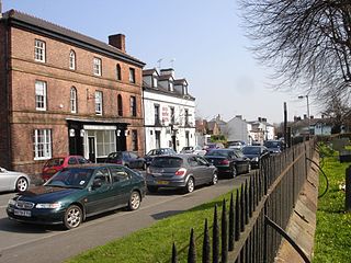
Bangor-on-Dee is a village and community in Wrexham County Borough, Wales, on the banks of the River Dee. Until 1974 it was in the exclave of Flintshire known as the Maelor Saesneg, and from 1974 to 1996 in the county of Clwyd.

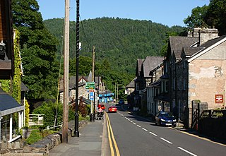
Betws-y-coed is a village and community in the Conwy valley in Conwy County Borough, Wales, located in the historic county of Caernarfonshire, right on the boundary with Denbighshire, in the Gwydir Forest. It is now a very popular visitor destination in the Snowdonia National Park.

The River Taff is a river in Wales. It rises as two rivers in the Brecon Beacons; the Taf Fechan and the Taf Fawr before becoming one just north of Merthyr Tydfil. Its confluence with the River Severn estuary is in Cardiff.

Raglan (; is a village and community in Monmouthshire, south east Wales, United Kingdom. It is located some 9 miles south-west of Monmouth, midway between Monmouth and Abergavenny on the A40 road very near to the junction with the A449 road. The fame of the village derives from Raglan Castle, built for William ap Thomas and now maintained by Cadw. The community includes the villages of Llandenny and Pen-y-clawdd. Raglan itself has a population of 1,183.

Rossett is a village, community and electoral ward in Wrexham County Borough, Wales. Rossett is served by the A483 road.

Farndon Bridge, also known as Holt Bridge, crosses the River Dee and the England-Wales border between the villages of Farndon, Cheshire, England and Holt, Wrexham, Wales. The bridge, which was built in the mid-14th century, is recorded in the National Heritage List for England and by Cadw as a designated Grade I listed building and scheduled monument. It is built from locally quarried red sandstone and had eight arches, of which five are over the river. On the Farndon side there is one flood arch and two flood arches are on the Holt side.

St Dunawd's Church, is in the village of Bangor-on-Dee, Wrexham County Borough, Wales. It is designated by Cadw as a Grade II* listed building. The church is an active Anglican church in the deanery of Dee Valley, the archdeaconry of Wrexham and the diocese of St Asaph.

Sesswick is a community in Wrexham County Borough, Wales. It lies south-east of Wrexham near Marchwiel. The population of the community at the 2011 Census was 609.

Cefn-coed-y-cymmer is a small community on the northwestern edge of Merthyr Tydfil County Borough in Wales. It is situated in the neck of land between the rivers Taf Fawr and Taf Fechan at their confluence. The village lies within the community of Vaynor. Immediately to the north of the village is the hill of Cefn Cil Sanws on the southern slopes of which is Merthyr Tydfil Golf Club. The village is bounded both to the north and the west by the Brecon Beacons National Park.

St Mary's Church, Betws-y-Coed, is in the village of Betws-y-Coed, Conwy, Wales. It is an active Anglican parish church of the Church in Wales, in the deanery of Arllechwedd, the archdeaconry of Bangor and the diocese of Bangor. The church is designated by Cadw as a Grade II* listed building.

In the United Kingdom, the term listed building refers to a building or other structure officially designated as being of special architectural, historical, or cultural significance; Grade I structures are those considered to be "buildings of exceptional interest". Listing was begun by a provision in the Town and Country Planning Act 1947. Once listed, strict limitations are imposed on the modifications allowed to a building's structure or fittings. In Wales, the authority for listing under the Planning Act 1990 rests with Cadw.

In the United Kingdom, the term listed building refers to a building or other structure officially designated as being of special architectural, historical, or cultural significance; Grade II* structures are those considered to be "particularly important buildings of more than special interest". Listing was begun by a provision in the Town and Country Planning Act 1947. Once listed, strict limitations are imposed on the modifications allowed to a building's structure or fittings. In Wales, the authority for listing under the Planning Act 1990 rests with Cadw.

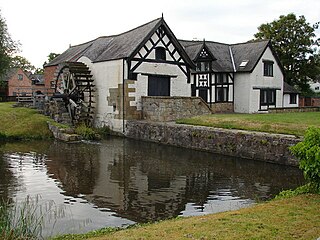
Melin-y-Coed is a small rural village in the county of Conwy, Wales.. The earliest surviving building in the village is Cyffdy Hall, built in 1596.
St Deiniols Ash is a 16th or 17th century Grade I listed timber framed manor house located next to the church of St Deiniol in Hawarden, in Flintshire, north-east Wales. The house contains a series of wall paintings depicting the life of St Deiniol which are considered among the best preserved examples in Britain.

The Cefn (Newbridge) Viaduct is Grade II* listed railway viaduct across the River Dee between Cefn and Chirk communities in Wrexham County Borough, Wales. The viaduct is near the villages of Cefn Mawr, Pentre and Newbridge. The viaduct forms the eastern boundary of Tŷ Mawr Country Park and is around a mile downstream of Pontcysyllte Aqueduct.

The Chirk Viaduct is a Grade II* listed railway viaduct over the River Ceiriog between England and Wales. The viaduct carries the Shrewsbury–Chester line from the Welsh town of Chirk in historic Denbighshire from the north to the English village of Chirk Bank in Weston Rhyn, Shropshire to the south. Chirk Aqueduct lies parallel to the viaduct's east.

Cook's Bridge is a Grade II listed bridge crossing the River Alyn near Trevalyn, Rossett in Wrexham County Borough, Wales. It is located to the south-east of Cooksbridge Farm, and roughly a third of a mile or half a kilometre from Rossett Road (B5102).

Newbridge is a village in Wrexham County Borough, Wales. The village is within the community of Cefn, to the south-east of Cefn Mawr. Newbridge is bounded to the west by the Shrewsbury–Chester railway line and the Newbridge Railway Viaduct which crosses the River Dee, which meanders to the south and east of the village. The Clwydian Range and Dee Valley AONB since 2011 borders the village to the south, as does the Wynnstay estate, and Tŷ Mawr Country Park is on the other side of the viaduct to the west.


