Trevor, Wrexham

Last updated

Trevor
Llangollen Road, Trevor - geograph.org.uk - 4959497.jpg
Llangollen Road in Trevor
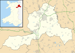
Wrexham UK location map.svg
Red pog.svg
Trevor
Location within Wrexham
OS grid reference SJ268425
Community
Principal area
Preserved county
Country Wales
Sovereign state United Kingdom
Post town LLANGOLLEN
Postcode district LL20
Dialling code 01978
Police North Wales
Fire North Wales
Ambulance Welsh
UK Parliament
Senedd Cymru – Welsh Parliament
List of places
UK
Wales
Wrexham
52°58′30″N3°05′20″W / 52.975°N 3.089°W / 52.975; -3.089

Trevor (Welsh : Trefor) is a village in Wrexham County Borough, Wales. It is situated in the scenic Vale of Llangollen, on the A539 between Llangollen and Wrexham, in the community of Llangollen Rural, and in the historic county of Denbighshire.

Its name is an anglicised version of the Welsh place-name Trefor, meaning "large village". This was one of the old townships of the parish of Llangollen, giving its name to both a powerful landowning family whose ancestral home was in the township, and to the later industrial settlement represented by the modern village. In common with neighbouring Froncysyllte, Trevor is largely made up of nineteenth- and twentieth-century cottages for workers in the area's traditional industries of limestone quarrying and brick-making. [1] Although these industries have now disappeared the area has a rich industrial archeology.

The village shown with the River Dee, Pontcysyllte Aqueduct, Trevor Basin and Llangollen Canal. Trevor, Wrexham.jpg
The village shown with the River Dee, Pontcysyllte Aqueduct, Trevor Basin and Llangollen Canal.

Trevor lies on the Llangollen Canal at the northern end of the Pontcysyllte Aqueduct: the Trevor Basin is at the north end of the aqueduct.

Until 1965, the village had a railway station on the now-closed Ruabon–Barmouth line. However the nearby Llangollen Railway aims to extend eastwards to Ruabon,[ citation needed ] which may include rebuilding and full restoration of the station as part of the work.

The Offa's Dyke Path passes through the village.
See also

Related Research Articles

<span class="mw-page-title-main">Llangollen</span> Town in Denbighshire, Wales

Llangollen is a town and community, situated on the River Dee, in Denbighshire, Wales. Its riverside location forms the edge of the Berwyn range, and the Dee Valley section of the Clwydian Range and Dee Valley Area of Outstanding Natural Beauty, with the easternmost point of the Dee Valley Way being within the town. It had a population of 3,658 at the 2011 census.

<span class="mw-page-title-main">Clwyd</span> Preserved county of Wales

Clwyd is a preserved county of Wales, situated in the north-east corner of the country; it is named after the River Clwyd, which runs through the area. To the north lies the Irish Sea, with the English ceremonial counties of Cheshire to the east and Shropshire to the south-east. Powys and Gwynedd lie to the south and west respectively. Clwyd also shares a maritime boundary with Merseyside along the River Dee. Between 1974 and 1996, a slightly different area had a county council, with local government functions shared with six district councils. In 1996, Clwyd was abolished, and the new principal areas of Conwy County Borough, Denbighshire, Flintshire and Wrexham County Borough were created; under this reorganisation, "Clwyd" became a preserved county, with the name being retained for certain ceremonial functions.

<span class="mw-page-title-main">Ellesmere Canal</span> United Kingdom legislation

The Ellesmere Canal was a waterway in England and Wales that was planned to carry boat traffic between the rivers Mersey and Severn. The proposal would create a link between the Port of Liverpool and the mineral industries in north east Wales and the manufacturing centres in the West Midlands. However, the canal was never completed as intended because of its rising costs and failure to generate the expected commercial traffic.

<span class="mw-page-title-main">Pontcysyllte Aqueduct</span> Waterway in Wales

The Pontcysyllte Aqueduct is a navigable aqueduct that carries the Llangollen Canal across the River Dee in the Vale of Llangollen in northeast Wales.

<span class="mw-page-title-main">Chirk</span> Town in Wales

Chirk is a town and community in Wrexham County Borough, Wales, 10 miles south of Wrexham, between it and Oswestry. At the 2011 census, it had a population of 4,468. Historically in the traditional county of Denbighshire, and later Clwyd, it has been part of Wrexham County Borough since a local government reorganisation in 1996. The border with the English county of Shropshire is immediately south of the town, on the other side of the River Ceiriog.

<span class="mw-page-title-main">Wrexham County Borough</span> County borough in Wales

Wrexham County Borough is a county borough, with city status, in the north-east of Wales. It borders the English ceremonial counties of Cheshire and Shropshire to the east and south-east respectively along the England–Wales border, Powys to the south-west, Denbighshire to the west and Flintshire to the north-west. The city of Wrexham is the administrative centre. The county borough is part of the preserved county of Clwyd.

<span class="mw-page-title-main">Ruabon</span> Village in Wales

Ruabon is a village and community in Wrexham County Borough, Wales. The name comes from Rhiw Fabon, rhiw being the Welsh word for "slope" or "hillside" and Fabon being a mutation from St Mabon, the original church name, of earlier, Celtic origin. An older English spelling, Rhuabon, can sometimes be seen.

<span class="mw-page-title-main">Acrefair</span> Village in Wales

Acrefair is a village in Wrexham County Borough, north-east Wales, in the community of Cefn. It was formerly part of the ancient parish of Ruabon, and is located between Wrexham and Llangollen. It is close to the villages of Trevor, Cefn Mawr, Ruabon and Plas Madoc. The name Acrefair originates from the Welsh word for acres—acrau, or acre in the local Welsh dialect—and Mair, the Welsh name for Mary. The English meaning of Acrefair is Mary's Acres.

<span class="mw-page-title-main">Ruabon railway station</span> Railway station in Wrexham, Wales

Ruabon railway station is a combined rail and bus interchange serving Ruabon, Wrexham County Borough, Wales. It is the second busiest station in Wrexham County Borough in terms of passenger journeys, after the mainline station, Wrexham General. It is on the Shrewsbury to Chester Line, which is part of the former Great Western Railway mainline route from London Paddington to Birkenhead Woodside which lasted until 1967.

<span class="mw-page-title-main">Cefn Mawr</span> Village in Wrexham County Borough, Wales

Cefn Mawr is a village in the community of Cefn within Wrexham County Borough, Wales. Its name translates as "big ridge". The population in 2001 was 6,669, increasing to 7,051 in 2011.

<span class="mw-page-title-main">Ponciau</span> Village in Wales

Ponciau is a village within the community of Rhosllanerchrugog, Wrexham County Borough, Wales. It is close to the villages of Legacy, Pentre Bychan, and Johnstown and is overlooked by Ruabon Mountain.

<span class="mw-page-title-main">Acrefair railway station</span> Disused railway station in Acrefair, Wrexham

Acrefair railway station was a former station on the Ruabon–Barmouth line in North East Wales. It closed to passengers on 18 January 1965 as part of the Beeching Axe.

<span class="mw-page-title-main">Rhostyllen</span> Village in Wrexham County Borough, Wales

Rhostyllen is a village in Wrexham County Borough, Wales, south-west of the city of Wrexham. At the time of the 2001 census, area Wrexham 014A, which includes Rhostyllen itself, had a population of 1,383 in 599 households.

<span class="mw-page-title-main">Froncysyllte</span> Village in Wrexham County Borough, Wales

Froncysyllte, colloquially known as Fron, is a village in Wrexham County Borough, Wales and stands on the banks of the River Dee and the Llangollen Canal. It is situated on the main A5 road which runs from London to Holyhead. It is in the community of Llangollen Rural. The population was 606 as of 2011 UK census.

<span class="mw-page-title-main">Trevor Basin</span>

Trevor Basin is a canal basin on the Llangollen Canal, situated near Trevor, Wrexham County Borough, Wales, in between Llangollen and Ruabon.

<span class="mw-page-title-main">Llangollen Rural</span> Community in Wrexham County Borough, Wales

Llangollen Rural is a community and electoral ward in Wrexham County Borough, Wales. It contains the villages of Froncysyllte, Garth, and Trevor, and had a population of 1,999 at the 2001 census, increasing to 2,059 at the 2011 Census. The Pontcysyllte aqueduct is a World Heritage Site. Although named Rural, it is actually densely populated.

<span class="mw-page-title-main">Pont Cysyllte</span> Road bridge in Trevor, Wrexham, Wales.

Pont Cysyllte, also known as Cysylltau Bridge or Bont Bridge, is a 17th-century road bridge crossing the River Dee near the village of Trevor, Wrexham County Borough, Wales. It lies 200 m west of Thomas Telford's Pontcysyllte Aqueduct and, carrying the B5434 road, is the main connection between Trevor and nearby Froncysyllte.

The Ruabon railway branch lines were a network of railways built to serve the mineral bearing area west of Ruabon, which contained many coal and iron deposits, as well as limestone, and a small but dense network of railways developed to handle the minerals.

<span class="mw-page-title-main">Plas Madoc</span> Housing estate in Wrexham County Borough, Wales

Plas Madoc is a housing estate and former electoral ward near Acrefair, in the Cefn community in Wrexham County Borough, Wales. It is located seven miles to the south-west of Wrexham, and contains The Land adventure playground, and a community-run leisure centre with a swimming pool. The area is one of the most deprived areas in Wales, and the fourth most deprived LSOA in Wrexham County Borough.

References

  1. Dee Valley, Froncysyllte to Newbridge, Wrexham County Borough Council Planning