Pontfadog | |
---|---|
Road into Pontfadog, showing former tramway waiting room (at left) and inn sign (centre) | |
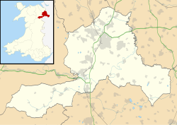
Location within Wrexham | |
OS grid reference | SJ233381 |
Community | |
Principal area | |
Country | Wales |
Sovereign state | United Kingdom |
Post town | LLANGOLLEN |
Postcode district | LL20 |
Dialling code | 01691 |
Police | North Wales |
Fire | North Wales |
Ambulance | Welsh |
UK Parliament | |
Senedd Cymru – Welsh Parliament | |
Pontfadog is a village in the Ceiriog Valley west of Chirk in Wrexham County Borough, Wales; it is part of the community of Glyntraian. Like the neighbouring village of Glyn Ceiriog, the growth of Pontfadog is connected to the area's former quarrying industry.
The village's name translates as "Bridge of Madoc", taking its name from a bridge over the River Ceiriog. Until April 2013, an oak tree stood near the village. Entitled the Pontfadog Oak, the tree reputed to be the oldest in the United Kingdom at the time; [1] however, strong winds on the 17 April 2013 caused the tree to topple overnight. [2]
The Glyn Valley Tramway had a station in the village, which has now been preserved by the Glyn Valley Tramway Group. In addition to the Swan Inn, the village's pub, there is also a village shop with a post office counter.
Llangollen is a town and community, situated on the River Dee, in Denbighshire, Wales. Its riverside location forms the edge of the Berwyn range, and the Dee Valley section of the Clwydian Range and Dee Valley Area of Outstanding Natural Beauty, with the easternmost point of the Dee Valley Way being within the town. It had a population of 3,658 at the 2011 census.
Quercus petraea, commonly known as the sessile oak, Cornish oak, Irish Oak or durmast oak, is a species of oak tree native to most of Europe and into Anatolia and Iran. The sessile oak is the national tree of Ireland, and an unofficial emblem in Wales and Cornwall.
Chirk is a town and community in Wrexham County Borough, Wales, 10 miles south of Wrexham, between it and Oswestry. At the 2011 census, it had a population of 4,468. Historically in the traditional county of Denbighshire, and later Clwyd, it has been part of Wrexham County Borough since a local government reorganisation in 1996. The border with the English county of Shropshire is immediately south of the town, on the other side of the River Ceiriog.
Wrexham County Borough is a county borough, with city status, in the north-east of Wales. It borders the English ceremonial counties of Cheshire and Shropshire to the east and south-east respectively along the England–Wales border, Powys to the south-west, Denbighshire to the west and Flintshire to the north-west. The city of Wrexham is the administrative centre. The county borough is part of the preserved county of Clwyd.
The Glyn Valley Tramway was a narrow-gauge railway that ran through the Ceiriog Valley in north-east Wales, connecting Chirk with Glyn Ceiriog in Denbighshire. The gauge of the line was 2 feet 4+1⁄4 inches (718 mm) while it was horse-drawn, which was unofficially increased to 2 ft 4+1⁄2 in when steam locomotives were introduced. The total length of the line was 8+1⁄4 miles (13.3 km), 6+1⁄2 miles (10.5 km) of which were worked by passenger trains, the remainder serving a large granite quarry and several minor slate quarries.
St Martin's is a village and civil parish in Shropshire, England, just north of Oswestry and east of Chirk, Wales on the England–Wales border.
The Ceiriog Valley is the valley of the River Ceiriog in north-east Wales. Its Welsh name, "Dyffryn Ceiriog", is the name of an electoral ward of Wrexham County Borough. The ward is the largest ward of the county borough by area and forms a strikingly-shaped salient of the county borough between Powys and Denbighshire.
Glyn Ceiriog is the principal settlement of the Ceiriog Valley and a community in Wrexham County Borough, north-east Wales. Glyn Ceiriog translates simply as Ceiriog Valley, though there are other villages in the valley. The village and community is technically known, in traditional Welsh naming style, as Llansantffraid Glyn Ceiriog or sometimes Llansanffraid Glyn Ceiriog, which means church of St Ffraid in the Ceiriog Valley, but it has come to be known simply as Glyn Ceiriog, or even Glyn for short. The name Llansanffraid is now more associated with other villages of the same name.
Llanarmon Dyffryn Ceiriog is a village in Wrexham County Borough, Wales. It lies on the River Ceiriog and is at the end of the B4500 road, five miles (8 km) south-west of Glyn Ceiriog and ten miles (16 km) north-west of Oswestry. It is within the Ceiriog Valley ward, Clwyd South Senedd constituency and Clwyd South UK parliamentary constituency. It is in the community of Ceiriog Ucha.
Glyn means "Valley" in Welsh and may refer to:
Llandre, or Llanfihangel Genau'r Glyn, is a village in Ceredigion, Wales. It lies 5 miles north of Aberystwyth in the north-west of the county, on the road from Rhydypennau to Borth. To the north of the community lies the village of Dôl-y-bont. The community is called Geneu'r Glyn.
A pandy is a Welsh name for a fulling mill, and may refer to:
Glyntraian is a community in Wrexham County Borough, Wales.
The Pontfadog Oak was a sessile oak tree that stood on Cilcochwyn farm above the village of Pontfadog, in the Ceiriog Valley west of Chirk in the county borough of Wrexham, Wales, until it was blown over in the early hours of 18 April 2013. At the time it was reputed to be the oldest and largest oak tree in the United Kingdom.
The Oak at the Gate of the Dead, or Crogen Oak is a veteran tree in Wrexham County Borough, Wales. Located near the 8th-century Offa's Dyke, the tree is thought to be more than 1,000 years old. The tree is located near the site of the 1165 Battle of Crogen, and is named for a supposed burial site of battle dead nearby.
Llwynmawr is a village in the Ceiriog Valley in North Wales, about halfway between the villages of Glyn Ceiriog and Pontfadog, in the community of Glyntraian. The name means "big grove".
The Cambrian quarry was a slate quarry, located to the west of Glyn Ceiriog in Denbighshire, North Wales. There was some small-scale extraction of slate from the 17th century, but commercial extraction began in 1857, and the scale of operation increased from 1873, when the Glyn Valley Tramway opened, providing an easier route to market for the output of the quarry. Production after 1938 was on a reduced scale, and the quarry closed in the winter of 1946/47, mainly due to a lack of workers.
Pandy is a hamlet in the Ceiriog Valley, Wrexham County Borough, Wales. It is located on the confluence of the River Ceiriog to the east, and the smaller River Teirw flowing from Nantyr moors to the north-west. The river level at Pandy of the River Ceiriog is ~665 feet (203 m), downstream from Llanarmon Dyffryn Ceiriog, and upstream from Glyn Ceiriog.
Media related to Pontfadog at Wikimedia Commons