Penley
| |
---|---|
The Dymock Arms public house in Penley | |
Location within Wrexham | |
Population | 606 |
OS grid reference | SJ414399 |
Community | |
Principal area | |
Country | Wales |
Sovereign state | United Kingdom |
Post town | WREXHAM |
Postcode district | LL13 |
Dialling code | 01948 |
Police | North Wales |
Fire | North Wales |
Ambulance | Welsh |
UK Parliament | |
Senedd Cymru – Welsh Parliament | |
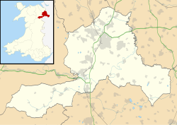
Penley (Welsh : Llannerch Banna) is a village in the County Borough of Wrexham, in Wales close to the border with Shropshire, England, and had a population of 606 as of the 2011 census. [1]
The village was, until 1974, in an exclave of the ancient county of Flintshire known as Maelor Saesneg . [2] (English: "English Maelor"), sometimes called "Flintshire Detached", which was administered from Overton-on-Dee. Between 1974 and 1996, Penley was in the short-lived county of Clwyd.
Penley lies on the path of the long-distance walk, the Maelor Way . [3]
Penley Church was originally built in 1538. The timber structure was replaced by a brick one in 1793. This was demolished in 1893, and the current church was completed in 1899; it was consecrated in 1902, and dedicated to Mary Magdalene.
Penley was originally part of the parish of Ellesmere in neighbouring Shropshire, but it became a separate parish towards the end of the Commonwealth period. In early 1661, it reverted to being part of the parish of Ellesmere, after the Restoration of Charles II. In 1860, it again became a separate parish.
It was then in the English Diocese of Lichfield until 1920, when following the disestablishment and disendowment of the Church in Wales, it was transferred to the Welsh Diocese of St Asaph, where it remains. [4]
Penley was home to the Penley Community Hospital, which cared for Polish ex-servicemen who settled in the area. It closed in 2002. [5]
Penley has one primary school and one secondary school. The primary school, known as the Madras School, [6] was built in 1811 by George Kenyon II, Baron Kenyon of Gredington. Penley's secondary school, The Maelor School, was built in 1957 and serves the rural communities on both sides of the border. It has had excellent GCSE results over the last few years with a high percentage of pupils getting A*s; it was awarded the title of the "most improved secondary school in North Wales" from the Curriculum Authority for Wales in 2006. [7]
Flintshire is a county in the north-east of Wales. It borders the English ceremonial counties of Merseyside and Cheshire, across the Dee Estuary to the north and by land to the east respectively, Wrexham County Borough to the south, and Denbighshire to the west. Connah's Quay is the largest town, while Flintshire County Council is based in Mold.
Until 1974, Flintshire, also known as the County of Flint, was an administrative county in the north-east of Wales, later classed as one of the thirteen historic counties of Wales.
Until 1974, Denbighshire, or the County of Denbigh, was an administrative county in the north of Wales, later classed as one of the thirteen historic counties of Wales. It was a maritime county, that was bounded to the north by the Irish Sea, to the east by Flintshire, Cheshire and Shropshire, to the south by Montgomeryshire and Merionethshire, and to the west by Caernarfonshire.
Bangor-on-Dee is a village and community in Wrexham County Borough, Wales, on the banks of the River Dee. Until 1974 it was in the exclave of Flintshire known as the Maelor Saesneg, and from 1974 to 1996 in the county of Clwyd.
The Maelor is an area of north-east Wales along the border with England. It is now entirely part of Wrexham County Borough. The name Maelor is an old Welsh word: it can be translated as "land of the prince", from mael ("prince") and llawr.
Maelor Saesneg, also known as English Maelor, comprises one half of the Maelor region on the Welsh side of the Wales-England border, being the area of the Maelor east of the River Dee. The region has changed counties several times, previously being part of Cheshire and later a detached portion of Flintshire. The area is currently in Wales, despite its name, and administered as part of Wrexham County Borough.
Wrexham County Borough is a county borough, with city status, in the north-east of Wales. It borders the English ceremonial counties of Cheshire and Shropshire to the east and south-east respectively along the England–Wales border, Powys to the south-west, Denbighshire to the west and Flintshire to the north-west. The city of Wrexham is the administrative centre. The county borough is part of the preserved county of Clwyd.
The Diocese of Saint Asaph is a diocese of the Church in Wales in north-east Wales, named after Saint Asaph, its second bishop.
Overton or Overton-on-Dee is a village and community in Wrexham County Borough, Wales. It is situated close to the Welsh-English border on the edge of an escarpment that winds its way around the course of the River Dee, from which Overton-on-Dee derives its name.
Maelor was a rural district in the administrative county of Flintshire, Wales, from 1894 to 1974. The area approximated to the hundred of Maelor or English Maelor, and was notable for forming a detached part of the county, surrounded by Cheshire, Denbighshire and Shropshire. The administrative centre was located at Overton.
Erbistock is a village and community in Wrexham County Borough, Wales. The village lies on the banks of the River Dee.
Hanmer is a village and community in Wrexham County Borough, Wales. At the 2001 Census the population of the Hanmer community area, which includes Hanmer village itself, Horseman's Green, Halghton and Arowry along with a number of small hamlets, was recorded at 726, reducing to 665 at the 2011 Census.
Gwersyllt is an urban village and community in Wrexham County Borough, Wales.
Willington Worthenbury is a community in Wrexham County Borough, Wales, and is situated near the England–Wales border.
Tudor Court is a house 0.5 miles (1 km) south of the village of Penley, Wrexham, Wales. It was originally called Llannerch Panna.
The Wych Brook, Worthenbury Brook and Red Brook, formerly known as the River Elfe, is a tributary of the River Dee in England and Wales, forming part of both the historic and present-day border between the two countries. The stream forms part of the border between Cheshire and Shropshire in England to the east, and Wales, particularly the Maelor Saesneg, to the west.
Maelor South is a community in the area of Maelor Saesneg, Wrexham County Borough, Wales. It contains the villages of Penley and Bettisfield along with a number of other small hamlets and is represented by the Maelor South Community Council. At the time of the 2001 census, the community area had a total population of 1,137 people, increasing to 1,268 at the 2011 Census.
Betsi Cadwaladr University Health Board (BCUHB) is the local health board of NHS Wales for the north of Wales. It is the largest health organisation in Wales, providing a full range of primary, community, mental health, and acute hospital services for a population of around 694,000 people across the six principal areas of north Wales as well as some parts of Mid Wales, Cheshire and Shropshire. Betsi Cadwaladr University Health Board is the operational name of Betsi Cadwaladr Local Health Board.
Whitewell is a dispersed rural settlement, and surrounding ecclesiastical parish, in the community of Bronington, in the east of Wrexham County Borough, Wales.
Tybroughton, occasionally written Ty Broughton, is the name of a former civil parish, historically in the Maelor Saesneg area of Flintshire, Wales and now in Wrexham County Borough. The rather isolated rural area contains no nucleated villages, although there are a few small hamlets such as Eglwys Cross.