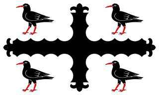
Until 1974, Flintshire, also known as the County of Flint, was an administrative county in the north-east of Wales, later classed as one of the thirteen historic counties of Wales.
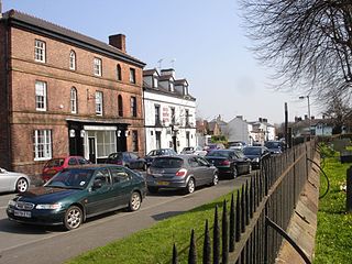
Bangor-on-Dee is a village and community in Wrexham County Borough, Wales, on the banks of the River Dee. Until 1974 it was in the exclave of Flintshire known as the Maelor Saesneg, and from 1974 to 1996 in the county of Clwyd.

Wrexham County Borough is a county borough, with city status, in the north-east of Wales. It borders the English ceremonial counties of Cheshire and Shropshire to the east and south-east respectively along the England–Wales border, Powys to the south-west, Denbighshire to the west and Flintshire to the north-west. The city of Wrexham is the administrative centre. The county borough is part of the preserved county of Clwyd.

Chirk Castle is a Grade I listed castle located in Chirk, Wrexham County Borough, Wales, 1.5 mi (2.4 km) from Chirk railway station, now owned and run by the National Trust.

Plas Coch is an area of the community of Rhosddu, in the city of Wrexham, Wales. A major retail and educational area of Wrexham, it lies to the north-west of Wrexham city centre. Formerly known as Lower Stansty, the term has fallen out of use in preference for Plas Coch in recent years, likely due to the popular retail area which shares its name.

In the United Kingdom, the term listed building refers to a building or other structure officially designated as being of special architectural, historical, or cultural significance; Grade II* structures are those considered to be "particularly important buildings of more than special interest". Listing was begun by a provision in the Town and Country Planning Act 1947. Once listed, strict limitations are imposed on the modifications allowed to a building's structure or fittings. In Wales, the authority for listing under the Planning Act 1990 rests with Cadw.

Whitewell is a dispersed rural settlement, and surrounding ecclesiastical parish, in the community of Bronington, in the east of Wrexham County Borough, Wales.
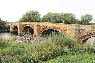
Bangor Bridge is a Grade I listed bridge crossing the River Dee in Bangor-on-Dee, Wrexham County Borough, Wales. It is situated on the community boundary between Bangor-is-y-Coed and Sesswick. Located to the west of Bangor-on-Dee, it connects the village's high street and the A525 road bypass. The narrow bridge is a one-way traffic bridge, west to east, and is downstream (north) of the Bangor by-pass bridge.

County Buildings is a Grade II listed building in Wrexham, Wrexham County Borough, Wales. It houses the Wrexham County Borough Museum and Wrexham Archives. It is proposed that a Football Museum for Wales be housed in the building. The building is located between Saint Mark's Road and Regent Street in the city centre and Offa, bounded by Wrexham Cathedral to the west.
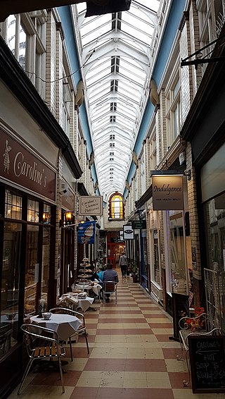
The Central Arcade, historically known as the Hope Street Arcade or Wrexham Arcade, is a shopping arcade in Wrexham city centre, Wales. Connecting Wrexham's Hope Street to the Butcher's Market, it was built in 1891.
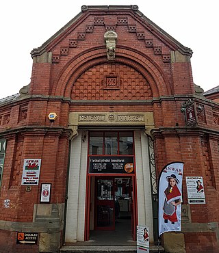
The General Market is an indoor market in Wrexham city centre, North Wales. It is situated inside a Grade II listed building between Wrexham's Henblas Street and Chester Street on a site formerly known as Manchester Square. Built in 1879 as the Butter Market, it is one of the two dedicated indoor markets of Wrexham.

The School of Creative Arts is the art school of Wrexham University on Regent Street, in Wrexham, North Wales.

In the United Kingdom, the term listed building refers to a building or other structure officially designated as being of special architectural, historical, or cultural significance; Grade II structures are those considered to be "buildings of special interest which justify every effort being made to preserve them". Listing was begun by a provision in the Town and Country Planning Act 1947. Once listed, strict limitations are imposed on the modifications allowed to a building's structure or fittings. In Wales, the authority for listing under the Planning Act 1990 rests with Cadw.
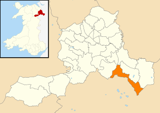
In the United Kingdom, the term listed building refers to a building or other structure officially designated as being of special architectural, historical, or cultural significance; Grade II structures are those considered to be "buildings of special interest which justify every effort being made to preserve them". Listing was begun by a provision in the Town and Country Planning Act 1947. Once listed, strict limitations are imposed on the modifications allowed to a building's structure or fittings. In Wales, the authority for listing under the Planning Act 1990 rests with Cadw.

In the United Kingdom, the term listed building refers to a building or other structure officially designated as being of special architectural, historical, or cultural significance; Grade II structures are those considered to be "buildings of special interest which justify every effort being made to preserve them". Listing was begun by a provision in the Town and Country Planning Act 1947. Once listed, strict limitations are imposed on the modifications allowed to a building's structure or fittings. In Wales, the authority for listing under the Planning Act 1990 rests with Cadw.

Chester Street is a street in Wrexham city centre, North Wales. It was once a main north–south road on the edge of the centre of Wrexham. The street has several listed buildings, as well as Wrexham's civic centre containing various council, memorial and leisure buildings, Coleg Cambria's Yale campus, Tŷ Pawb and various historical buildings now demolished.

Fairy Road is a road and conservation area in Wrexham, North Wales. The conservation has five Grade II listed buildings and one scheduled monument, the Fairy Oak Round Barrow.

Grosvenor Road is a road and conservation area in Wrexham city centre, North Wales. The conservation area spans the road itself and adjacent streets, particularly all of Grove Road.

Church Street is a street in Wrexham city centre, North Wales. The street leads to St Giles' Church, and contains the Grade II listed Nos. 3–4 and the Grade II* listed Nos. 7–10, as well as the church gates of St Giles'. These gates form the entrance to the church's grounds, as well as a junction with Temple Row.

Halghton Hall is a house in the hamlet of Halghton in Wrexham County Borough, North Wales. Designed in around 1662 in a Jacobean style, it is a Grade I listed building. Various former estate buildings have their own historic listings.


