
A hillfort is a type of earthwork used as a fortified refuge or defended settlement, located to exploit a rise in elevation for defensive advantage. They are typically European and of the Bronze Age or Iron Age. Some were used in the post-Roman period. The fortification usually follows the contours of a hill and consists of one or more lines of earthworks, with stockades or defensive walls, and external ditches. Hillforts developed in the Late Bronze and Early Iron Age, roughly the start of the first millennium BC, and were used in many Celtic areas of central and western Europe until the Roman conquest.

Uffington Castle is an early Iron Age univallate hillfort in Oxfordshire, England. It covers about 32,000 square metres and is surrounded by two earth banks separated by a ditch with an entrance in the western end. A second entrance in the eastern end was apparently blocked up a few centuries after it was built. The original defensive ditch was V-shaped with a small box rampart in front and a larger one behind it. Timber posts stood on the ramparts. Later the ditch was deepened and the extra material dumped on top of the ramparts to increase their size. A parapet wall of sarsen stones lined the top of the innermost rampart. It is very close to the Uffington White Horse on White Horse Hill.
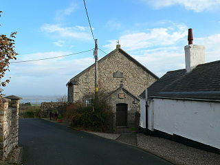
Pentre Halkyn is a small village in Flintshire, Wales. It is situated approximately two miles from Holywell, and is off Junction 32 of the A55 North Wales Expressway. It has a quarry, a small hotel, and a local shop. The village borders on the Halkyn Mountain Site of Special Scientific Interest and Special Area of Conservation.

Y Gaer is a Roman fort situated near modern-day Brecon in Mid Wales, United Kingdom. Y Gaer is located at grid reference SO00332966.

The Clwyd-Powys Archaeological Trust(CPAT) (Welsh: Ymddiriedolaeth Archeolegol Clwyd-Powys is an educational charity which was established in 1975. Its objective is ‘to advance the education of the public in archaeology’. CPAT is one of four Welsh Archaeological Trusts which work to help protect, record and interpret all aspects of the historic environment. This includes providing advice to local authorities on archaeology and planning, undertaking archaeological projects for private- and public-sector clients, and delivering a programme of community archaeology events and activities.
Eddisbury hill fort, also known as Castle Ditch, is an Iron Age hill fort near Delamere, Cheshire, in northern England. Hill forts are fortified hill-top settlements constructed across Britain during the Iron Age. Eddisbury is the largest and most complex of the seven hill forts in the county of Cheshire. It was constructed before 200–100 BC and expanded in 1–50 AD. In the 1st century AD, the Romans slighted the site. It was reoccupied in the 6th–8th centuries AD, and an Anglo-Saxon burh was probably established at Eddisbury in 914. In the medieval and post-medieval periods quarrying and farming have damaged the site. Ownership is currently split between the Forestry Commission and a local farm. Eddisbury is protected as a Scheduled Ancient Monument.

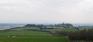
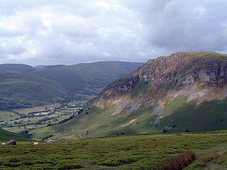
Moel y Gaer is an Iron Age hillfort at the northern end of the Clwydian Range, located on a summit overlooking the valley of the River Wheeler, near the village of Bodfari, Denbighshire, Wales, five miles north-east of Denbigh. The site is a scheduled monument, classified as a prehistoric defensive hillfort.

Moel y Gaer, also known as Moel-y-Gaer Camp or Moel y Gaer Hillfort, is an Iron Age hillfort located on a western spur of the Clwydian Range, near the village of Llanbedr, Denbighshire, Wales. The site is a scheduled monument, classified as a prehistoric defensive hillfort.
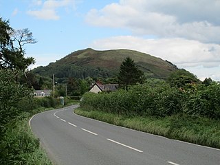
Moel y Gaer is an Iron Age hillfort on a summit of Llantysilio Mountain, northwest of the town of Llangollen, Denbighshire, Wales. The site is a scheduled monument classified as a prehistoric defensive hillfort.

Buckland Rings is the site of an Iron Age hill fort in the town of Lymington, Hampshire. Today, the mounds and dykes around the outside which once constituted its defences are still clearly visible, although the outer bank lies under the road on the west side, and on the south-east it is nearly ploughed-out. Excavations of the inner and middle ramparts in 1935 revealed that they were of wall-and-fill construction, retained at the front by upright timber beams and walls of cut and laid turf. The entrance, which lies on the east side, was also excavated revealing a long entrance passage and the postholes for a pair of stout gateposts. The site was bought by Hampshire County Council in 1989 to ensure its preservation, and it is open to the public from the A337 road onto which part of it faces.

Blewburton Hill is the site of an Iron Age hillfort located in Oxfordshire, in the southeast of England. It was a univallate hillfort. The area is mostly farmland with some small areas of wooded copse to the south and the northeast. The hill fort may have been occupied from the 4th century BC to the 1st century BC, and replaced a small settlement surrounded by a stockade, which is estimated to have been built in the 5th or 6th century BC.
The Dinas Powys hillfort is an Iron Age hillfort near Dinas Powys, Glamorgan, Wales. It is just one of several thousand hillforts to have been constructed around Great Britain during the British Iron Age, for reasons that are still debatable. The main fort at Dinas Powys was constructed on the northernmost point of the hill in either the third or 2nd century BCE, with two further constructs, known as the Southern Banks, being built further down on the southern end of the hill in the following 1st century BCE. It appears that occupation at the site ceased during the period of Roman Britain, but was re-inhabited by an Early Mediaeval settlement in the 5th century CE, who constructed further additions to the fort. The site was subsequently excavated by a team of archaeologists led by Leslie Alcock from 1954 through to 1958.

Slwch Tump, also known as Slwch Camp and formerly known as Pen Cevn-y-Gaer, is an Iron Age hillfort close to Brecon in Powys, Wales.

Ffridd Faldwyn is an Iron Age hillfort in northern Powys, in the former county of Montgomeryshire, It is sited on a prominent hill west of Montgomery, close to but higher than Montgomery Castle, overlooking the River Severn. It is one of the largest hill-forts in Wales.

Caesar's Camp is an Iron Age hill fort straddling the border of the counties of Surrey and Hampshire in southern England. The fort straddles the borough of Waverley in Surrey and the borough of Rushmoor and the district of Hart, both in Hampshire. Caesar's Camp is a Scheduled Ancient Monument with a list entry identification number of 1007895. It lies approximately 3 kilometres (1.9 mi) north of the town of Farnham, and a similar distance west of Aldershot. The hillfort lies entirely within the Bourley and Long Valley Site of Special Scientific Interest. Caesar's Camp is a multivallate hillfort, a fort with multiple defensive rings, occupying an irregular promontory, with an entrance on the south side. The site has been much disturbed by military activity, especially at the southeast corner. The remains of the hillfort are considered to be of national importance.

Bedd-y-Cawr Hillfort, or Bedd y Cawr Hillfort, is an Iron Age hillfort on a natural inland promontory in the community of Cefnmeiriadog in Denbighshire in North Wales. The name of the hillfort translates from the Welsh as Giant's Tomb.
Llwyn Bryn-Dinas is an Iron Age hillfort on the north side of the Tanat valley, about 1 mile (1.6 km) west of the village of Llangedwyn, in Powys, Wales.

Castell Caer Seion is an Iron Age hillfort situated at the top of Conwy Mountain, in Conwy County, North Wales. It is unusual for the fact that the main fort contains a smaller, more heavily defended fort, complete with its own distinct defences and entrance, with no obvious means of access between the two. The construction date of the original fort is still unknown, but recent excavations have revealed evidence of occupation as early as the 6th century BC, whilst the smaller fort can be dated with reasonable certainty to around the 4th century BC. Whilst the forts were constructed in different periods, archaeologists have uncovered evidence of concurrent occupation, seemingly up until around the 2nd century BC. The larger fort contained around 50 roundhouses during its lifetime, whereas examinations of the smaller fort have turned up no more than six. The site was traditionally associated with Maelgwyn Gwynedd, but there is no evidence pointing to a 6th-century occupation. The fort and wider area beyond its boundaries have been said to retain significant archaeological potential, and are protected by law as a scheduled ancient monument.
Craig Rhiwarth is a mountain in the Berwyn range, in Powys, Wales, overlooking the village of Llangynog to the south. On the summit is an Iron Age hillfort, and there are remains of slate quarrying on the southern slopes.

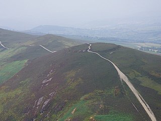
The Clwydian Range and Dee Valley is a designated Area of Outstanding Natural Beauty (AONB) and proposed national park, located in north-east Wales, covering the Clwydian Range, and the valley of the River Dee. Designated in 1985 as the Clwydian Range AONB, and expanded to its current form in 2011, the Area of Outstanding Natural Beauty includes: medieval field systems, open heather moorland, prehistoric hillforts, limestone crags, broad leaved woodland, wooded valleys, and farmland. In 2018, an estimated 1.1 million people visited six key sites across the AONB, generating approximately £24.1 million to the Welsh economy, according to Natural Resources Wales. The AONB falls within the jurisdiction of the local authorities of Denbighshire, Flintshire, and Wrexham County Borough, with the majority, 80% of the AONB in Denbighshire, and the remaining 20% split evenly between the other two authorities. The AONB is the largest of only five AONBs in Wales, and one of the 46 in the United Kingdom. Additionally, it is one of only 8 protected areas of Wales. Long-distance footpaths; Offa's Dyke Path, and the Clwydian Way pass through the AONB. The area of the Clwydian Range and Dee Valley AONB is 390 km2 (150 sq mi), and has been proposed by the Welsh Government to become Wales' fourth national park.

