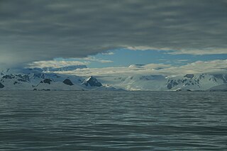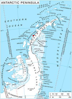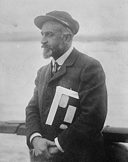
Drygalski Glacier is a broad glacier, 18 nautical miles long and 15 miles (24 km) wide at its head, which flows from Herbert Plateau southeast between Ruth Ridge and Kyustendil Ridge, and enters Solari Bay immediately north of Sentinel Nunatak on Nordenskjöld Coast, the east coast of Graham Land, Antarctica. It was discovered in 1902 by the Swedish Antarctic Expedition, under Otto Nordenskiöld, and named "Drygalski Bay" after Professor Erich von Drygalski. The feature was determined to be a glacier by the Falkland Islands Dependencies Survey in 1947.
Hackapike Bay is an anchorage 4 miles (6 km) northwest of Ryswyck Point, entered west of False Island along the northeast coast of Anvers Island, in the Palmer Archipelago, Antarctica. It was charted and named by the British Graham Land Expedition, 1934–37, under John Rymill.

Beascochea Bay is a bay, 10 nautical miles (19 km) long and 5 nautical miles (9 km) wide, indenting the Graham Coast of Graham Land, Antarctica, between Kiev Peninsula and Barison Peninsula, and entered south of Cape Perez. The glaciers Lever, Funk, Cadman, Talev and Butamya feed the bay.

Bigo Bay is a bay 8 nautical miles (15 km) long and 6 nautical miles (11 km) wide, indenting the west coast of Graham Land between Cape Garcia and Magnier Peninsula surmounted by the Magnier Peaks and Lisiya Ridge.

Birley Glacier is a glacier, at least 10 nautical miles (19 km) long, flowing west into the eastern extremity of Barilari Bay north of Vardun Point, on the west coast of Graham Land. First seen and roughly surveyed in 1909 by the French Antarctic Expedition under Jean-Baptiste Charcot, it was re-surveyed in 1935–36 by the British Graham Land Expedition (BGLE) under John Rymill, and later named for Kenneth P. Birley, who contributed toward the cost of the BGLE, 1934–37.
Comrie Glacier is a glacier 13 nautical miles (24 km) long, flowing west to enter the head of Bigo Bay on the west coast of Graham Land. It was first sighted and roughly surveyed by the French Antarctic Expedition in 1909. It was resurveyed in 1935–36 by the British Graham Land Expedition (BGLE), and later named for Leslie J. Comrie, founder and first Director of the Scientific Computing Service Ltd, London, who, as Superintendent of HM Nautical Almanac Office in 1934, greatly assisted the BGLE, 1934–37, by providing advance copies of The Nautical Almanac up to 1937.

Weir Glacier is a glacier 8 nautical miles (15 km) long, flowing north into the south part of Barilari Bay between Prestoy Point and Byaga Point, on the west coast of Graham Land. First sighted and roughly charted in 1909 by the French Antarctic Expedition under Charcot. It was surveyed in 1935-36 by the British Graham Land Expedition (BGLE) under Rymill and later named for William D. Weir, 1st Viscount Weir of Eastwood, and his son, the Hon. James K. Weir, who contributed toward the cost of the BGLE, 1934-37.

Darbel Bay is a bay 25 nautical miles (50 km) wide, indenting the west coast of Graham Land between Stresher Peninsula and Pernik Peninsula. Entered southwest of Cape Bellue and northeast of Cape Rey. The glaciers Widmark Ice Piedmont, Cardell, Erskine, Hopkins, Drummond, Widdowson, McCance, Solun and Škorpil feed the bay.

Drummond Glacier is a glacier 10 nautical miles (18 km) long and 2 nautical miles (4 km) wide, on the west coast of Graham Land, situated south of Hopkins Glacier and flowing west-northwest between Voit Peak and Sherba Ridge into Darbel Bay east of Sokol Point.

Duyvis Point is the point forming the southeast side of the entrance to Urovene Cove situated 11 nautical miles (20 km) south-southeast of Cape Garcia and 2.65 km southeast of Laskar Point, on the southwest coast of Felipe Solo (Obligado) Peninsula, Graham Land in Antarctica. It was first roughly charted by the British Graham Land Expedition under John Rymill, 1934–37. It was mapped more accurately by the Falkland Islands Dependencies Survey from photos taken by Hunting Aerosurveys Ltd in 1956–57, and was named by the UK Antarctic Place-Names Committee for F. Donker Duyvis, a Dutch documentalist who was Secretary of the International Federation for Documentation.

Edgeworth Glacier is a glacier 12 nautical miles (22 km) long, flowing south-southwestwards from the edge of Detroit Plateau below Wolseley Buttress and Paramun Buttress between Trave Peak and Chipev Nunatak into Mundraga Bay west of Sobral Peninsula, on the Nordenskjöld Coast of Graham Land. It was mapped from surveys by the Falkland Islands Dependencies Survey (1960–61), and was named by the UK Antarctic Place-Names Committee for Richard Lovell Edgeworth, the British inventor of the "portable railway," the first track-laying vehicle, in 1770.

Girard Bay is a bay 2 nautical miles (4 km) long and 1 nautical mile (2 km) wide, indenting the northwest coast of Kiev Peninsula, Graham Land, between Cape Cloos and Mount Scott. It was discovered by the Belgian Antarctic Expedition, 1897–99, and was named by the French Antarctic Expedition, 1903–05, under Jean-Baptiste Charcot, for Jules Girard of the Paris Société de Géographie.

Loqui Point is a point at the northern extremity of Velingrad Peninsula on the west coast of Graham Land, Antarctica. It marks the south side of the entrance to Barilari Bay. This feature was discovered and named "Cap Garcia" by the French Antarctic Expedition, 1903–05, under Jean-Baptiste Charcot. At the same time Charcot gave the name "Cap Loqui" to the north cape of Barilari Bay, after a Captain Loqui of the Argentine Navy. The maps of Charcot's French Antarctic Expedition of 1908–10, showed "Cap Garcia" as the north cape of Barilari Bay, and the name Cape Garcia has since become established in that position. Charcot did not use the name "Cap Loqui" on the maps of the 1908–10 expedition, and with his shifting of the name Cape Garcia, this south entrance point to Barilari Bay had remained unnamed. For the sake of historical continuity, the name Loqui Point was accepted for this feature in the 1950s.

McCance Glacier is the 30-km long and 5 km wide glacier draining the Hutchison Hill area on the west slopes of Avery Plateau on Loubet Coast in Graham Land, Antarctica. It flows north-northwestwards along the west side of Osikovo Ridge, Kladnitsa Peak and Rubner Peak and enters Darbel Bay.
Screen Islands is a group of islands extending northwest from Aguda Point for 1.5 nautical miles (2.8 km) across the entrance to Hidden Bay, off the west coast of Graham Land. First charted by the Belgian Antarctic Expedition under Gerlache, 1897-99. So named by the United Kingdom Antarctic Place-Names Committee (UK-APC) in 1958 because they form a screen across the entrance to Hidden Bay.

Sphinx Island is an island 2 nautical miles (3.7 km) long and 1 nautical mile (1.9 km) wide, having a bare rocky summit with vertical faces on all four sides, lying in the entrance to Barilari Bay north of Loqui Point on Velingrad Peninsula, Graham Land in Antarctica. Discovered and named by the British Graham Land Expedition (BGLE), 1934–37, under Rymill.

Luke Glacier is a glacier at least 15 nautical miles (28 km) long, flowing northwest into the head of Leroux Bay on the west coast of Graham Land, Antarctica. It is surmounted by Mount Chevreux on the south, Mount Perchot on the southwest and Mount Radotina on the northeast. The glacier was first sighted and roughly surveyed in 1909 by the Fourth French Antarctic Expedition. It was resurveyed in 1935–36 by the British Graham Land Expedition and later named for George Lawson Johnston, 1st Baron Luke of Pavenham, Chairman of Bovril Ltd, who contributed toward the cost of the expedition.
Romulus Glacier is a glacier, 7 nautical miles (13 km) long and 2 nautical miles (3.7 km) wide, which flows from the north slopes of Mount Lupa westward to Rymill Bay between the Blackwall Mountains and Black Thumb, on the west coast of Graham Land. First surveyed in 1936 by the British Graham Land Expedition (BGLE) under Rymill. Resurveyed in 1948-49 by the Falkland Islands Dependencies Survey (FIDS), who so named it for its association with Remus Glacier, whose head lies near the head of this glacier.

Leroux Bay is a bay 9 nautical miles (17 km) long in a northwest–southeast direction and averaging 5 nautical miles (9 km) wide, between Nunez Point and the narrow Magnier Peninsula surmounted by the Magnier Peaks and Lisiya Ridge, along the west coast of Graham Land, Antarctica. The glaciers Chernomen, Luke and Muldava feed the bay.


