
Rongé Island or Curville Island or De Rongé Island or Isla Curville or Rouge Island is a high, rugged island 8 km (5 mi) long, the largest island of the group which forms the west side of Errera Channel, off the west coast of Graham Land in Antarctica. Rongé Island is located at 64°43′S62°41′W. Rongé Island was discovered by the Belgian Antarctic Expedition (1897–1899) under Adrien de Gerlache who named it for Madame de Rongé, a contributor to the expedition.
Pavie Ridge or Cap Pavie or Île Pavie is a rocky ridge located at 68°34′S66°59′W in Antarctica which rises over 500 m. It extends south and west from Martin Glacier to Moraine Cove, and forms the southeastern limit of the Bertrand Ice Piedmont, on the west coast of Graham Land.
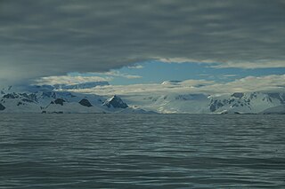
The French Antarctic Expedition is any of several French expeditions in Antarctica.

Mount Zdarsky is a mountain rising at the east side of Simler Snowfield on Velingrad Peninsula, between Barilari and Holtedahl Bays on the west coast of Graham Land, Antarctica. First charted and named "Mont Garcia" by the French Antarctic Expedition under Jean-Baptiste Charcot, 1908–10, presumably in association with his nearby "Cap Garcia".
Beascochea Bay is a bay, 10 nautical miles (19 km) long and 5 nautical miles (9 km) wide, indenting the Graham Coast of Graham Land, Antarctica, between Kiev Peninsula and Barison Peninsula, and entered south of Cape Perez. The glaciers Lever, Funk, Cadman, Talev and Butamya feed the bay.

Birley Glacier is a glacier, at least 10 nautical miles (19 km) long, flowing west into the eastern extremity of Barilari Bay north of Vardun Point, on the west coast of Graham Land. First seen and roughly surveyed in 1909 by the French Antarctic Expedition under Jean-Baptiste Charcot, it was re-surveyed in 1935–36 by the British Graham Land Expedition (BGLE) under John Rymill, and later named for Kenneth P. Birley, who contributed toward the cost of the BGLE, 1934–37.
Wylie Bay is a bay 4 nautical miles (7 km) wide, lying between Cape Monaco and Norsel Point on the southwest coast of Anvers Island, in the Palmer Archipelago. First charted by the French Antarctic Expedition under Charcot, 1903–1905. Named by the United Kingdom Antarctic Place-Names Committee (UK-APC) in 1959 for John P. Wylie, Falkland Islands Dependencies Survey (FIDS) surveyor at Arthur Harbor in 1956 and 1957.
Weir Glacier is a glacier 8 nautical miles (15 km) long, flowing north into the south part of Barilari Bay between Prestoy Point and Byaga Point, on the west coast of Graham Land. First sighted and roughly charted in 1909 by the French Antarctic Expedition under Charcot. It was surveyed in 1935-36 by the British Graham Land Expedition (BGLE) under Rymill and later named for William D. Weir, 1st Viscount Weir of Eastwood, and his son, the Hon. James K. Weir, who contributed toward the cost of the BGLE, 1934-37.
Turks Head Bay is a small bay between Tryggve Point and Turks Head on the west side of Ross Island. The bay name appears to be first used on a map of the British Antarctic Expedition (1910–13) and is in association with Turks Head.

Mount Perchot is a mountain, 2,040 m, surmounted by Lisiya Ridge, a prominent ridge extending in a general north-south direction, standing 4 nautical miles (7 km) southeast of Magnier Peaks on Magnier Peninsula, Graham Coast in Graham Land, Antarctica. Discovered by the French Antarctic Expedition, 1908–10, and named by Charcot for Monsieur Perchot, an acquaintance who donated seventy pairs of boots to the expedition.

Cape Evensen is a cape forming the north side of the entrance to Auvert Bay, on the northwest coast of Stresher Peninsula, Graham Land in Antarctica. It was discovered by the French Antarctic Expedition, 1903–05, and named by Jean-Baptiste Charcot for Captain C.J. Evensen of the Hertha, who explored along the west coast of the Antarctic Peninsula in 1893.
Loqui Point is a point at the northern extremity of Velingrad Peninsula on the west coast of Graham Land, Antarctica. It marks the south side of the entrance to Barilari Bay. This feature was discovered and named "Cap Garcia" by the French Antarctic Expedition, 1903–05, under Jean-Baptiste Charcot. At the same time Charcot gave the name "Cap Loqui" to the north cape of Barilari Bay, after a Captain Loqui of the Argentine Navy. The maps of Charcot's French Antarctic Expedition of 1908–10, showed "Cap Garcia" as the north cape of Barilari Bay, and the name Cape Garcia has since become established in that position. Charcot did not use the name "Cap Loqui" on the maps of the 1908–10 expedition, and with his shifting of the name Cape Garcia, this south entrance point to Barilari Bay had remained unnamed. For the sake of historical continuity, the name Loqui Point was accepted for this feature in the 1950s.
The Havre Mountains are a large group of mountains forming the northwestern extremity of Alexander Island, Antarctica, extending 20 nautical miles (37 km) in an east–west direction between Cape Vostok and the Russian Gap. They were first seen in 1821 by a Russian expedition under Fabian Gottlieb von Bellingshausen and re-sighted by the Belgian Antarctic Expedition, 1897–99. They were roughly charted by the French Antarctic Expedition, 1908–10, under Jean-Baptiste Charcot, who named them for Le Havre, the French port from which the Pourquol Pas? sailed in 1908. The mountains were mapped in detail from air photos taken by the Ronne Antarctic Research Expedition, 1947–48, by D. Searle of the Falkland Islands Dependencies Survey in 1960.
Huitfeldt Point is a point southeast of Vorweg Point on the southwest side of Barilari Bay, on the west coast of Graham Land, Antarctica. It was charted by the British Graham Land Expedition under John Rymill, 1934–37, and was named by the UK Antarctic Place-Names Committee in 1959 for Fritz R. Huitfeldt, a Norwegian pioneer ski exponent, the author of one of the earliest skiing manuals, and the designer of the Huitfeldt ski binding, for long the standard binding.
Hulot Peninsula is a rugged peninsula forming the southwestern extremity of Brabant Island, in the Palmer Archipelago, Antarctica. It was first charted by the French Antarctic Expedition, 1903–05, and named by Jean-Baptiste Charcot for Baron Hulot.

Cape Kjellman is a cape forming the west extremity of Belitsa Peninsula and marking the east side of the entrance to Charcot Bay, on the west side of Trinity Peninsula, Antarctica. It was first charted by the Swedish Antarctic Expedition, 1901–04, under Otto Nordenskiöld, and named by him, probably for Professor Frans Reinhold Kjellman, a Swedish botanist.
The Magnier Peaks are two mountain peaks, the higher at 1,345 metres (4,410 ft), surmounting the peninsula between Leroux Bay and Bigo Bay on the west coast of Graham Land, Antarctica. These peaks were discovered and named by the Fourth French Antarctic Expedition, 1908–10, under Jean-Baptiste Charcot.
Sphinx Island is an island 2 nautical miles (3.7 km) long and 1 nautical mile (1.9 km) wide, having a bare rocky summit with vertical faces on all four sides, lying in the entrance to Barilari Bay north of Loqui Point on Velingrad Peninsula, Graham Land in Antarctica. Discovered and named by the British Graham Land Expedition (BGLE), 1934–37, under Rymill.
Vieugue Island is an island 3 nautical miles (6 km) long at the west side of Grandidier Channel, lying 1 nautical mile (1.9 km) northwest of Duchaylard Island and 12 nautical miles (22 km) west-northwest of Cape Garcia, off the west coast of Graham Land. Discovered by the French Antarctic Expedition, 1903–05, and named by Charcot after Monsieur Vieugue, then French Charge d'Affaires at Buenos Aires.


