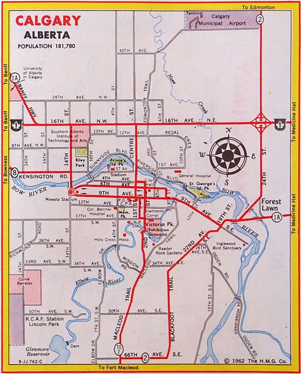
Barlow Trail

Last updated
Barlow Trail
OwnerCity Of Calgary, EllisDon (EllisDon is responsible for construction of the highway, while City of Calgary is responsible for maintaining the whole highway.)
Location Calgary, Alberta

Southern section
Length8.7 km (5.4 mi) [1]
South end Deerfoot Trail (Hwy 2)
Major
junctions
Glenmore Trail
North end Deerfoot Trail (Hwy 2) /
Peigan Trail

Central section
Length11.6 km (7.2 mi) [1]
South end 17 Avenue SE
Major
junctions
Memorial Drive
16 Avenue NE (Hwy 1)
McKnight Boulevard
North endMcCall Way

Northern section
Length3.8 km (2.4 mi) [1]
South endAirport Road
Major
junctions
Airport Trail
Country Hills Boulevard
North end128 Avenue NE

Barlow Trail is a major arterial road in Calgary, Alberta, that is composed of three parts: the southern section which runs from Deerfoot Trail near 130 Avenue SE to Deerfoot Trail at the intersection with Peigan Trail. The afore mentioned section is the central section which runs from 17 Avenue SE to McCall Way; and the northern section which runs from Airport Road (the main entrance into the Calgary International Airport) to 128 Avenue NE. [2]

Contents

The central and northern sections of Barlow Trail is run roughly where the fifth meridian lies in the Dominion Land Survey. The road is named for Noel Barlow, a resident of Carseland, Alberta, Canada, who served as the ground crewman to Douglas Bader, a Royal Air Force flying ace in World War II. [3]

History

Barlow Trail used to be the main northern entrance into the city of Calgary and was a continuous roadway. It served as a portion of Alberta Highway 2 from the northern city limits to Blackfoot Trail, near the present location of the Max Bell Centre. At that point, Highway 2 followed Blackfoot Trail to 66 Avenue SE (present-day Glenmore Trail) before turning south on Macleod Trail, while Barlow Trail continued south along 26 Street SE. [4] [5] In the early 1970s, Highway 2 was diverted to the new freeway as part of the Blackfoot Trail Freeway (present-day Deerfoot Trail) construction, resulting in Barlow Trail becoming a rural road north of 112 Avenue NE (present-day Country Hills Boulevard) and being re-designated as Highway 2A. [6] [7] In the late 1970s, Deerfoot Trail was extended further south, resulting in the direct connection to Blackfoot Trail being removed in favour of using 17 Avenue SE, and Barlow Trail being realigned as part of the construction of the Peigan Trail interchange. [8] As part of the construction, direct movement to 26 Avenue SE was removed in favour of the southern section of Barlow Trail accessing Deerfoot Trail, and subsequent traffic calming removed direct access south of 17 Avenue SE. In the 1980s, the city of Calgary annexed land north of the airport, resulting in the Highway 2A designation being removed. [9]

Barlow Trail was the primary route to the Calgary International Airport until the 2001 completion of Airport Trail, [10] where the primary north-south entrance to the airport was diverted to the Airport Trail via the Deerfoot Trail. Barlow Trail functioned as an alternate route to the airport until April 3, 2011, where the section of Barlow Trail between 48 Avenue NE and Airport Road was permanently closed in order to provide space for a new runway. [11] In the late 2000s, as part of the construction of the northeast portion of Stoney Trail, access to Rocky View County was closed.

Future

The section of Barlow Trail north of Country Hills Boulevard is being reconstructed and realigned as part of the Stonegate Landing business park development. Barlow Trail will be upgraded to an arterial road to 128 Avenue NE, and continue north as Barlow Crescent, where it will circle back to 128 Avenue NE and continue south as 36 Street NE. [12]

Major intersections

The entire route is in Calgary.

km [1] miDestinationsNotes
0.00.0Alberta Highway 2.svg Deerfoot Trail (Hwy 2) Semi-directional T interchange (Hwy 2 Exit 240)
0.90.56114 Avenue SE
1.71.1106 Avenue SE
2.31.4Shepard Road Trumpet interchange
3.32.190 Avenue SE
4.12.5 Glenmore Trail Split intersection
4.83.076 Avenue SE
5.23.272 Avenue SE
6.33.961 Avenue SE
7.34.554 Avenue SE
7.94.950 Avenue SE
8.75.4Alberta Highway 2.svg Deerfoot Trail (Hwy 2) / Peigan TrailInterchange (Hwy 2 exit 251); at-grade access to Peigan Trail
5.5 km (3.4 mi) gap in Barlow Trail
0.00.0 17 Avenue SE, 26 Street SENo connection with 26 Street SE; no eastbound entrance from 17 Avenue SE
5.23.2 Memorial Drive Partial cloverleaf interchange
5.53.4Century Gate, 3 Avenue SE
6.03.7Centre Avenue E
6.44.04 Avenue NE
6.74.27 Avenue NE
7.64.7Alberta Highway 1.svg 16 Avenue NE (Hwy 1) Cloverleaf interchange
8.45.223 Avenue NE, Sunridge Way
8.75.427 Avenue NE, Sunridge Boulevard
9.35.832 Avenue NE
9.86.137 Avenue NE
10.16.339 Avenue NE
10.56.5 McKnight Boulevard
10.96.8Pegasus Road, 48 Avenue NE
11.67.2McCall WayRoundabout
4.1 km (2.5 mi) gap in Barlow Trail
0.00.0Ontario M502.svg Airport Road Calgary International Airport
0.40.25Alberta Highway 2.svg Airport Trail to Hwy 2 Interchange under construction
0.80.50100 Avenue NE
1.71.1Freeport Boulevard
2.01.2 Country Hills Boulevard
2.31.4116 Avenue NE
3.82.4128 Avenue NE
Barlow Crescent
Continues as Barlow Crescent
1.000 mi = 1.609 km; 1.000 km = 0.621 mi

See also

Route map:

Template:Attached KML/Barlow Trail
KML is not from Wikidata

Related Research Articles

<span class="mw-page-title-main">Alberta Highway 2</span> Highway in Alberta, Canada

Alberta Provincial Highway No. 2, commonly referred to as Highway 2 or the Queen Elizabeth II Highway, is a major highway in Alberta that stretches from the Canada–United States border through Calgary and Edmonton to Grande Prairie. Running primarily north to south for approximately 1,273 kilometres (791 mi), it is the longest and busiest highway in the province carrying more than 170,000 vehicles per day near Downtown Calgary. The Fort Macleod—Edmonton section forms a portion of the CANAMEX Corridor that links Alaska to Mexico. More than half of Alberta's 4 million residents live in the Calgary–Edmonton Corridor created by Highway 2.

<span class="mw-page-title-main">Deerfoot Trail</span> Freeway in Calgary

Deerfoot Trail is a 46.4-kilometre (28.8 mi) freeway segment of Highway 2 in Calgary, Alberta, Canada. It stretches the entire length of the city from south to north and links suburbs to downtown via Memorial Drive and 17 Avenue SE. The freeway begins south of Calgary where it splits from Macleod Trail, crosses the Bow River into city limits, and reaches the Stoney Trail ring road. Crisscrossing twice more with the river, it intersects Glenmore Trail and Memorial Drive; the former is a major east–west expressway while the latter is a freeway spur into downtown. In north Calgary, it crosses Highway 1 and passes Calgary International Airport before ending at a second interchange with Stoney Trail. Highway 2 becomes the Queen Elizabeth II Highway as it continues north into Rocky View County towards Edmonton.

<span class="mw-page-title-main">Alberta Highway 2A</span> Highway in Alberta, Canada

Alberta Provincial Highway No. 2A is the designation of six alternate routes off Highway 2 in Alberta, Canada. In general, these are original sections of Highway 2, such as the southern portion of Macleod Trail in Calgary. They passed through communities before limited-access freeways were built to shorten driving distance, accommodate heavier volumes and to bypass city traffic. Portions of the alignment of Highway 2A follow the route of the former Calgary and Edmonton Trail.

<span class="mw-page-title-main">Stoney Trail</span> Freeway in Calgary, Alberta

Alberta Provincial Highway No. 201, officially named Stoney Trail and Tsuut'ina Trail, is an approximately 92-kilometre (57 mi) freeway in Calgary, Alberta. It forms part of the CANAMEX Corridor which connects Calgary to Edmonton and Interstate 15 in the United States via Highways 2, 3, and 4. Planned for a total length of 101 kilometres, the final segment of the ring road is currently under construction to be completed by 2024 at the latest, delayed from an original target of 2022. The freeway serves as a bypass for the congested routes of 16 Avenue N and Deerfoot Trail through Calgary. At its busiest point near Beddington Trail in north Calgary, the six-lane freeway carried nearly 79,000 vehicles per day in 2019.

Alberta Provincial Highway No. 1, commonly referred to as Highway 1, is a major east–west highway in Southern Alberta that forms the southern mainline of the Trans-Canada Highway. It runs from the British Columbia border near Lake Louise through Calgary to the Saskatchewan border east of Medicine Hat. It continues as Highway 1 into both provinces. It spans approximately 534 km (332 mi) from Alberta's border with British Columbia in the west to its border with Saskatchewan in the east. The route is a divided 4-lane expressway throughout the province with the exception of a section in central Calgary where it is an arterial thoroughfare and Urban Boulevard carrying 4 to 6 lanes. The highway is a freeway between the Sunshine exit near the town of Banff and Home Road in Calgary. Other rural sections have at grade intersections with Interchanges only at busier junctions. Twinning of the final 8.5 km (5.3 mi) of Highway 1 between Lake Louise and the British Columbia border was completed by Parks Canada and opened to traffic on June 12, 2014 making the whole length of Alberta Highway 1 a divided minimum 4-lane route.

<span class="mw-page-title-main">Alberta Highway 1A</span> Designation for two disconnected sections of provincial highway in Alberta, Canada

Alberta Provincial Highway No. 1A is the designation of two alternate routes off the Alberta portion of Trans-Canada Highway 1. However, it is not the only name used for spurs off Highway 1 - Highway 1X is another such designation. Despite these highways being suffixed routes of Highway 1, they are not part of the Trans-Canada Highway network, and are signed with Alberta's provincial primary highway shields instead of the Trans-Canada shields used for Highway 1.

The city of Calgary, Alberta, has a large transportation network that encompasses a variety of road, rail, air, public transit, and pedestrian infrastructure. Calgary is also a major Canadian transportation centre and a central cargo hub for freight in and out of north-western North America. The city sits at the junction between the "Canamex" highway system and the Trans-Canada Highway.

<span class="mw-page-title-main">Memorial Drive (Calgary)</span> Road in Calgary

Memorial Drive is a major road in Calgary, Alberta. Aside from its important role in city infrastructure, the tree lined sides of Memorial Drive serve as a living testament to the many local soldiers who died during World War I and give it a parkway look on the western section. An active path system also runs along the south side of Memorial Drive, beside the banks of the Bow River. The Calgary Soldiers' Memorial forms part of an extensive renovation to Memorial Drive, which heightens the function of the road as a monument to the city's military. The Landscape of Memory Project began in 2004, in order to revitalize a nine kilometre stretch of the road. The design incorporated "Poppy Plaza" at the corner of Memorial Drive and 10th Street NW. The plaza used "weathered steel" to create large gateways, and the plaza and adjacent river walk were lined with the same rusted metal into which quotes about the Canadian experiences of war were cut. The Peace Bridge was incorporated into the remembrance theme of Memorial Drive, though there are no explanatory plaques at the site of the bridge.

Glenmore Trail is a 22-kilometre (14 mi) expressway in Calgary, Alberta, Canada, named after the reservoir which it crosses. It is a freeway between Sarcee Trail in southwest Calgary to Ogden Road in the southeast, carrying nearly 160,000 vehicles per weekday at its busiest point placing it second only to Deerfoot Trail as the busiest road in Alberta. East of Calgary, Glenmore Trail becomes Highway 560 en route to Langdon.

<span class="mw-page-title-main">Centre Street (Calgary)</span> Major street in Calgary, Alberta

Centre Street is a major road in Calgary, Alberta, and defines the east and west halves of the city for the purposes of street addresses.

<span class="mw-page-title-main">Macleod Trail</span> Road in Calgary

Macleod Trail is a major road in Calgary, Alberta. It is a six- to eight-lane principal arterial road extending from downtown Calgary to the south of the city, where it merges into Highway 2. South of Anderson Road, Macleod Trail is an expressway and is slated to be upgraded to a freeway in the future. It is named for its destination to the south, Fort Macleod.

<span class="mw-page-title-main">Country Hills Boulevard</span>

Country Hills Boulevard is a major expressway in Calgary, Alberta. It is notably one of the longest east-west routes in Calgary and one few routes north of 16 Avenue N that is mostly continuous from the west end of the city to the east end. East of Calgary, Country Hills Boulevard continues as Alberta Highway 564. West of Calgary, it continues as Hamilton Drive as it passes through the Bearspaw Country Club. Country Hills Boulevard was originally named 112 Avenue N, and was a rural road in northeastern Calgary, but was renamed in the early 1990s when its namesake community of Country Hills, as well as Harvest Hills and Coventry Hills, were constructed. Throughout the 1990s, the roadway was constructed in segments in northwest Calgary, departing from the original road allowance to follow the area's hilly topography.


John Laurie Boulevard / McKnight Boulevard is a major east-west arterial road and expressway in north Calgary, Alberta. The two roadways function together as a major crosstown route between the northwest and northeast quadrants and are part of Calgary's Skeletal Road Network.

Blackfoot Trail is a super-4 expressway in Calgary, Alberta. It is named for the Blackfoot Confederacy, and more specifically the Siksika Nation, located east of Calgary. The road runs from 17 Avenue SE in the north, where Blackfoot Trail meets Deerfoot Trail, to Southland Drive in the south. It is the historical alignment of Highway 2 in south Calgary. The section of Blackfoot Trail between 19 Street SE and Deerfoot Trail is a former alignment, and still technically part of, 17 Avenue SE; however, it is generally referred to as being part of Blackfoot Trail.

<span class="mw-page-title-main">16 Avenue N</span> Road in Calgary, Alberta, Canada

16 Avenue N is a major road in Calgary, Alberta, that forms a 26.5-kilometre (16.5 mi) segment of Highway 1 and connects Calgary to Banff and Medicine Hat. It is a four to six-lane principal arterial expressway at its extremities, but is an urban arterial road between the Bow River and Bowness Road, and also between Crowchild Trail and Deerfoot Trail. Due to Calgary's quadrant system, it is known as 16 Avenue NW west of Centre Street and 16 Avenue NE to the east.

<span class="mw-page-title-main">17 Avenue SE (Calgary)</span> Road in Calgary, Alberta

17 Avenue SE is a major arterial road in east Calgary, Alberta. 17 Avenue SE is the focal point of the International Avenue Business Revitalization Zone (BRZ) and the main roadway through the former town of Forest Lawn. Chestermere Boulevard is a major arterial road and the eastern extension of 17 Avenue SE through Chestermere, Alberta, Canada. The roadway is a former alignment of Highway 1A.

<span class="mw-page-title-main">Blue Line (Calgary)</span> Light rail line in Calgary, Alberta

The Blue Line, also known as Route 202, is a light rail transit (LRT) line in Calgary, Alberta, Canada. Partnered with the Red Line, and future Green Line it makes up Calgary's CTrain network. Following its initial approval in 1976, the Red Line opened in 1981, with the first trains running on what is now the Blue Line in 1985.

Calgary Trail and Gateway Boulevard are a pair of major arterial roadways in Edmonton, Alberta. Gateway Boulevard carries northbound traffic while Calgary Trail carries southbound traffic. From south of 31 Avenue, they form a two-way freeway separated by a median; for this portion, the roadway maintains the separate names for northbound and southbound traffic. Near 31 Avenue, Calgary Trail and Gateway Boulevard separate and become parallel one-way arterial roadways to Saskatchewan Drive, at the edge of the North Saskatchewan River valley. Designated as part of Highway 2 south of Whitemud Drive, it is Edmonton's main southern entrance and is both a major commuter route, connecting to the Edmonton International Airport and Leduc, as well as a regional connection to Red Deer and Calgary.

36 Street E, Métis Trail, and Dwight McLellan Trail is a major arterial road in eastern Calgary and Rocky View County, Alberta. It connects with residential neighborhoods and commercial corridors in northeast Calgary.

Airport Trail and 96 Avenue NE is an arterial road and developing expressway in the northeast quadrant of Calgary, Alberta. It is an important east-west roadway and is the main access route to the Calgary International Airport.

References

  1. 1 2 3 4 Google (May 5, 2017). "Barlow Trail in Calgary, Alberta" (Map). Google Maps . Google. Retrieved May 5, 2017.
  2. Sherlock Publishing (2014). Sherlock's Map of Calgary (Map) (16th ed.). Langdon, AB: Sherlock Publishing. pp. 6, 6A, 12, 20, 28–29, 36–37, 43, 49. ISBN   1-895229-80-4.
  3. Calgary Herald. "Barlow Trail has a soaring history". Archived from the original on 2011-04-13. Retrieved 2011-04-10.
  4. The H.M. Gousha Company (1951). Alberta Road Map (Map). Calgary inset.
  5. Clear-View Guide to the City of Calgary (Map). Clear-View Street Maps. 1972.
  6. Klaszus, Jeremy (June 7, 2012). "Deerfoot's Revenge". Calgary Herald. Archived from the original on January 2, 2016. Retrieved May 5, 2017.
  7. Alberta Business Development and Tourism (1978–79). Alberta Official Road Map (Map). Government of Alberta. Calgary inset.
  8. "Deerfoot Trail opening". The Calgary Herald. January 20, 1975. Retrieved May 5, 2017.
  9. Travel Alberta (1988). Alberta Official Road Map (Map). Government of Alberta. Calgary inset.
  10. Transportation Infrastructure Management System: Existing Structures in the Provincial Highway Corridor (PDF). Alberta Transportation (Report). Government of Alberta. p. 31. Retrieved May 5, 2017.
  11. "Reminder: Permanent Road Closure". YYC: Calgary International Airport. Calgary Airport Authority. March 28, 2011. Retrieved May 5, 2017.
  12. Stonegate Landing Overview (PDF) (Map). One Properties. p. 1.[ permanent dead link ]