Barrow, Illinois

Last updated

Barrow, Illinois
USA Illinois location map.svg
Red pog.svg
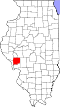
Barrow, Illinois
Location of Barrow within Illinois
Usa edcp location map.svg
Red pog.svg
Barrow, Illinois
Barrow, Illinois (the United States)
Coordinates: 39°30′22″N90°24′05″W / 39.50611°N 90.40139°W / 39.50611; -90.40139
CountryUnited States
StateIllinois
County Greene
Elevation
[1]
653 ft (199 m)
Time zone UTC-6 (CST)
  Summer (DST) UTC-5 (CDT)
ZIP Code
62082
GNIS feature ID422440 [1]

Barrow is an unincorporated community located in Greene County, Illinois, United States outside Roodhouse, just off Rt. 106.

Contents

History

In March 2006, Barrow experienced an F1 tornado. [2]

Religion

Barrow Baptist Church is located in Barrow.

Related Research Articles

<span class="mw-page-title-main">1965 Palm Sunday tornado outbreak</span> Natural disaster in the US

On April 10–12, 1965, a devastating multiple-vortex tornado affected the Midwestern and Southeastern United States. The tornado outbreak produced 55 confirmed tornadoes in one day and 16 hours. The worst part of the outbreak occurred during the afternoon hours of April 11 into the overnight hours going into April 12. The second-largest tornado outbreak on record at the time, this deadly series of tornadoes, which became known as the 1965 Palm Sunday tornado outbreak, inflicted a swath of destruction from Cedar County, Iowa, to Cuyahoga County, Ohio, and a swath 450 miles long (724 km) from Kent County, Michigan, to Montgomery County, Indiana. The main part of the outbreak lasted 16 hours and 35 minutes and is among the most intense outbreaks, in terms of tornado strength, ever recorded, including at least four "double/twin funnel" tornadoes. In all, the outbreak killed 266 people, injured 3,662 others, and caused $1.217 billion in damage.

<span class="mw-page-title-main">Tornado outbreak sequence of March 9–13, 2006</span> Weather event sequence

The Tornado outbreak sequence of March 9–13, 2006 was an early season and long lasting tornado outbreak sequence in the central United States that started on the morning of March 9 and continued for over four days until the evening of March 13. The outbreak produced 99 confirmed tornadoes, which killed a total of 10 people. The Storm Prediction Center (SPC) issued multiple elavated outlook throughout the sequence, including a rare high risk for March 12, which would end up being the most intense day of the outbreak, producing 62 in total. 11 F3 tornadoes were tallied, and a violent F4 tornado touched down in Monroe County, Missouri, becoming the strongest of the outbreak. Multiple tornado emergencies were issued for tornadoes throughout the outbreak as well. An intense F3 tornado that affected the towns of Renick and Maddison in Missouri killed 4 people and injured dozens others, becoming the deadliest of the sequence. Multiple of the tornadoes were long-tracked in nature, with 6 of them having paths exceeding 30 miles (48 km). One particular supercell thunderstorm during the outbreak persisted for many hours and progressed in excess of 800 miles (1,300 km) through Oklahoma, Kansas, Missouri, Illinois, Indiana, and extreme southern Michigan.

<span class="mw-page-title-main">Tornado outbreak sequence of January 7–11, 2008</span>

An unseasonably strong tornado outbreak began on January 7, 2008, and continued for nearly four days across the Central and Southern United States, with the hardest hit area being southwestern Missouri, northwestern Arkansas, and the surrounding area. In addition, a strong supercell in northern Illinois and southeastern Wisconsin produced that region's first January tornadoes since 1967.

<span class="mw-page-title-main">Satellite tornado</span> Tornado that orbits around a parent tornado

A satellite tornado is a tornado that revolves around a larger, primary tornado and interacts with the same mesocyclone. Satellite tornadoes occur apart from the primary tornado and are not considered subvortices; the primary tornado and satellite tornadoes are considered to be separate tornadoes. The cause of satellite tornadoes is not known. Such tornadoes are more often anticyclonic than are typical tornadoes and these pairs may be referred to as tornado couplets. Satellite tornadoes commonly occur in association with very powerful, large, and destructive tornadoes, indicative also of the strength and severity of the parent supercell thunderstorm.

<span class="mw-page-title-main">Tornado outbreak of May 1–3, 2008</span>

A destructive and deadly tornado outbreak that took place across the Southern and Central United States from May 1 to May 3, 2008. The outbreak was responsible for at least seven fatalities and 23 injuries in Arkansas. There were at least 29 tornado reports from Iowa to Oklahoma on May 1 and 67 more in Arkansas, Missouri, Mississippi, Tennessee, Louisiana and Texas on May 2. A total of 60 tornadoes were confirmed by weather authorities.

<span class="mw-page-title-main">National Weather Service Lincoln, Illinois</span> Forecast office in central Illinois

National Weather Service Lincoln, Illinois also known as National Weather Service Central Illinois is a weather forecast office responsible for monitoring weather conditions for 35 counties in Central and Southeastern Illinois. The Central Illinois office initially consisted of two forecast offices in Peoria and Springfield until the current location in Lincoln became the sole local forecast office in 1995. Federal meteorology offices and stations in the region date back to the 19th century when the Army Signal Service began taking weather observations using weather equipment at the Springer Building in Springfield. Since that time the presence of the National Weather Service greatly increased with the installation of new weather radars, stations and forecast offices. The current office in Lincoln maintains a WSR-88D (NEXRAD) radar system, and Advanced Weather Interactive Processing System (AWIPS) that greatly improve forecasting in the region. Lincoln is in charge of weather forecasts, warnings and local statements as well as aviation weather.

A destructive multi-day tornado outbreak across a large portion of the Southern United States that occurred at the end of April and the beginning of May 2010. Five people were killed from the tornadoes – one in Arkansas, one in Tennessee, and three in Mississippi. The tornado event was overshadowed by the 2010 Tennessee floods, which occurred at the same time.

<span class="mw-page-title-main">2012 Hurricane Isaac tornado outbreak</span>

The passage of Hurricane Isaac generated a long-lived, nine-day tornado outbreak that affected the Central and Eastern United States from August 27 to September 4, 2012. The hurricane produced a total of 34 tornadoes, with the strongest being two EF2 tornadoes in Mississippi and Arkansas. There were 19 tornado watches were issued for Isaac over eight days and 171 tornado warnings were issued across 12 states, with 77 of them in Mississippi.

<span class="mw-page-title-main">National Weather Service Norman, Oklahoma</span> Weather Forecast Office of the National Weather Service

National Weather Service - Norman, Oklahoma is a Weather Forecast Office (WFO) of the National Weather Service based in Norman, Oklahoma, which is responsible for forecasts and the dissemination of weather warnings and advisories for central and most of western Oklahoma, and western portions of north Texas. It is located in the National Weather Center on the University of Oklahoma campus, where it acts as one of the NOAA Weather Partners, a group of close-together weather-related agencies of the National Oceanic and Atmospheric Administration. NWS Norman is currently overseen by Mark Fox, who serves as the Meteorologist In Charge of the office.

<span class="mw-page-title-main">Tornado outbreak of November 17, 2013</span> Natural disaster

On November 17, 2013, the deadliest and costliest November tornado outbreak in Illinois history took shape, becoming the fourth-largest for the state overall. With more than 30 tornadoes in Indiana, it was that state's largest tornado outbreak for the month of November, and the second largest outbreak recorded in Indiana. Associated with a strong trough in the upper levels of the atmosphere, the event resulted in 77 tornadoes tracking across regions of the Midwest United States and Ohio River Valley, impacting seven states. Severe weather during the tornado outbreak caused over 100 injuries and eleven fatalities, of which eight were tornado related. Two tornadoes—both in Illinois and rated EF4 on the Enhanced Fujita scale—were the strongest documented during the outbreak and combined for five deaths. In addition to tornadoes, the system associated with the outbreak produced sizeable hail peaking at 4.00 in (10.2 cm) in diameter in Bloomington, Illinois, as well as damaging winds estimated as strong as 100 mph (160 km/h) in three locations.

<span class="mw-page-title-main">National Weather Service Kansas City/Pleasant Hill, Missouri</span> NWS Forecast Office serving west central Missouri, east central Kansas

National Weather Service - Pleasant Hill/Kansas City, Missouri is a Weather Forecast Office (WFO) of the National Weather Service, which is responsible for forecasts and the dissemination of weather warnings and advisories for 37 counties in northern and western Missouri and seven counties in extreme eastern Kansas, including the Kansas City and St. Joseph metropolitan areas. Though, as the Storm Prediction Center (SPC) in Norman, Oklahoma is responsible for issuing severe thunderstorm and tornado watches, the Pleasant Hill/Kansas City WFO only composes outline and status updates for SPC-issued watches affecting any portion of its designated County Warning Area.

<span class="mw-page-title-main">Tornado outbreak of December 23–25, 2015</span> Storm

On December 23, 2015, an outbreak of supercell thunderstorms produced tornadoes across northern Mississippi and middle Tennessee, resulting in 13 tornado-related deaths and numerous injuries. Other tornadoes occurred as far north as Indiana and Michigan. Scattered tornado activity continued over the next two days before the outbreak ended. This was the first of two deadly tornado outbreaks to impact the southern United States during December 2015 with the other occurring just a day after this one ended.

<span class="mw-page-title-main">December 2015 North American storm complex</span> 2015 massive storm system that affected North America

The December 2015 North American storm complex, also known as Winter Storm Goliath, was a major storm complex that produced a tornado outbreak, a winter storm, a blizzard and an ice storm in areas ranging from the Southwestern United States to New England. Tornadoes struck the Dallas–Forth Worth metroplex in Texas while several other states, especially Missouri, were affected by heavy rain and snow causing severe floods. As the system moved through the Great Lakes, heavy rain, ice pellets and heavy snow fell in the entire region. Wintry mix moved through southern Ontario and Quebec had significant snowfall on December 29. Almost 60 people were killed during the storm system's progression and aftermath, making it one of the deadliest such systems of 2015 in the United States.

<span class="mw-page-title-main">Tornado outbreak of February 28 – March 1, 2017</span>

The tornado outbreak of February 28 – March 1, 2017 was a widespread and significant outbreak of tornadoes and severe weather that affected the Midwestern United States at the end of February 2017 and beginning of March. Fueled by the combination of ample instability, strong wind shear, and rich low-level moisture, the event led to 71 confirmed tornadoes and thousands of other non-tornadic severe weather reports. The most notable aspect of the outbreak was a long-tracked EF4 tornado—the first violent tornado of 2017 and the first violent tornado during the month of February since the 2013 Hattiesburg, Mississippi tornado—that tracked from Perryville, Missouri to near Christopher, Illinois, killing one person. Three EF3 tornadoes were recorded during the event, including one that caused two fatalities in Ottawa, Illinois, one that caused a fatality near Crossville, and one that heavily damaged or destroyed homes in and around Washburn. In addition to the deaths, 38 people were injured by tornadoes and an additional 30 were injured by non-tornadic impacts, mainly by fallen trees.

<span class="mw-page-title-main">Tornado outbreak of April 8–9, 2015</span>

The tornado outbreak of April 8–9, 2015 was a relatively small but damaging outbreak of tornadoes that occurred in parts of the Great Plains and in the Midwestern United States. 27 tornadoes were confirmed during the two days, most of them weak, however a select few of them were powerful and damaging.

<span class="mw-page-title-main">Tornado outbreak and floods of April 28 – May 1, 2017</span>

The tornado outbreak and floods of April 28 – May 1, 2017 were a series of severe weather events that affected the central United States, producing life-threatening flooding and a major tornado outbreak. It formed out of a disturbance in the Southwestern United States on April 28, and caused significant impacts, including a heavy snowstorm in the Rockies, and other types of severe weather. Up to 3 feet (36 in) of snow fell on the cold side of the system, and up to a foot of rain fell in and around the central parts of the nation.

<span class="mw-page-title-main">Tornado outbreak sequence of May 15–20, 2017</span> American severe weather event

A prolonged period of intense tornado activity affected the Great Plains, Great Lakes, and Ohio Valley during May 15–20, 2017. This outbreak sequence was the most prolific tornado event of 2017 in terms of number of tornadoes. It is also notable for producing the longest-tracked tornado in Wisconsin state history: an intense EF3 tornado that remained on the ground for over 82 miles (132 km) and killed one person while causing major damage near Chetek and Conrath. Overall, the outbreak sequence resulted in two deaths and several injuries.

<span class="mw-page-title-main">Tornado outbreak of November 30 – December 2, 2018</span> Weather event in the central US

The tornado outbreak of November 30 – December 2, 2018 was a late-season tornado outbreak that occurred across portions of the West South Central states and Midwestern United States. As a potent shortwave trough moved across the southern portions of the country, it was met with ample moisture return and destabilization, resulting in widespread severe thunderstorms that produced damaging winds, hail, and tornadoes. The event began late on November 30 in Oklahoma, spreading east and resulting in one fatality in Aurora, Missouri. Several tornadic supercells moved across portions of Illinois on December 1, and resulted in 29 confirmed tornadoes. This outbreak was the largest December tornado event on record in Illinois history, surpassing the December 1957 tornado outbreak sequence. The most significant tornado of the event was an EF3 that impacted Taylorville, Illinois, damaging or destroying hundreds of structures and injuring 22 people.

<span class="mw-page-title-main">Weather of 2017</span>

The following is a list of weather events that occurred in 2017.

References

  1. 1 2 U.S. Geological Survey Geographic Names Information System: Barrow, Illinois
  2. "Tornado #1: Long-Track Tornado of Greene/Scott/Morgan/Sangamon Counties". NOAA's National Weather Service Weather Forecast Office Central Illinois. April 1, 2006. Archived from the original on April 14, 2006. Retrieved September 28, 2016.