References
36°56′28″N76°32′13″W / 36.941°N 76.537°W
Municipalities and communities of Isle of Wight County, Virginia, United States | ||
|---|---|---|
| Towns | 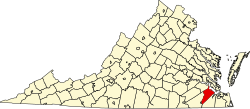 | |
| CDPs | ||
| Unincorporated communities | ||
| | This Isle of Wight County, Virginia state location article is a stub. You can help Wikipedia by expanding it. |