Carrollton, Virginia

Last updated

Carrollton, Virginia
USA Virginia location map.svg
Red pog.svg
Carrollton
Usa edcp location map.svg
Red pog.svg
Carrollton
Coordinates: 36°56′1″N76°31′38″W / 36.93361°N 76.52722°W / 36.93361; -76.52722
CountryUnited States
State Virginia
County Isle of Wight
Area
  Total5.8 sq mi (15.0 km2)
  Land5.7 sq mi (14.8 km2)
  Water0.08 sq mi (0.2 km2)
Elevation
22 ft (7 m)
Population
 (2020)
  Total7,498
  Density925/sq mi (357.3/km2)
Time zone UTC−5 (Eastern (EST))
  Summer (DST) UTC−4 (EDT)
ZIP code
23314
FIPS code 51-13160
GNIS feature ID2584823

Carrollton is a census-designated place (CDP) in Isle of Wight County, Virginia, United States. The population as of the 2020 census was 7,498. [1]

Contents

Carrollton is located near the southern end of the James River Bridge across from Newport News. Carrollton has recently experienced growth as a bedroom community.

History

Carrollton is named for the Carroll family, prominent landowners of the 19th century. The remaining home of the Carroll family is located at the intersection of Reynolds Drive and Norsworthy Drive, and is considered to have been in deteriorating condition for many years. At one time the home also is said to have served as the Carrollton Country Store.

The Carroll home is one of only a handful of truly historic Carrollton homes. It predates the original Carrollton Post Office, which is now occupied by a locally owned heating business. The old post office is located about 300 feet (100 m) east of the Carroll home on Norsworthy Drive near the western end of the current CDP. Its flagpole still stands.

Geography

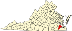
The Carrollton CDP is in the eastern portion of Isle Wight County, occupying a swath of land west of the James River and southeast of Smithfield. It includes the unincorporated community of Bartlett. The southern border of the CDP is tidal Chuckatuck Creek, forming the border between Isle of Wight County and the independent city of Suffolk. The eastern border of the CDP follows Winall Creek north from Chuckatuck Creek, then Newbill Lane and State Route 661, then extends east to tidal Ragged Island Creek. The border runs north up the creek to U.S. Route 17, then follows State Routes 659 and 712 (Vellines Lane) west to State Route 665 (Smiths Neck Road). The border continues southwest on Route 665, which becomes Reynolds Drive, running to an unnamed creek near Woolard Lane. The border follows the creek south to U.S. Route 258, which it follows east back to US-17 at Bartlett, then turns south on US-17 to Deep Bottom Drive. The border then runs south to Creer Creek, continuing south (downstream) to Brewers Creek, which it follows southeast back to Chuckatuck Creek. [2]

According to the U.S. Census Bureau, the Carrollton CDP has a total area of 5.8 square miles (15.0 km2), of which 5.7 square miles (14.8 km2) are land and 0.1 square miles (0.2 km2), or 1.48%, are water. [1]

The Carrollton ZIP code area extends outside the CDP east as far as the James River and the border with Newport News, southeast to the border with the city of Suffolk, west to the area of Benns Church, and northwest to Jones Creek near Smithfield. [2] The Carrollton post office lies about one mile southeast of the intersection of Carrollton Boulevard and Brewer's Neck Boulevard (U.S. Routes 17 and 258 and State Route 32), along Carrollton Boulevard (US-17). Carrollton does not include the communities of Battery Park or Rescue.

Carrollton has a humid subtropical climate (Cfa) and average monthly temperatures range from 40.4 °F in January to 80.0 °F in July. The local hardiness zone is 8a.

Current growth

Carrollton has seen significant growth in the last decade, including developments like condominiums, [3] new hospitals, schools, several restaurants, and new houses. [4]

Several residential communities have been developed since 2001, with homes having starting prices above $250,000 and some as high as $900,000. Condominiums adjoin these communities, as well as luxury apartments. Some of these are not newly approved, as the Eagle Harbor subdivision was originally approved in the 1970s by the county's Board of Supervisors, though development plans lay dormant until around 2000. One of the latest developments in the Carollton area is The Carrollton Fire Department has undergone extensive expansion, adding bays and being the only fire department in the county to also offer EMS service with two new Freightliner ambulances.

Carrollton is one of the two largest voting districts in Isle of Wight County, the other being Smithfield. The Route 17 James River Bridge carries in excess of 30,000 vehicles per day through Carrollton, many of which carry commuters to and from Newport News Shipbuilding.

Related Research Articles

<span class="mw-page-title-main">Isle of Wight County, Virginia</span> County in Virginia, United States

Isle of Wight County is a county located in the Hampton Roads region of the U.S. state of Virginia. It was named after the Isle of Wight, England, south of the Solent, from where many of its early colonists had come. As of the 2020 census, the population was 38,606. Its county seat is Isle of Wight, an unincorporated community.

<span class="mw-page-title-main">Carroll County, Georgia</span> County in Georgia, United States

Carroll County is a county located in the northwestern part of the State of Georgia. As of the 2020 census, its population was 119,148. Its county seat is the city of Carrollton. Carroll County is included in the Atlanta-Sandy Springs-Roswell, GA Metropolitan Statistical Area and is also adjacent to Alabama on its western border.

<span class="mw-page-title-main">Huntington, Virginia</span> Census-designated place in Virginia, United States

Huntington is a census-designated place (CDP) in Fairfax County, Virginia, United States. The population was 11,267 at the 2010 census. It is located next to the southern border of the city of Alexandria and is part of the Washington metropolitan area. Its main component is the namesake Huntington subdivision, a late-1940s neighborhood of mainly duplex homes.

<span class="mw-page-title-main">Rushmere, Virginia</span> Census-designated place in Virginia, United States

Rushmere is a census-designated place (CDP) in Isle of Wight County, Virginia, United States. The population was 1,018 at the 2010 census.

Landover is an unincorporated community and census-designated place in Prince George's County, Maryland, United States. As of the 2020 census, it had a population of 25,998.

<span class="mw-page-title-main">U.S. Route 258</span> U.S. Highway in North Carolina and Virginia

U.S. Route 258 is a spur of US 58 in the U.S. states of North Carolina and Virginia. The U.S. Highway runs 220.15 miles (354.30 km) from US 17 Business and NC 24 Business in Jacksonville, North Carolina north to Virginia State Route 143 at Fort Monroe in Hampton, Virginia. In North Carolina, US 258 connects Jacksonville with the Inner Banks communities of Kinston, Snow Hill, Farmville, Tarboro, and Murfreesboro. The U.S. Highway continues through the Virginia city of Franklin, where the highway intersects US 58, and the town of Smithfield on its way to the Hampton Roads metropolitan area. US 258 crosses the James River on the James River Bridge and follows Mercury Boulevard through Newport News and Hampton.

<span class="mw-page-title-main">James River Bridge</span> Bridge in VA to Newport News, VA

The James River Bridge (JRB) is a four-lane divided highway lift bridge across the James River in the Commonwealth of Virginia. Owned and operated by the Virginia Department of Transportation, it carries U.S. Route 17 (US 17), US 258, and State Route 32 across the river near its mouth at Hampton Roads. The bridge connects Newport News on the Virginia Peninsula with Isle of Wight County in the South Hampton Roads region, and is the easternmost such crossing without a tunnel component.

<span class="mw-page-title-main">Virginia State Route 10</span>

State Route 10 is a primary state highway in the U.S. state of Virginia. The state highway runs 93.58 miles (150.60 km) from U.S. Route 360 in Richmond east to SR 337 in Suffolk. SR 10 is a major suburban highway through Chesterfield County between the Southside of Richmond and Hopewell. Between Hopewell and Smithfield, which is served by SR 10 Business, the state highway passes through rural Prince George, Surry, and Isle of Wight counties, following the route of an old stagecoach road through an area that features many of the preserved James River plantations. SR 10 runs concurrently with US 258 and SR 32 between Smithfield and Suffolk.

<span class="mw-page-title-main">Virginia State Route 32</span> Primary state highway in the US

State Route 32 is a primary state highway in the U.S. state of Virginia. The state highway runs 38.89 miles (62.59 km) from the North Carolina state line in Suffolk north to U.S. Route 17, US 258, and SR 143 in Newport News. The southernmost part of SR 32 connects Suffolk with the Albemarle Region of North Carolina via North Carolina Highway 32. The remainder of SR 32 runs concurrently with at least one other state or U.S. Highway between Suffolk and Newport News, including US 13, SR 10, US 258, and US 17. The last two highways run together with SR 32 on the James River Bridge.

Lansdowne is a census-designated place and planned community located near Leesburg, Virginia in Loudoun County, Virginia. The population as of the 2010 United States Census was 11,253. It is north of State Route 7 and south of the Potomac River. Before the Revolutionary War, the Lee family established Coton Manor here. A section of the Potomac Heritage Trail runs through Lansdowne. It is the home of Inova Loudoun Hospital, the Jack Kent Cooke Foundation, Lansdowne Resort, Prison Fellowship, and Lansdowne Woods of Virginia, a gated, age-restricted community.

<span class="mw-page-title-main">U.S. Route 17 in Virginia</span> Section of U.S. highway in Virginia

U.S. Route 17 (US 17) is a part of the United States Numbered Highway System that runs from Punta Gorda, Florida, to Winchester, Virginia. In Virginia, the U.S. Highway runs 255.83 miles (411.72 km) from the North Carolina state line in Chesapeake north to its northern terminus at US 11, US 50, and US 522 in Winchester. US 17 is a major highway in the eastern half of Virginia. The U.S. Highway connects the Albemarle Region of North Carolina with the Hampton Roads metropolitan area. Within the urban area, US 17 passes through the South Hampton Roads cities of Chesapeake, Portsmouth, and Suffolk and the Virginia Peninsula city of Newport News. Between Yorktown and Fredericksburg, the U.S. Highway serves as the primary highway of the Middle Peninsula. At Fredericksburg, US 17 leaves the Atlantic Plain; the highway passes through the Piedmont town of Warrenton and crosses the Blue Ridge Mountains on its way to Winchester in the Shenandoah Valley. The route from Tappahannock to Winchester roughly follows the Confederate march during the Civil War to Gettysburg.

Benns Church is a census-designated place (CDP) in Isle of Wight County, Virginia, United States. It is located at the junction of U.S. Route 258 and State Routes 10 and 32, southeast of Smithfield. The population as of the 2010 census was 872.

Chuckatuck Creek is a 13.3-mile-long (21.4 km) tributary of the James River in the U.S. state of Virginia. The creek rises in Isle of Wight County and flows southeast to Chuckatuck in the city of Suffolk, where it turns northeast as it passes under State Route 10/State Route 32. Becoming tidal, the creek continues northeast to the mouth of Brewers Creek, where it broadens considerably and becomes the boundary between Isle of Wight County and the city of Suffolk. If proceeds under the Crittenden Bridge at Crittenden and reaches the James River at Batten Bay.

<span class="mw-page-title-main">Cetronia, Pennsylvania</span> Census-designated place in Pennsylvania, United States

Cetronia is a census-designated place (CDP) in South Whitehall Township in Lehigh County, Pennsylvania, located near Allentown. As of the 2020 census, its population was 2,421.

McConnellstown is a census-designated place in Walker Township, Huntingdon County, Pennsylvania, United States. Due to its long name, the village is often nicknamed "Mactown". The population of McConnellstown was 1,194 as of the 2010 census.

<span class="mw-page-title-main">Kingstowne, Virginia</span> Census-designated place in Virginia, United States

Kingstowne is a census-designated place (CDP) in Fairfax County, Virginia, United States. It is a planned community amid the Washington, D.C. suburbs of Springfield, Alexandria, and Franconia, Virginia, and is centered on the intersection of South Van Dorn Street and Kingstowne Boulevard. The population as of the 2020 census was 16,825.

<span class="mw-page-title-main">Fair Lakes, Virginia</span> Census-designated place in Virginia, United States

Fair Lakes is a census-designated place (CDP) and business park located west of Fairfax in Fairfax County, Virginia, United States. Fair Lakes had a population of 8,404 in 2020.

Camptown is a census-designated place in Isle of Wight County, Virginia, United States, lying just east of Franklin. The population as of the 2010 census was 766. The International Paper mill is here along with a black Community known as Camptown.

<span class="mw-page-title-main">Merritt Park, New York</span> Census-designated place in New York, United States

Merritt Park is a census-designated place (CDP) in the town of Fishkill in Dutchess County, New York, United States. As of the 2010 census it had a population of 1,256.

References

  1. 1 2 "2020 Cenus results". United States Census Bureau. U.S. Census Bureau. Archived from the original on January 18, 2024. Retrieved January 18, 2024.
  2. 1 2 "TIGERweb: Carrollton CDP, Virginia". Geography Division, U.S. Census Bureau. Retrieved April 13, 2018.
  3. Faleski, Stephen (May 2, 2023). "More condos proposed for Carrollton". Smithfield Times. Retrieved January 26, 2024.
  4. "Isle of Wight seeing tremendous growth as officials balance development with 'small town charm'". 13newsnow.com. December 15, 2023. Retrieved January 26, 2024.