Related Research Articles

Cauville is a commune in the Calvados department in the Normandy region in northwestern France.

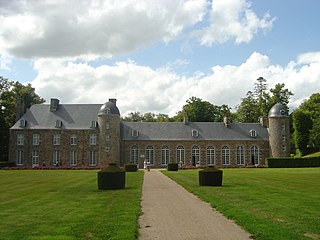
Pontécoulant is a commune in the Calvados department in the Normandy region in northwestern France.

La Villette is a commune in the Calvados department in the Normandy region in northwestern France.

Perrou is a commune in the Orne department in north-western France.

Souleuvre en Bocage is a commune in the department of Calvados, northwestern France. The municipality was established on 1 January 2016 by merger of the former communes of Beaulieu, Le Bény-Bocage, Bures-les-Monts, Campeaux, Carville, Étouvy, La Ferrière-Harang, La Graverie, Malloué, Montamy, Mont-Bertrand, Montchauvet, Le Reculey, Saint-Denis-Maisoncelles, Sainte-Marie-Laumont, Saint-Martin-des-Besaces, Saint-Martin-Don, Saint-Ouen-des-Besaces, Saint-Pierre-Tarentaine and Le Tourneur.

Valdallière is a commune in the department of Calvados, northwestern France. The municipality was established on 1 January 2016 by merger of the 14 former communes of Vassy, Bernières-le-Patry, Burcy, Chênedollé, Le Désert, Estry, Montchamp, Pierres, Presles, La Rocque, Rully, Saint-Charles-de-Percy, Le Theil-Bocage and Viessoix.

Juvigny Val d'Andaine is a commune in the department of Orne, northwestern France. The municipality was established on 1 January 2016 by merger of the former communes of La Baroche-sous-Lucé, Beaulandais, Juvigny-sous-Andaine, Loré, Lucé, Saint-Denis-de-Villenette and Sept-Forges.

Dialan sur Chaîne is a commune in the department of Calvados, northwestern France. The municipality was established on 1 January 2017 by merger of the former communes of Jurques and Le Mesnil-Auzouf.

Les Monts d'Aunay is a commune in the department of Calvados, northwestern France. The municipality was established on 1 January 2017 by merger of the former communes of Aunay-sur-Odon, Bauquay, Campandré-Valcongrain, Danvou-la-Ferrière, Ondefontaine, Le Plessis-Grimoult and Roucamps.

Terres de Druance is a commune in the department of Calvados, northwestern France. The municipality was established on 1 January 2017 by merger of the former communes of Lassy, Saint-Jean-le-Blanc and Saint-Vigor-des-Mézerets.
Haute vallée de l'Orne et affluents translated as the Upper Orne Valley and tributaries is a Natura 2000 conservation area that is 20,593 hectares in size. The site is managed by CPIE Collines normandes.
Haute Vallée de la Sarthe translated as the Upper Sarthe VAlley is a Natura 2000 conservation area that is 3,503 hectares in size.
Haute Vallée de la Touques et affluents translated as the Upper Touques valley and tributaries is a Natura 2000 conservation area that is 1,400 hectares in size.
Risle, Guiel, Charentonne is a Natura 2000 site around the rivers and valleys of the Risle, Charentonne, Guiel and their tributaries and valleys of these rivers.
Sites d'Ecouves is a Natura 2000 site within the Orne department. The protected area is based on the Cance River.
Vallée de l'Orne et ses affluents translated as Orne Valley and tributaries is a Natura 2000 conservation area that is 2,115 hectares in size.
Vallée du Sarthon et affluents translated as Sarthon Valley and tributaries is a Natura 2000 conservation area that is 5,255 hectares in size.
Alpes Mancelles is a Natura 2000 conservation area that is 1,190 hectares in size.
Bassin de l'Andainette translated as the Andainette basin is a Natura 2000 conservation area that is 1,024 hectares in size.
Forets, etangs et tourbieres du Haut-Perche translated as the Forests, ponds peat bogs of Haut-Perche is a Natura 2000 conservation area that is 3,670 hectares in size.
References
- 1 2 3 "INPN - FSD Natura 2000 - FR2500118 - Bassin de la Druance - Description".
- ↑ "Au fil de la Druance" (PDF) (in French). www.calvados-tourisme.com.
- ↑ "EUNIS -Site factsheet for Bassin de la Druance". eunis.eea.europa.eu.