The San Francisco Peninsula is a peninsula in the San Francisco Bay Area that separates San Francisco Bay from the Pacific Ocean. On its northern tip is the City and County of San Francisco. Its southern base is Los Altos, Mountain View, in Santa Clara County, south of Palo Alto and north of Sunnyvale and Los Altos. Most of the Peninsula is occupied by San Mateo County, between San Francisco and Santa Clara counties, and including the cities and towns of Atherton, Belmont, Brisbane, Burlingame, Colma, Daly City, East Palo Alto, El Granada, Foster City, Hillsborough, Half Moon Bay, La Honda, Loma Mar, Los Altos, Menlo Park, Millbrae, Mountain View, Pacifica, Palo Alto, Pescadero, Portola Valley, Redwood City, San Bruno, San Carlos, San Mateo, South San Francisco, and Woodside.

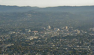
Palo Alto is a charter city in the northwestern corner of Santa Clara County, California, United States, in the San Francisco Bay Area, named after a coastal redwood tree known as El Palo Alto.

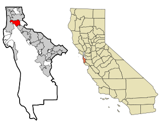
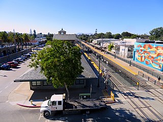
Menlo Park is a city at the eastern edge of San Mateo County within the San Francisco Bay Area of California, United States. It is bordered by San Francisco Bay on the north and east; East Palo Alto, Palo Alto, and Stanford to the south; and Atherton, North Fair Oaks, and Redwood City to the west. It had 33,780 residents at the 2020 United States census. It is home to the corporate headquarters of Meta, and is where Google, Roblox Corporation and Round Table Pizza were founded. The train station holds the record as the oldest continually operating train station in California. It is one of the most educated cities in California and the United States; nearly 70% of residents over 25 have earned a bachelor's degree or higher.

San Bruno is a city in San Mateo County, California, United States, incorporated in 1914. The population was 43,908 at the 2020 United States Census. The city is between South San Francisco and Millbrae, adjacent to San Francisco International Airport and Golden Gate National Cemetery; it is approximately 12 miles (19 km) south of Downtown San Francisco.

San Mateo is a city in San Mateo County, California, United States, on the San Francisco Peninsula. About 20 miles (32 km) south of San Francisco, the city borders Burlingame to the north, Hillsborough to the west, San Francisco Bay and Foster City to the east and Belmont to the south. The population was 105,661 at the 2020 census.

Caltrain is a California commuter rail line serving the San Francisco Peninsula and Santa Clara Valley. The southern terminus is in San Jose at Tamien station with weekday rush hour service running as far as Gilroy. The northern terminus of the line is in San Francisco at 4th and King Street. Caltrain has 28 regular stops, one limited-service weekday-only stop, one weekend-only stop (Broadway), and one football-only stop (Stanford). While average weekday ridership in 2019 exceeded 63,000, impacts of the COVID-19 pandemic have been significant: in August 2022, Caltrain had an average weekday ridership of 18,600 passengers.

SamTrans is a public transport agency in and around San Mateo, California, in the San Francisco Bay Area. It provides bus service throughout San Mateo County and into portions of San Francisco and Palo Alto. SamTrans also operates commuter shuttles to BART stations and community shuttles. Service is largely concentrated on the east side of the Santa Cruz Mountains, and, in the central county, I-280, leaving coast-side service south of Pacifica spotty and intermittent.

The Third Street Light Rail Project was the construction project that expanded the Muni Metro system in San Francisco, California, linking downtown San Francisco to the historically underserved southeastern neighborhoods of Bayview-Hunters Point and Visitacion Valley along the eastern side of the city. Construction was finished in late 2006, non-revenue weekend service began on January 13, 2007, and full service began on April 7, 2007. The new service, as the T Third Street Metro line, replaced the 15 Third bus line, which ran south from the Caltrain Depot at 4th and King streets, along Third Street and Bayshore Boulevard to the southeastern neighborhoods.

Millbrae station is an intermodal transit station serving Bay Area Rapid Transit (BART) and Caltrain, located in Millbrae, California. The station is the terminal station for BART on the San Francisco Peninsula, served by two lines: The Red Line before 9 pm and the Yellow Line during the early morning and evening. It is served by all Caltrain services. The station is also served by SamTrans bus service, Commute.org and Caltrain shuttle buses, and other shuttles.
Bay Meadows was a horse racing track in San Mateo, California from 1934 until 2008, in the San Francisco Bay Area in the United States.

South San Francisco station is a Caltrain station in South San Francisco, California. The station is on the east side of the Bayshore Freeway, east and south of the curved Grand Avenue overpass, and north of where the freeway crosses over the tracks. Downtown South San Francisco is to the west, across the freeway. It previously underwent a substantial modernization and expansion project, completed in January 2022.

San Mateo station is the northernmost of the three Caltrain stations in San Mateo, California. It is in downtown San Mateo.

Hillsdale station is one of three Caltrain stations in San Mateo, California. The station is next to the Bay Meadows neighborhood and close to the Hillsdale Shopping Center.
Throughout the history of Bay Area Rapid Transit, there have been plans to extend service to other areas.

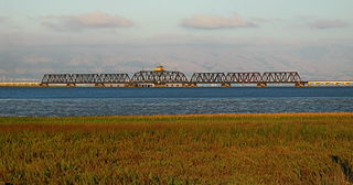
The Dumbarton Rail Corridor is a proposed transbay passenger rail line which would reuse the right-of-way that was initially constructed from 1907–1910 as the Dumbarton Cut-off. The Dumbarton Cut-off includes the first structure to span San Francisco Bay, the 1910 Dumbarton Rail Bridge, although the vintage Cut-off bridges would likely be replaced prior to activating new passenger service. Dumbarton Rail Corridor would provide service between Union City in the East Bay and Menlo Park on the Peninsula, with train service continuing to both San Francisco and San José along the existing Caltrain tracks. It has been in the planning stages since 1988, and would be the first above-ground transbay rail line since Key System electric trains stopped running on the lower deck of the Bay Bridge in 1958, and the first new transbay crossing of any kind since the completion of the Transbay Tube in 1974.

The Caltrain Express (CTX) project was implemented from 2002 to 2004 and led to the establishment of the Baby Bullet express service, which shortened the transit time between San Francisco and San Jose, and certain stations in between. New locomotives and rolling stock were purchased for dedicated express service, bypassing most stations; quad-track overtake sections were added in two locations along the Peninsula Corridor right-of-way to allow express trains to pass slower local trains that were making all stops; tracks were also upgraded with continuous-welded rail; a centralized traffic control system was added; and crossovers were added every few miles to allow single-tracking trains around disabled trains. Congresswoman Jackie Speier, then serving as a California State Senator, is credited with securing the funding for CTX and one of the new locomotives acquired for the project is named for her as a result. During commute hours, the Baby Bullet is up to 20% faster than driving south from San Francisco to San Jose.
The Downtown Rail Extension (DTX) is a planned second phase of the San Francisco Transbay Transit Center (TTC). When complete, it will extend the Caltrain Peninsula Corridor commuter rail line from its current northern terminus at 4th and King via a 1.3 mi (2.1 km) tunnel. The new terminus will be near the Financial District and will provide intermodal connections to BART, Muni, Transbay AC Transit buses, and long-distance buses. In addition, the California High Speed Rail Authority (CHSRA) plans to use DTX and the Caltrain-owned Peninsula Corridor for service on the CHSRA San Francisco–San Jose segment. Because DTX uses a long tunnel, current diesel locomotives are not suitable and the Caltrain Modernization Project (CalMod), which includes electrification of the line and acquisition of electrified rolling stock, is a prerequisite.
Stockbridge Capital Group is a private-equity real estate investment company based in San Francisco, led by Terry Fancher and Sol Raso. Currently, the company has over $33 billion in assets under management.

San Jose, California has various cycling routes on roads and trails used by both commuters and recreational riders. The city has plans to expand the current 285 miles (459 km) of bike lanes to 400 miles (640 km), and the current 60 miles (97 km) of trails to 100 miles (160 km). San Jose was ranked as a bronze-level bicycle-friendly community by the League of American Bicyclists.


