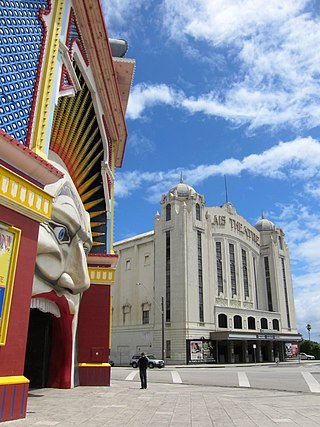
St Kilda is an inner seaside suburb in Melbourne, Victoria, Australia, 6 km south-east of the Melbourne central business district, located within the City of Port Phillip local government area. St Kilda recorded a population of 19,490 at the 2021 census.

St Kilda West is an inner suburb in Melbourne, Victoria, Australia, 5 km south of Melbourne's Central Business District, located within the City of Port Phillip local government area. St Kilda West recorded a population of 2,951 at the 2021 census.

Albert Park is an inner suburb of Melbourne, Victoria, Australia, 4 km (2.5 mi) south of Melbourne's Central Business District. The suburb is named after Albert Park, a large lakeside urban park located within the City of Port Phillip local government area. Albert Park recorded a population of 6,044 at the 2021 census.

Port Melbourne is an inner-city suburb in Melbourne, Victoria, Australia, 3 km (2 mi) south-west of the Melbourne central business district, located within the Cities of Melbourne and Port Phillip local government areas. Port Melbourne recorded a population of 17,633 at the 2021 census.

Brighton is a suburb in Melbourne, Victoria, Australia, 11 km south-east of Melbourne's Central Business District, located within the City of Bayside local government area. Brighton recorded a population of 23,252 at the 2021 census.

Elsternwick is an inner suburb in Melbourne, Victoria, Australia, 9 km south-east of Melbourne's Central Business District, located within the City of Glen Eira local government area. Elsternwick recorded a population of 10,887 at the 2021 census.

Mentone is a suburb in Melbourne, Victoria, Australia, 21 km south-east of Melbourne's Central Business District, located within the City of Kingston local government area. Mentone recorded a population of 13,197 at the 2021 census.

St Kilda Road is a street in Melbourne, Victoria, Australia. It is part of the locality of Melbourne which has the postcode of 3004, and along with Swanston Street forms a major spine of the city.

Nepean Highway is a major highway in Victoria, running south from St Kilda Junction in inner-southern Melbourne to Portsea, tracing close to the eastern shore of Port Phillip for the majority of its length. It is the primary road route from central Melbourne through Melbourne's southern suburbs. This name covers a few consecutive roads and is not widely known to most drivers except for its central section, as the entire allocation is still best known by the names of its constituent parts: St Kilda Road, Brighton Road and Nepean Highway proper, and Point Nepean Road. This article will deal with the entire length of the corridor for sake of completion, as well to avoid confusion between declarations.

Elwood is an inner suburb in Melbourne, Victoria, Australia, 8 km south-east of Melbourne's Central Business District, located within the City of Port Phillip local government area. Elwood recorded a population of 15,153 at the 2021 census.

Beaumaris is a suburb in Melbourne, Victoria, Australia, 20km south-east of Melbourne's Central Business District, located within the City of Bayside local government area. Beaumaris recorded a population of 13,947 at the 2021 census.

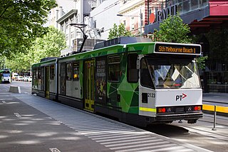
Melbourne tram route 1 is operated by Yarra Trams on the Melbourne tram network from East Coburg to South Melbourne Beach. The 13.2-kilometre (8.2 mi) route is operated out of Brunswick depot with Z and B class trams.

Beaumaris Bay is a minor short but wide bay within the eastern shore of Port Phillip Bay in Victoria, Australia. It commences at the cliffs of Rickett's Point in the southern end of the Melbourne suburb of Beaumaris, then recesses north briefly alongside Mentone Beach in Mentone before stretching south through a string of suburban beaches along Parkdale, Mordialloc, Aspendale, Edithvale, Bonbeach, Carrum and Seaford, and ends at a small headland near the Olivers Hill boat ramp at the junction between Frankston and Mount Eliza. The main tributary streams draining into the bay are Mordialloc Creek, Patterson River, Kananook Creek and Sweetwater Creek.

Melbourne tram route 3 is operated by Yarra Trams on the Melbourne tram network from Melbourne University to Malvern East. The 14.9-kilometre (9.3 mi) route is operated out of Glenhuntly depot with Z and B class trams. On weekends route 3 operates as route 3a and diverts via St Kilda Beach.

Melbourne tram route 64 is operated by Yarra Trams on the Melbourne tram network from Melbourne University to Brighton East. The 18.1 kilometre route is operated out of Glenhuntly depot with Z and B class trams.
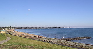
St Kilda Beach is a beach located in St Kilda, Port Phillip, Victoria, Australia, 6 kilometres (3.7 mi) south from the Melbourne city centre. It is Melbourne's most famous beach. The beach is a sandy beach about 700 metres (2,300 ft) long between St Kilda Marina and St Kilda Harbour along Jacka Boulevard and St Kilda Esplanade. It is located at the north-east corner of Port Phillip and is protected from ocean swell, though still affected by strong westerly winds. With Port Phillip Bay being open to the sea, St Kilda Beach is subject to regular tides.

Fitzroy Street is the major thoroughfare of the beachside Melbourne suburb of St Kilda. Its fortunes have risen and fallen along with that of St Kilda itself, from wealthy residential district to a popular working and middle class beachside entertainment district, to cheap and seedy, and popular again in the late 20th century. In recent years Fitzroy Street itself has gone from a popular restaurant strip to the situation in 2017 where only a few restaurants remain amongst kebab shops and convenience stores catering the backpackers and many empty shopfronts. It is named after Charles Augustus FitzRoy, Governor of New South Wales in 1842 when St Kilda was first subdivided.
The Melbourne tram network began in 1884 with the construction of the Fairfield Horse Tramway. However, the purpose of the line was to increase land prices in the area, and it soon closed during the depression in 1890. The first genuine attempt to construct a tramway network was the construction of the Richmond cable tram line by the Melbourne Tramway & Omnibus Company in 1885. Over the next few years, 16 more cable tram lines were constructed, as well as numerous other horse tramways. The depression of the early 1890s slowed further expansion of the cable network. The first electric tram line was the Box Hill and Doncaster tramway which opened in 1889. This was a pioneering line in what was then the countryside and thus didn't receive much patronage. It closed in 1896. The next attempt at an electric tramway was Victorian Railways' St Kilda to Brighton line, which opened in 1906. Later that year, the North Melbourne Electric Tramway & Lighting Company opened lines to Essendon and Maribyrnong. Many local councils formed their own tramway trusts and built tramways within their own constituency. The most successful of these was the Prahran & Malvern Tramways Trust.

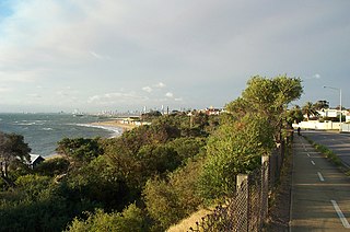
The Bay Trail is a shared use path for cyclists and pedestrians which follows the coastline of Port Phillip Bay through the south-eastern suburbs of Melbourne, Victoria, Australia.


