Beaminster Down

Last updated

Beaminster Down
Beaminster Down viewed from the Monarch's Way - geograph.org.uk - 529371.jpg
Beaminster Down viewed from the Monarch's Way looking southwest
Highest point
Elevation 244 m (801 ft) [1]
Listing Hills of Dorset
Coordinates 50°49′42″N2°43′02″W / 50.8283°N 2.71711°W / 50.8283; -2.71711
Geography
Dorset UK relief location map.jpg
Red triangle with thick white border.svg
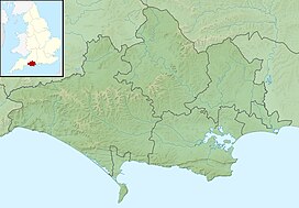
Beaminster Down
Dorset, England
Parent range Dorset Downs
OS grid ST493033
Topo map OS Landranger No. 194

At 244 metres, Beaminster Down is one of the highest hills in West Dorset, England.

Contents

Location

Beaminster Down is common land on the Dorset Downs and overlooks the steep scarp slope above the town of Beaminster, [2] which is about a mile and a half to the southwest. The hill is crossed by two long-distance trails, two minor roads and several other tracks. [1]

History

There is evidence of prehistoric settlement on in the form of tumuli to the northeast. [1] Grenade practice took place in the sandbagged, zig-zag trenches on Beaminster Down during the Second World War. [3]

Related Research Articles

<span class="mw-page-title-main">Dorset</span> County of England

Dorset is a ceremonial county in South West England. It is bordered by Somerset to the north-west, Wiltshire to the north and the north-east, Hampshire to the east, the Isle of Wight across the Solent to the south-east, the English Channel to the south, and Devon to the west. The largest settlement is Bournemouth, and the county town is Dorchester.

<span class="mw-page-title-main">Bridport</span> Town in Dorset, England

Bridport is a market town in Dorset, England, 2 miles (3.2 km) inland from the English Channel near the confluence of the River Brit and its tributary the Asker. Its origins are Saxon and it has a long history as a rope-making centre. On the coast and within the town's boundary is West Bay, a small fishing harbour also known as Bridport Harbour.

<span class="mw-page-title-main">Beaminster</span> Human settlement in England

Beaminster is a town and civil parish in Dorset, England, situated in the Dorset Council administrative area approximately 15 miles (24 km) northwest of the county town Dorchester. It is sited in a bowl-shaped valley near the source of the small River Brit. The 2013 mid-year estimate of the population of Beaminster parish is 3,100.

<span class="mw-page-title-main">West Dorset</span> Former non-metropolitan district in England

West Dorset was a local government district in Dorset, England. The district was formed on 1 April 1974 under the Local Government Act 1972, and was a merger of the boroughs of Bridport, Dorchester and Lyme Regis, along with Sherborne urban district and the rural districts of Beaminster, Bridport, Dorchester and Sherborne. Its council was based in Dorchester.

<span class="mw-page-title-main">Dorset Downs</span>

The Dorset Downs are an area of chalk downland in the centre of the county Dorset in south west England. The downs are the most western part of a larger chalk formation which also includes Cranborne Chase, Salisbury Plain, Hampshire Downs, Chiltern Hills, North Downs and South Downs.

<span class="mw-page-title-main">Rampisham</span> Village in Dorset, England

Rampisham is a village and civil parish in the county of Dorset in southern England, situated approximately 11 miles (18 km) northwest of the county town Dorchester. The village is sited on greensand in a valley surrounded by the chalk hills of the Dorset Downs. The parish includes the hamlet of Uphall northwest of the main village.

<span class="mw-page-title-main">Seaborough</span> Human settlement in England

Seaborough is a small village and civil parish in the county of Dorset in southwest England. It is sited in the valley of the River Axe and lies approximately 2 miles (3.2 km) south of Crewkerne in Somerset. The parish was previously part of the hundred of Crewkerne, but was transferred to within Dorset in 1896. In 2013 the estimated population of the civil parish was 60.

<span class="mw-page-title-main">Stoke Abbott</span> Human settlement in England

Stoke Abbott is a village and civil parish in west Dorset, England, 2 miles (3.2 km) west of Beaminster. In 2013 the estimated population of the parish was 190.

<span class="mw-page-title-main">Lewesdon Hill</span> Hill and hill fort in south west Dorset, England

Lewesdon Hill is a hill in west Dorset, England. With a maximum elevation of 279 m (915 ft), it is the highest point in Dorset.

<span class="mw-page-title-main">Waddon Hill</span> Hill in Dorset, England

Waddon Hill is a hill and the site of an old Roman fort near Beaminster, in the English county of Dorset. The name Waddon is from the Old English meaning wheat hill.

<span class="mw-page-title-main">Saint-James</span> Commune in Normandy, France

Saint-James is a commune in the Manche department in Normandy in north-western France. On 1 January 2017, the former communes of Argouges, Carnet, La Croix-Avranchin, Montanel, Vergoncey and Villiers-le-Pré were merged into Saint-James.

<span class="mw-page-title-main">Blackdown, Dorset</span> Human settlement in England

Blackdown is a small village in western Dorset, England; situated 7 miles (11 km) west of Beaminster. With the creation of the new Dorset Council, Blackdown is now part of the new Marshwood Vale Ward. The local travel links are located 5 miles (8.0 km) from the village to Crewkerne railway station and 25 miles (40 km) to Exeter International Airport. The main road through the village is the B3165, connecting Blackdown and Lyme Regis. The village has a population of 128 according to the 2001 Census. The village and surrounding area makes up the Blackdown ward of the Broadwindsor Group Parish Council which besides the few houses in Blackdown includes Kittwhistle, Templeman's Ash (part), Laymore (part), Coles Cross, Causeway Lane, Venn, Southcoombe, Stoney Knapp, Schoolhouse Lane, Speckets Lane, Racedown, Cockpit, Horn Ash, Berechapel, two houses in Synderford, some houses in Birdsmoregate including the old Rose & Crown Public House now a private residence. The area is split between many postcodes partly due to the County boundary being realigned in the 1960s. Residents have postcodes with the main town as either Beaminster, Bridport, Crewkerne or Chard. Divisions also arise within telephone exchange areas, the BT phone box was removed from the centre of Blackdown in March 2017. Water services are provided by either South West Water or Wessex Water.

<span class="mw-page-title-main">East Chelborough</span> Human settlement in England

East Chelborough is a small village and civil parish 7 miles (11 km) north-east of Beaminster in Dorset, England. Dorset County Council estimated in 2013 that the population of the parish was 50.

<span class="mw-page-title-main">Beaminster Tunnel</span>

Beaminster Tunnel or Horn Hill Tunnel is a 345-foot-long (105 m) road tunnel on the A3066 road between Beaminster and Mosterton in Dorset, England. The tunnel was constructed between 1830 and 1832; it was one of the first road tunnels built in Britain, and is the only pre-railway road tunnel in the country still in use. It was built to take a toll road underneath a steep hill to the north of Beaminster and make it easier for horse-drawn traffic to travel from the coast to the hinterland of Dorset. It underwent significant repairs in 1968 and again in 2009, but in 2012 a torrential rainstorm caused a landslide that resulted in the partial collapse of the tunnel's north entrance and the deaths of two people.

<span class="mw-page-title-main">Weston Hill</span> Hill in Dorset, England

Weston Hill is a hill, 250 metres (820 ft) high, on the A 356, 1 kilometre west of Corscombe in the county of Dorset in southern England. It is located within the Dorset Downs. It is named after the hamlet of Weston to the northeast.

<span class="mw-page-title-main">Beaminster Grammar School</span> Grammar school in Beaminster, Dorset, England

Beaminster Grammar School, known in its final years as Beaminster and Netherbury Grammar School, was a small grammar school in the town of Beaminster, in Dorset, England, founded about 1868 and closed in 1962.

<span class="mw-page-title-main">Beaminster School</span> Voluntary controlled school in Beaminster, Dorset, England

Beaminster School is a co-educational secondary school and sixth form located in Beaminster in the English county of Dorset.

Jonah Ananias Paul Ayunga is an English-Kenyan professional footballer who plays as a winger for St. Mirren.

<span class="mw-page-title-main">2020 Wareham Forest fire</span> Forest fire in England

The 2020 Wareham Forest fire was a wildfire in Wareham Forest, Dorset, in May 2020. It destroyed over 220 Hectares of the heathland, and was described "one of the most devastating fires in Dorset, in living memory" by Dorset and Wiltshire Fire and Rescue Service.

References

  1. 1 2 3 Ordnance Survey 1:50,000 Landranger series.
  2. "Beaminster Down". common-land.com. Retrieved 29 March 2013.
  3. "Beaminster at war". dorsetlife.co.uk. Retrieved 29 March 2013.