List of hills of Dorset

Last updated

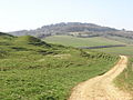
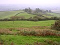
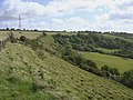
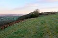
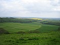
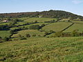
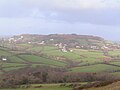
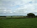
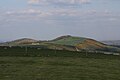
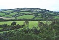
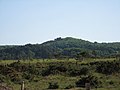
This is a list of hills in Dorset. Many of these hills are important historical, archaeological and nature conservation sites, as well as popular hiking and tourist destinations in the county of Dorset in southern England.

Contents

Colour key

ClassProminence
Marilyns 150 – 599 m
HuMPs 100 – 149 m
TuMPs 30 – 99 m
Unclassified0 – 29 m

The table is colour-coded based on the classification or "listing" of the hill. The two types that occur in Dorset are Marilyns, HuMPs and TuMPs, listings based on topographical prominence. "Prominence" correlates strongly with the subjective significance of a summit. Peaks with low prominences are either subsidiary tops of a higher summit or relatively insignificant independent summits. Peaks with high prominences tend to be the highest points around and likely to have extraordinary views. A Marilyn is a hill with a prominence of at least 150 metres or about 500 feet. [1] A "HuMP" (the acronym comes from "Hundred Metre Prominence) is a hill with a prominence of at least 100 but less than 150 metres. [2] In this table Marilyns are in beige and HuMPs in lilac. The term "sub-Marilyn" or "sub-HuMP" is used, e.g. in the online Database of British and Irish Hills to indicate hills that fall just below the threshold. To qualify for inclusion, hills must either be 200 metres or higher with a prominence of at least 30 metres, below 200 metres with a prominence of at least 90 metres (the threshold for a sub-HuMP) or be in some other way notable. For further information see the Lists of mountains and hills in the British Isles and the individual articles on Marilyns, HuMPs and TuMPs. By way of contrast, see also the article listing Tumps (a traditional term meaning a hillock, mound, barrow or tumulus).

The county top (i.e. highest point) of Poole unitary authority is not strictly in the county of Dorset, but is included for interest because it falls within Dorset's historic county boundary.

List of hills

HillHeight (m)Prom. (m)Grid ref.ClassParentRange/RegionRemarksImage
Lewesdon Hill [3] 279185 ST437012 Marilyn Staple Hill, Somerset Marshwood & Powerstock Vales Dorset's county top.

One of Dorset's 4 Marilyns.
Iron Age hill fort.

Track to Stoke Knapp Farm from Chart Knolle - geograph.org.uk - 1232636.jpg
Pilsdon Pen [4] 27783 ST413011 TuMP Lewesdon Hill Marshwood & Powerstock Vales Dorset's second highest summit.

For many years thought to be Dorset's highest point.
Iron Age hill fort.

Pilsdon.jpg
Bulbarrow Hill [3] 274141 ST777055 HuMP,

sub-Marilyn

Lewesdon Hill Dorset Downs Rawlsbury Camp, Iron Age hill fort.

Paragliding site.

Bulbarrow Hill and Balmers Coombe Bottom - geograph.org.uk - 57825.jpg
Telegraph Hill [3] 267121 ST644050 HuMP Lewesdon Hill Dorset Downs Paragliding site. Telegraph Hill - geograph.org.uk - 1120127.jpg
Melbury Hill [5]
(Melbury Beacon [6] [7] )
26366 ST873197 [8] TuMP Win Green [9] Cranborne Chase Near Melbury Abbas.

Trig point on summit
National Trust wood on western flank above A 350.

View from Melbury Beacon - geograph.org.uk - 358553.jpg
Breeze Hill [6] [5] [10] 26220 ST899204 [5] Unclassified Win Green [5] Cranborne Chase [11] Striking ridgeline above Zig Zag Hill near Melbury Abbas

with sweeping views over Blackmore Vale
W (Dorset) end of Win Green ridge

Clump on Breeze Hill - geograph.org.uk - 620319.jpg
Lyscombe Hill [3] 262100 ST738029 HuMP Telegraph Hill Dorset Downs Hill fort on Nettlecombe Tout (N spur) Lyscombe Bottom near Higher Melcombe 1 - geograph.org.uk - 466403.jpg
Watts Hill [7] 26269 ST673036 TuMP Lewesdon Hill Dorset Downs Just above Minterne Parva and E of the A352 Dorchester to Middlemarsh road Watts Hill - geograph.org.uk - 1180197.jpg
Lambert's Castle Hill [3] 258121 SY370988 HuMP Lewesdon Hill Blackdowns Site of Lambert's Castle - Iron Age hill fort Lambert's Castle 1.jpg
Bell Hill [6] [7] 25850 ST800082 [8] TuMP Lewesdon Hill [9] Dorset Downs Nr Turnworth, 5 miles W of Blandford Forum.
Paragliding site.
Bell Hill - geograph.org.uk - 373443.jpg
Eggardon Hill [3] [5] 252117 SY546944 HuMP Telegraph Hill Marshwood & Powerstock Vales Western extremity of the South Dorset Downs.

Hill fort
Paragliding site

Eggardon Hill from southwest.JPG
Toller Down [4] 25296 SY518031 [3] TuMP, sub-HuMP Lewesdon Hill [9] Dorset Downs Just SW of A356 near Corscombe Toller Down - geograph.org.uk - 558588.jpg
Ball Hill [6] [7] 251 [5] 74 ST721034 [8] TuMP Lewesdon Hill [9] Dorset Downs Above Folly (paragliding site), 9 miles N of Dorchester. Ball Hill - geograph.org.uk - 1322619.jpg
Dogbury Hill [6] [10] 24813 ST660051 [5] Unclassified Watts Hill [5] Blackmore Vale Hill fort site nr Minterne Magna on the A 352

NW spur of Watts Hill.

Countryside near Minterne Magna - geograph.org.uk - 1120453.jpg
Black Down [7] 24278 SY611876 [5] TuMP Lewesdon Hill South Dorset Downs Site of the Hardy Monument.
2 km NE of Portesham.
Hardy's Monument - geograph.org.uk - 1022562.jpg
West Hill [6] [7] 22463 ST566042 [5] TuMP Lewesdon Hill [9] Dorset Downs SW of Evershot, near the A 37 West Hill Evershot from the W.JPG
Coney's Castle [6] [10] 22217 SY371979 Unclassified Lambert's Castle Hill Blackdowns Iron Age hill fort at SY372975 (ca. 210 m [5] or 205 m [6] ) Coney's Castle - geograph.org.uk - 475966.jpg
Drackenorth [12] [7] 22160 SY532985 [7] TuMP Lewesdon Hill [9] Dorset Downs 3 km NNE of Powerstock on the Jubilee Trail Signpost - Mount Pleasant - geograph.org.uk - 1284313.jpg
Rampisham Down [6] [10] 2198 ST544014 [5] Unclassified Toller Down Dorset Downs By A 356, about 12 km NW of Dorchester.

SE extension of Toller Down ridge.
Former transmission site for BBC World Service.

Rampisham Down - geograph.org.uk - 560820.jpg
Bubb Down Hill [6] [5] [7] 21740 ST592060 [5] TuMP Lewesdon Hill [9] Dorset Downs Just E of A 37, about 10 km S of Yeovil Batcombe Hill - geograph.org.uk - 912239.jpg
Abbotsbury Castle [6] [10] 21520 SY555866 [13] Unclassified Black Down South Dorset Downs Iron Age hill fort site.
Trig point at summit.

Part of Black Down ridge.

Abbotsbury Castle from Tulks Hill - geograph.org.uk - 758981.jpg
Warren Hill [7] 21551 SY526994 [8] TuMP Lewesdon Hill [9] Dorset Downs Location of Hooke Park Burnt Bottom - geograph.org.uk - 558820.jpg
Blackdown Hill [7] 21534 ST395038 [8] TuMP Lewesdon Hill [9] Blackdown Hills 8 km SW of Crewkerne, just NW of Pilsdon Pen Pasture land, north of the B3164 - geograph.org.uk - 971123.jpg
Conegar Hill [7] 21447 ST439032 [8] TuMP Lewesdon Hill [9] Yeovil Scarplands 500 m N of Broadwindsor Blagdon Hill - geograph.org.uk - 659099.jpg
Waddon Hill [7] 21335 ST448015 [8] TuMP Lewesdon Hill [9] Marshwood & Powerstock Vales Site of old Roman fort (Waddon Hill Fort, 207 m [6] ) near Beaminster. Waddon Hill - geograph.org.uk - 1030076.jpg
Payne's Down [7] 21162 ST385012 [8] TuMP Lewesdon Hill [9] Marshwood & Powerstock Vales 10 km ENE of Axminster Headwater valleys of the Blackwater - geograph.org.uk - 478348.jpg
Bookham Knoll [7] 21143 ST702046 [8] TuMP Lewesdon Hill [9] Dorset Downs 1 km SE of Buckland Newton Horse Close Wood Alton Common - geograph.org.uk - 669595.jpg
Duncliffe Hill [4] 21096 ST826226 [3] TuMP, sub-HuMP Win Green [3] Blackmore Vale Iron Age hill fort site. Duncliffe Hill 20071031.jpg
Swyre Head [3] 208150 SY934784 sub-Marilyn, HuMP, TuMP, Clem Lewesdon Hill Purbeck Hills On Dorset coast E of Durdle Door.
Tumulus on summit.
Paragliding site.
Swyre Head from St Aldhelm's Head.JPG
Hardown Hill [3] 207154 SY405942 Marilyn Lewesdon Hill Marshwood & Powerstock Vales One of Dorset's 4 Marilyns. Hardown Hill - geograph.org.uk - 1184418.jpg
Seaborough Hill [7] 20480 ST429071 [8] TuMP Lewesdon Hill [8] Yeovil Scarplands 2 km SW of Crewkerne on the Somerset-Dorset border Farmland around Axe River Valley from Seaborough Hill - geograph.org.uk - 556007.jpg
Nine Barrow Down [3] 199152 SZ007811 Marilyn Lewesdon Hill Purbeck Hills One of Dorset's 4 Marilyns.
Views of Poole Harbour.
Nine Barrow Down.jpg
Ridgeway Hill [3] [5] 199107 SY914817 HuMP Swyre Head Purbeck Hills Ridgeway Hill from Povington Hill.JPG
Chardown Hill [7] 19468 SY396936 TuMP Hardown Hill South Dorset Downs Dorset coast, E of Charmouth.

Stonebarrow Hill is its SW spur.

Chardown Hill - geograph.org.uk - 1454478.jpg
Creech Barrow Hill [14] [7] 19338 SY921823 TuMP Swyre Head Dorset Heaths One of Dorset's most distinctive landmarks. [14]

Highest point of the Heaths.
Largest Tertiary hill in England. [15]
Site of round barrow. [16]

Creech Barrow - geograph.org.uk - 1334661.jpg
Hambledon Hill [4] 192131 ST845125 HuMP Win Green [3] Cranborne Chase Prehistoric hill fort site.
Tumulus on summit.
Hambledon Hill 20080926.jpg
Golden Cap [6] [7] 19163 SY384934 TuMP Hardown Hill [9] South Dorset Downs Highest point on the south coast of England. Golden Cap from Charmouth - geograph.org.uk - 1184579.jpg
Chaldon Hill [4] 17890 SY783812 [5] (est.)sub-HuMP Lewesdon Hill [9] South Dorset Downs Dorset coast, W of Swyre Head and Lulworth Cove.
Tumulus at summit.
Old Navigation Beacon Chaldon Down - geograph.org.uk - 1529123.jpg
Bindon Hill [4] 16894 SY839802 TuMP, sub-HuMP Lewesdon Hill [9] South Dorset Downs Dorset coast, immediately E of Lulworth Cove East end of Bindon Hill from Arish Mell gap - geograph.org.uk - 222057.jpg
The Verne [3] 147140 SY692737 HuMP Lewesdon Hill Isle of Portland Summit occupied by HM Prison, Verne Seaward side of The Verne - geograph.org.uk - 432967.jpg
Maiden Castle [7] 13439 SY671884 [8] TuMP Lewesdon Hill [9] South Dorset Downs Largest hill fort in Britain
2.5 kilometres (1.6 mi) south west of Dorchester.
Aerial photograph of Maiden Castle, 1935.jpg
Hambury Tout [5] [7] 13435 SY815802 [5] TuMP Lewesdon Hill [9] South Dorset Downs 
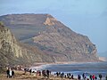
Dorset coast, immediately W of Lulworth Cove.
Most popular route to Durdle Door.
Trig point at summit; tumuli nearby.
OS Landranger map gives ht as "134 (138)" metres.
Hambury Tout from hills above Lulworth Cove - geograph.org.uk - 432348.jpg
Colmer's Hill [5] 12735 SY440936 [5] TuMP Hardown Hill Marshwood Vale The local hill of Symondsbury.
Obvious summit.
Colmer's Hill.jpg
Corfe Hills [4] 782 SY998966 None Lewesdon Hill Dorset Heaths Poole's county top, i.e. highest point in Poole unitary authority. Mobile Phone Mast, Corfe Hills School. - geograph.org.uk - 370775.jpg

Footnotes:

1. Ferranti's Summit Listings by Relative Height does not list Ridgeway Hill but suggests that the highest point of this stretch of the Purbecks is Povington Hill (198 m, drop 107 m). However, the current Ordnance Survey Landranger map (No. 194) agrees with Jackson (2009), which gives Ridgeway Hill as the highest point in the area at 199 m (drop 107 m).

2. The following summits listed by the North Dorset Ramblers have been omitted from the table as they are considered sub-peaks or alternative names of hills in the main list:

See also

References and footnotes

  1. Dawson, Alan (1992). The Relative Hills of Britain. Milnthorpe: Cicerone Press. ISBN   1-85284-068-4. Archived from the original on 21 September 2010.
  2. Jackson, Mark. "More Relative Hills of Britain" (PDF). Relative Hills of Britain. Archived from the original (PDF) on 12 October 2013. Retrieved 31 March 2013.
  3. 1 2 3 4 5 6 7 8 9 10 11 12 13 14 15 Name, height, prominence, grid, class and parent data from: Jackson, Mark (2009). More Relative Hills of Britain, Marilyn News Centre, UK, p. 168. E-book Archived 2013-10-12 at the Wayback Machine .
  4. 1 2 3 4 5 6 7 Name, height, prominence, grid and class data from Database of British and Irish Hills - Dorset. Accessed on 23 Mar 2013.
  5. 1 2 3 4 5 6 7 8 9 10 11 12 13 14 15 16 17 18 19 20 21 22 23 24 25 Ordnance Survey 1:50,000 Landranger map series online at Database of British and Irish Hills
  6. 1 2 3 4 5 6 7 8 9 10 11 12 13 14 15 16 17 Name and height from Going High in Dorset. Accessed on 23 Mar 2013.
  7. 1 2 3 4 5 6 7 8 9 10 11 12 13 14 15 16 17 18 19 20 21 Prominence from Summit Listings by Relative Height by Jonathan de Ferranti. Accessed on 25 Mar 2013.
  8. 1 2 3 4 5 6 7 8 9 10 11 12 Grid reference from Summit Listings by Relative Height by Jonathan de Ferranti. Accessed on 25 Mar 2013.
  9. 1 2 3 4 5 6 7 8 9 10 11 12 13 14 15 16 17 18 Parent peak from Summit Listings by Relative Height by Jonathan de Ferranti. Accessed on 25 Mar 2013.
  10. 1 2 3 4 5 Prominence estimated from Ordnance Survey 1:50,000 Landranger series
  11. The face of Dorset — Cranborne Chase at www.dorsetlife.co.uk. Accessed on 23 Mar 2013.
  12. Ordnance Survey Open Street Map
  13. Abbotsbury Castle at www.megalithic.co.uk. Accessed on 23 Mar 2013.
  14. 1 2 The Purbeck Volcano at www.dorsetlife.co.uk. Accessed on 3 Apr 2013.
  15. Dorset Heaths - Natural Area Profile by English Nature. Accessed on 3 Apr 2013.
  16. Creech Barrow at www.themodernantiquarian.com. Accessed on 3 Apr 2013.
  17. Name and grid from geodata.us
  18. Sidling Saint Nicholas at www.sydlingstnicholas.org.uk. Accessed on 23 Mar 2013.

Related Research Articles

<span class="mw-page-title-main">Ridgeway Hill</span> Hill in Dorset, England

Ridgeway Hill, also referred to as Grange Hill or Steeple Hill, is the third highest point of the Purbeck Hills in the county of Dorset standing at 199 metres (653 ft), is one of the only hills with a prominence of over a hundred metres, HuMPs, in the county. Near the top of the hill is an 18th-century folly known as Grange Arch, built by the former owner of Creech Grange, Denis Bond. On the eastern spur of the hill is Stonehill Down which is now a nature reserve. There are also good views of Swyre Head on the Jurassic Coast.

<span class="mw-page-title-main">Bell Hill, Dorset</span> Hill in Dorset, England

At 258 metres, Bell Hill is one of the highest hills in the county of Dorset, England and a high point on the Wessex Ridgeway.

<span class="mw-page-title-main">Toller Down</span> Hill in Dorset, England

Toller Down is one of the highest hills in the county of Dorset, England. It stands 252 metres high and is just 200 metres west of the main A356 road from Dorchester to Crewkerne. It is part of the Dorset Downs. Its prominence of just under 100 metres classifies it as a sub-HuMP.

<span class="mw-page-title-main">Ball Hill, Dorset</span>

At 251 metres, Ball Hill is one of the highest hills in the county of Dorset, England, and is on the Wessex Ridgeway.

<span class="mw-page-title-main">Watts Hill</span> Hill in Dorset, England

Watts Hill is a hill in the Dorset Downs and one of the highest in the county of Dorset, England. The height of the summit is variously recorded as 261 metres or 262 metres.

<span class="mw-page-title-main">Creech Barrow Hill</span>

Creech Barrow Hill is a steep, conical hill, 193 metres (633 ft) high, near the coast of Dorset, England, and the highest point of the Dorset Heaths. It has been described as "one of Dorset's most distinctive landmarks." Geologically, it is also the highest Cenozoic hill in England.

<span class="mw-page-title-main">West Hill, Dorset</span> Hill in Dorset, England

West Hill is a prominent hill, 224 metres (735 ft) high, just to the west of the village of Evershot in the county of Dorset in southern England. Its prominence of 63 metres (207 ft) means it is listed as one of the Tumps. It is located within the Dorset Downs.

<span class="mw-page-title-main">Drackenorth</span>

Drackenorth or Drakenorth is a prominent hill, 221 metres (725 ft) high, 3 km NNE of Powerstock on the Jubilee Trail in the county of Dorset in southern England. Its prominence of 61 metres (200 ft) means it is listed as one of the Tumps. It is located within the Dorset Downs.

<span class="mw-page-title-main">Chardown Hill</span>

Chardown Hill is a prominent, rounded hill, 194 metres (636 ft) high, just to the southwest of the village of Morcombelake in the county of Dorset in southern England. It overlooks the Dorset coast around 1½ kilometres to the south. Its prominence of 63 metres (207 ft) means it is listed as one of the Tumps. It is located within the South Dorset Downs.

<span class="mw-page-title-main">Blackdown Hill, Dorset</span>

Blackdown Hill is a prominent elevation, 215 metres (705 ft) high, 5 miles (8.0 km) south west of the town of Crewkerne, in the county of Dorset in the south west of England. Its prominence of 34 metres (112 ft) means it is listed as one of the Tumps. It runs parallel to the B3165 towering over the village of Blackdown and hamlet of Kittwhistle at the foot of the eastern flanks of the ridge.

<span class="mw-page-title-main">Bookham Knoll</span>

Bookham Knoll is a rounded hill, 211 metres (692 ft) high, about 1 kilometre southeast of the village of Buckland Newton in the county of Dorset in southern England. Its prominence of 43 metres (141 ft) qualifies it as one of the Tumps. It is located within the Dorset Downs.

<span class="mw-page-title-main">Seaborough Hill</span>

Seaborough Hill is a prominent ridge, 204 metres (669 ft) high, on the Dorset-Somerset border in the Yeovil Scarplands in southwestern England. It has a prominence of 80 metres (260 ft) which classifies it as one of the Tumps.

<span class="mw-page-title-main">Povington Hill</span> Hill in Dorset, England

Povington Hill, at 198 metres (650 ft) high, is one of the highest points on the chain of the Purbeck Hills in south Dorset on the southern coast of England. Its prominence of 107 metres (351 ft) means it is listed as one of the Tumps, although map sources suggest this honour should go to Ridgeway Hill further east.