
Alton Pancras is a small village and civil parish in Dorset, England. In the 2011 census the civil parish had a population of 175.

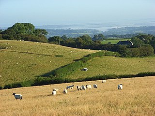
Cheselbourne is a village and civil parish in Dorset, England, situated in the Dorset Downs, 7 miles (11 km) north-east of Dorchester. The parish is at an altitude of 75 to 245 metres and covers an area of 1,175 hectares ; the underlying geology is chalk. In the 2011 census the parish had a population of 296.
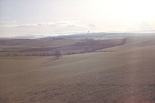
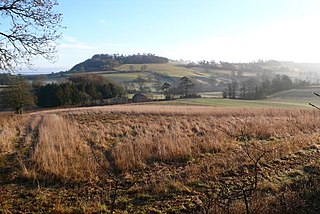
The Dorset Downs are an area of chalk downland in the centre of the county Dorset in south west England. The downs are the most western part of a larger chalk formation which also includes Cranborne Chase, Salisbury Plain, Hampshire Downs, Chiltern Hills, North Downs and South Downs.

Long Bredy is a village and civil parish in the county of Dorset in south-west England, situated approximately 7 miles (11 km) west of the county town Dorchester. It is sited in the valley of the small River Bride, beneath chalk hills of the Dorset Downs. In the 2011 census the parish had a population of 208.

Powerstock is a village and civil parish in south west Dorset, England, situated in a steep valley on the edge of the Dorset Downs, 5 miles (8 km) north-east of the market town of Bridport. The civil parish includes the village of West Milton to the west and the summit and northern slopes of Eggardon Hill to the south-east. Powerstock village contains many cottages and two inns: The Three Horseshoes near the church and The Marquis of Lorne Inn on the other side of the valley in a small hamlet called Nettlecombe. The small Mangerton River runs through the valley.

Golden Cap is a hill and cliff situated on the English Channel coast between Bridport and Charmouth in Dorset, England. At 191 metres (627 ft), it is arguably the highest point near the south coast of Great Britain and is visible for tens of miles along the coastline. It is accessible via a coastal footpath from Seatown, and takes around 40 minutes to reach the summit.
Cranborne Chase is an area of central southern England, straddling the counties Dorset, Hampshire and Wiltshire. It is part of the Cranborne Chase and West Wiltshire Downs Area of Outstanding Natural Beauty (AONB).
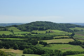
Lewesdon Hill is a hill in west Dorset, England. With a maximum elevation of 279 m (915 ft), it is the highest point in Dorset.

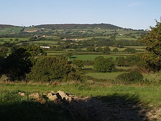
Hardown Hill is a hill between Ryall and Morcombelake in the county of Dorset, England. It rises west of the South Dorset Downs, close to the Dorset coast, and overlooks the Marshwood Vale to the north. Its prominence qualifies it as one of Dorset's four Marilyns and it is listed as one of the "top 12 Dorset views to take your breath away" by Dorset's official tourist website.
Lambert's Castle Hill rises between the villages of Marshwood and Fishpond Bottom in the county of Dorset, England. It is part of the South Dorset Downs and its prominence qualifies it as one of the so-called HuMPs.

Black Down is a hill on the South Dorset Ridgeway about 2 kilometres north-northeast of the village of Portesham in the county of Dorset, England and around 5 kilometres from the coast.

At 258 metres, Bell Hill is one of the highest hills in the county of Dorset, England and a high point on the Wessex Ridgeway.
Toller Down is one of the highest hills in the county of Dorset, England. It stands 252 metres high and is just 200 metres west of the main A356 road from Dorchester to Crewkerne. It is part of the Dorset Downs. Its prominence of just under 100 metres classifies it as a sub-HuMP.

At 251 metres, Ball Hill is one of the highest hills in the county of Dorset, England, and is on the Wessex Ridgeway.

The Dorsetshire Gap, also called the Dorset Gap, is an important, historic track junction - once the hub of central Dorset in southern England - and a well known beauty spot and magnet for ramblers. It is located on the northern slopes of Lyscombe Hill and not far from the village of Melcombe Bingham in the vicinity of grid reference ST743031. It is 13 km west-northwest of Bere Regis.
At 248 metres (814 ft), Dogbury Hill is one of the highest hills in the county of Dorset, England. It is the site of a prehistoric hill fort.

Creech Barrow Hill is a steep, conical hill, 193 metres (633 ft) high, near the coast of Dorset, England, and the highest point of the Dorset Heaths. It has been described as "one of Dorset's most distinctive landmarks." Geologically, it is also the highest Cenozoic hill in England.
Richard Carver (1792-1862) was a prolific architect of churches and secular buildings in Somerset, England, first based in his home town of Bridgwater and from 1828 in Taunton. Possibly a pupil of Sir Jeffry Wyatville, he held the post of county surveyor, from which he retired in 1857 and died at Wilton, now part of Taunton, on 1 September 1862.
