List of hills
| Hill | Height (m) | Prom. (m) | Grid ref. | Class | Parent | Range/Region | Remarks | Image |
|---|---|---|---|---|---|---|---|---|
| St Boniface Down [3] | 241 | 241 | SZ568785 | Marilyn, HuMP, TuMP, Isle of Wight county top (historical and current) | Southwest of the island. | Isle of Wight county top. Above steep cliffs dropping down to coastal village of Bonchurch |  | |
| St Catherine's Hill [3] | 239 | 127 | SZ493772 | HuMP, TuMP | St Boniface Down | Southern tip of the island. | Isle of Wight's second highest hill. Tumulus 35 metres south of trig point. |  |
| Appuldurcombe Down [3] | 226 | 91 | SZ536796 | TuMP, sub-HuMP | St Boniface Down | Southwest of the island. | Very flat summit area. |  |
| Brighstone Down [3] | 214 | 150 | SZ432847 | Marilyn, HuMP, TuMP | St Boniface Down | West of the island. | Trig point at summit. |  |
| Harboro [3] | 203 | 78 | SZ406847 | TuMP | Brighstone Down | West of the island. | Tumulus at summit. |  |
| Chillerton Down [3] | 167 | 61 | SZ475834 | TuMP | Brighstone Down | West of the island. | Summit 2m from trig point which is in a depression. |  |
| Brook Down [3] | 164 | 69 | SZ390852 | TuMP | Brighstone Down | West of the island. | Barrows and tumulus near summit. |  |
| Whitwell Hill [3] | 158 | 45 | SZ520766 (est.) | TuMP | St Boniface Down | South of the island. | Open downland above the coast. | |
| Chillerton Down South Top [3] | 148 | 35 | SZ475826 | HuMP, TuMP, sub-Marilyn | Brighstone Down | West of the island. | No summit feature; 20 metres ENE of Tennyson's Monument. | |
| Tennyson Down [3] | 147 | 145 | SZ475826 | HuMP, TuMP, sub-Marilyn | Brighstone Down | Southwest of the island. | No summit feature; ground on fenceline. |  |
| West High Down [3] | 141 | 30 | SZ306849 | TuMP | Brighstone Down | Western tip of the island. | Summit 1 metre E of marker stone. |  |
| Grammar's Common [3] | 137 | 35 | SZ415837 (est.) | TuMP | Brighstone Down | Southwest of the island. | Wooded summit. | |
| Arreton Down [3] | 135 | 108 | SZ526840 | HuMP, TuMP | Brighstone Down | East of centre of the island. | Trig point at summit. |  |
| Berry Hill [3] | 134 | 35 | SZ484827 | TuMP | Brighstone Down | Southwest centre of the island. | No summit feature; ground on fenceline. | |
| Brading Down [3] | 131 | 58 | SZ585869 | TuMP | St Boniface Down | East of the island. | Obvious grassy summit. In the vicinity are the site of a Roman villa, field systems, a vineyard, the Devil's Punch Bowl and Nunwell House | 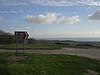 |
| Ashey Down [3] | 130 | 32 | SZ574875 | TuMP | St Boniface Down | East of the island. | Open summit on south side of obelisk (sea mark. Nearby tumuli. | 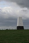 |
| Headon Hill [3] | 120 | 34 | SZ312858 | TuMP | Brighstone Down | Western tip of the island. | Open summit above steep hillside overlooking Totland Bay. |  |
| Bembridge Down [3] | 104 | 101 | SZ625860 | HuMP, TuMP | St Boniface Down | Eastern coast of the island. | Bembridge Fort at summit. Nearby road and car park. Overlooking Sandown Bay. |  |
| Golden Hill [3] | 52 | 34 | SZ339878 | TuMP | Brighstone Down | Western end of the island. | Golden Hill Fort at the summit, which is on circular bank around former fortress. | 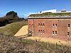 |

