List of hills of Wiltshire

Last updated

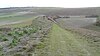
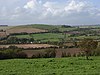
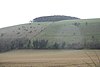
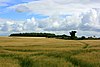
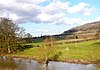
This is a list of hills in Wiltshire. Many of these hills are important historical, archaeological and nature conservation sites, as well as popular hiking and tourist destinations in the county of Wiltshire in southern England.

Contents

Colour key

ClassProminence
Marilyns 150 – 599 m
HuMPs 100 – 149 m
TuMPs 30 – 99 m
Unclassified0 – 29 m

The table is colour-coded based on the classification or "listing" of the hill. The types that occur in Wiltshire are Marilyns, HuMPs and TuMPs, listings based on topographical prominence. "Prominence" correlates strongly with the subjective significance of a summit. Peaks with low prominences are either subsidiary tops of a higher summit or relatively insignificant independent summits. Peaks with high prominences tend to be the highest points around and likely to have extraordinary views. A Marilyn is a hill with a prominence of at least 150 metres or about 500 feet. [1] A "HuMP" (the acronym comes from "Hundred Metre Prominence) is a hill with a prominence of at least 100 but less than 150 metres. [2] In this table Marilyns are in beige and HuMPs in lilac. The term "sub-Marilyn" or "sub-HuMP" is used, e.g. in the online Database of British and Irish Hills to indicate hills that fall just below the threshold. To qualify for inclusion, hills must either be 200 metres or higher with a prominence of at least 30 metres, below 200 metres with a prominence of at least 90 metres (the threshold for a sub-HuMP) or be in some other way notable. In this context, a "TuMP" is a hill with a prominence of at least 30 but less than 100 metres; by way of contrast, see also the article listing Tumps (a traditional term meaning a hillock, mound, barrow or tumulus). For further information see the Lists of mountains and hills in the British Isles and the individual articles on Marilyns, HuMPs and TuMPs.

Table

HillHeight (m)Prom. (m)Grid ref.ClassParentRange/RegionRemarksImage
Milk Hill [3] 294.3147 SU104643 Hardy,sub-Marilyn, HuMP, Wiltshire county top (historical and current) Walbury Hill [4] North Wessex Downs Wiltshire's county top.

Highest point of North Wessex Downs.
Second highest chalk hill in the UK.
Tiny cairn in middle of field may be inaccessible if crops present.

Downland West of Milk Hill. - geograph.org.uk - 185577.jpg
Tan Hill [3] 29448 SU082647 TuMP Walbury Hill North Wessex Downs Wiltshire's second highest summit.

Second highest point of North Wessex Downs.
No summit feature. 25 cm lower than nearby Milk Hill.

Tan Hill - geograph.org.uk - 1583499.jpg
Martinsell Hill [3] 28976 SU178638 TuMP Walbury Hill North Wessex Downs Wiltshire's third summit.

Trig point at summit.
Prehistoric fort at summit

Martinsell Hill - geograph.org.uk - 282532.jpg
Long Knoll [3] 288171 ST786376 Marilyn, HuMP, TuMP Beacon Batch [4] Cranborne Chase and West Wiltshire Downs Featureless summit 10m NE of trig point and 50 cm higher than its base. Long view of Long Knoll - geograph.org.uk - 946041.jpg
Brimsdown Hill [3] 28588 ST824391 TuMP Long Knoll Cranborne Chase and West Wiltshire Downs Copse on summit.

Summit is 1m higher than base of trig point 50 m S.

White Sheet Hill - geograph.org.uk - 909707.jpg
Win Green [3] 277159 ST925206 Marilyn, HuMP, TuMP Long Knoll [4] Cranborne Chase, North Wessex Downs Copse on summit.

Summit is 1m higher than base of trig point 50 m S.

Wingreen Hill Wiltshire UK.jpg
Hackpen Hill [3] 272104 SU129743 HuMP, TuMP Milk Hill [4] Marlborough Downs, North Wessex Downs Trig point in middle of field Hackpen Hill eastern arm.JPG
Golden Ball Hill [3] 27152 SU129640 TuMP Walbury Hill North Wessex Downs Flat summit area; summit 2m S of fence corner Farmland in the Vale of Pewsey - geograph.org.uk - 1410682.jpg
Wexcombe Down [3] 26784 SU277577 TuMP Walbury Hill North Wessex Downs Long barrow and water tower near summit Downland, Marten - geograph.org.uk - 738258.jpg
Cherhill Down [3] 26286 SU053689 TuMP Walbury Hill North Wessex Downs No summit feature; ground 5m S of fence.

Oldbury Castle ramparts are as high but man-made.

View towards Cherhill Down - geograph.org.uk - 300055.jpg
Jack's Castle [3] 26233 ST745354 TuMP Long Knoll Cranborne Chase and West Wiltshire Downs
Morgan's Hill [3] 26083 SU029668 TuMP Walbury Hill North Wessex Downs Toppled trig point at summit Morgan's Hill - geograph.org.uk - 1564963.jpg
Haydown Hill [3] 25831 SU313566 TuMP Walbury Hill North Wessex Downs Trig point at summit Haydown Hill and Fosbury Camp from Conholt Hill - geograph.org.uk - 23042.jpg
Little Knoll [3] 25652 ST807378 TuMP Long Knoll Cranborne Chase and West Wiltshire Downs No summit feature; ground by fence Little Knoll seen from Long Knoll - geograph.org.uk - 932802.jpg
Little Hill [3] 24987 ST868251 TuMP Long Knoll Cranborne Chase and West Wiltshire Downs
Park Hill [3] 24765 ST825431 TuMP Long Knoll Cranborne Chase and West Wiltshire Downs
Coombe Down [3] 24637 SU181744 TuMP Long Knoll Marlborough Downs, North Wessex Downs Downs, Ogbourne St George - geograph.org.uk - 265651.jpg
White Sheet Hill, Mere [3] 24573 ST804347 TuMP Long Knoll Cranborne Chase & West Wiltshire Downs Tumulus, White Sheet Hill - geograph.org.uk - 909706.jpg
Cley Hill [3] 24473 ST838448 TuMP Long Knoll Cranborne Chase & West Wiltshire Downs Tumuli and fort Cley Hill - geograph.org.uk - 951832.jpg
Easton Hill [3] 24391 SU210592 TuMP, sub-HuMP Walbury Hill North Wessex Downs Summit knoll Farmland, Easton Hill - geograph.org.uk - 391101.jpg
Beacon Hill [3] 24259 SU210592 TuMP Long Knoll Cranborne Chase & West Wiltshire Downs
Roundway Hill [3] 24255 SU022646 TuMP Walbury Hill North Wessex Downs Site of Battle of Roundway Down, 1643 Roundway hill - geograph.org.uk - 57773.jpg
White Sheet Hill, Swallowcliffe [3] 24290 ST944242 TuMP, sub-HuMP Win Green Cranborne Chase & West Wiltshire Downs Summit 20m SE of trig point. Trees atop of White Sheet Hill - geograph.org.uk - 353417.jpg
Peaks Downs [3] 24134 SU264789 TuMP Walbury Hill North Wessex Downs flat summit area. Close to M4 motorway Peaks Downs, near Baydon - geograph.org.uk - 949195.jpg
Milton Hill [3] 23838 SU192584 TuMP Walbury Hill North Wessex Downs Pewsey Hill - geograph.org.uk - 370519.jpg
Summerslade Down [3] 23831 ST878379 TuMP Long Knoll Cranborne Chase & West Wiltshire Downs Triangulation Pillar, Summerslade Down - geograph.org.uk - 1401695.jpg
King's Play Hill [3] 23232 SU009660 TuMP Long Knoll Cranborne Chase & West Wiltshire Downs Summit knoll Farmland above Stockley - geograph.org.uk - 1564937.jpg
White Horse Hill, Westbury [3] 230108 ST901511 HuMP, TuMP Long Knoll Salisbury Plain Trig point at summit; flat summit area. Westbury White Horse - geograph.org.uk - 1638342.jpg
Horningsham Common [3] 22931 ST805411 TuMP Long Knoll Cranborne Chase & West Wiltshire Downs No summit feature.
Knoyle Hill [3] 22630 ST898307 TuMP Long Knoll Cranborne Chase & West Wiltshire Downs No summit feature.
Tinhead Hill [3] 22664 ST941524 TuMP Long Knoll Salisbury Plain Long barrow at ST 939524 probably higher but manmade. A field of barley on Tinhead Hill - geograph.org.uk - 886476.jpg
Haddon Hill [3] 22544 ST875316 TuMP Long Knoll Cranborne Chase & West Wiltshire Downs Farmland near Down Dairy - geograph.org.uk - 914318.jpg
Sidbury Hill [3] 22369 SU216506 TuMP Walbury Hill Salisbury Plain Trig point, fort and earthworks Trig point, Sidbury Hill - geograph.org.uk - 433781.jpg
Clyffe Pypard Hill [3] 21630 SU074764 TuMP Walbury Hill North Wessex Downs Mast near summit Concrete track, near Bupton Hill Farm, Clyffe Pypard - geograph.org.uk - 1188025.jpg
Pythouse Hill [3] 21632 ST909289 TuMP Long Knoll North Wessex Downs
Urchfont Hill [3] 21689 SU040555 TuMP Long Knoll North Wessex Downs Flagpole on mound summit (mound probably manmade). Ground 100m SW is lower than base of summit mound Track to Urchfont Hill - geograph.org.uk - 424815.jpg
Barkers Hill [3] 20859 ST905256 TuMP Win Green Cranborne Chase & West Wiltshire Downs No summit feature. Road winding down from Barkers Hill - geograph.org.uk - 318735.jpg
Battlesbury Hill [3] 20839 ST898455 TuMP Win Green Cranborne Chase & West Wiltshire Downs Hilltop fort; above Waterloo Lines Battlesbury iron age hillfort, Salisbury Plain - geograph.org.uk - 237382.jpg
Bathford Hill [3] 205101 ST791661 HuMP, TuMP Birdlip Hill [4] Summit within 2m of tower (Brown's Folly) River Avon at Bathampton - geograph.org.uk - 1771377.jpg
Woodborough Hill [3] 20538 SU118614 TuMP Walbury Hill North Wessex Downs No summit feature; centre of flat area View towards Woodborough Hill - geograph.org.uk - 416272.jpg
Beacon Hill, Salisbury Plain [3] 20488 SU194427 TuMP Walbury Hill Salisbury Plain Above Bulford Camp and just N of A303; mast near summit. Beacon Hill - geograph.org.uk - 431914.jpg
High Wood [3] 20250 ST941268 TuMP Win Green Cranborne Chase & West Wiltshire Downs Near Old Wardour Castle Old Wardour Castle 56.JPG
Scratchbury Hill [3] 19760 ST911442 TuMP Long Knoll Salisbury Plain Hillfort summit: Scratchbury Camp; trig point View south-east from Battlesbury Hill, near Warminster - geograph.org.uk - 962175.jpg
Castle Ditches [3] 19368 ST962284 TuMP Win Green Cranborne Chase & West Wiltshire Downs Hillfort summit; trig point Castle ditches geograph-390993-by-Toby.jpg
Silbury Hill [3] 18729 SU100685 Unclassified Walbury Hill North Wessex Downs Prehistoric chalk mound SilburyHill gobeirne.jpg
Old Sarum [3] 12243 SU138326 TuMP Walbury Hill Salisbury Plain Earliest settlement at Salisbury and remains of Iron Age hillfort, Norman castle and Old Sarum Cathedral Old Sarum Cathedral with motte.JPG

See also

References and footnotes

  1. Dawson, Alan (1992). The Relative Hills of Britain. Milnthorpe: Cicerone Press. ISBN   1-85284-068-4. Archived from the original on 21 September 2010.
  2. Jackson, Mark. "More Relative Hills of Britain" (PDF). Relative Hills of Britain. Archived from the original (PDF) on 12 October 2013. Retrieved 31 March 2013.
  3. 1 2 3 4 5 6 7 8 9 10 11 12 13 14 15 16 17 18 19 20 21 22 23 24 25 26 27 28 29 30 31 32 33 34 35 36 37 38 39 40 41 42 43 44 45 46 Name, height, prominence, grid and class data from: Database of British and Irish Hills, retrieved 2 Jul 2016.
  4. 1 2 3 4 5 Name, height, prominence, grid, class and parent data from: Jackson, Mark (2009). More Relative Hills of Britain, Marilyn News Centre, UK, p. 168. E-book Archived 2013-10-12 at the Wayback Machine .

Related Research Articles

<span class="mw-page-title-main">Lists of mountains and hills in the British Isles</span> Highest mountains in the British Isles

The mountains and hills of the British Isles are categorised into various lists based on different combinations of elevation, prominence, and other criteria such as isolation. These lists are used for peak bagging, whereby hillwalkers attempt to reach all the summits on a given list, the oldest being the 282 Munros in Scotland, created in 1891.