
The North Wessex Downs Area of Outstanding Natural Beauty (AONB) is located in the English counties of Berkshire, Hampshire, Oxfordshire and Wiltshire. The name North Wessex Downs is not a traditional one, the area covered being better known by various overlapping local names, including the Berkshire Downs, the North Hampshire Downs, the White Horse Hills, the Lambourn Downs, the Marlborough Downs, the Vale of Pewsey and Savernake Forest.

Ashmore is a village and civil parish in the North Dorset district of Dorset, England, 20 miles southwest of Salisbury.

Melbury Abbas is a village and civil parish in north Dorset, England, 3 km SSW of the town of Shaftesbury, east of the A350 Shaftesbury to Blandford Forum road.

Evershot is a village and civil parish in the county of Dorset in southwest England, situated approximately 7 miles (11 km) south of Yeovil in Somerset. It is the second highest village in the county at 175 metres (574 ft) above sea-level. Evershot parish encompasses part of the nearby hamlet of Holywell, 1.25 miles (2.01 km) east of Evershot village. Dorset County Council's latest (2013) estimate of the parish population is 210. The village has connections with the writer Thomas Hardy.
The Dorset Downs are an area of chalk downland in the centre of the county Dorset in south west England. The downs are the most western part of a larger chalk formation which also includes Cranborne Chase, Salisbury Plain, Hampshire Downs, Chiltern Hills, North Downs and South Downs.

Fontmell Magna is a village and civil parish in north Dorset, England. It is situated in the Blackmore Vale, close to the chalk hills of Cranborne Chase, on the A350 road five miles south of Shaftesbury and eight miles north of Blandford Forum. In the 2011 census the parish had a population of 734.

Sixpenny Handley or Handley is a village and former civil parish, now in the parish of Sixpenny Handley and Pentridge, in north east Dorset, England, situated on Cranborne Chase ten miles (16 km) north east of Blandford Forum. In the 2011 census the parish had a population of 1,233. The civil parish was abolished on 1 April 2015 and merged with Pentridge to form Sixpenny Handley and Pentridge.

Farnham is a village and civil parish in North Dorset, in the south of England, on Cranborne Chase, seven miles northeast of Blandford Forum. In the 2011 census the parish had a population of 183.

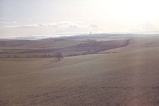
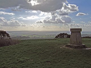
Cranborne Chase is a chalk plateau in central southern England, straddling the counties Dorset, Hampshire and Wiltshire. The plateau is part of the English Chalk Formation and is adjacent to Salisbury Plain and the West Wiltshire Downs in the north, and the Dorset Downs to the south west. The scarp slope of the hills faces the Blackmore Vale to the west, and to some extent the Vale of Wardour to the north. The chalk gently slopes south and dips under clays and gravels. The highest point is Win Green Down, in Wiltshire, at 910 feet (280 m).

Long Knoll is a hill in the west of the English county of Wiltshire. It is a ridge of chalk grassland, some 1.5 kilometres (0.93 mi) in length, and forms the boundary between the civil parishes of Kilmington to the south and Maiden Bradley to the north. The ridge is 288 metres (945 ft) above sea level at its highest point and it is possible to view King Alfred's Tower, Cranmore Tower, the Black Mountains and Glastonbury Tor on clear days.

Old Winchester Hill is a 66.2-hectare (164-acre) biological Site of Special Scientific Interest in Hampshire. It is a Nature Conservation Review site, Grade I, and a National Nature Reserve. Part of it is a Scheduled Monument.
Quarley Hill is the site of an Iron Age univallate hill fort in Hampshire, southern England. The hill affords commanding views of the surrounding countryside.

Dorset is a county located in the middle of the south coast of England. It lies between the latitudes 50.512°N and 51.081°N and the longitudes 1.682°W and 2.958°W, and occupies an area of 2,653 km². It spans 90 kilometres (56 mi) from east to west and 63 kilometres (39 mi) from north to south.
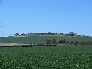
Melbury Hill, whose summit is also called Melbury Beacon, is a prominent hill, 263 metres high, on the high chalk escarpment of the North Dorset Downs above the village of Melbury Abbas in the county of Dorset in southern England.

At 251 metres, Ball Hill is one of the highest hills in the county of Dorset, England, and is on the Wessex Ridgeway.

Seven Wells Hill is a prominent hill in the Cotswolds hill range in the counties of Gloucestershire and Worcestershire. At 319 metres (1,047 ft), is the second highest point in Gloucestershire.
