
Shaftesbury is a town and civil parish in Dorset, England. It is situated on the A30 road, 20 miles west of Salisbury, near the border with Wiltshire. It is the only significant hilltop settlement in Dorset, being built about 215 metres above sea level on a greensand hill on the edge of Cranborne Chase.

West Dorset was a local government district in Dorset, England. Its council was based in Dorchester. The district was formed on 1 April 1974, under the Local Government Act 1972, and was a merger of the boroughs of Bridport, Dorchester and Lyme Regis, along with Sherborne urban district, and the rural districts of Beaminster, Bridport, Dorchester and Sherborne.

North Dorset was a local government district in Dorset, England. It was largely rural, but included the towns of Blandford Forum, Gillingham, Shaftesbury, Stalbridge and Sturminster Newton. Much of North Dorset was in the River Stour valley and is called the Blackmore Vale. The economy of North Dorset was largely dairy agriculture based.

Iwerne Minster is a village and civil parish in Dorset, England. It lies on the edge of the Blackmore Vale, approximately midway between the towns of Shaftesbury and Blandford Forum. The A350 main road between those towns passes through the edge of the village, just to the west. In the 2011 Census the civil parish had a population of 978.

Melbury Abbas is a village and civil parish in north Dorset, England, 3 km SSW of the town of Shaftesbury, east of the A350 Shaftesbury to Blandford Forum road.

Fontmell Magna is a village and civil parish in north Dorset, England. It is situated in the Blackmore Vale, close to the chalk hills of Cranborne Chase, on the A350 road five miles south of Shaftesbury and eight miles north of Blandford Forum. In the 2011 census the parish had a population of 734.

Melbury Bubb is a small village and civil parish in the county of Dorset in South West England, situated approximately 7 miles (11 km) south of the town of Sherborne. It is sited on Cornbrash limestone beneath the chalk hills of the Dorset Downs. The A37 trunk road between Dorchester and Bristol passes about 0.5 miles (0.80 km) to the west, on the other side of Bubb Down Hill. This hill used to be the site of a beacon. The first half of the village name derives from maele and burh—Old English for "multi-coloured" and "fortified place"—and the second half is a manorial name which derives either from a Saxon resident named 'Bubba' or from medieval lords of the manor. Dorset County Council's latest (2013) estimate of the parish population is 40.

Cranborne Chase is a chalk plateau in central southern England, straddling the counties Dorset, Hampshire and Wiltshire. The plateau is part of the English Chalk Formation and is adjacent to Salisbury Plain and the West Wiltshire Downs in the north, and the Dorset Downs to the south west. The scarp slope of the hills faces the Blackmore Vale to the west, and to some extent the Vale of Wardour to the north. The chalk gently slopes south and dips under clays and gravels. The highest point is Win Green Down, in Wiltshire, at 910 feet (280 m).

Hardown Hill is a hill between Ryall and Morcombelake in the county of Dorset, England. It rises west of the South Dorset Downs, close to the Dorset coast, and overlooks the Marshwood Vale to the north. Its prominence qualifies it as one of Dorset's four Marilyns and it is listed as one of the "top 12 Dorset views to take your breath away" by Dorset's official tourist website.

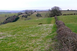
Breeze Hill is a prominent, largely treeless, rounded summit, 262 metres high, on the edge of Cranborne Chase about a mile east of the village of Melbury Abbas, Dorset.

At 210 metres, Duncliffe Hill is one of the highest hills in the Blackmore Vale region in the county of Dorset, England.
Watts Hill is a hill in the Dorset Downs and one of the highest in the county of Dorset, England. The height of the summit is variously recorded as 261 metres or 262 metres.
Shaftesbury School is a coeducational secondary day and boarding school located in Shaftesbury in the English county of Dorset.