| Designations | |
|---|---|
| Official name | Dorset Heathlands |
| Designated | 1 October 1998 |
| Reference no. | 964 [1] |


The Dorset Heaths form an important area of heathland within the Poole Basin [2] in southern England. Much of the area is protected.
| Designations | |
|---|---|
| Official name | Dorset Heathlands |
| Designated | 1 October 1998 |
| Reference no. | 964 [1] |
The Dorset Heaths form an important area of heathland within the Poole Basin [2] in southern England. Much of the area is protected.
According to Natural England, who have designated the Dorset Heaths as National Character Area 135, the heathlands cover an area of 61,662 hectares, whose boundary runs from Bockhampton and Warmwell in the west via Wimborne Minster to Fordingbridge in the far northeast. It then turns southwards to Hengistbury Head, before following the coastline to Studland and Brownsea Island then finally heading westwards - north of South Purbeck (with the Purbeck Hills) and the Weymouth Lowlands - to the Warmwell area. [3]
The character of the Dorset Heaths contrasts strongly with its neighbouring natural regions. Undulating lowland heath with heather, pines and gorse alternates with exposed, open, large-scale farmland, woodland and scrub. Blocks of conifers form locally prominent landmarks. Apart from the major Poole-Bournemouth-Christchurch conurbation on the coast, much of the area is sparsely populated with scattered settlements and a few small villages and towns. Valleys are flat-bottomed and open with floodplain pastures. There is an outer perimeter of low, rolling hills marking the transition to chalk downland. [4]

The land within the Dorset Heaths rises to a maximum of 193 metres (633 ft) at Creech Barrow Hill, [5] [6] [7] [8] but the average height is just 32 metres (105 ft).
Major rivers include the Frome, Stour, Moors, Piddle, Sherford, Allen, Corfe and Dorset Avon. [3]
The largest settlement within the Dorset Heaths is the extensive South East Dorset conurbation, this includes the large towns of Poole, Bournemouth and Christchurch. Other significant Satellite towns are Wareham, Fordingbridge and Wimborne Minster. The total population for the NCA was 446,296 as of 2001 with an increase to 466,626 following the 2011 census.

The Dorset Heaths are home to a large number of protected areas including:
Dorset is a county in South West England on the English Channel coast. The ceremonial county comprises the unitary authority areas of Bournemouth, Christchurch and Poole and Dorset. Covering an area of 2,653 square kilometres (1,024 sq mi), Dorset borders Devon to the west, Somerset to the north-west, Wiltshire to the north-east, and Hampshire to the east. The county town is Dorchester, in the south. After the reorganisation of local government in 1974, the county border was extended eastward to incorporate the Hampshire towns of Bournemouth and Christchurch. Around half of the population lives in the South East Dorset conurbation, while the rest of the county is largely rural with a low population density.

Studland is a village and civil parish on the Isle of Purbeck in Dorset, England. The village is located about 2 miles (3.2 km) north of the town of Swanage, over a steep chalk ridge, and 3 miles (4.8 km) south of the South East Dorset conurbation at Sandbanks, from which it is separated by Poole Harbour. The parish includes Brownsea Island within the harbour. In the 2011 census the parish had 182 households and a population of 425, though many of the houses in the village are holiday homes, second homes, or guest houses, and the village's population varies depending upon the season.

The Studland and Godlingston Heaths NNR is located on the Isle of Purbeck in the English county of Dorset. It borders Studland Bay on the south side of Poole Harbour, between the settlements of Swanage and Sandbanks. Extending to 631ha, it is owned and managed by the National Trust following the Bankes bequest of the Kingston Lacy estate. Studland & Godlingston Heath is designated as one of only 35 "spotlight reserves" in England by Natural England in the list of national nature reserves in England and is listed as a Site of Special Scientific Interest (SSSI).

Poole Harbour is a large natural harbour in Dorset, southern England, with the town of Poole on its shores. The harbour is a drowned valley (ria) formed at the end of the last ice age and is the estuary of several rivers, the largest being the Frome. The harbour has a long history of human settlement stretching to pre-Roman times. The harbour is extremely shallow, with one main dredged channel through the harbour, from the mouth to Holes Bay.

The Isle of Purbeck is a peninsula in Dorset, England. It is bordered by water on three sides: the English Channel to the south and east, where steep cliffs fall to the sea; and by the marshy lands of the River Frome and Poole Harbour to the north. Its western boundary is less well defined, with some medieval sources placing it at Flower's Barrow above Worbarrow Bay. According to writer and broadcaster Ralph Wightman, Purbeck "is only an island if you accept the barren heaths between Arish Mell and Wareham as cutting off this corner of Dorset as effectively as the sea." The most southerly point is St Alban's Head.

Purbeck was a local government district in Dorset, England. The district was named after the Isle of Purbeck, a peninsula that forms a large proportion of the district's area. However, it extended significantly further north and west than the traditional boundary of the Isle of Purbeck which is the River Frome. The district council was based in the town of Wareham, which is itself north of the Frome.

Upton is a town in south-east Dorset, England. Upton is to the east of Holton Heath and Upton Heath, and to the north of the Poole suburb of Hamworthy. It is the second largest town in the Purbeck Hills.

Arne is a village and civil parish in Dorset, England, situated 4 miles (6.4 km) east of Wareham. The local travel links are located at Wareham railway station. Bournemouth International Airport is 11 miles (18 km) away. The main road through the village is Arne Road connecting Arne to Wareham. The village is situated on the Arne Peninsula, which protrudes into Poole Harbour opposite the town of Poole.

Dorset is a rural county in south west England. Its archaeology documents much of the history of southern England.
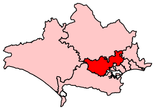
Mid Dorset and North Poole is a constituency represented in the House of Commons of the UK Parliament since 2015 by Michael Tomlinson, a Conservative.
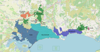
The South East Dorset conurbation is a multi-centred conurbation on the south coast of Dorset in England. The main population centres are Bournemouth, Christchurch and Poole, which together form the single unitary authority of Bournemouth, Christchurch and Poole; however, the urbanised area spreads into the Dorset unitary authority and into the New Forest District as far east as Barton on Sea. There are a number of satellite towns peripheral to these main urban centres. In clockwise rotation these include: Wareham, Verwood and Ringwood (Hampshire). The urban area is generally surrounded by a green belt.

Creech Grange is an elegant country house in Steeple, south of Wareham in Dorset at the foot of the Purbeck Hills. Historic England designate it as a Grade I listed building. The park and gardens are Grade II* listed in the National Register of Historic Parks and Gardens.

Dorset is a county in South West England. The county is largely rural and therefore does not have a dense transport network, and is one of the few English counties without a motorway. Due to its position on the English Channel coast, and its natural sheltered harbours, it has a maritime history, though lack of inland transport routes have led to the decline of its ports.

Dorset is a county located in the middle of the south coast of England. It lies between the latitudes 50.512°N and 51.081°N and the longitudes 1.682°W and 2.958°W, and occupies an area of 2,653 km2. It spans 90 kilometres (56 mi) from east to west and 63 kilometres (39 mi) from north to south.

The Thames Basin Heaths are a natural region in southern England in Berkshire, Hampshire and Surrey, a slightly mottled east-west belt of ecologically recognised and protected land.

Creech Barrow Hill is a steep, conical hill, 193 metres (633 ft) high, near the coast of Dorset, England, and the highest point of the Dorset Heaths. It has been described as "one of Dorset's most distinctive landmarks." Geologically, it is also the highest Cenozoic hill in England.