
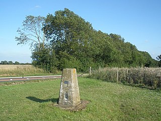
The Yorkshire Wolds are hills in the counties of the East Riding of Yorkshire and North Yorkshire in Northern England. The name also applies to the district in which the hills lie. They are the northernmost chalk hills in the UK and within lies the northernmost chalk stream in Europe, the Gypsey Race.

The Isle of Purbeck is a peninsula in Dorset, England. It is bordered by water on three sides: the English Channel to the south and east, where steep cliffs fall to the sea; and by the marshy lands of the River Frome and Poole Harbour to the north. Its western boundary is less well defined, with some medieval sources placing it at Flower's Barrow above Worbarrow Bay. John Hutchins, author of The History and Antiquities of the County of Dorset, defined Purbeck's western boundary as the Luckford Lake steam, which runs south from the Frome. According to writer and broadcaster Ralph Wightman, Purbeck "is only an island if you accept the barren heaths between Arish Mell and Wareham as cutting off this corner of Dorset as effectively as the sea." The most southerly point is St Alban's Head.

Purbeck was a local government district in Dorset, England. The district was named after the Isle of Purbeck, a peninsula that forms a large proportion of the district's area. However, it extended significantly further north and west than the traditional boundary of the Isle of Purbeck which is the River Frome. The district council was based in the town of Wareham, which is itself north of the Frome.
Dunstable Downs are part of the Chiltern Hills, in southern Bedfordshire in England, located near the town of Dunstable. They are a chalk escarpment forming the north-eastern reaches of the Chilterns. At 243 m (797 ft), Dunstable Downs are the highest point in the county of Bedfordshire.
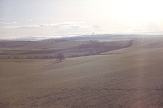
The Dorset Downs are an area of chalk downland in the centre of the county Dorset in south west England. The downs are the most western part of a larger chalk formation which also includes Cranborne Chase, Salisbury Plain, Hampshire Downs, Chiltern Hills, North Downs and South Downs.

The Purbeck Hills, also called the Purbeck Ridge or simply the Purbecks, are a ridge of chalk downs in Dorset, England. It is formed by the structure known as the Purbeck Monocline. The ridge extends from Lulworth Cove in the west to Old Harry Rocks in the east, where it meets the sea. The hills are part of a system of chalk downlands in southern England formed from the Chalk Group which also includes Salisbury Plain and the South Downs. For most of their length the chalk of the Purbeck Hills is protected from coastal erosion by a band of resistant Portland limestone. Where this band ends, at Durlston Head, the clay and chalk behind has been eroded, creating Poole Bay and the Solent. The ridge of steeply dipping chalk that forms the Purbeck Hills continues further east on the Isle of Wight.

Swyre Head is the highest point of the Isle of Purbeck in Dorset, on the south coast of England. The hill Swyre Head lies about 2 kilometres (1 mi) southwest of the village Kingston, about 5 kilometres (3 mi) south of Corfe Castle and 8 kilometres (5 mi) west of Swanage.

Therfield Heath is a biological Site of Special Scientific Interest and Local Nature Reserve on the chalk escarpment just north of Therfield, Hertfordshire. Since it lies south-west of the town of Royston, it is also known locally as Royston Heath. The heath is a common on which sheep are still regularly grazed. The site offers views towards the north, over the valley of the Cam as far as Cambridge.
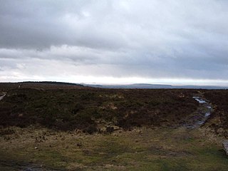
Black Down is the highest hill in the Mendip Hills, Somerset, in south-western England. Black Down lies just a few miles eastward of the Bristol Channel at Weston-super-Mare, and provides a view over the Chew Valley. The summit is marked with an Ordnance Survey trig point, the base of which has been rebuilt by the Mendip Hills AONB authority.

Worbarrow Bay is a large broad and shallow bay just to the east of Lulworth Cove on the Isle of Purbeck, Dorset, England.

Beacon Hill, Warnford is a 46.4-hectare (115-acre) biological Site of Special Scientific Interest west of Warnford in Hampshire. It is a Nature Conservation Review site, and an area of 40.1 hectares is a national nature reserve. There is a round barrow cemetery dating to the Late Neolithic or Bronze Age on the hill, and this is a scheduled monument.

Clayton to Offham Escarpment is a 422.5-hectare (1,044-acre) linear biological Site of Special Scientific Interest (SSSI) which runs from Clayton in West Sussex to Lewes in East Sussex. Its ownership and management is divided between over fifteen landowners and farmers. Parts of Ditchling's Downs, e.g. TQ 323 133, and the scarp between Blackcap and Mount Harry, e.g. TQ 378 124, are owned by the National Trust. What remains of Ditchling Tenantry Down common at Ditchling Beacon is leased to the Sussex Wildlife Trust.

Cow Corner is the north-western end of Worbarrow Bay, a small secluded bay on the south coast of the Isle of Purbeck in Dorset, England.
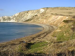
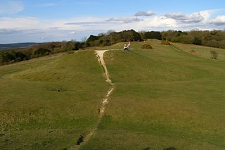
Flower’s Barrow is an Iron Age hillfort, built over 2500 years ago, above Worbarrow Bay in Dorset on the south coast of England.

Dorset is a county located in the middle of the south coast of England. It lies between the latitudes 50.512°N and 51.081°N and the longitudes 1.682°W and 2.958°W, and occupies an area of 2,653 km2. It spans 90 kilometres (56 mi) from east to west and 63 kilometres (39 mi) from north to south.

Creech Barrow Hill is a steep, conical hill, 193 metres (633 ft) high, near the coast of Dorset, England, and the highest point of the Dorset Heaths. It has been described as "one of Dorset's most distinctive landmarks." Geologically, it is also the highest Cenozoic hill in England.

The Stonehill Down Nature Reserve is a downland nature reserve on the Purbeck Hills in the county of Dorset, England. It is managed by the Dorset Wildlife Trust.

Stoney Down or Stony Down is both a hill and an area of forested countryside in the county of Dorset, England, that has been designated an "Area of Great Landscape Value" (AGLV) in the East Dorset Local Plan. The forest is known as the Stoney Down Plantation or Stony Down Plantation. It covers an area of 51.13 hectares. The area is popular with riders and walkers.
Bow Hill is an elongated hill ridge, 206 metres (676 ft) high, and running roughly from north to south in the South Downs, in the county of West Sussex, England. It has a prominence of 74 metres.
